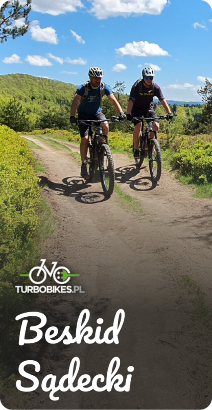
category-icon

Projekt Azja

19788 km
0 m
0 m
Azja Pd-Wsch, Chiny, Mongolia

Charakterystyka trasy

2014-11-27
Azja Pd-Wsch, Chiny, Mongolia
category-icon
19788 km
0 m
0 m
2.7/6
Projekt Azja to 8 miesięcy dzielenia się kulturą azjatycką poprzez nagrywanie wywiadów i wysyłanie prezentów do Polski. Chcemy spędzić 30 dni w każdym z 8 odwiedzanych krajów. Nie zamierzamy zwiedzać kolejnych świątyń i popularnych atrakcji. Celem naszego projektu jest poznanie odmiennej kultury, codziennych obowiązków i podejścia do życia mieszkańców Azji. Kulturą Azji będziemy dzielić się z naszymi odbiorcami poprzez prowadzenie reportażu i wysyłanie prezentów poprzez portal Polakpotrafi.pl : https://polakpotrafi.pl/projekt/prezenty-z-azji.

Komentarze

NA TEJ TRASIE PRZYDA CI SIĘ MAPA Z NASZEJ APLIKACJI

Metéora
MAPA TURYSTYCZNA W APLIKACJI TRASEO
Metéora
A monument of World Natural and Cultural Heritage of UNESCO, Meteora is a unique landscape of rocky spines and the second largest monastic complex in Greece. The name "Meteora" is attributed to the founder of the monastery of Megalo Meteoron, Saint Athanasios, who named "Mateoron" the rock spire that he climbed in 1344. However the first hermits had settled on the vertical rocks before the 11th c. In the heyday of Meteora, from the late 15th c and especially in the 16th-17 th c were 24 monasteries. Today six monasteries are inhabited and open to public. To experience the magic of Meteora one should follow the hiking trails. The proposed trails (marked with a number in a green circle) are obvious and maintained.
Sandomierz. The trail of cozy leisure.
MAPA TURYSTYCZNA W APLIKACJI TRASEO
Sandomierz. The trail of cozy leisure.

There are few places on the map of Poland with a soul, where people with a passion find the power of inspiration to creat and find meaning in life. In Sandomierz, plans and dreams come true, and time becomes relative. During your visit, you can part take in a number of "cozy leisures", the most popular of which are themed walks around the city. Planned tours will allow you to discover what is interesting, hidden, and not obvious to the naked eye. Sandomierz, thanks to its unique ambience, is an ideal proposal for a trip at any time of the year.

We invite you to discover Sandomierz. The Trail of Cozy Leisure. 

Northern and Southern Imitos
MAPA TURYSTYCZNA W APLIKACJI TRASEO
Northern and Southern Imitos
The digital hiking map of Southern Imitos extends between Ilioupoli, Argyroupoli, Glyfada, Voula and Koropi. Hiking and cycling routes are proposed and shown in detail. The mountain s points of interest such as caves, sinkholes and archaeological sites are pinpointed on the map.
Mt Penteli
MAPA TURYSTYCZNA W APLIKACJI TRASEO
Mt Penteli

The hiking map in detailed scale invites you to discover one of the mountains that delimit the Athens plain through hiking and cycling trails. Old quarries, caves and monuments, including the famous "lithagogias road" from where the Parthenon marbles were transported to the Acropolis are recorded on the map.

Jezioro Solinskie
MAPA TURYSTYCZNA W APLIKACJI TRASEO
Jezioro Solinskie
Exo Mani: Stoupa. Agios Nikolaos. Trachila
MAPA TURYSTYCZNA W APLIKACJI TRASEO
Exo Mani: Stoupa. Agios Nikolaos. Trachila
Mani is the middle and southernmost peninsula of the Peloponnese and is split between Laconia and Messinia. Exo Mani is the name of the northwestern part, which belongs to the prefecture of Messinia. Exo Mani preserves a treasure trove of Byzantine and post-Byzantine churches and castles in breathtaking landscapes. This digital map covers the southern part of Exo Mani from Stoupa to Trachila and includes the areas of the villages Prastio, Saidona, Neochori, Pyrgos, Kastania, Karyovouni, Milia, Thalames, Agios Nikolaos, Lagada.

Miejscowości na trasie