Szczytno (0.0 km) – MOR Ochódno (7.1 km) – MOR Dźwierzuty (20.1 km) – MOR Popowa Wola (30.2 km) – MOR Kobułty (32.0 km) – MOR Rudziska (35.9 km) – Observation Tower (37.3 km) – MOR Kraksy (41.6 km) – Biskupiec (42.0 km)
An easy trail running along the embankment of a former railroad line, where an asphalt bike path has been constructed. It’s perfect for both a few-hour family outing with children and for cycling enthusiasts who enjoy a brisk ride. Those interested in history and culture, as well as fans of Sienkiewicz, will certainly not be disappointed. Cyclists who appreciate the beauty of nature will also find something to enjoy. The latter can also take advantage of two additional loops around the lake and the nature reserve. The trail is marked with blue signs.
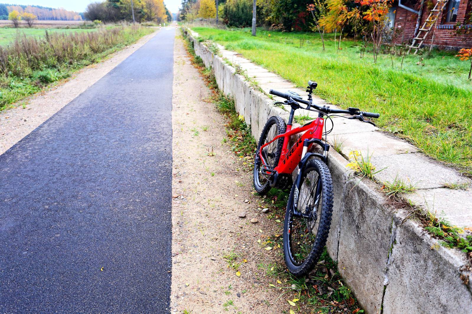
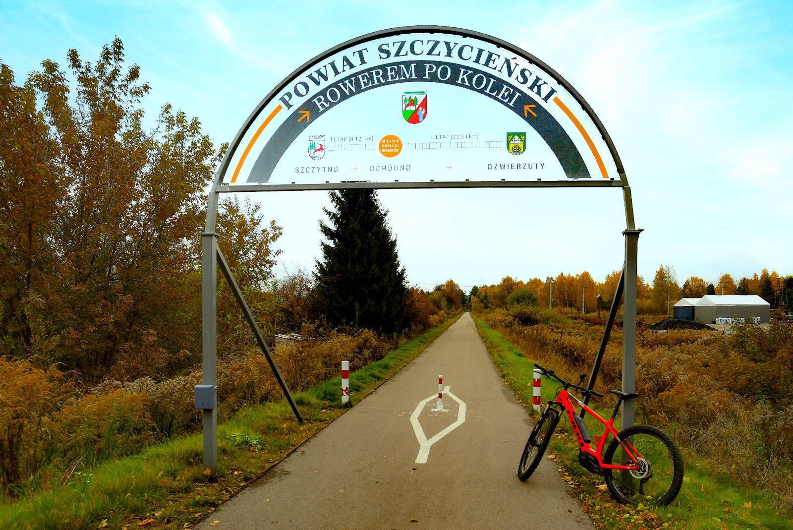
The trailhead is located in Szczytno at the exit toward Ostrołęka (along National Road DK53), where Piłsudskiego Street turns into Ostrołęcka Street, approximately 2.5 km from the city center and 1.9 km from the train station. At the start of the trail, on the left side of DK53, there is a gas station; on the right, a parking lot. The trailhead is clearly marked. We head north along an asphalt bike path approximately 3 m wide. Along the entire route, warning posts are placed in the middle of the path to indicate intersections with local roads. Field and forest landscapes alternate along the path for its entire length.
After about 5 km, we cross National Road DK58 (Szczytno–Pisz); much further on, we’ll also cross Provincial Road DW600 (Szczytno–Mrągowo). We pass the brick buildings of the former Ochódno train station, and 7.1 km from the start, we reach the first MOR stop on the route: Ochódno. There are information signs here showing two additional (unmarked) loops in the area that are worth exploring. The first of these begins near the MOR, is 4.5 km long, and leads along dirt roads to the village of Wałpusz on the lake of the same name. We, however, continue along the trail. A few hundred meters past the MOR, the trail narrows to about 2 m. About 2 km further on, we pass the former train station in Nowe Kiejkuty. Not far from here, you can turn right onto a second additional loop that leads to the Kulka Nature Reserve—which protects steppe vegetation—and around Lake Łęsk (an additional 4.9 km). Keep in mind that on both additional loops, you’ll have to find your own way. Therefore, a detailed map of the area is essential.
After about 1.5 km, at the DW600 provincial road (Szczytno–Mrągowo), the path suddenly ends. You’ll need to walk your bike across to the other side of the road via a poorly marked crosswalk and ride 20 m downhill on a gravel path. This will take you to the path on the other side of the provincial road. A little further on, the route turns sharply west. You’ll pass the buildings of three former train stations with visible remnants of their platforms: Jabłonka, Olszewki Mazurskie, and Dźwierzuty. After a short while, you’ll cross the road and reach the Dźwierzuty MOR. A small village lies on the left; it’s home to the only store on the route, and there are also two historic churches. A few kilometers past Dźwierzuty, you can see the remains of the large Targowska Wola train station. The terrain changes slightly, with larger hills and expansive depressions appearing. You don’t notice this on the path, however, as it runs along a high embankment or cuts into the slopes of the hills. From time to time, we pass through intersections with local roads or over viaducts spanning them. We pass another former station and arrive at the MOR in Popowa Wola. To our left lie the vast Dymerskie Meadows. A few hundred meters past the MOR, the trail crosses the border between the Szczytno and Olsztyn counties, continuing on through the Biskupiec municipality (11.5 km).
The next section of the trail runs through forested areas. After covering about 1.5 km, we reach the Kobułty MOR, near which the station building and platform have been preserved. If we’d like to see the Kobułckie Wzgórza nature and landscape complex, we must turn right off the route and cross the village of Kobułty. The moraine hills there reach 220 m above sea level and are covered with picturesque forests.
Continuing along the trail, after another 4 km—with the forest edge on the right and National Road DK57 (Szczytno–Biskupiec) on the left—we reach the Rudziska MOR, which was also built near the former station building and platform. Less than 0.5 km further on, we cross a bridge over the Dymer River, which historically marked the border between Warmia and Masuria at this point.
Another 1 km of cycling, and we can get off our bikes to… go climbing. One of the features of the Zabrodzie MOR is a wooden tower with an observation deck, accessible via 32 steps. Here, you can rest and take in the surrounding area. After getting back on the trail, we enter a forest where (on the left side of the trail) the Zabrodzie Nature Reserve is hidden. The reserve protects stands of dwarf birch and peatland vegetation.
The forest section ends 2.5 km further on, when we reach National Road DK16, passing under its overpasses. We turn left, leaving the former railroad tracks, and ride along an asphalt path parallel to the road. After the roundabout, we turn left, cross National Road DK57, and reach Lake Krasy Małe, on the shore of which the MOR Kraksy is located. We turn left and continue along the lake’s shore to the dike between this body of water and Lake Kraksy. We turn right onto the dike, where the trail’s endpoint is located.
Construction of the bike path to Biskupiec has not been completed; you can return the same way or ride toward Biskupiec along a route you map out yourself.
Szczytno has direct rail connections to Olsztyn, Ełk, Pisz, Braniewo, and Chorzele. It lies at the intersection of three national highways. It is easily accessible by car and bus. There is a free parking lot at the trail’s starting point. The Olsztyn–Mazury Airport operates in Szymany, located about 10 km from Szczytno. After reaching Biskupiec, cyclists can take public roads (about 10 km) to the train station in Czerwonka, located on the Olsztyn–Ełk route.
Police Officers and Spies
The trail runs near two well-known institutions shrouded in an aura of mystery: the Police Academy in Szczytno at 111 Piłsudskiego Street, close to the starting point, and the Intelligence Personnel Training Center in Stare Kiejkuty, known throughout Poland as the “spy school.”
An Early 18th-Century Bible
In the Evangelical church in Dźwierzuty, built in the late 14th century, a copy of a Bible bound in brass reliefs and dated 1708 was still present at the beginning of the 20th century. This edition contained engravings by Joachim Sandrart, a German painter and copperplate engraver who lived in the 17th century.
Szczytno
Most of the major sites in Szczytno are located on the isthmus between two lakes: Domowe Duże (Długie) and Domowe Małe. It is here that we find, among other things, the restored ruins of the Teutonic castle, which Henryk Sienkiewicz immortalized in *The Teutonic Knights* as the place where Jurand of Spychów was imprisoned and tortured. The writer himself visited Szczytno in 1908, and his novels greatly popularized the town. In recognition of these contributions, the residents of Szczytno erected a bust of Sienkiewicz in the town hall courtyard and named one of the streets in the city center after him. It runs past the castle and the town hall, between the lakes.
The town hall was built between 1936 and 1937 on the site of the castle’s eastern wing, which had been demolished earlier. Its style draws on medieval defensive architecture. It was designed by Kurt Frick, an architect from Königsberg. The town hall’s 46-meter-high tower, sometimes called Jurand’s Tower, is an excellent vantage point offering a panoramic view of the city and the lake. The observation deck is open during the summer season (opening hours are listed on the website www.miastoszczytno.pl under the “Tourism” tab). The town hall serves as the seat of the city government and the county administration, and its ground floors in the south and east wings house the Masurian Museum at 1 Sienkiewicza St., 12-100 Szczytno, tel. 89 624 24 37, szczytno@muzeum.olsztyn.pl, www.szczytno.muzeum.olsztyn.pl. The permanent exhibitions showcase the history of Szczytno and the surrounding area, the folk culture of the Masurians, traditional furniture, and embroidery. The collection of painted Masurian tiles is particularly beautiful. The tower houses an exhibition dedicated to Krzysztof Klenczon, a composer and vocalist associated with Szczytno (Niebiesko-Czarni, Czerwone Gitary, Trzy Korony), the author of such hits as “Kwiaty we włosach,” “10 w skali Beauforta,” “Biały Krzyż,” and “Wróćmy na jeziora.” A statue of Klenczon holding a guitar stands on the promenade on the west side of the castle. In many places around the town, you can find figurines of gnomes, known as Masurian “pofajdoki.” In Warmia and Masuria, “pofajdok” was the term used to describe young, slightly eccentric people who loved to have fun but were always quick to help others. A map showing the locations of the figurines is available at the tourist information center in City Hall.
There are three historic churches of different denominations in Szczytno. The oldest is the Evangelical church on Warszawska Street, built between 1717 and 1719 on the site of an earlier wooden church. It still features original Baroque elements: the altar and the pulpit. Behind the castle stands a Neo-Gothic Baptist church dating from 1903. The Catholic Church of the Assumption of the Blessed Virgin Mary, also Neo-Gothic, was built in 1899. A promenade with bike paths runs along the shore of Lake Domowe Duże. On one side of the lake are the aforementioned castle ruins; on the other, a supervised swimming area with a beach and a small pier. A water sports equipment rental shop operates near the beach. Bicycle paths extend around both lakes.
Dźwierzuty
The town has more historical sites than shops. The oldest is a 14th-century Gothic church—now Evangelical—which was rebuilt after a fire in the late 17th century. The preserved 16th-century altar depicts the Crucifixion, with portraits of Martin Luther and his colleague Philip Melanchthon on its side panels. Behind the church lies one of the best-preserved Evangelical cemeteries in Masuria, featuring wrought-iron and cast-iron crosses as well as black glass-cast plaques. The pastor’s house standing next to the church dates from the 17th century. Nearby is also a school building from the mid-19th century, originally built as a single-room structure, which now houses a preschool. The school and the teachers’ residence from the early 20th century, as well as the monument to those who fell during World War I located in the center of the village, are also designated as historic monuments. The Neo-Gothic Catholic Church of the Holy Trinity was built in 1884. The oldest element of its furnishings is a Baroque cross. Also noteworthy is the stylish building of the former railway station, located along the bike path before the entrance to Dźwierzut.
The Dymerskie Meadows
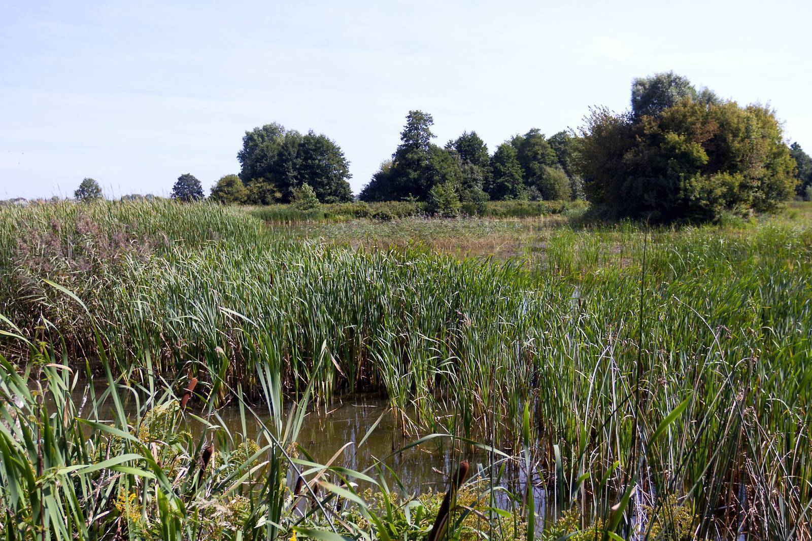
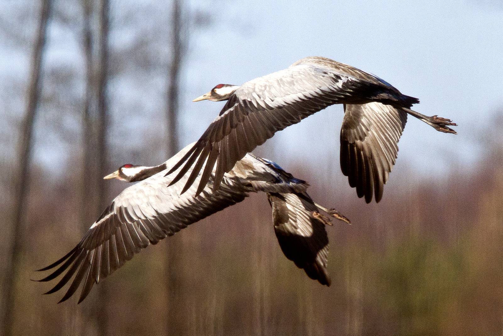
The marshy areas between the villages of Dymer, Popowa Wola, and Rutkowo are remnants of Lake Dymer, which was drained in 1876. Most of the area is covered by reed beds, though there are also wet meadows and willow thickets. The Dymerski Canal runs through the center, into which smaller drainage canals flow. The area is difficult for people to access. Flocks of cranes gather in its western part during migration. The largest flock numbered 2,500 birds. The Dymerskie Meadows serve as a breeding ground for many rare bird species, including the bittern, marsh harrier, Montagu’s harrier, corncrake, spotted crake, green sandpiper, and bearded reedling. Unfortunately, falling water levels mean that bird populations are steadily declining. Cranes on migration typically spend the night standing in the water, which is why the ongoing drainage is very detrimental to them. The area has the status of an ecological site.