Giżycko (0.0 km) • Wilkasy (5.1 km) • Bogaczewo (11.4 km) • Gorazdowo (14.4 km) • Monetki (20.3 km) • Stara Rudówka (23.0 km) • Ryn (30.6 km) • Nakomiady (42.3 km) • Owczarnia (46.7 km) • Kwiedzina (49.2 km) • Gierłoż (53.7 km) • Kętrzyn (61.9 km) • Święta Lipka (76.1 km) • Pilec (81.8 km) • Polska Wieś (94.7 km) • Mrągowo (100.8 km) • Jora Wielka (115.3 km) • Faszcze (124.3 km) • Nowe Sady (128.4 km) • Mikołajki (130.8 km)
The trail passes through the most famous towns of Masuria: Giżycko, Ryn, Kętrzyn, Mrągowo, and Mikołajki. Along the route are the region’s main attractions, including Boyen Fortress—the finest example of 19th-century Prussian fortification architecture—the castle in Ryn—the second-largest Teutonic castle in Poland— the Wolf’s Lair—Adolf Hitler’s main wartime headquarters, the sanctuary in Święta Lipka—one of the country’s most beautiful Baroque churches, as well as the oldest remnants associated with the pagan Prussians—burial mounds and hillforts, including the largest one in Nakomiady.
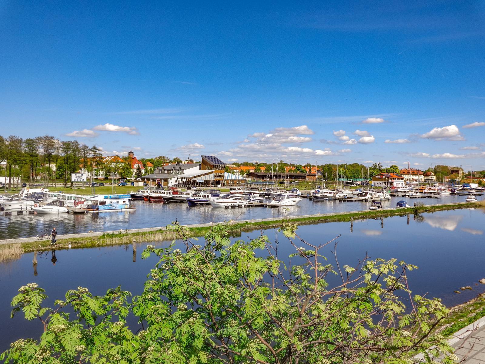
The trail begins in Giżycko, at the train station. From here, we head west toward St. Bruno’s Hill. We pass the wooded Boyen Fortress on our right and continue along the bike path to National Road No. 59. Here, we turn left and cross the bridge over the Niegocin Canal. Next, we cross the railroad tracks in Niegocin. To the left, Lake Niegocin can be seen in the distance. We arrive in Wilkas. At the roundabout, we turn left toward Mikołajki. As we ride through this summer resort town, we pass a beach, marinas, and tourist resorts on our left.
The next 6-kilometer section of the route follows Provincial Road No. 643. This is a very charming stretch, running along the lake’s shore through Strzelce to Bogaczewo. In Bogaczewo, we turn right off the main road toward Szczybały Giżyckie. However, we do not reach that village. In Gorazdowo, we turn left onto a dirt road. On a hill, we see a renovated 19th-century neoclassical manor house with farm buildings and the remains of a park. We continue through Kolonia Kozin to the village of Staropole; on its outskirts, we turn right toward Monetki. Here we see a small manor house from the early 20th century, with a distinctive mansard roof. Remnants of the park and farm buildings have been preserved in its vicinity. At the intersection, we turn left. Behind Stara Rudówka, at the edge of the forest, near the exit to Ryn, stands a stone obelisk commemorating the residents murdered in January 1945. As you pass through Ryn, it’s worth visiting its historic sites. We leave the town via Provincial Road No. 642, heading toward Sterławki Wielkie, but just on the outskirts of Ryn, we turn left off it onto a picturesque road through Knis and Salpik (the names of these villages are of Prussian origin). Before reaching Knis, you’ll see the ruins of World War II bunkers on the left. We arrive in Nakomiad. The village features a palace and park complex. We turn right, heading north. On the right, among the marshy meadows along the Guber River, you can see Zamkowa Góra.
We continue for 2 km along an asphalt road, then turn right and follow a dirt road through the forest to Owczarnia. Next, we cross the railroad tracks, reach Provincial Road No. 592, and turn left toward Kętrzyn. After 600 m, in Kwiedzin, we turn right off the main road and continue along a dirt road to Gierłoż. This section features a cobblestone and concrete surface, built during World War II to facilitate access from the Wolf’s Lair to the airport in Wilamów.
Gierłoż is home to Hitler’s former headquarters, the Wolf’s Lair, and the Mazurolandia miniature park is also nearby. From Gierłoż, head toward the provincial road leading from Węgorzewo to Kętrzyn. Turn left onto it. As we enter Kętrzyn, just before the roundabout across from the cemetery, we see two air-raid shelters. From the roundabout, we take the left exit, pass the stud farm complex, and at the next roundabout, we turn right. On the left, next to the parking lot, the remains of the town’s defensive walls can still be seen. The route continues through the next roundabout to the right, onto Sikorskiego Street. However, near the city walls, it’s worth turning left onto Staromiejska Street to explore Kętrzyn’s historic sites: the Gothic Church of St. George and the reconstructed Teutonic Castle. Following the route signs along Sikorskiego Street, we pass a square with a Neo-Gothic town hall, then reach another roundabout where we turn left and leave Kętrzyn toward Reszel on Provincial Road No. 594.
Passing through Biedaszki, Pudwągi, and Pieckowo, we head to Święta Lipka, known as the “pearl of Baroque architecture in northern Poland.” Święta Lipka is home to a Marian shrine famous throughout Poland. We pass the sanctuary buildings on our left and ride uphill on an asphalt road. At the fork in the road, we take the right-hand branch. We reach the forest and turn right onto a very good gravel road.
From there, all the way to Mrągowo, we ride along the so-called Great Mrągowo Trough. It is formed by Lakes Dejnowa, Kiersztanowskie, and Juno, through which the Dajna River canoe trail runs. First, we pass through the village of Staniewo, then cross the Dajna River, on which a small hydroelectric power plant has been built. Past the power plant, we continue on a gravel road. On the right, you can occasionally catch a glimpse of Lake Dejnowa, which is part of the trough. On a hill before Pilec, also on the right, there is a rural cemetery. We descend a cobblestone road to the village and continue along it to the main road. On the main road, we first turn left and then immediately right, following the sign for Burszewo. At the turn-off on the left, you can see the bridge over the Dajna River. We continue our trip along a straight road through the village. At the edge of the forest, there is a beautiful avenue of old chestnut trees. Here, we take a sharp left turn and, from this point until we exit the forest, we follow Fire Road No. 9. On the left, we pass the “Secrets of the Forest” nature trail. As we leave the forest, we can see buildings in the distance. We continue along a gravel road through meadows and fields. At the fork in Gizewo, we take the paved road to the right, toward the village center. Then, next to the bus stop, we turn left onto a gravel road leading to Kiersztanowo. The next section of the trail leads through the forest and then across meadows. Along the way, we’ll see a beautiful panoramic view of the surrounding area below, featuring Lake Kiersztanowskie. The village of Kiersztanowo lies between it and Lake Juno.
We ride toward the massive cross visible in the distance, standing at the foot of a wooded hill. We exit the forest and continue along the gravel road through the fields toward Polska Wieś. When we reach the paved road, we pass a mini-zoo on the right. To reach Mrągowo, however, we turn left through the village. At the bend, we have a magnificent view of Lake Juno. We follow the bike path along the road toward Mrągowo. In Mrągowo, the route intersects with the Masurian Cycling Loop (Mrągowo Loop), and from Kosewo to Jora Wielka, it follows the same path. The two trails meet one last time in Mikołajki.
In Mrągowo, in front of the amphitheater, we turn left and head uphill. We continue along a gravel road through Tymnikowo and Czerwonki toward Kosewo, circling Lake Juksty from the west and south. Before the railroad tracks in Kosewo, we turn left into an avenue of chestnut trees, and then, before the railroad overpass, we follow the signpost toward Użranek.
Near Użranek lies the highest hill in the Mrągowo Lake District—Królewska Góra. We pass a Neo-Gothic church from 1895 and reach the intersection in the center of the village, next to the fire station. We turn right, following the signpost for Jora Wielka. From here on to Mikołajki, through Cudnochy, Faszcze, Cimowo, and Nowe Sady, we’ll be riding almost exclusively on paved roads. This stretch is lined with moraine hills offering sweeping views. After passing through Faszcze, turn left at the intersection where a monument commemorating the village’s founding stands.
The final section of the route runs through Mikołajki. We pass the Gołębiewski Hotel on our left and follow the pedestrian and bike path along National Road No. 16. The trail ends at the square next to the Evangelical church and the Museum of the Polish Reformation.
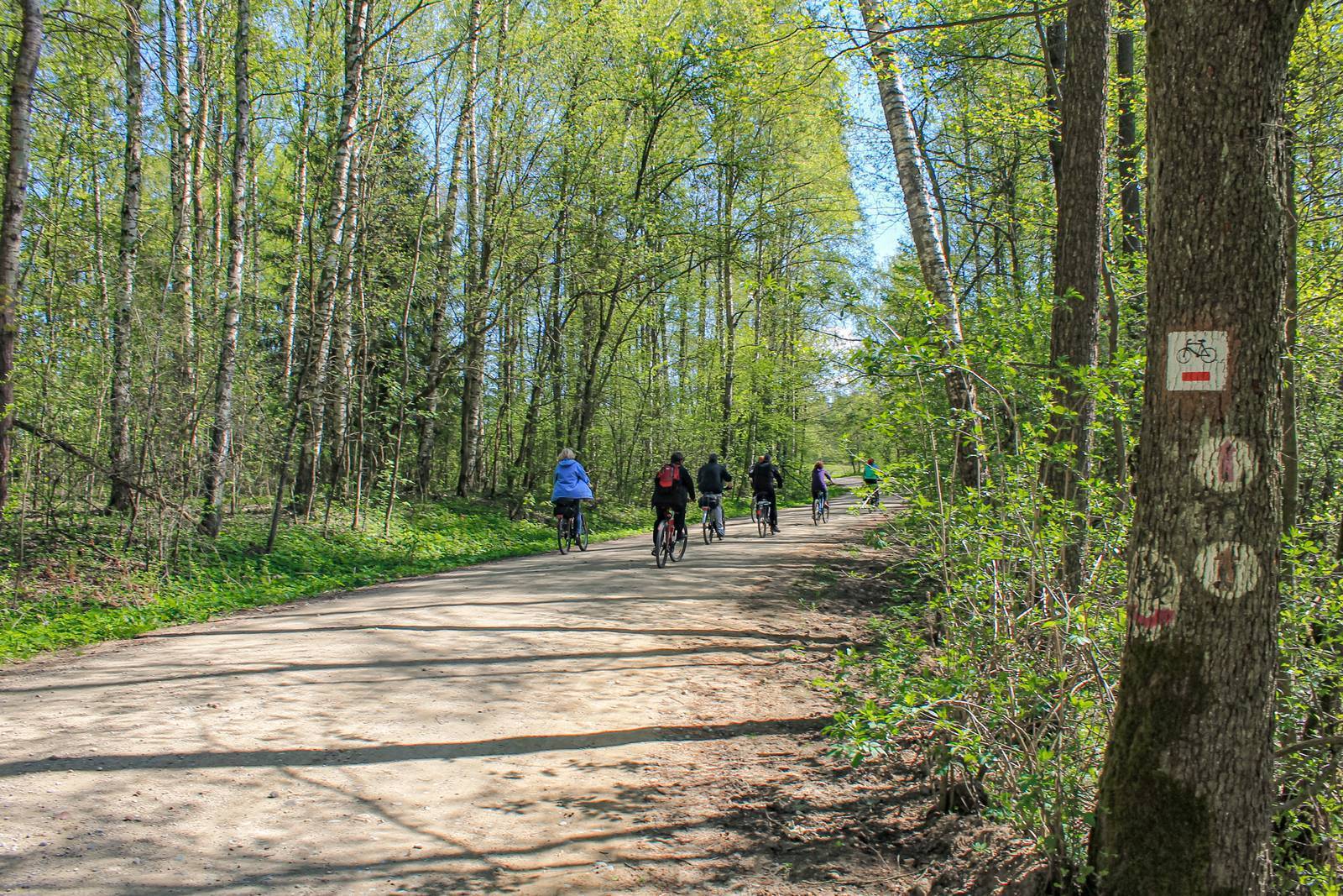
The trail is marked in red. Since the Mrągowo–Mikołajki section partially overlaps with the Masurian Cycling Loop, the markings on this section will not be renewed and may become illegible over time.
Regional trains running between Olsztyn and Ełk pass through Giżycko and Kętrzyn. There are also several long-distance connections.
The History of Pilec
The village of Pilec was founded in 1326. A castle stood in the village until the 15th century. According to legend, a sunken church lies at the bottom of Pilecki Pond.
Ryn
Former seat of a Teutonic Knights commandery. The local castle, now a hotel, is the second-largest Teutonic stronghold in Poland. The 14th-century structure stands on a hill between Lakes Ołów and Ryńskie. Among those who stayed at the Ryńskie Castle was Prince Witold with his family. Ryn has preserved its characteristic 19th-century Masurian small-town architecture, an old mill (now an inn), and a Dutch windmill standing at the intersection with the road to Krzyżany. It is worth noting the medieval underground canal connecting Lakes Ołów and Ryńskie (water flowing from Lake Ołów once powered a Teutonic Knights’ mill). The difference in water levels between these lakes over a stretch of about 200 m reaches nearly 8 m. A section of the canal is clearly visible near Gościniec Ryński Młyn—a restaurant serving regional cuisine.
Nakomiady
The village is home to a preserved 17th-century palace, built in the Dutch Baroque style. The building has been completely restored. It is surrounded by a landscape park featuring the 19th-century von Redecker family chapel. Another notable landmark is St. Joseph’s Church, first mentioned in 1554. In 1932, the church underwent a thorough renovation. At that time, a tower was added (replacing the earlier freestanding wooden belfry), as well as a narthex and a sacristy. The 17th-century altar was repositioned so that it now rests against the wall. There used to be a staircase leading down to the crypt behind it. Next to the church stands a monument dedicated to the villagers who died during World War I. An additional attraction of the village is a workshop that produces replicas of historic stoves and fireplaces.
Castle Hill
A hillfort measuring 96 m by 44 m, located near the village of Nakomiady. In 1962, the site was excavated by archaeologists. It was determined that the hillfort was in use during the Early Iron Age and likely also during the Early Middle Ages.
Owczarnia
A small hamlet where, on the grounds of a private farm, the Masurian Museum has been established, showcasing a rich collection of original household and farm equipment.
Wolf’s Lair
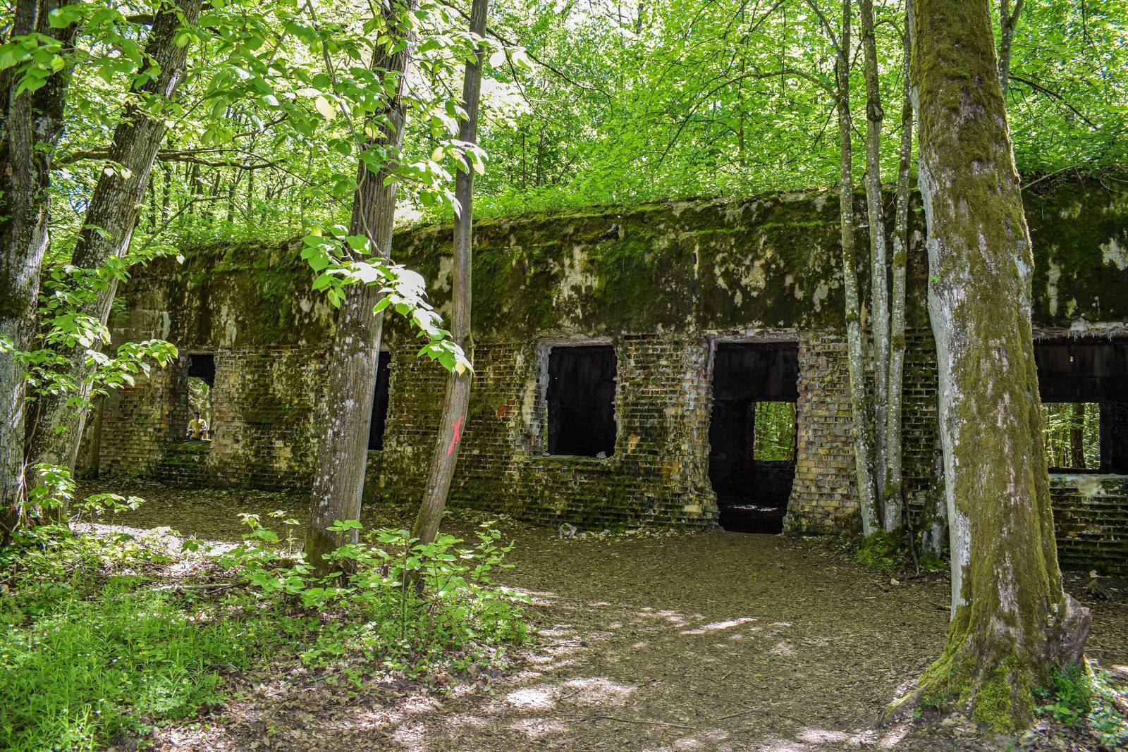
The most famous of Adolf Hitler’s headquarters from World War II. The complex consisted of a total of about 80 structures, including 50 brick buildings and concrete bunkers, most of which were blown up. The site now houses a lodging facility with a restaurant, and tourists can enjoy numerous attractions, including rides in historic vehicles and a shooting range.
Mazurolandia
The Mazurolandia Amusement and Education Park consists of the Masurian Miniature Park, which features miniatures of the most famous architectural landmarks of Warmia and Masuria, the Military Museum, and attractions for children—including a shooting range, a knight’s stronghold, a knight’s costume try-on area, and a clearing dedicated to Masurian legends and fairy tales.
Kętrzyn
The city has nearly 30,000 residents. The main religious monument is the 14th-century Church of St. George, elevated to the rank of a minor basilica. It is the best-preserved fortified church in Masuria. Inside, the crystal vaults from 1515, the 16th-century pulpit featuring depictions of leading figures of the Reformation, and the penitential cell are particularly noteworthy. At the same time as the church was being built, construction also began on a Teutonic Knights’ castle. In 1945, the castle burned down, but it was reconstructed in the 1960s. It currently houses a museum. One of the town’s attractions is the Stud Farm complex, built in 1877, featuring a 200-meter-long stable—the longest in Europe. Mainly cold-blooded horses are bred here. The stud farm is famous for its horse-drawn carriage rides.
Kętrzyn also has an industrial heritage. Among its most recognizable facilities are the Kętrzyn “Majonezy” mayonnaise factory and the Philips Lighting Poland plant—a company founded in 1948 that operated in the 1960s as the Kętrzyn Farel Electrical Equipment Factory.
Farelka from Farel
To this day, many people refer to a fan heater as a “farelka.” This term dates back to a time when fan heaters from the Kętrzyn-based company Farel were among the few available on the market.
“Secrets of the Forest” Educational Trail
A trail winding through the forests north of Mrągowo. Thirteen informational signs have been placed along it, and there are also numerous nesting boxes, bat shelters, and a feeding station for animals. A massive oak tree—a natural monument—stands by the trail. Along the route, there is a rest area with benches and a table.
Mini-Zoo in Polska Wieś
The enclosures here are home to many species of animals, both domestic and wild. Among them are sheep, goats, ponies, Peruvian guinea pigs, ornamental birds, pheasants, and emus. You can walk among them and even feed them by hand.
Mrągowo
Mrągowo was granted town privileges in the early 15th century. Unlike other towns in the region, it was virtually untouched by the destruction of World War II. Along the main streets of the old town—Warszawska and Królewiecka—stand historic townhouses in the Neo-Gothic, Art Nouveau, and Neoclassical styles. The historic town hall from 1824 has also been preserved; it currently houses a branch of the Museum of Warmia and Mazury, as well as the Bosnian Watchtower, first mentioned as early as 1771. Three churches are also historic: a Neo-Gothic Catholic church from 1860, an Orthodox church—a former synagogue from 1894–1895—and an Evangelical church built in the 18th century. In Sikorski Park, the scenic Bismarck Tower, built in 1906, is worth seeing. The structure is approximately 23 meters tall. Military enthusiasts will be interested in the Museum of Military Equipment, which houses the largest collection in northeastern Poland of approximately 70 operational military vehicles.
Mrągowo is famous for its many cultural events and festivals. Undoubtedly the largest of these is the Country & Folk Picnic. Other events well-known from television coverage include the Masurian Cabaret Night and the Borderland Culture Festival. The Mrągowo stage is beautifully situated on Lake Czos.
To make exploring the town easier, the Mrągowo Tourist Trail has been established. It is marked with a bear’s paw—the coat of arms of Mrągowo.
Królewska Góra
The highest hill in the Mrągowo Lake District (212 m above sea level). Its name refers to a visit by the Prussian King Frederick William IV, who stopped here in 1845 during his journey through East Prussia.
Mikołajki
This small town, with a population of just under 4,000, is one of the region’s main tourist centers. It boasts impressive lodging capacity (approx. 8,000 beds). The town’s symbol is the King of Whitefish—he can be seen in the center of Mikołajki, in the fountain on Wolności Square. The local Evangelical church, with its distinctive, slender tower, is a magnificent example of 19th-century religious architecture. Nearby is the Museum of the Polish Reformation (one of only two in the country), and on Dybowska Street stands a Jewish cemetery dating from 1881—one of the few that has survived in such good condition. A long promenade invites visitors to stroll through the harbor along the shore of Lake Mikołajskie. One of Mikołajki’s main attractions is a cruise on a passenger boat, and the most popular route is a trip to Lake Śniardwy.
IMGW Observatory
Mikołajki is home to the Observatory of the Institute of Meteorology and Water Management. The station conducts synoptic measurements and research on solar radiation. Radioactive contamination was recorded here following the Chernobyl reactor accident in 1986.
Stara Rudówka and the Polish Arians
Stara Rudówka is a village dating from the mid-16th century that became famous for being home to the Polish Brethren. Two Arian synods were held here. The Arian congregation was presumably dissolved in 1753. From 1663 onward, the local estate was leased by the poet Zbigniew Morsztyn, who himself belonged to this religious community. Morsztyn died in 1689 in Königsberg, and his funeral took place on January 17, 1690, in Rudówka. It is not known exactly where he was buried. A boulder with a commemorative plaque serves as a memorial to the poet.