

Charakterystyka trasy

The Great Masurian Lakes region occupies the central part of the Masurian Lake District. The surface area of the lakes in this mesoregion is impressive, accounting for nearly 25% of its total area. The connection of these bodies of water via canals has created Poland’s longest navigable waterway, stretching over 130 km. Much of this region is covered by forests, and its landscape is predominantly hilly. Due to its natural and recreational values, it is a unique area both nationally and in Europe. Despite its turbulent history, many historical monuments have been preserved here.
The Masurian Cycling Loop is a route that allows you to explore the Region of the Great Masurian Lakes in an active way. It runs around most of the Great Masurian Lakes complex and connects the towns situated on their shores: Węgorzewo, Ryn, Mikołajki, and Giżycko, as well as Ruciane-Nida and Pisz, located on the Masurian Plain, and Mrągowo in the Mrągowo Lake District.
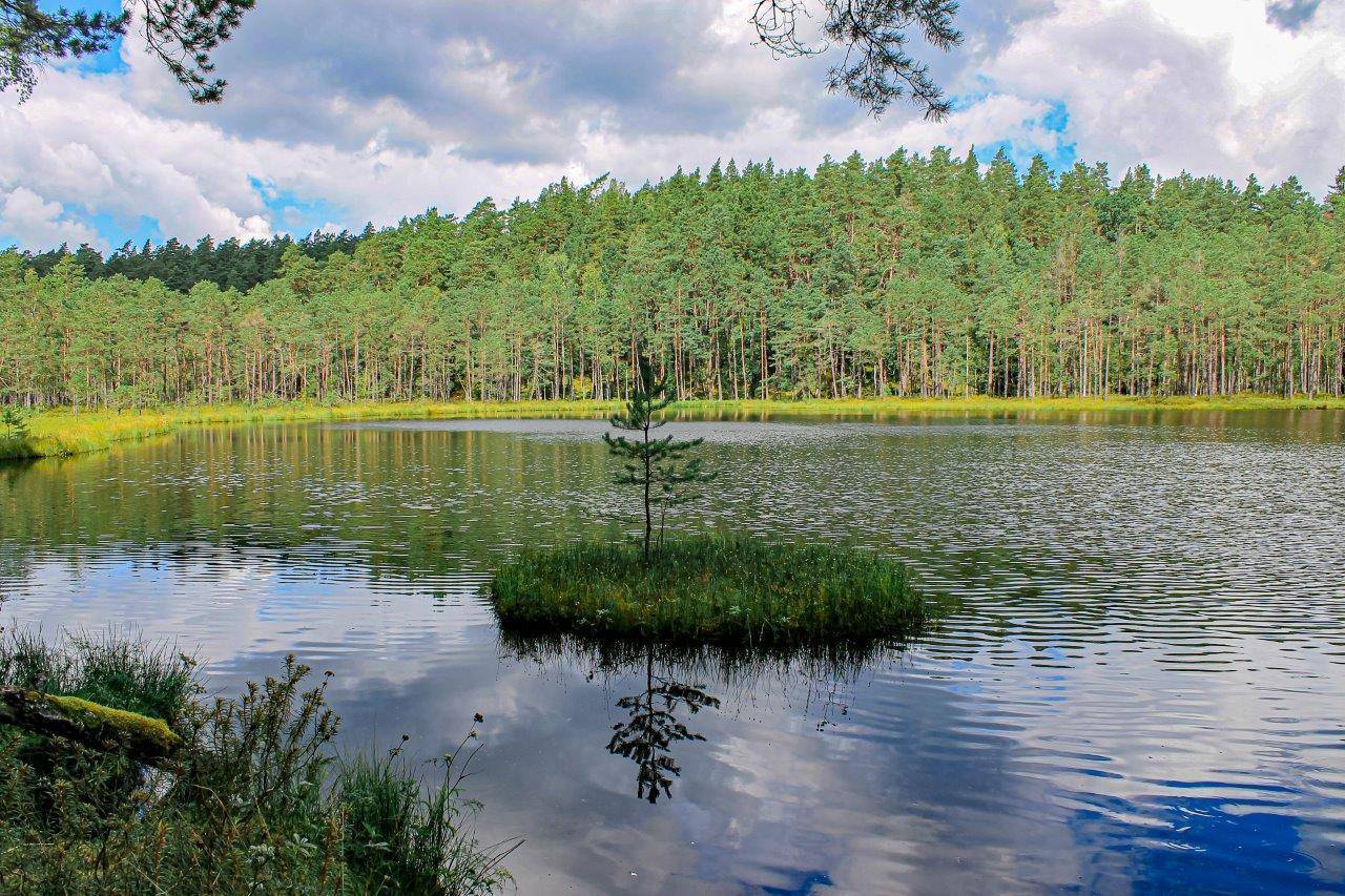
Nature lovers will find quiet corners and unspoiled nature here in the nature reserves of Sztynort, Lake Dobskie, and Lake Nidzkie, as well as numerous lakes, open meadows and fields, and the enchanting forests of the Piska Primeval Forest. Nine observation towers have been erected along the trail in the areas with the most attractive landscapes and natural features.
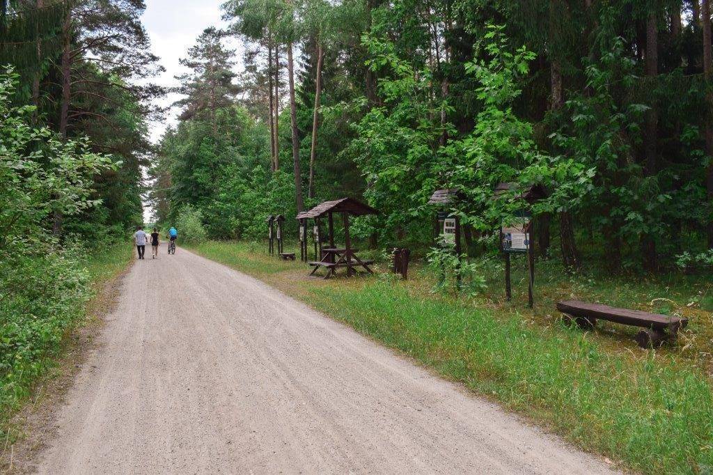
The trail is marked with orange signs bearing the letters “MPR.” The terrain through which the trail passes is varied in terms of topography. Most of the route runs through moraine hills, although in the south it crosses the Masurian Plain, which is covered by the Piska Primeval Forest. Due to the specific nature of this area, it is best to take a touring or hybrid bike on this trip. There are 18 Cyclist Service Stations (MORs) along the route, ensuring a comfortable experience on the trail. They are equipped with, among other things, rest and recreation shelters, bike shelters, restrooms, benches, tables, and bike racks.
The trail is nearly 300 km long, so it’s best to divide the trip into stages that are comfortable for you. The individual towns are usually several dozen kilometers apart, so you can spend a few days on the route, exploring the various towns and tourist attractions.
Three towns along the route are accessible by train. Trains traveling from Olsztyn to Ełk via Kętrzyn from the north stop in Giżycko. There is still a railway line connecting Węgorzewo with Kętrzyn (34 km), on which tourist trains ran during the summer season just a few years ago. Ruciane-Nida and Pisz lie on the railway line connecting Olsztyn with Ełk from the south. Both regional and long-distance trains stop here, including those from Białystok, the Tri-City, and Szczecin.
Western section: Węgorzewo (0.0 km) · Mamerki (13.9 km) · Sztynort (23.8 km) · Radzieje (30.1 km) · Doba (39.3 km) · Sterławki Małe (51.4 km) · Orło (57.0 km) · Ryn (62.4 km) · Krzyżany (70.5 km) Mrągowo Loop: Krzyżany (70.5 km) · Wyszembork (79.5 km) · Mrągowo (90.6 km) · Góra Czterech Wiatrów (95.0 km) · Kosewo (99.8 km) · Użranki (105.0 km) · Jora Wielka (110.7 km)
Alternative Route to the Mrągowo Loop: Krzyżany (0.0 km) · Notyst Wielki (7.2 km) · Jora Wielka (11.8 km) Stare Sady (115.1 km) · Mikołajki (121.1 km)
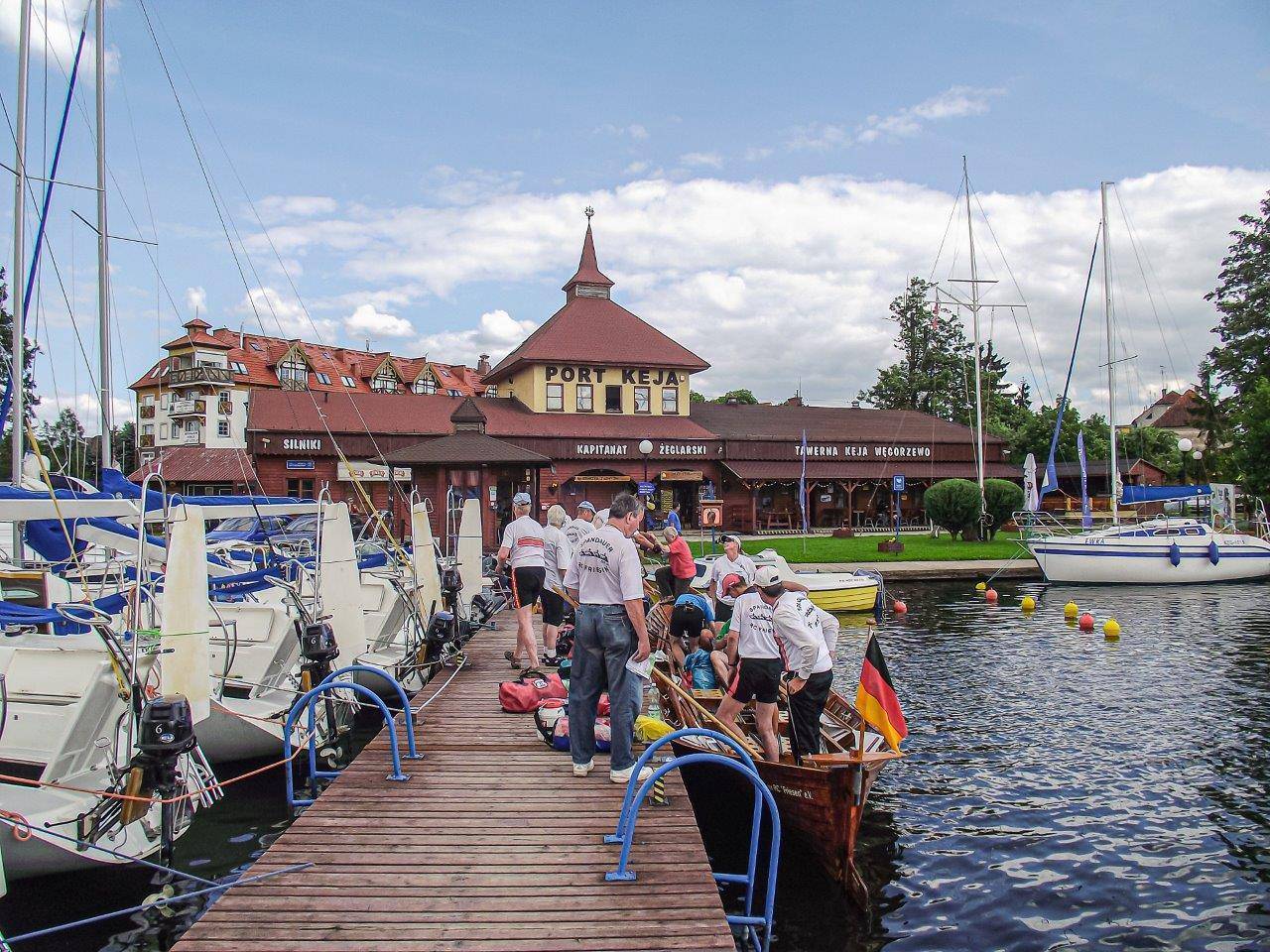
The trail begins in Węgorzewo, next to the Tourist Information Office on Loir et Cher Boulevard. The office is located in the Ekomarina building, next to the Mazurska Żegluga marina. The boulevard is approximately 1.5 km long and runs from the Młyński Canal along the Węgorapa River. While walking along it, you can also see the renovated Teutonic castle and the Museum of Folk Culture with its ethnographic park.
To begin, head west on the bike path along the promenade; then—still on the bike path—ride about 250 m along Provincial Road No. 650, after which turn left onto Krótka Street and then onto Reymonta Street, leading to Ruska Wieś.
The next, very scenic section of the route runs along the shore of Lake Mamry. This is a glacial moraine lake and, in terms of surface area, is the second-largest lake in Poland. Although trees often block the view of the lake here, there are campgrounds along the route where you can rest and admire the lake. On the peninsula known as Zwierzyniecki Róg, you’ll find MOR.
Staying as close to the lake’s shore as possible and turning left at every turn, we reach Provincial Road No. 650. We ride a short stretch of the bike path running alongside it, pass the MOR section of the Green Velo trail and a nearby beach, and then turn left onto a public road toward the village of Radzieje.
Almost 3 km further on, past the village of Przystań, we cross a bridge over the unfinished Masurian Canal and pass the German Army Headquarters in Mamerki on our left.
We reach Pniewa via an asphalt road. August Quednau lived in this small town, which was known as Stobben until 1945.
On the right, you can see a restored manor and park complex that once belonged to the famous East Prussian Lehndorff family, who had their seat in Sztynort. Today, it is private property. A smithy located by the road catches the eye. The small Pniewskie Lake is also a delight; it is a cut-off bay of Lake Mamr, connected to it only by a narrow isthmus.
Continuing south, we reach Kamionek Wielki. At the intersection, we turn left and ride through Sztynort Mały to Sztynort. Kamionek Wielki and Sztynort Mały are small villages that were formerly state-owned farms, featuring buildings characteristic of their former function, while in Sztynort, the Baroque Lehndorff Palace—well worth a visit—has been preserved. A historic oak-lined avenue leads to the village, running along the border of the Sztynort Nature Reserve. On Lake Sztynorckie, connected to Lake Łabap, lies the largest yacht marina in the Great Masurian Lakes. On the outskirts of Sztynort, the trail turns off the oak-lined avenue onto a gravel road that leads to the village of Łabapa, picturesquely situated on a hill overlooking Lake Łabap. From here, a panoramic view of the lake unfolds, and below the road, you can see the ruins of a former farmstead, which was used after the war as farm buildings for the state-owned agricultural enterprise (PGR).
When you reach a fork in the road—one leading toward the village of Radzieje and the other toward the lake—you can veer off the trail by taking the latter and take a break on the village beach with a pier on Lake Dobskie. If you’re not tempted to rest, turn toward the village of Radzieje. Although the trail bypasses the village, it’s worth stopping by.
We then head south toward Pilwa. We pass a small brick building—a former school dating from 1909. There used to be a manor house in the village; all that remains is the park, which is now virtually unrecognizable in the landscape. Leaving Pilwa, we turn left and continue southeast. In the small forest on the left, we pass a neglected, small Evangelical cemetery. Nearby lies a field of fallow land where the village of Skrzypy once stood; however, its buildings have not survived to the present day.
As we enter the forest, on the right we notice signs for the blue hiking trail and the Way of St. James, leading toward Gierłoż. It’s worth extending the trip here to visit the Wolf’s Lair, the headquarters of the Third Reich’s supreme commander, located 5.5 km from this spot—one of the region’s major tourist attractions.
Further on, the trail leads to Doba. It is a small but very interesting town. Before reaching it, on the left side, in a field about 100 m from the road, you’ll pass the base of the German FuMG-65 Würzburg-Riese ground-based radar, which was used to direct anti-aircraft artillery fire during World War II and was part of the Wolf’s Lair defense system.
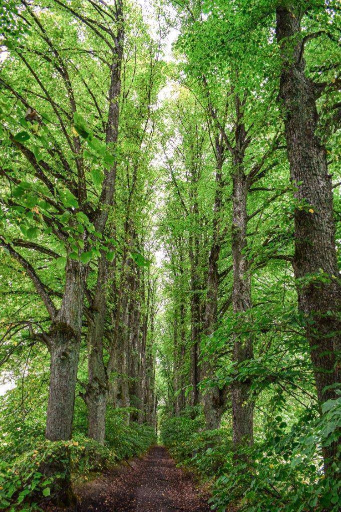
In Doba, the trail turns right, but if you’d like to take a break, you can turn left toward the beach, which offers a view of Gilma Island and the Church of St. John the Baptist. You’ll leave the village via an asphalt road heading south. It’s worth taking a detour to the right onto a gravel road to see the chapel of the von Schenk zu Tautenberg family, the former owners of the village. An impressive linden tree-lined avenue leads to it. Before reaching Dziewiszewo, we turn right off the paved road. The trail continues through farmland toward the northern shore of Lake Dejguny. Here, you can relax on a sandy beach with a lovely meadow.
Next, we head through the forest to Bogacko. The village’s name comes from the surnames of the brothers Szymon and Jan Bogacz, who founded it in 1545. We turn onto an asphalt road and continue through the village toward the south. It’s worth noting the house at number 10, which is an example of a traditional 19th-century Masurian wooden cottage. It was built on a foundation of fieldstone and roofed with reeds. The cottage has a post-and-beam structure, and its gable is adorned with distinctive, richly decorated tiles. Bogack also features a beach with a pier and a MOR facility.
Behind the village’s tightly packed buildings, we turn right off the paved road onto a gravel road, continuing our trip along the eastern shore of Lake Dejguny.
When we reach Provincial Road No. 592, we turn right and head toward Sterławki Małe. At the entrance to the village, on a hill to the left, you can see part of a windmill built in the 19th century.
We turn left toward Szczybały Giżyckie, and after about 200 m, we turn right and continue through the fields for about 5 km to the village of Orło. Here, turn left; after 700 m, you’ll pass the so-called Strażnicza Hill. This is the remnant of a Prussian fortified settlement. Circle the eastern shore of Lake Orło and follow the gravel road to Canek and National Road No. 59. Take the bike path running alongside it toward Ryn. At the entrance to the town, on Ogrodowa Street, you’ll find the MOR. As you ride through Ryn, head north. On a well-maintained gravel road, you’ll circle Lake Ołów from the east. There is a small beach on one of its bays, offering a nice view of the town. We cross Provincial Road No. 642 and continue our trip on a gravel road. Upon reaching the next intersection with an asphalt road, we turn left onto it. Next to the intersection, we see the remains of a small bunker. There are many such ruins of World War II fortifications in the area, part of the Giżycko Fortified Region, which were blown up by the retreating Germans.
About 500 m further on, across from the gravel pit, turn onto the first road on the right and ride 2.5 km through the forest straight to Krzyżany. Just outside the village stands a preserved Evangelical cemetery with a monument to residents who fell during World War I; right next to it is a plebiscite monument, the upper part of which has been damaged.
The Mrągowo Loop
On the section between Krzyżany and Jora Wielka, a 40.2-km branch of the Masurian Cycling Loop has been marked out, leading through Mrągowo. A shorter, alternative route from Krzyżany to Jora Wielka via Wejdyki and Notyst Wielki is 11.8 km long. Both of these sections make up the so-called Mrągowo Loop.
This part of the trail runs through the Mrągowo Lake District. The region is characterized by the meridional orientation of its glacial troughs. There are eight of them, and most are filled with lakes. They are crossed by seven terminal moraine ridges running almost parallel to the equator.
From Krzyżany, the branch to Mrągowo leads through Słabowo and Szczerzbowo to Wyszemborek. It’s worth taking a look at the information boards located in the center of this village. On the outskirts of the village, there is a shelter where you can rest. We pass it on the right as we leave Wyszemborek heading southeast.
We travel 2.5 km along a road with a well-maintained gravel surface and reach the causeway running across Lake Salęt. This is a very nice viewpoint. On the other side of the lake, by the beach with a pier, a shelter for cyclists has been built.
The next section of the trail follows the former tracks of a narrow-gauge railway. We pass Popowo Salęckie on the right and reach the paved road leading to Mrągowo. We turn onto Młynowa Street, and after turning left off it, we pass under the overpass of the city bypass and head right. Along the way, we see the Mrongoville Western-Themed Town on our right. The next section of the trail is the Mrągowo bicycle bypass, which circles the city from the west. Although it bypasses the city center, it’s worth taking some time to explore it.
We follow the trail south. Observation towers have been built on Rynkowa Street and at the city beach in the Grunwaldzkie neighborhood. Additionally, the MOR is located near the latter. As we leave Mrągowo, we pass Lake Sutapie Małe. Here, you can relax on a small beach. We approach National Road No. 16, pass under a railroad overpass, and travel a short stretch along the bike path running parallel to the main road. We reach a point where the trail forks—its 2-kilometer-long branch leads left along a bike path to Góra Czterech Wiatrów, home to the MOR and an observation tower. The main route continues along a gravel road to National Road No. 16, and then along a separate bike path to Nowy Probark. We cross the railroad tracks and ride along a gravel road (with a loose, sandy surface in places) along the southern shore of Lake Juksty, then turn north toward Użranki. Before reaching Użranki, on the left, rises the highest point in the area—Królewska Góra. In 1845, the Prussian King Frederick William IV is said to have stopped here during his journey through East Prussia. We arrive at the village. Its name likely derives from the Prussian language, in which the similar word “isrankut” meant “freed, saved.” It’s worth noting the Neo-Gothic Church of Sts. Peter and Paul the Apostles, built in 1895. A few dozen meters past the church, the trail turns right. From there, we continue on an asphalt road toward Jora Wielka. On this stretch, we’ll descend nearly 2 km down the hill.
Alternative Route Option
Jora Wielka is a tourist town, picturesquely situated on Lake Tałty. An alternative route for this section of the Masurian Cycling Loop also leads here. If you take this route, after turning left in Krzyżany, you’ll ride through the fields. Halfway to the village of Wejdyki, we cross National Road No. 59. In Wejdyki, there is a monument commemorating the village residents who fell during World War I. In this village, on Lake Ryńskie, there is also a large beach with piers.
Continuing along the route past Wejdyki, we pass the ruins of a World War II bunker that was part of the Giżycko Fortified Area. Additional fortifications are scattered along the stretch between Lake Ryńskie and Lake Dejguny to the north.
The next village on the route is Notyst Wielki. The name “Notyst” may derive from the Prussian name “Note.” This small village was once home to a manor house with farm buildings, a distillery, a watermill, and a windmill. Horses and cattle were raised here. After World War II, the estate was used by a state-owned farm (PGR). Unfortunately, in the 1990s, the property fell into disrepair, so a decision was made to demolish it. A new manor house, now privately owned, began to be built on the site of the former cellars.
Further on, the trail runs close to Lake Tałty. From the hill, there is a beautiful view of the lake. Tałty is the deepest trough lake in the Great Masurian Lakes Region. Together with Lake Ryńskie, it forms a single 20-kilometer-long stretch. Its average depth is approximately 14 meters, and its greatest depth, reaching 50.8 meters, is located near Skorupki. Riding along the lake, we reach Jora Wielka, where the alternative route joins the main route of the Masurian Cycling Loop.
At the intersection in Jora Wielka, we head toward Jora Mała. We continue south along the lake’s shore on a gravel road. After passing through the forest, we enter a bike path. On the way to Mikołajki, we pass the tourist town of Stare Sady, which has a nice, well-maintained, public beach. On the outskirts of Mikołajki, on the left, you’ll see the rally track used during the Polish Rally. You’ll pass the MOR resort on Spacerowa Avenue. It’s worth taking a detour here to explore Mikołajki, situated on both sides of the isthmus connecting Lakes Tałty and Mikołajskie.
Southern Section: Mikołajki (121.1 km) · Iznota (130.7 km) · Wygryny (138.1 km) · Ruciane-Nida (142.8 km) · Pranie (150.6 km) · Krzyże (153.6 km) · Karwica (156.8 km) · Wiartel (172.6 km) · Pisz (182.3 km)
The trail then heads south along the western shore of Lake Mikołajskie toward the Piska Forest. On this stretch, a steep climb awaits us, which may pose some challenges.
We cover about 8 km on a gravel road cutting through the forest wilderness and arrive in Iznota. The village is located at the mouth of the Krutynia River where it flows into Lake Bełdany. During the summer season, a food stand operates by the bridge. Nearby, on Iznocka Bay, you’ll find the Galindia resort and amusement park, which draw inspiration from the culture and customs of the ancient inhabitants of these lands—the Prussian Galindians.
From Iznota, we continue south. We ride through the forest, passing a series of small, picturesque forest lakes: Sęczek, Gryżewskie, and Borkowskie, and after covering about 7 km, we reach Wygryn. The village, situated between Lake Wygryny and Lake Bełdany, with numerous lodging facilities, is a popular vacation and tourist destination. It’s worth noting the wooden Masurian cottages from the late 19th century.
Past Wygryny, we continue along a gravel road through the forest to the hamlet of Guzianka, now part of Ruciane-Nida. We turn right onto Cicha Street. On the right is a preserved Evangelical cemetery with a wooden chapel and a section dedicated to soldiers who fell in World War I. We reach the bike path and turn left toward the center of Ruciane-Nida. On the right, we pass the historic Church of Our Lady of Mercy, built in 1910—originally Evangelical, now Catholic—which stands out for its unusual architecture. The building houses the church itself, the pastor’s residence, the parish office, and a parish hall.
On Dworcowa Street in Ruciane-Nida, there is a tourist information center, as well as numerous restaurants where you can relax. The trail continues along Wczasów Avenue. Not far from the entrance to this avenue is the MOR. After crossing the bridge over the Nidka River, which flows into Lake Nidzkie, turn left and follow the pedestrian and bike path along the river to the town beach. Traveling along Wiejska Street and then Żeglarska Street, you’ll leave the town.
The next section of the route runs along the shore of Lake Nidzkie. The lake, together with the surrounding forest areas, forms a landscape nature reserve. It is open to boaters, although the use of internal combustion engines is prohibited in its southern part.
The further south you go, the flatter the terrain becomes, and the soil grows sandier. The southern part of the Masurian Lake District is the Masurian Plain, formed when, at the end of the last ice age, water from melting glaciers flowed southward, smoothing out the unevenness of the terrain.
About 4 km from Ruciane-Nida, we turn left off the paved road and head toward the Pranie Forest Lodge, home to the Konstanty Ildefons Gałczyński Museum. We then take a gravel road to the village of Krzyże. It’s worth taking a break here on the lakeside beach, where an observation tower has been built.
We leave Krzyże via a gravel road and head toward Karwica. Along the way, we pass Binduga Bobrowa, a popular camping spot. There is a grassy beach here with piers. In Karwica, too, we’ll take a break on the beach, where a MOR has been set up.
Beyond Karwica, the trail follows a gravel road for about 10 km through the Piska Primeval Forest along the southern shore of Lake Nidzkie. Along the route are the Duży Lasek and Mały Lasek campsites, where you can rest, as well as an Evangelical cemetery, a remnant of the village of Przerośl. Before the war, 122 people lived there, making their living from fishing and trade. After the war, the village was abandoned, and the houses were demolished. Only the foundations remain to this day. We reach an asphalt road and head north. After about 3.5 km, on the left, we see a signpost pointing to a grave of Russian soldiers who fell in 1914–1915, located 400 m away on the shore of the lake. Not far from this spot, we turn left onto a gravel forest road leading to Wiartla, which is about 2 km away. Along the way, on the left side of the trail, we pass the small forest lake Linówko. It is muddy and shallow (about 2.5 m deep), usually with a still surface. It is notable for its very clear water.
Wiartel is a tourist village situated between Lakes Nidzkie and Wiartel, which are connected by the Wiartelnica River. The village features a MOR resort, as well as bars and restaurants. In winter, the village attracts tourists with its groomed cross-country ski trails. In the southern part of Lake Wiartel, known as Południowy Przylasek, there is a beach with a pier. A road runs eastward alongside it, along which the trail leads. We reach the paved road and follow the bike path toward Pisz. After passing the village of Jabłoń, we turn toward Wąglik. Near the turnoff, there is a small cemetery. The first person buried here was likely a forest inspector who died in 1908. In 1915, several unidentified Russian soldiers were laid to rest here. In Snopki, we reach National Road No. 58. The village was founded in 1515 and belonged to Janik Snopek. On the other side of the road stands a preserved Evangelical cemetery with a monument to the victims of a Nazi concentration camp.
We turn right and continue along the bike path parallel to the main road.
Along the road, on the right, we pass the first bunker of the Pisz Riegel Position, and further on, on Nidzka Street, sections of an anti-tank barrier. About 100 meters from the national highway runs the historical route of the Pisz Resistance Point, and the Riegelbau bunker houses a small museum run by the Pisz Fortifications Enthusiasts Association (Facebook: Mazurskie Fortyfikacje). The Masurian Cycling Loop does not pass through the center of Pisz, but it’s worth veering off the trail to explore the town.
Eastern Section: Pisz (182.3 km) · Jeglin (188.9 km) · Zdory (195.0 km) · Nowe Guty (206.9 km) · Okartowo (211.3 km) · Cierzpięty (218.9 km) · Marcinowa Wola (224.9 km) · Rydzewo (237.2 km) · Kula Canal (239.7 km) · Bogaczewo (242.3 km) · Wilkasy (248.7 km) · Giżycko (253.3 km) · Pieczarki (262.2 km) · Pozezdrze (268.4 km) · Ogonki (271.4 km) · Węgorzewo (285.2 km)
The route continues along the bike path on Warmińska Street to National Road No. 63, then follows that road, and in Maldanin turns right toward Imionek. Before reaching the village, in the forest on the left, there is an Evangelical cemetery with a dilapidated chapel, and a little further on, a manor and park complex from the turn of the 19th and 20th centuries, which is privately owned.
We reach the Jegliński Canal. After crossing the bridge over the canal, we turn left and ride along it for 2.5 km on a beautiful bike path. From Jeglin, we head toward Szczechy Wielkie along a former railroad embankment through the forest. The railroad line from Pisz to Orzysz was built in 1905. It officially ceased operations in May 1945 and was dismantled very quickly.
We ride to Nowe Gut along the old route leading from Pisz to Orzysz. As late as the 19th century, there was no direct connection between these towns. First, we take the paved road to Zdor. About 100 meters from the road is a small beach on Lake Seksty (which is, in fact, the southern bay of Lake Śniardwy), accessible via the so-called Seksty Gate. Its shores are forested. At the bend, on the left, stands the building of a former inn (which now houses the village community center). A plaque commemorating the 500th anniversary of the village’s founding in 1508 is affixed to it.
At this point, it’s worth taking a detour to one of Masuria’s most famous viewpoints, Szeroki Ostrów, to see the open waters of Poland’s largest lake. The route is marked by signposts. Turn left off the paved road, and then, past the grocery store, turn right onto a gravel road. The distance from Zdor to the lake is about 3 km.
The route then continues to the right along a bike path, which will take you all the way to Nowe Gut. First, past Zdor, you’ll pass a weir on the Śniardwy–Roś Canal. This hydraulic structure maintains a level difference of about 1 m between Lake Śniardwy and Lake Roś. Not far from the trail, about 400 m to the west, there is a viewpoint called Wysoki Brzeg, offering a beautiful panoramic view of Lake Śniardwy.
Next, we arrive at the village of Kwik. Here, you can relax on a large beach with a pier, where the MOR is located, and by Lake Białoławki, see a monument commemorating the village’s 500th anniversary.
Following the bike path, we reach Nowe Gut. The 1.5-km stretch just before the village runs quite close to Lake Śniardwy; we can see the lake through the trees. In Nowe Gut, we turn onto an asphalt road and follow it to National Road No. 16. On the other side of the road runs a bike path leading to Okartowo. We cross a bridge from which we can see Lake Tyrkło on the right and Lake Śniardwy on the left. The isthmus between the two lakes was an important defensive point. This is where the border between the lands belonging to the Galindians and the Yotvingians once ran. Now, the isthmus is home to the Polish Navy (MOR). We pass through Okartowo. In Wężewo, where the bike path ends, we turn right and continue along a gravel road through the forest. On the right, on the shore of Lake Tyrkło, there is a small hill called Góra Zamkowa. It is the remnant of a Prussian settlement. Before reaching the paved Cierzpięty–Orzysz road, we’ll descend a hill along a road with a loose, sandy surface. On the way to Cierzpięty and on to Marcinowa Wola, we come across the remains of bunkers. They are part of the Giżycko Field Position.
At the intersection in the center of Cierzpięty, a World War I cemetery has been preserved. General Paul von Hindenburg was present at its opening on September 2, 1914. In the village, along the road overlooking Lake Buwełno, there is also a manor and park complex from the second half of the 19th century, now in a state of disrepair. After World War II, a state-run farm operated here.
From Cierzpięt, we ride to Marcinowa Wola along a beautiful gravel-surfaced avenue. To the left lies the Nietlickie Bagno Nature Reserve. Marcinowa Wola is a village with a linear layout. In the center of the village, you can rest on benches next to the World War I cemetery. Continuing on, we follow the paved road north. We pass an observation tower and a 327-meter-high radio and television mast, built in 1998. Near the mast, we turn left off the paved road toward Kleszczewo, onto a picturesque road running along Lake Wojnowo. There is a large municipal beach here with piers and a MOR facility. We reach a fork in the road and turn left toward Rydzewo. Just before this village, on the right side of the road, there is a very picturesque, grassy beach. To get there, follow the signpost to the campground. After passing through the village, at its edge, turn onto the gravel Spacerowa Street, which runs close to the shore of Lake Boczne. You’ll reach an asphalt road and turn right toward the Kula Canal.
Before reaching Bogaczewo, you’ll come to Provincial Road No. 643 and follow it north to Wilkas—one of the most picturesque sections of the trail along Lake Niegocin. This stretch is approximately 7 km long. You’ll pass through the resort and tourist towns of Bogaczewo and Strzelce. We reach Wilkas via a bike path. Here, you can relax on the AZS beach, which features piers and a MOR facility; there are also dining options nearby. As we leave the town, we pass the Es-System Wilkasy plant. The company specializes in the production of lighting equipment.
Next, we follow the bike path along National Road 59 toward Giżycko. We cross over the Niegociński Canal and turn right off the main road. We continue along the bike path. On the left is one of the most beautiful viewpoints in the Giżycko area—St. Bruno’s Hill. It’s also a favorite walking spot for both locals and tourists. Here, you can use the public barbecue area and covered shelters. An observation tower stands nearby. It’s worth veering off the trail here to visit Boyen Fortress, near which the MOR is located.
We pass the stone Stations of the Cross and, after passing the barracks, turn left into Roger Goemaere Park. Then we head right, pass the Teutonic Castle (now a hotel), and cross the swing bridge to the other side of the Łuczański Canal. The trail continues along 1 Maja, Kościuszki, and Nowowiejska Streets, crosses National Road No. 59, and after the intersection, follows Świderska Street. From there, we turn left onto Antonowska Street, then right onto Zachodnia Street, and head north on a gravel road toward Świdr, where the MOR is located, and on to Pieczarki.
Pieczarki lies on Lake Dgał Wielki. The trail continues north on an asphalt road toward Pozezdrze, but you can veer off it and try to circle Lake Dgał Wielki, approaching Lake Dargin. In Pozezdrze, about 2 km from the village center, on the shore of the lake of the same name, there is a beach with a pier and the MOR. In the village, head north on Węgorzewska Street. The next section of the route follows the embankment of the former railway line from Giżycko to Węgorzewo. It was opened in 1905, and the tracks were dismantled in 1945. Not far past Pozezdrze, we pass the remains of Heinrich Himmler’s “Hochwald” compound. Built between 1940 and 1941, the complex consisted of five bunkers, a garage, two guardhouses, and a special bunker for Himmler, the commander of the SS and the police of the Third Reich. In January 1945, the structures were blown up by the retreating Germans. We continue along a gravel forest road that follows the former railroad tracks, passing under two overpasses. We reach the village of Ogonki, situated on the isthmus between Lakes Święcajty and Stręgiel. Just outside the village is a MOR. In Ogonki, we join a bike path running alongside National Road No. 63.
Right next to the Giżycko–Węgorzewo route, the ruins of a World War II B1-1 combat bunker and a Soviet military cemetery from World War I on Konopki Hill have been preserved. At this point, we cross to the other side of the street and head west, following the signs pointing to the observation tower and the German war cemetery at Jägerhöhe.
Next, we take the gravel road Wodociągowa to the beach in Kal. The Kalska Column stands along the trail on Jasna Street. Continuing westward, we reach “Mamry” Beach on the lake of the same name, one of the most beautiful in Masuria. There is an observation tower next to it, and a food stand operates during the summer.
Finally, following the bike path along Braci Ejsmontów Avenue and the Węgorapa River, we reach the center of Węgorzewo, where we complete the Masurian Bike Loop.
Węgorzewo
Węgorzewo was granted city rights in 1571. Its unique coat of arms depicts a brick structure resembling the Kalska Column. Perhaps at the time the city was granted its rights, the column was so famous that the town was commonly associated with it.
The oldest historic site in Węgorzewo is a Teutonic castle from the late 14th century, which was destroyed by the Tatars in 1656. It was later rebuilt as a Baroque residence. Another fire, set by the Red Army, destroyed the building in 1945. Only the walls survived. The castle was rebuilt again in the 1980s. It is currently privately owned.
An interesting cultural institution is the Museum of Folk Culture in Węgorzewo. The exhibition features, among other things, everyday objects, farm equipment, and works of folk art. Adjacent to the museum is the Ethnographic Park, located on the banks of the Węgorapa River, where visitors can not only see traditional Masurian architecture but also encounter goats of a regional breed.
On Konopki Hill, also known as Devil’s Mountain, stands a monument to Red Army soldiers, unveiled in 1968. The monument, nearly 7 meters tall, is located in a cemetery where Soviet soldiers who fell in 1945 are buried.
In the summer, the Railway Tradition Museum operates in the train station building. The exhibits on display are related to railways in East Prussia. Here, you can see old timetables and maps, as well as equipment and tools once used by railroad workers.
Until 1945, Węgorzewo was famous for hosting iceboat races. In 1936, Lake Święcajty even hosted the European Championships. Even today, the area around the town is a popular destination for iceboat enthusiasts.
Ruska Wieś
This small settlement was founded in 1402. Over the centuries, it changed hands many times. In 1760, a nobleman’s manor house was built there; although it was rebuilt in the 19th century, it has retained its original architectural features to this day. The manor is surrounded by a park with old linden and hornbeam trees. The property is currently privately owned.
The Masurian Canal
The first documented references to plans for the construction of the Masurian Canal date back to the 17th century. The canal was intended to connect the Great Masurian Lakes with the Baltic Sea via the Łyna and Pregoła rivers—on which the city of Königsberg is situated—and through the Vistula Lagoon.
Construction began in 1911 but was interrupted by World War I. After the war ended, construction resumed, but it was halted again in 1924 due to the economic crisis. Work was resumed as part of public works projects when the Nazis came to power. The outbreak of World War II led to a reduction in work, and in 1942, construction—which was already well advanced at that time—was officially halted.
The partition of East Prussia in July 1945 resulted in the Masurian Canal being divided between two countries. The unfinished waterway was approximately 50 km long (of which over 20 km lay on the Polish side, and nearly 30 km on the Soviet—now Russian—side). The difference in water levels was 111 m. Ten locks were intended to compensate for this difference. Five unfinished locks remained on Polish territory.
German Army Headquarters in Mamerki
The complex was built between 1940 and 1944 along the Masurian Canal and Lake Mamry. The code name “Mamerki” is the Polish translation of the German term “Mauerwald,” meaning “forest by Lake Mamry.” It is one of the best-preserved complexes of German bunkers from World War II in Poland. The compound was built to house 40 of the highest-ranking generals and field marshals, as well as 1,500 officers. It consisted of 250 structures, including 30 reinforced concrete bunkers. Unlike the Wolf’s Lair near Kętrzyn, the complex in Mamerki was not destroyed. The Germans did not have time to blow up the bunkers; Wehrmacht troops abandoned them without a fight in early 1945. Today, visitors can enter the structures and appreciate the sheer scale of the complex. Currently, museum exhibits on World War II have been set up here, and the tallest observation tower in Masuria (38 meters high) has been erected.
Sztynort
From 1420 onward, Sztynort belonged to the Lehndorffs, one of the most powerful Prussian noble families, and served as their main residence from 1572 to 1945. The Baroque palace was built between 1689 and 1691, and behind it lay a vast park that was among the most beautiful in Prussia. It was adorned with flower beds and a variety of shrubs and trees. Regular oak-lined avenues were also laid out within the park. Preserved within the park are a Classicist tea house from the turn of the 18th and 19th centuries and a Neo-Gothic chapel. Centuries-old oak trees have also survived to this day.
The palace was not destroyed during World War II. After the war, it served as quarters for Soviet troops. Later, it was managed by the State Agricultural Farm (PGR) and housed a cafeteria and a preschool. The farm buildings were also put to use. After the liquidation of the PGR, the palace complex fell into disrepair. Currently, the property belongs to the Polish-German Foundation for the Preservation of Cultural Monuments, which is carrying out renovation work.
During the summer season, the room on the right side of the building features an exhibition on the history of the site and plans for its restoration. Guided tours of the palace’s interior are also available.
Just outside the town lies the Lehndorff family mausoleum, situated on the Sztynort Canal, on a peninsula surrounded by the waters of Lakes Sztynort, Dargin, and Łabap. The octagonal, Neo-Gothic structure was built in 1857.
Sztynort Nature Reserve
The reserve encompasses part of a peninsula covered with an alder-ash forest, as well as the bays of Lake Kirsajty, which serve as a nesting site for waterfowl and marsh birds and a gathering place for them during their fall and spring migrations. The reserve’s boundary runs along a historic oak-lined avenue leading toward Sztynort. The oldest oak, planted in 1683, does not grow right next to the road but several dozen meters away from it.
Dobskie Lake Nature Reserve
The reserve encompasses the lake and the islands located within it: Wysoki Ostrów (Cormorant Island), Helena Island, Gilma, Lipka, Ilmy Wielkie, and several small, unnamed islets. Cormorant Island serves as a breeding colony for cormorants and gray herons, while Gilma was once dedicated to deities—pagan rituals were performed there. On this island, the last chieftain of the Galindians held out in his stronghold until the very end, defending himself against the Teutonic Knights. Remains of a 13th-century Prussian fortified settlement, castle ruins, and the remnants of stone-paved stairs have been preserved here.
Since the islands serve as breeding grounds for waterfowl, a quiet zone is in effect on the reservoir. The birds’ peace should not be disturbed, so it is prohibited to approach the shores of the islands by boat.
Radzieje
The village likely existed as early as around 1400. Its most famous landmark is the unusual Church of Christ the King from 1827, built on an octagonal plan with a pyramidal roof topped by a lantern. The building is said to have been designed by Frederick William IV, heir to the Prussian throne. Inside are two 17th-century Dutch paintings. Other elements of the interior decor also date from the same century: a cherub, figures of the Evangelists, and a suspended Baroque baptismal angel. During baptisms, the angel was lowered, and the baptismal font was placed between its outstretched arms. Today, very few artifacts of this kind remain. Next to the church stands a wooden bell tower bearing the coat of arms of the patrons, the Lehndorff family. It predates the surviving church and dates from the first half of the 18th century. On the roadside is a World War I military cemetery where 15 German soldiers and two Russian soldiers are buried.
Nearby, about 3 km north of the village, the forest still contains the bunkers of the headquarters of Reich Chancellery Chief Hans Lammers—built between 1940 and 1941. The complex was codenamed “Wendula” and comprised two bunkers, hospital buildings, and barracks. It was abandoned at the end of 1944.
The Wolf’s Lair in Gierłoż
Construction of Adolf Hitler’s headquarters and the High Command of the Armed Forces in Gierłoż near Kętrzyn began in the spring of 1940. From the start of the war with the Soviet Union in June 1941 until the fall of 1944, with only brief interruptions, the Führer of the Third Reich resided there. The original plan called for a swift victory, so initially there were no plans to build a large headquarters. Over time, as the conflict dragged on, the complex was expanded. Ultimately, it covered an area of approximately 250 hectares, containing about 130 structures, including approximately 70 bunkers. Unlike the Mamerek complex, this compound was blown up by the retreating Germans. The remains of the complex are now one of the region’s major tourist attractions.
Doba
From 1529 to 1945, the village belonged to the aristocratic von Schenk zu Tautenberg family, whose members served for many years as starosts of Giżycko and Węgorzewo. The surname “Schenk” can be linked to the German word “einschenken,” which means “to pour.” The family may have owed this name to their legendary ancestor Vargula, who is said to have held the position of cupbearer at the Burgundian court in the 15th century.
The former owners built a palace and manor complex in Doba, but it has not survived to the present day. The residence was surrounded by an English-style landscape park, which has been entered into the register of historic monuments. Another interesting structure is the 19th-century blacksmith’s shop.
On the outskirts of the village, near the beach on Lake Dobskie, stands the 16th-century Church of St. John the Baptist. The church is in the late Gothic style, built of brick and set on foundations of field boulders. The beach offers a view of Gilma Island.
About 1 km north of the village, on three small hills, lies a boulder field designated as a natural monument.
Ryn
Former seat of a Teutonic Knights commandery. The town is situated on a hill between Lakes Ołów and Ryńskie. Ryn’s main attraction is its 14th-century castle, which now serves as a hotel. The town has also preserved its characteristic 19th-century Masurian architecture. Along the promenade by Lake Ryńskie stands a former mill, which now houses an inn. The millwheel was powered by water flowing through an underground canal connecting Lakes Ołów and Ryńskie, built as far back as the Middle Ages. The difference in elevation between these bodies of water is nearly 8 meters over a distance of about 200 meters. The canal is still in use, and a short section of it can be seen in a glass-enclosed display well at the Ryńskie market.
Wyszembork
The village is located in the Mrągowo Lake District, which is part of the Masurian Lake District. The large number of lakes and postglacial hills contributes to the area’s unique microclimate. Wyszembork is one of the oldest settlements in Mrągowo County. It was founded in 1376, following the construction of the castle in Szestno, when the colonization of the area began. The name likely derives from the German town of Weissenburg near Nuremberg, from which the settlers are said to have come. In 1897, a narrow-gauge railway station on the Mrągowo–Kętrzyn line was opened in Wyszembork. The line operated until the late 1960s. Today, a bicycle trail leading to Mrągowo runs along the former railway embankment. In the center of the village stands an impressive school building, erected in 1926.
The area around Wyszemborek is among the most thoroughly archaeologically studied regions in Poland. Research, with only brief interruptions, has been ongoing here since 1949. Near the village, there are 13 archaeological sites, including several cemeteries and the remains of a settlement. The oldest traces of settlement found here date back 2,000 years.
Lake Ryńskie
The lake is 7 km long, and its average depth is approximately 13 m. The deepest point (20.2 m) is located near Ryn. There are three islands in the lake. The largest, known as Duża Wyspa (Big Island), is situated opposite the beach; it is also called Ptasia Wyspa (Bird Island) or Goła Zośka and is a nature reserve. There are no trees on the island, but 12 species of birds have been recorded here, including the crested duck, which rarely breeds in Poland. However, the most numerous species—as many as 9,000 pairs—are black-headed gulls, which form a very noisy colony. Thousands of birds build their nests here and safely raise their young.
Piska Primeval Forest
The largest forest complex in Masuria and one of the largest in Poland, covering approximately 100,000 hectares. More than half of its area falls within the boundaries of the Masurian Landscape Park.
The primeval forest is located partly on the Masurian Plain. It is a remnant of the ancient forests that once covered the territory of Prussia. To this day, the area remains sparsely populated. Most of the settlements were established in the 19th century following the arrival of the Filipons, a religious sect of Russian Old Believers. After the end of the Ice Age, approximately 12,000 years ago, a taiga forest grew here, which over time, as the climate gradually warmed, transformed into a Central European forest. Today, it is home to all animal species characteristic of this latitude, with the exception of brown bears. Here you can encounter: moose, deer, wolves, lynx, and wild boars; and among the birds, black storks, which build their nests in trees.
The Konstanty Ildefons Gałczyński Museum – Pranie Forest Lodge
The museum was established in 1980. Today, it is a very vibrant cultural institution, open year-round. Previously, a Memorial Room was established here dedicated to the poet, who spent a total of over a year in Pranie in the early 1950s. The forester’s lodge was built around 1880 and is beautifully situated on the high bank of Lake Nidzkie, surrounded by the Piska Primeval Forest. The “In the Footsteps of Gałczyński” nature and educational trail begins at the parking lot next to the forester’s lodge. The trail is approximately 1.4 km long and forms a loop, leading along the steep shore of Lake Nidzkie to the 800-year-old natural monument known as the Perkun Oak. A short section runs along a picturesque footbridge. Information panels have been placed along the trail, presenting the lake’s fauna and the principles of forest management. Konstanty Ildefons Gałczyński undoubtedly walked this route.
Pisz
The town’s name derives from the Pisa River, which flows through it; the Pisa is a right tributary of the Narew, which in turn flows into the Vistula. As a result, it connects the Great Masurian Lakes with the waters of the Vistula basin. Interestingly, it is the only river in this part of Europe that flows southward from start to finish.
The history of Pisz dates back to the mid-14th century. At that time, the Teutonic Knights built a defensive castle on the right bank of the Pisa. Only fragments of its walls remain, which can be seen in the park on Gizewiusza Street. The castle was almost completely destroyed during World War II, and its remains were demolished in the 1960s.
In the town center stands the Neo-Gothic town hall—one of the most beautiful in Masuria. The building, dating from 1900, houses the Museum of the Pisz Region. Behind the town hall stands a Neo-Gothic tower that formerly served as the malt house for a 19th-century brewery.
A Prussian stone statue has been erected on Daszyński Square; it was brought to Pisz from Wejsun, where it was discovered in 1872. A human face is carved on the obelisk. Today, we do not know the purpose of these stone figures. It is known that they were likely crafted by the Prussians, the former inhabitants of these lands, and that they depicted male figures—perhaps deities or distinguished warriors.
Among Pisz’s religious monuments, the oldest church in the town, St. John the Baptist Church, deserves special mention; until 1945, it served as a Lutheran church. The tower, rebuilt after a fire, dates back to 1694, and the half-timbered walls were erected in 1737. Inside, the main altar from the late Renaissance period, renovated in 1696, and a Baroque pulpit from 1701 have been preserved. Dating from the 17th century are a wooden polychrome crucifix, a sculpture depicting a pelican, and a baptismal font.
The town had a small Jewish cemetery on Parkowa Street, established in 1850. Only one gravestone survived the destruction of the Third Reich. Fragments of one matzeva were transferred to the Museum of the Pisz Region.
Other historical monuments in Pisz include: a water tower from 1907, three Baroque houses on Rybacka Street (18th century) and Lipowa Street (19th century), houses on Rybacka Street dating from the first half of the 19th century, as well as two buildings on Daszyńskiego Square, the only remaining vestiges of the town’s once-prosperous Art Nouveau architecture.
During World War II, approximately 80% of the town was destroyed; however, the structures of the Piska Half-Timbered Position have been preserved in very good condition, and a historical trail now leads to them. The shelters began to be built in 1939 between Lakes Roś and Brzozolasek. The expansion of the complex was completed in 1944. Two shelters have been renovated, and one of them now houses a military-historical exhibition.
Lake Śniardwy
Śniardwy is the largest lake in Poland. Its surface area is 113 km². It is of glacial origin and is classified as a moraine lake. Bodies of water of this type formed during glacial retreat, when massive chunks of ice that had broken off from the glacier melted on sandy ground, deepening depressions in the terrain. This is why moraine lakes are shallow. Poland’s largest lake has an average depth of 7 m and a maximum depth of 22 m.
The largest island on Lake Śniardwy is Szeroki Ostrów, connected to the mainland by a causeway. There used to be a small settlement here. A magnificent view of the lake stretches out from the high cliff.
The Jegliński Canal
Built between 1845 and 1849, it shortened the original, natural route from Śniardwy to Lakes Roś and Pisz by as much as 22 km. The canal is 5,250 m long and is the longest on the entire Great Masurian Lakes route. It is named after the village of Jeglin, through which it runs. The Karwik lock is located on the initial section of the canal.
Nowe Guty
A village picturesquely situated on the eastern, high shore of Lake Śniardwy. It is a typical linear village, approximately 2 km long. The village’s original name, Gussepilcke—which translates from Prussian as “Gussa’s Stronghold”—likely referred to an earlier Prussian settlement located here. Founded by the Teutonic Knights in 1450, the settlement adopted this name.
It was one of the largest towns in the area, more significant than Orzysz. Today, it serves as a resort and tourist destination. One of the most famous beaches in Masuria is located here. In this part of Lake Śniardwy, the shore is sandy and the water is shallow, making it ideal for swimming. On the lake’s shore stands an observation tower and one of the village’s few historical landmarks—a Dutch-style windmill.
Okartowo
This is a small village with an interesting history. Around 1340, the Teutonic Knights built their own earth-and-wood stronghold here, on the site of a former Prussian stronghold, and later a stone castle. However, it was completely destroyed in 1379 during a Lithuanian raid. It was likely never rebuilt due to its proximity to the castles in Ryn, Giżycko, and Pisz.
The village was founded in the second half of the 15th century. Between 1709 and 1711, as a result of a plague epidemic, its population was completely wiped out. It is known that as late as 1800, there was no bridge on the isthmus connecting Lakes Śniardwy and Tyrkło, on which the village lies, and crossings were made by boat. Among the most important historical monuments is a church that is unique in the Masuria region. The Church of the Immaculate Heart of the Blessed Virgin Mary was built in 1799, most likely on the site of a Teutonic Knights’ castle. Destroyed during World War I, it was later rebuilt. The church’s interior is famous for its polychrome decorations featuring symbolic, geometric, and botanical motifs that reflect the nature of Masuria. The panels above the Baroque main altar display painted signs of the zodiac and symbols referring to God’s authority over the entire universe. Bible quotations in German are placed between the panels. Behind the current rectory stands a building that formerly served as the rectory. It is located on the site of the original castle complex. A cellar lined with stone slabs was discovered beneath the rectory; the castle walls have likely survived underground. Near the rectory is a small mound on which a “gdanisko”—a sanitary and defensive tower—once stood.
Orzysz
This small town, with a population of nearly 6,000 today, is an example of a typical garrison town. For centuries, it provided for the needs of the troops stationed here and the military training ground. Currently, American troops are also stationed in the local barracks.
The settlement was founded in the mid-15th century. It expanded along a trade route. It was granted town privileges in 1725. Troops have been stationed here since 1753; a military training ground was established in the vicinity in 1890; and in 1895, Orzysz was granted the status of a garrison town.
The establishment and expansion of the military training ground, along with related investments (the construction of large barracks), contributed to the flourishing of trade and services, and thus to the town’s development. This was further aided by the launch of railway connections in the early 20th century—in 1908 to Pisz and Giżycko, and in 1911 to Mrągowo and Ełk.
During World War I, Orzysz was occupied by the Russians. In 1945, the town was destroyed. Not many historic monuments have survived, but it is worth visiting the Church of Our Lady of the Scapular, located in the center, which was built in 1530 and later rebuilt. Nearby, on Ełcka Street, an eclectic building with a decorative façade catches the eye. It is the Church of the Sacred Heart of Jesus, built in 1913.
A new tourist attraction is the Museum of the Army, Military Affairs, and the Orzysz Region, where visitors can learn about the history and traditions of the town, known as the Military Capital of Poland.
In 1940, the Masurian poet Michał Kajka died in Orzysz; he was born in the village of Ogródek, located about 15 km from the town, where a museum dedicated to him operates today.
Nietlickie Bagno Nature Reserve
This is one of the few such large wetland areas in the region, covering over 1,100 hectares. It is a remnant of the wetlands that once stretched from Lake Buwełno to Lakes Jędzelka and Jagodne. In the mid-19th century, large-scale land reclamation work was carried out in the area to expand agricultural land. The water levels of the surrounding lakes dropped by 2 meters at that time.
Today, the Nietlickie Marsh is a bird sanctuary of European importance. Eighteen breeding species have been recorded here, including protected species such as the black grouse, the corncrake, the black tern, and the aquatic warbler. The marsh is also home to Poland’s largest concentrations of cranes. In the fall, flocks of this species numbering as many as 10,000 individuals can be observed.
Rydzewo
The town is located on the Great Masurian Lakes Trail, on Lake Boczne. A well-known landmark in Rydzewo is the Church of St. Andrew Bobola, originally a Lutheran church, consecrated in 1591. The Gothic-style church is picturesquely situated on the lake. Among its oldest furnishings are the main altar from 1600 and the pulpit from 1630. It is adorned with Corinthian columns, capitals, and statues of saints. The brass baptismal font dates from the early 17th century, and the oldest bell is from 1604. It is worth walking around the building to see the historic wooden doors leading to the side porch and the sacristy. They were built in the 17th century and are decorated with floral motifs and Latin inscriptions. A neoclassical chapel stands in the church cemetery. Not far from the church is a pretty half-timbered inn from the mid-19th century, which currently serves as a village community center.
TheKula Canal
It connects Lake Boczne and Lake Jagodne. It is 25 meters wide and 110 meters long, making it the shortest canal on the Great Masurian Lakes Trail. Interestingly, it has no official name assigned in accordance with current legislation.
The canal marks the conventional watershed between the Vistula (to the south) and Pregolya (to the north) river basins. In reality, the dividing line depends on the strength and direction of the wind, and scientific studies indicate that it runs further north, through Lake Niegocin.
North of the canal, near the shore of Lake Boczne, lie the remains of a battery consisting of 12 100-mm field guns, which was part of the Kula Defense Node. Unfortunately, they are in very poor condition, and access to them is difficult; nevertheless, they are undoubtedly a treat for enthusiasts.
Wilkasy
A well-known water sports center with a large number of lodging options, as well as water equipment rental shops and companies offering yacht charter services. The town is also home to the Central Academic Sports Center.
Niegociński Canal
It was built between 1765 and 1772, during a period when construction of other Masurian canals was also underway. It connects Lake Niegocin and Lake Kisajno, is 1,200 meters long, and is used by smaller vessels. It serves as an alternative waterway for them to the Łuczański Canal.
It was once also known as the Rafalski Canal—because it was described as “Rafalker Mühlgraben” on old German maps. The term suggests that it may have been a natural stream that was channeled to power a watermill.
Giżycko
A town situated on Lakes Kisajno and Niegocin, on the Great Masurian Lakes Trail. It is home to the main port of Żegluga Mazurska; it’s worth taking a cruise from here. A footbridge leads from the port to the town center, ending in an observation deck on the side facing Lake Niegocin.
Giżycko is famous for its opportunities for active recreation on the water, but its historical sites are also well worth visiting. In the town center stands a neoclassical Evangelical church from 1827, designed by K.F. Schinkel. Every year, it hosts the International Festival of Organ and Chamber Music. Near the church stands the so-called “plebiscite oak,” which crowns a V-shaped arrangement of linden trees. This unique monument commemorates the plebiscite held on July 11, 1920, and its shape was intended to symbolize victory (derived from the first letter of the word “victoria”).
It’s worth climbing the restored water tower. Built in 1900, the structure serves as an observation deck with a café and a small gallery of souvenirs related to the city’s history.
A technical monument unique in Europe is the swing bridge over the Łuczański Canal. It is a drawbridge that does not lift upward but swings to the side. This 100-metric-ton structure dates from 1889 and is still operated manually.
On the other side of the canal stands a wing of the Teutonic Castle that has been rebuilt and converted into a hotel. Structures that once stood here have been reconstructed around it. As part of the modernization, three wings and a tower were added to the preserved main structure.
Giżycko’s biggest attraction is the Boyen Fortress, located on the isthmus between Lakes Kisajno and Niegocin. This artillery barrier fort was built in the mid-19th century and is an example of the New Prussian school of fortification. It features well-preserved bastions, caponiers, and pens. Its total area is approximately 100 ha! The site lies along the following trails: the Baltic Sea Fortresses Trail, the Masurian Fortifications Trail, and the Eastern Front of World War I Trail.
An interesting historic site located along the last of these trails is St. Bruno’s Church on Pionierska Street, the oldest Catholic church in Giżycko. It was built in 1938 in honor of German soldiers who fell on the Eastern Front during World War I. Its military character is emphasized by certain elements of the church’s interior design and by the clock on the tower, whose hands are made of bayonets. The top of the pediment is adorned with a mosaic depicting St. Bruno surrounded by Prussian warriors, created in the 1970s.
Pieczarki
The origins of the village are unknown. Traces of a Prussian settlement in the form of a pile-dwelling settlement were discovered on a former artificial island built on a sandbar in Lake Dgał Wielki. It was connected to the mainland by a wooden causeway.
As early as the 15th century, a mill stood on a stream connecting Lakes Dgał Wielki and Skarż within the area of present-day Pieczarki, and an ironworks operated there, utilizing nearby deposits of bog iron ore. In 1481, a man named Jan Pieczarka purchased the mill and the ironworks and founded a village there. In the 16th century, it was called “Pietzarken” (Pieczarki) or “Gehlingen”—likely named after a Prussian associated with the original settlement.
In the center of Pieczarki stands a fieldstone obelisk dedicated to the villagers who fell during World War I, as well as a marble plaque commemorating the victims of World War II.
Pozezdrze
On Polna Street stands the Church of St. Stanisław Kostka, unusual for Masuria because it was built on an irregular octagonal plan. Plans for the church had been in the works since the 1840s, but construction was not completed until 1891. When its location was being decided, the residents of the neighboring village of Harsz demanded that the church be built as close as possible to their village. The main altar is made of marble and set into the wall of the altarpiece.
During World War I, Pozezdrze found itself on the front lines. In 1915, the church was partially destroyed. The cause was an artillery attack by the German side, as the Russian general staff had taken up quarters in the rectory. Local residents also lost their lives during the fighting. These events are commemorated by a monument on Węgorzewska Street, dedicated to those who fell during World War I. The church was rebuilt in 1923. The starting point of the educational trail “What Do the Masurian Forests Hide?” is located near the cemetery. Along the route, divided into two stages (approx. 2 km and approx. 3 km), there are 12 nature and educational panels. They depict phenomena occurring in the forest environment and provi
Komentarze
NA TYCH TRASACH PRZYDA CI SIĘ MAPOPRZEWODNIK LUB MAPA Z NASZEJ APLIKACJI
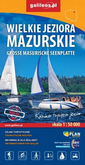
Przedstawia północną część krainy Wielkich Jezior Mazurskich. Zasięg mapy ograniczony jest miesjcowościami Węgorzewo na północy, jeziorem Gołdopiwo na wschodzie, Tałty na południu oraz Ryn i Kwiedzina na zachodzie. Mapa posiada informacje przydatne dla żeglarzy, zawiera szczegółowe informacje dotyczące przystani wraz z ich infrastrukturą, miejsca czarterów, oraz specjalne oznakowania na jeziorach a także ich batymetrię. Na mapie naniesiono również szlaki piesze, rowerowe, konne, kajakowe i ścieżki dydaktyczne, formy ochrony przyrody, bazę noclegową i gastronomiczną, najważniejsze atrakcje turystyczne.
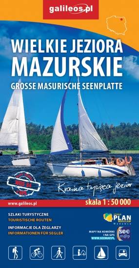
Przedstawia południową część krainy Wielkich Jezior Mazurskich. Zasięg mapy ograniczony jest miesjcowościami Mrągowo na północy, Orzysz na wschodzie, Karwica i Świętajno na południu oraz Piasutno i Borowe na zachodzie. Mapa posiada informacje przydatne dla żeglarzy, zawiera szczegółowe informacje dotyczące przystani wraz z ich infrastrukturą, miejsca czarterów, oraz specjalne oznakowania na jeziorach a także ich batymetrię. Na mapie naniesiono również szlaki piesze, rowerowe, konne, kajakowe i ścieżki dydaktyczne, formy ochrony przyrody, bazę noclegową i gastronomiczną, najważniejsze atrakcje turystyczne.
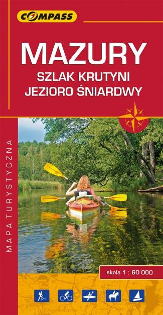
Mapa "Mazury Szlak Krutyni" obejmuje środkową część Pojezierza Mazurskiego, w tym część Pojezierza Mrągowskiego, Jezioro Śniardwy, rzekę Krutynię. Jej granicami na wschodzie jest miasto Orzysz, na zachodzie Sorkwity, na południu Świętajno, zaś od północy Mrągowo.
Olbrzymia różnorodność mazurskich krajobrazów, dzika przyroda i uważany za najpiękniejszy w Polsce szlak kajakowy sprawiają, że jest to wyjątkowo atrakcyjny turystycznie region.
Publikacja zawiera bogaty informator turystyczny, a w nim opisany szlak kajakowy Krutyni, najciekawsze atrakcje regionu, ciekawostki przyrodnicze oraz praktyczne plany Mikołajek, Mrągowa i Rucianego-Nidy.
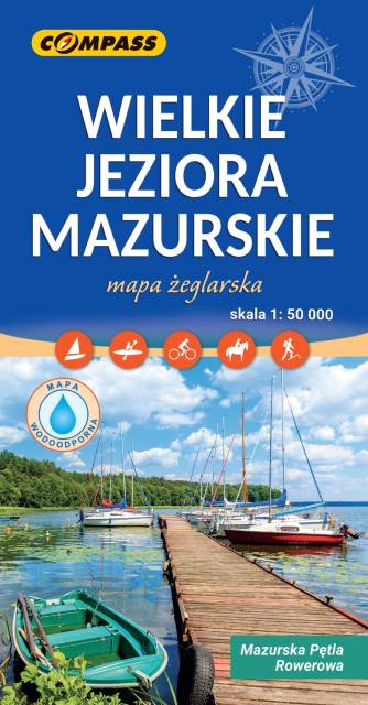
Mapa Wielkie Jeziora Mazurskie przedstawia środkową część Pojezierza Mazurskiego, obszar zamknięty przez Węgorzewo na północy, Ruciane-Nida na południu, Orzysz na wschodzie i Mikołajki na zachodzie. Na mapie znajdują się szlaki piesze, rowerowe, kajakowe i żeglarskie, batymetria jezior oraz atrakcje turystyczne. Na mapie znajdują się największe jeziora mazurskie m.in. Śniardwy, Mamry, Niegocin, Orzysz. Rok wydania 2023 Mapa żeglarska, zawiera też naniesiony szlak rowerowy Mauzrska Pętla Rowerowa.
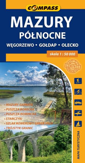
Mapa turystyczna "Mazury Północne" obejmuje przygraniczne tereny od Węgorzewa aż po trójstyk granic: Polski-Litwy-Rosji, a także fragment Mazur Garbatych sięgający poniżej Olecka. Zasięg mapy wyznaczają: granica polsko-rosyjska na północy, Węgorzewo na zachodzie, Kruklanki i Gąski na południu, Bakałarzewo na wschodzie. Obszar ten promowany jest jako Dzikie Mazury. Na mapie zaznaczono najbardziej znane atrakcje regionu: Puszczę Borecką, Puszczę Romincką z dokładną lokalizacją głazów cesarskich, Stańczyki ze słynnymi wiaduktami kolejowymi, gołdapskie uzdrowisko, piramidę w Rapie, lądowisko w Giżach oraz dziesiątki pamiątek i zabytków architektury, atrakcyjnych obiektów wodnych i przyrodniczych, punktów widokowych i jezior. Miłośnicy podróży na dwóch kółkach mogą zapoznać się z dokładnym przebiegiem prawie 100 km fragmentu najdłużej trasy rowerowej (wydzielony pas ruchu) w Polsce, tj. "Green Velo".

Mapa samochodowo-krajoznawcza, przedstawia obszar województwa warmińsko-mazurskiego. Zasięg mapy wyznaczają: granica polsko-rosyjska na północy, Elbląg na zachodzie, Ostrołęka na południu i Grajewo na wschodzie. Warmia i Mazury to region o niezwykłej różnorodności przyrodniczej, unikalnym ukształtowaniu terenu i dużym nagromadzeniem zabytków historycznych. Niniejsze wydawnictwo to ogólna mapa poglądowa rozległego obszaru, jakim są Warmia i Mazury. Dedykowana jest zwłaszcza turystom zmotoryzowanym. Przedstawiono na niej aktualną sieć dróg, wybraną bazę noclegową oraz propozycje najciekawszych atrakcji regionu. Wśród nich znajdują się: zamki, pałace, kościoły, muzea, zabytki techniki, obiekty militarne, cuda przyrody, wyróżniające się miejsca widokowe i panoramy. Mapę offline można zakupić w aplikacji Traseo na urządzenia mobilne. Rok wydania 2022