category-icon

Szwajcaria Czeska dzień 4

61 km
4 h 8 min
1495 m
1488 m

Charakterystyka trasy

2019-05-04
category-icon
61 km
1495 m
1488 m
4 h 8 min
4.4/6
To moja pierwsza trasa na elektryku.Bateria była lekko rozładowana. miałem 80 %. I pierwszy raz w trasę. Pół drogi zastanawiałem sie czy prądu styknie,wiedząc, że na końcu czeka mnie stromy podjazd a będę raczej zmęczony. Myślałem, że najwyżej wezwę wóz serwisowy ale to przecież dyshonor. trza pedałować i prąd oszczędzać. Tak naoszczędzałem, że ostatni podjazd robiłem na pełnej mocy jadąc 25 km pod stromą górę na luzie. A co do trasy - śliczna ciekawa zjazdy podjazdy stromo w dół i łagodnie pod górę. Nawet nie wiem kiedy machnąłem te 60 km prawie bez odpoczynku. W większości asfalt i szuter. Na zapisie z trasy widać, że lekko pobłądziłem. Chciałem skrócić drogę i cieszę się, że w porę się z tego pomysłu wycofałem W tym miejscu to nie takie proste.

Komentarze

NA TEJ TRASIE PRZYDA CI SIĘ MAPA Z NASZEJ APLIKACJI

Szwajcaria Saksońska część wschodnia
MAPA TURYSTYCZNA W APLIKACJI TRASEO
Szwajcaria Saksońska część wschodnia

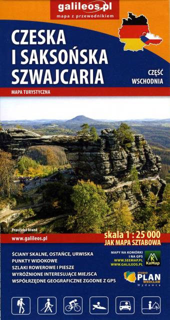
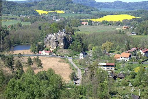
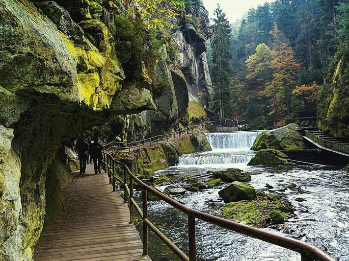
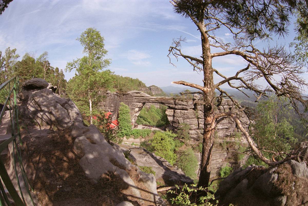
Mapa obejmuje pogranicze Czeskiej i Saksońskiej Szwajcarii. Zaznaczono na niej wszystkie formy skalne regionu, kurorty i miasteczka oraz atrakcje przy nich, czyli: Sebnitz, Mikulášovice, Hinterhermsdorf, Jetřichovice, Růžová oraz Kuhnstal, Pravčicka brana, Idaggrottę, Affelsteione, spływy łodziami i inne. Na mapie oznaczono szlaki piesze i rowerowe oraz wszystkie informacje potrzebne turyście. Mapa opisana na siatce WGS 84, zgodna z polskimi systemami nawigacyjnymi. Rok wydania 2023
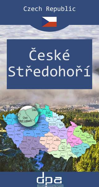
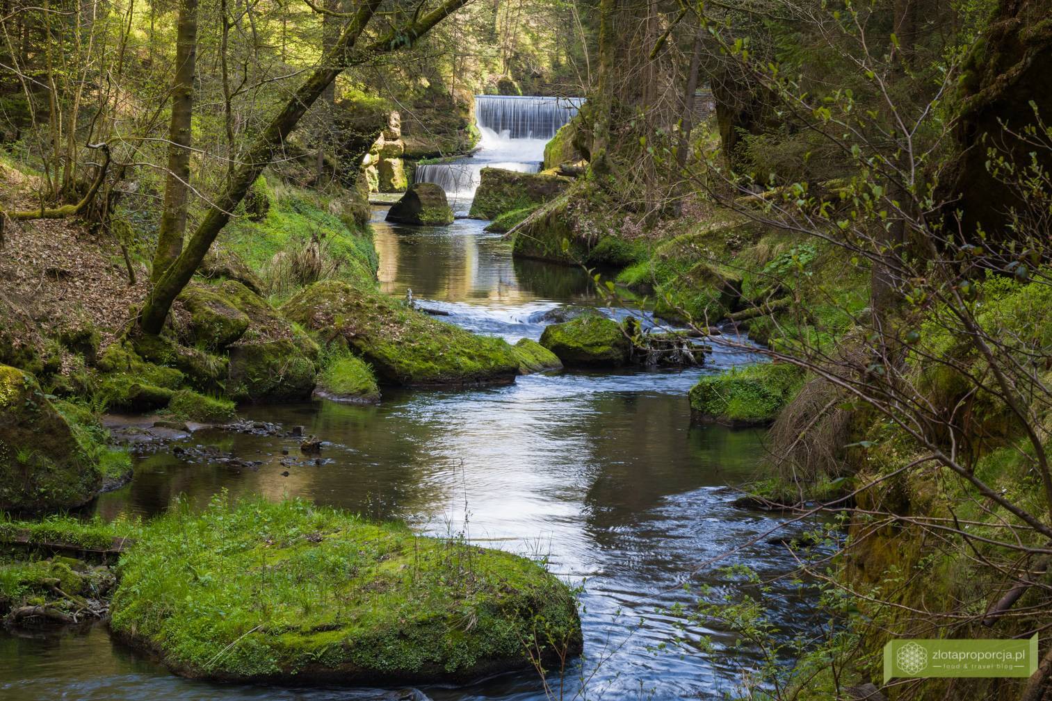
Lusatian Mountains
MAPA TURYSTYCZNA W APLIKACJI TRASEO
Lusatian Mountains
The Lusatian Mountains are a mountain range of the Western Sudetes on the southeastern border of Germany with the Czech Republic. They are a continuation of the Ore Mountains range west of the Elbe valley. The mountains of the northern, German, part are called the Zittau Mountains. The range is among the westernmost extensions of the Sudetes, which stretch along the border between the historic region of Silesia in the north, and Bohemia and Moravia in the south up to the Moravian Gate in the east, where they join the Carpathian Mountains. The northwestern foothills of the Lusatian Mountains are called the Lusatian Highlands; in the southwest the range borders on the České Středohoří mountains. Both the German (Zittau Mountain Nature Park) and the Czech (Lusatian Mountain Nature Park or ChKO Lužické hory) parts nowadays are protected areas.
Bohemian Switzerland, Šluknov Region
MAPA TURYSTYCZNA W APLIKACJI TRASEO
Bohemian Switzerland, Šluknov Region
Bohemian Switzerland (Czech: České Švýcarsko), also known as Czech Switzerland, is a picturesque region in the north-western Czech Republic. It lies on the Czech side of the Elbe Sandstone Mountains north of Děčín on both sides of the Elbe River. It extends eastward into the Lusatian Mountains and westward into the Ore Mountains. Its highest elevation is the mountain Děčínský Sněžník at 726 m above sea level. It has been a protected area (as ChKO Labske Piskovce) since 1972. The National Park is adjacent to the Saxon Switzerland National Park (Sächsische Schweiz) in Germany.
Central Bohemian Uplands
MAPA TURYSTYCZNA W APLIKACJI TRASEO
Central Bohemian Uplands

The Central Bohemian Uplands is a mountain range located in northern Bohemia, the Czech Republic. The range is about 80 km long, spanning from Česká Lípa (northeast) to Bílina (southwest) and from Litoměřice (south) to Děčín (north), intersected by the river Elbe. The mountains are of volcanic origin, with distinctively sharp solitary peaks. The name středohoří can be translated into English as "middle mountains". However, the correct meaning is medium-sized Czech mountains. Another translation is "central uplands" (as opposed to "highlands"), the range being part of the European Central Uplands, hence Bohemian Central Uplands would be a reasonable description. České středohoří is a nature reserve, and the D8 motorway connecting Prague and Dresden traverses the mountains.

Czechy i Słowacja – mapa samochodowa
MAPA TURYSTYCZNA W APLIKACJI TRASEO
Czechy i Słowacja – mapa samochodowa

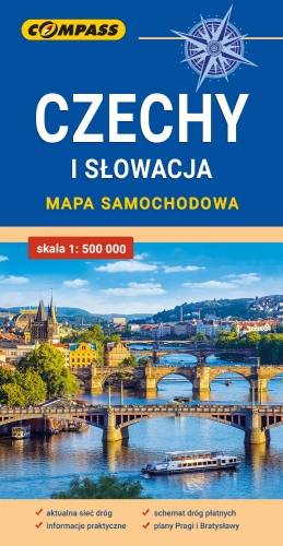
Mapa samochodowa Słowacji i Czech zawiera: aktualną sieć autostrad, dróg ekspresowych i głównych, z podziałem na dwupasmowe i jednopasmowe; drogi w budowie, numerację dróg oraz kilometraż. Na mapie zaznaczono: przejścia graniczne, Autostradowe Miejsca Obsługi Podróżnych, wybrane stacje benzynowe, parkingi i promy wodne, porty lotnicze, obszary leśne, parki narodowe, uzdrowiska, większe ośrodki narciarskie, obiekty na Liście UNESCO. Legenda w językach: polskim, angielskim, czeskim i słowackim.
Mapa dodatkowo zawiera:
- schemat dróg płatnych na Słowacji i w Czechach;
- wykaz węzłów na autostradach i drogach ekspresowych na Słowacji;
- plany Pragi i Bratysławy;
- schemat metra w Pradze;
- informacje praktyczne dla podróżujących samochodem po Słowacji i Czechach (m.in.: wybrane przepisy drogowe, wymagane dokumenty, obowiązkowe wyposażenie samochodu, rodzaje winiet).
Mapę offline można zakupić w aplikacji Traseo na urządzenia mobilne. Rok wydania 2020