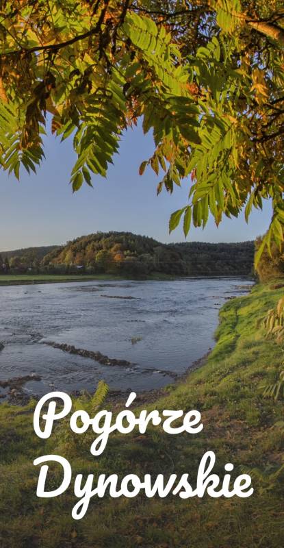
category-icon

Pogórza MK 2013

255 km
2223 m
2189 m
Pogórze Przemyskie + Pogórze Strzyżowsko-Dynowskie
Zdjęcie 1
Zdjęcie 2
Zdjęcie 3
Zdjęcie 4
Zdjęcie 5
Zdjęcie 6

Charakterystyka trasy

2013-09-27
Pogórze Przemyskie + Pogórze Strzyżowsko-Dynowskie
category-icon
255 km
2223 m
2189 m
3.6/6
1. TBG - Przemyśl (PKP)

Forty Twierdzy Przemyśl

Tyrawa Wołoska

Wańkowa

Uherce Mineralne

Myczkowce


2. Myczkowce

Ustjanowa

Równia

Hoszowczyk

Żłobek

Czarna


3. Myczkowce

Lesko

Góra Sobień

Sanok

Haczów

Krosno


4. Krosno

Odrzykoń

Strzyżów


4-dniowy tour młodych z Małego Księcia w Tarnobrzegu - cerkwie, ruiny i natura.


Noclegi: Caritas Myczkowce, SSM w Krośnie.

Komentarze

NA TEJ TRASIE PRZYDA CI SIĘ MAPA Z NASZEJ APLIKACJI

Jezioro Solinskie
MAPA TURYSTYCZNA W APLIKACJI TRASEO
Jezioro Solinskie
Bieszczady. Ustrzyki Dolne
MAPA TURYSTYCZNA W APLIKACJI TRASEO
Bieszczady. Ustrzyki Dolne

Mapa obejmuje obszar na południe od miejscowości Ustrzyki Dolne. Przez Holicę, Czarną Górną do Lutowisk i rezerwatu Krywe. Na wschodzie ogranicza ją granica polsko - ukraińska. Na mapie oznaczono szlaki turystyczne i ścieżki dydaktyczne wraz z czasami przejść. Przy trasach rowerowych podano ich długości. Ponadto na mapie znajdziemy wszelkie informacje potrzebne turyście. Rok wydania 2024

Laborec Highlands, Dukla Region
MAPA TURYSTYCZNA W APLIKACJI TRASEO
Laborec Highlands, Dukla Region

The Laborec Highlands is a mountain range in northeastern Slovakia, part of the Lower Beskids of the Outer Eastern Carpathians.  The highest point is Vysoký Grúň, at 905 metres. The region is drained by the Laborec River and, in its western portion, by the Ondava. Notables town and villages in the hill country include Medzilaborce (site of the Andy Warhol Museum of Modern Art), Vyšná Jablonka, Bodružal, and Vyšný Komárnik. The highlands are also the location of the strategically significant Dukla Pass, the lowest mountain pass in the main ranges of the Carpathians, and the site of the Battle of the Dukla Pass of September and October 1944.

Published: 2016/2017

Okolice Sanoka
MAPA TURYSTYCZNA W APLIKACJI TRASEO
Okolice Sanoka

Nowa mapa okolic Sanoka, łącząca nasze dwie dotychczasowe pozycje: Bieszczady i Pogórze Przemyskie. Sanok i jego okolice znajdowały się na obrzeżach tamtych map. Teraz te ciekawe tereny można zwiedzać korzystając z jednej mapy. Na mapie wyeksponowana obiekty znajdujące się na coraz bardziej popularnym Szlaku Ikon.

Rok wydania: 2018

Bieszczady - Bieszczady National Park
MAPA TURYSTYCZNA W APLIKACJI TRASEO
Bieszczady - Bieszczady National Park

The map covers the area from Wola Michowska to Tarnawa Niżna and from “The Sack of Bieszczady” to Solina Lake. It includes all the polonynas: Wetlińska, Caryńska, Bukowska, Dźwinicka, Tarnica, Szeroki Wierch, Mała and Duża Rawka and the Jeleniowego Range (next to Muczne) with a newly built viewing tower. “The Sack of Bieszczady” is shown on a separate sheet.  All the trails and nature trails are shown here, with their lengths and walking times. Their lengths are given next to the cycling routes. In addition, all the information needed by tourists is marked on the map.

Bieszczady Mountains
MAPA TURYSTYCZNA W APLIKACJI TRASEO
Bieszczady Mountains

The map depicts the Polish Bieszczady mountains, which are part of the Eastern Carpathians, spreading over the Slovak, Polish and Ukrainian borders. Map range: Lesko and Ustrzyki Dolne to the north, Komańcza to the west, the Ukrainian border to the east. The map also presents part of Národný park Poloniny (Poloniny National Park) in Slovakia.