
Charakterystyka trasy

Komentarze
NA TYCH TRASACH PRZYDA CI SIĘ MAPOPRZEWODNIK LUB MAPA Z NASZEJ APLIKACJI
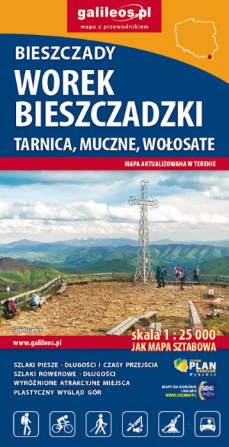
Obszar mapy to: Wołcze (na Ukrainie), Stuposiany, Wołosate, źródła Sanu. W jej centralnej części jest Worek Bieszczadzki, miejscowość Muczne i szczyt Tarnica. Mapa zawiera wszelkie informacje pozwalające łatwiej zaplanować wycieczkę – trasy rowerowe, szlaki piesze i ścieżki przyrodniczo-edukacyjne z podaniem ich długości i czasów przejść. Rok wydania 2024
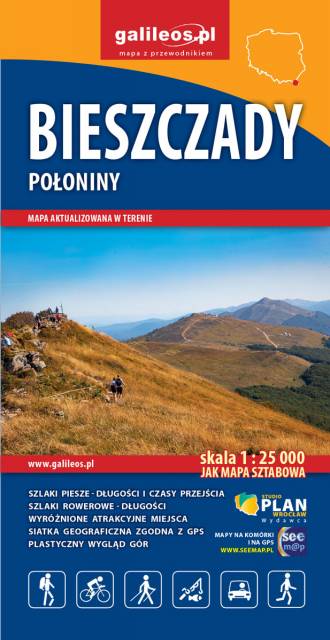
Mapa swym zasięgiem obejmuje najciekawsze pasma górskie Bieszczadów. Są tu wszystkie połoniny: Wetlińska, Caryńska, Bukowska, Dźwinicka, Tarnica, Szeroki Wierch, Mała i Duża Rawka oraz Pasmo Jeleniowatego (obok Mucznego) z nowo wybudowaną wieżą widokową. Pokazano tu wszystkie szlaki i ścieżki dydaktyczne z ich długościami i czasami przejść. Przy trasach rowerowych podano ich długości. Ponadto na mapie zaznaczono wszystkie informacje potrzebne turyście. Rok wydania 2024
W części opisowej mapy, wzbogaconej fotografiami, zawarto informacje o pasmach i szczytach górskich oraz miejscowościach tu położonych.
Uwaga! Mapa obarczona niewielkim błędem kalibracji - ok. 200 m przesunięcia w stosunku do podkładu google maps.
Uwaga! Mapa obarczona niewielkim błędem kalibracji - ok. 200 m przesunięcia w stosunku do podkładu google maps.
Uwaga! Mapa obarczona niewielkim błędem kalibracji - ok. 200 m przesunięcia w stosunku do podkładu google maps.