category-icon

Bogatynia - Hradek (CZ)

15 km
18 min
137 m
124 m
Polska, dolnośląskie, Bogatynia
no photo

Charakterystyka trasy

2023-09-02
Polska, dolnośląskie, Bogatynia
category-icon
15 km
137 m
124 m
18 min
1.5/6
Spacer

Komentarze

NA TEJ TRASIE PRZYDA CI SIĘ MAPA Z NASZEJ APLIKACJI

Lusatian Mountains
MAPA TURYSTYCZNA W APLIKACJI TRASEO
Lusatian Mountains
The Lusatian Mountains are a mountain range of the Western Sudetes on the southeastern border of Germany with the Czech Republic. They are a continuation of the Ore Mountains range west of the Elbe valley. The mountains of the northern, German, part are called the Zittau Mountains. The range is among the westernmost extensions of the Sudetes, which stretch along the border between the historic region of Silesia in the north, and Bohemia and Moravia in the south up to the Moravian Gate in the east, where they join the Carpathian Mountains. The northwestern foothills of the Lusatian Mountains are called the Lusatian Highlands; in the southwest the range borders on the České Středohoří mountains. Both the German (Zittau Mountain Nature Park) and the Czech (Lusatian Mountain Nature Park or ChKO Lužické hory) parts nowadays are protected areas.
Jizera Mountains
MAPA TURYSTYCZNA W APLIKACJI TRASEO
Jizera Mountains
Jizera Mountains or Izera Mountains are part of the Western Sudetes on the border between the Czech Republic and Poland. The range got its name from the Jizera River, which rises at the southern base of the Smrk massif. The range stretches from the Lusatian Mountains (Zittau Mountains) in the northwest to the Krkonoše in the southeast. The highest peak is Wysoka Kopa (1,127 m) near the town of Szklarska Poręba in Poland. Neverteheless, a better-known mountain is Smrk (1124 m), with a recently rebuilt look-out tower. The Jizera Mountains are an attractive location for winter sports, cycling and hiking. The centre for both downhill skiing and ski run is Bedřichov.
Upper Lusatia
MAPA TURYSTYCZNA W APLIKACJI TRASEO
Upper Lusatia

The map presents the area where three borders meet: that of Poland, Germany and Czech Republic. The area is part of the Upper Lusatia historical region. Tourist attracions, cycling and walking trails are marked on the map.

Województwo Dolnośląskie - mapa atrakcji turystycznych
MAPA TURYSTYCZNA W APLIKACJI TRASEO
Województwo Dolnośląskie - mapa atrakcji turystycznych

Wybrać około 100 atrakcji z tego regionu to niezwykle trudne zadanie. Miejsc szczególnych, wartych odwiedzenia jest tutaj znacznie więcej. Subiektywnego wyboru dokonał – opierając się na doświadczeniu jako pilota wycieczek, przewodnika turystycznego i górskiego – Waldemar Brygier (naszesudety.pl). Wśród polecanych atrakcji: zamki, pałace, muzea, skanseny, kopalnie, twierdze, osobliwości przyrody, uzdrowiska i wiele innych. Zapraszamy do lektury! Mapę offline można zakupić w aplikacji Traseo na urządzenia mobilne. Rok wydania 2019

Czechy i Słowacja – mapa samochodowa
MAPA TURYSTYCZNA W APLIKACJI TRASEO
Czechy i Słowacja – mapa samochodowa

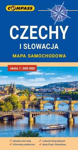
Mapa samochodowa Słowacji i Czech zawiera: aktualną sieć autostrad, dróg ekspresowych i głównych, z podziałem na dwupasmowe i jednopasmowe; drogi w budowie, numerację dróg oraz kilometraż. Na mapie zaznaczono: przejścia graniczne, Autostradowe Miejsca Obsługi Podróżnych, wybrane stacje benzynowe, parkingi i promy wodne, porty lotnicze, obszary leśne, parki narodowe, uzdrowiska, większe ośrodki narciarskie, obiekty na Liście UNESCO. Legenda w językach: polskim, angielskim, czeskim i słowackim.
Mapa dodatkowo zawiera:
- schemat dróg płatnych na Słowacji i w Czechach;
- wykaz węzłów na autostradach i drogach ekspresowych na Słowacji;
- plany Pragi i Bratysławy;
- schemat metra w Pradze;
- informacje praktyczne dla podróżujących samochodem po Słowacji i Czechach (m.in.: wybrane przepisy drogowe, wymagane dokumenty, obowiązkowe wyposażenie samochodu, rodzaje winiet).
Mapę offline można zakupić w aplikacji Traseo na urządzenia mobilne. Rok wydania 2020

Miejscowości na trasie