Lidzbark (0.0 km) – Jeleń (4.3 km) – Tarczyny (10.9 km) – Kiełpiny (14.2 km) – Chełsty (18.5 km) – Słup (21.7 km) – Wlewsk (24.6 km) – Piaseczno (27.7 km) – Klonowo (30.8 km) – Jamielnik (34.6 km) – Lidzbark (37.5 km)
An easy loop of just under 40 km, offering outstanding natural and cultural attractions. Along the way, we are accompanied by the spirit of the Polish-Teutonic (and later Polish-German) borderland, traces of which are visible in the form of historical monuments encountered along the route. The natural surroundings along the route are also exceptionally interesting—as we ride, we pass through two landscape parks: the Welski Landscape Park and the Górzno-Lidzbark Landscape Park.
The town of Lidzbark lies within the boundaries of the Welski Landscape Park. The best place to start the trip is at the municipal swimming area on Lake Lidzbarskie. A cobblestone bike path leads along the lakeside promenade to the park, where, on a hill surrounded by trees, stands the historic Evangelical-Augsburg Church of the Living Jesus. There is also a historical trail here, and below stands an observation tower from which you can view the lake. From the church, we turn left and head down Górka Street, which merges into Kopernika Street. At the fork, we turn right onto Stare Miasto Street and, a little further on, left onto Krótka Street, which leads us to the central square in Lidzbark, Hallera Square. Not far from the square, in the fire station building on Provincial Road 541 (4 Nowy Rynek Street), is the Warmia-Masuria Firefighting Museum.
From the square, head east on Kościelna Street, pass St. Adalbert’s Church on your left, and reach provincial road DW541 (Działdowska Street), where you turn left. Cross the bridge over the Wel River; at the first intersection, go straight, and at the second, turn left onto Jeleńska Street. We continue straight along this street; a few hundred meters further on, we also go straight through the roundabout and, without turning anywhere, leave the city heading northeast on the local road toward Jeleń and Koszelewy. A few hundred meters before the Lidzbark city limits, a cobblestone bike path begins on the left side of the road. After about 2 km, at the entrance to the forest, the path ends. We continue on the paved road.
Four kilometers from Lidzbark, in the village of Jeleń, the headquarters of the Welski Landscape Park is located on the left side of the road. We continue on; at the edge of the village, a walking and biking path begins, which ends in Wapiersko. Near this village lies the Bagno Koziana Nature Reserve, which you can reach by turning sharply left. You’ll arrive there after traveling about 2 km, first passing Lake Jeleń on your left. Return via the same route. Past Wąpiersko, turn left toward Tarczyny, where an interesting archaeological site is located north of the village, on Lake Grądy. A few hundred meters further on, the road surface changes to gravel. In Tarczyny, it becomes paved again. We follow this narrow paved road roughly westward to Kiełpin, where, at the intersection with Provincial Road DW541, we turn left toward Lidzbark and Żuromin.
Just past the village, at the edge of the forest, we turn right, and a little further on, we take a dirt forest road that runs diagonally to the left, toward the southwest. We ride about 2 km through the forest, then 1 km through fields. Upon reaching the forested valley of the Wel River, turn left, then right onto an asphalt road, and after about 1 km, you’ll reach the bridge in Chełsty, next to which stand the ruins of a mill. Below the mill, the Wel has a very strong current and forms numerous rapids. We cross the bridge and, continuing along the paved road, begin the climb uphill.
From the bridge, the road is paved for a few hundred meters, and then gravel for about 3 km. We ride southwest through the forest and fields to the village of Słup. In the village, we turn left onto a paved road toward Wlewsko. We pass through the village and turn right onto Provincial Road 544 toward Brodnica. After 3 km, we reach Piaseczno, where a nice view of Lake Piaseczno stretches out on the right. There’s also a seasonal food stand here. Nearby, there’s a public beach next to a campground.
Colonial Goods and Vodka
As you pass through Kiełpiny, take a moment to notice the pre-war farm buildings. On the wall of one of them, located across from the church, you could still see, until recently, the remnants of a sign reading: “Tavern and Inn. Grocery and Vodka Store,” evidence that the village was once more bustling than it is today.
Watermills on the Wel River
The fast-flowing current of the Wel River was once heavily utilized. Water mills were built every few to a dozen or so kilometers. Some of them have survived intact, while only traces remain of others. Mills operated, among other places, in Ciborz, Lidzbark, Kurojady, and Chełsty.
An alternative route for this section
We can also get from Wlewsko to Piaseczno via a different route. Near the small church in Wlewsko, we turn right and follow a dirt road through the fields toward the west. 2.5 km further on, the road enters the forest, where it may present some challenges, as it is sandy and features fairly steep ascents and descents. After riding a few hundred meters, we emerge in Piaseczno, at a spot offering a nice view of Lake Piaseczno.
From the lake, we ride about 150–200 m west along the road and turn left into the forest toward Klonowo. We are now in the Górzno-Lidzbark Landscape Park. Near Klonowo, about 1.5 km away, there are two interesting nature reserves: Klonowo—to the east—and Jar Brynicy to the southwest of the trail. After crossing the former railroad tracks in Klonowo, we take the left fork at the fork in the road. We ride through the village, and after about 1 km, at a blue wayside shrine on the left side of the road—a few dozen meters before the bus stop—we turn left onto a cobblestone road. On the left, a short distance from the road, run railroad tracks. After riding another kilometer, we enter the forest, and the road surface becomes gravel. The road turns right, and instead of the tracks on the left, we see the forest lake Zwórzno. At the forks in the road, take the left-hand branch and stay close to the lake. This section of the route is very scenic.
After riding about 2 km, we enter Jamielnik. The road surface changes to cobblestones. After riding another few hundred meters, we reach an asphalt road and turn left onto it. From here, it’s less than 2 km to Lidzbark. A cobblestone bike path begins at the sign marking the city limits. It’s not worth riding all the way along it, as it ends near the city center and you’ll have to ride along the city’s main streets. After riding a few hundred meters, we turn left off the path at the railroad crossing and follow the residential streets. First, take Polna Street, then turn left onto Wiśniowa Street, which becomes Klonowa Street. This brings you to Lipowa Street near the city beach (about 200 m to the left), where the trip ends.
Due to the lack of signage, some hiking experience, good sense of direction, and a map are recommended. Recommended bike type: mountain bike.
Lidzbark is located at the intersection of provincial roads DW544 (Brodnica–Działdowo) and DW541 (Żuromin–Lubawa). The railroad line running through the town is no longer in operation.
Lidzbark
Lidzbark is home to the Warmia-Masuria Firefighting Museum at ul. Nowy Rynek 4, 13-230 Lidzbark, tel. 730 757 752—the only facility of its kind in the region. It is housed in a firefighter’s house. It displays old firefighter uniforms, fire hoses, and motor pumps; visitors can also see a leather bucket from 1902, a wooden fire hose, and a horse-drawn fire engine from around 1930. There are also exhibits unrelated to firefighting, such as the Book of the Blacksmiths’ Guild—a manuscript covering the years 1725–1845. The museum can be visited by prior telephone appointment.
The oldest building in the city is St. Adalbert’s Church, which was built in 1752 on the site of an earlier wooden church. Its interior is decorated in the Baroque style. The altar is adorned with sculptures of St. Adalbert, St. Peter, and St. Paul; a bas-relief of Jesus with St. Thomas; and a painting of the Immaculate Conception. The organ dates from 1904. The church has a wooden barrel vault. A commemorative plaque marking the town’s 700th anniversary is embedded in the wall in front of the entrance. The church houses the relics of its patron saint, St. Adalbert.
The Evangelical Church of the Augsburg Confession is located on a hill separating part of the city from Lake Lidzbark. This Classicist building was constructed in 1829 and is a replica of the church in Potsdam, which the Prussian King Wilhelm III built as a gift for the queen. The church was designed by the renowned architect Karl Friedrich Schinkel. The brick church was plastered. Of its original furnishings, the altar, two paintings depicting Jesus, the pulpit, the baptismal font, and the organ have survived. Next to the church stands the parsonage, built in 1898. Nearby, on a small hill, a historical trail has been created.
On the western edge of the town, on Lake Lidzbark, a beach with swimming areas has been developed. It is accessible via a bike path, a pedestrian promenade, and an asphalt road (Lipowa Street), alongside which there is a large parking lot for passenger cars. The beach features three swimming areas, as well as piers, a diving tower, the region’s largest outdoor water slide, water equipment rentals, volleyball courts, a rope park, and a restaurant with a terrace offering a beautiful panoramic view of the lake.
Welski Landscape Park
The park covers an area of over 2,000 hectares, and its buffer zone extends over 16,000 hectares. It stretches to the north and northeast of Lidzbark. Its central feature is the Wel River, which forms a large “U”-shaped loop within the park’s boundaries. The park encompasses hilly terrain, forming a mosaic of natural and cultural landscapes: beech and mixed forests, lakes, marshes, rivers and streams, meadows, fields, and ponds. The terrain’s topography was shaped by a glacier, and settlement dating back to the early Middle Ages has given it a distinctive character. The settlements are located on flat, dry areas; forests have survived on the highest hills, and the wetlands serve as oases of wildlife. A network of hiking trails and educational paths has been established in the park, and there are also observation towers. A total of 160 bird species and 47 mammal species (including wolves) have been recorded within the park, along with approximately 900 species of vascular plants.
The Museum of Nature and the Ethnographic Museum in Jeleń
The headquarters of the Welski Landscape Park, Jeleń 84, 13-230 Lidzbark, tel. 23 698 10 36, e-mail: wpk@warmia.mazury.pl, wpk.warmia.mazury.pl is housed in a stylish red-brick building. Two museums are also located here (open Monday through Friday from 9 a.m. to 3 p.m.), with free admission. The Museum of Nature focuses on presenting the most important natural environments: forests, bodies of water, and fields and meadows. It also features an archaeological exhibition, the highlight of which is a model of an Old Prussian settlement of the Sasin tribe. The Ethnographic Museum, on the other hand, displays objects of material culture from the surrounding areas, among which tools for digging peat—once an important fuel source—stand out. The museum also has a collection of old photographs and documentation on the local Lubawa dialect. Here, you can also learn more about the history of the Lubawa region.
Koziana Marsh Nature Reserve
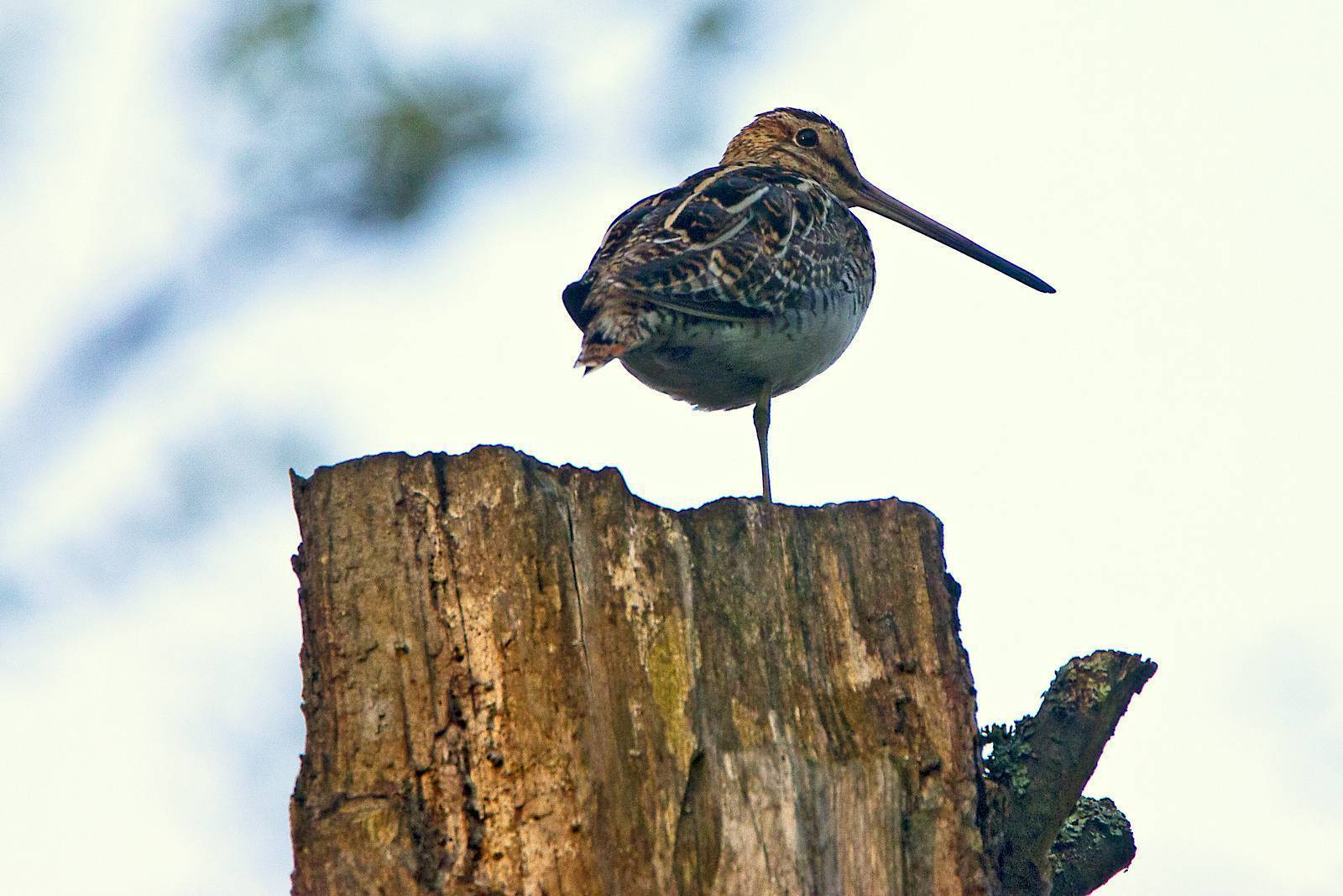
The reserve covers an area of approximately 55 hectares. It has existed since 1991 and is the oldest reserve located within the boundaries of the Welski Landscape Park. It encompasses marshy areas of raised bogs and transitional bogs, some of which have been significantly altered as a result of peat extraction. Eighty bird species have been recorded within its boundaries, including 61 breeding species. Among others, visitors can spot great crested grebes, teals, red-necked grebes, snipes, corncrakes, and cranes. Rare plant species include the round-leaved sundew and the marsh marigold.
Archaeological Site in Tarczyny
The site is located about 1 km north of the village, on a headland overlooking Lake Grądy. It consists of two parts. The first is a fortified settlement dating from the 11th–12th centuries, with ramparts several meters high, a moat separating the headland from the mainland, and the remains of a gate. The second part consists of the remains of a settlement, which likely served a supporting role to the stronghold. Nearby, an open-air museum has been established, where events are held featuring combat demonstrations, presentations of medieval crafts, and tastings of dishes prepared according to recipes from that period. The settlement and the stronghold likely belonged to the Old Prussian tribe of the Sasins. On the other side of the lake, in the village of Grądy, there is a lookout point from which you can admire the lake and the stronghold.
TheWel River Kayaking Trail
Foaming waters, sharp bends, and fallen trees in the narrow riverbed are quite impressive. There are several such spots on the Wel; the best-known one lies in the Piekiełko Nature Reserve, a few kilometers downstream from the village of Chełsty. The rapids there are entirely natural, and the current, which erodes the steep, forested banks, constantly provides fallen trees. The river also has calm stretches where it flows slowly, overgrown with aquatic vegetation, meandering and cutting through several lakes. There, instead of struggling to keep the kayak balanced, you can focus on contemplating nature: lush vegetation and numerous birds (you can spot, among others, goldeneyes, common mergansers, and kingfishers). In the morning and evening, there’s a chance to encounter beavers or otters. The river is navigable over a stretch of approximately 103 km, from the village of Dąbrówno to its confluence with the Drwęca River. The estimated duration of the trip is four days. Along the way, kayakers will encounter several portages and the aforementioned challenging sections. One-day trips can start, for example, in Ciborz or at the municipal beach in Lidzbark.
Wlewsk
The Różycki family’s burial chapel from 1863 serves as the church for the residents of Wlewsk. It was built in the Neo-Gothic style using red brick. A small cemetery has been preserved around it, adorned with a wooden statue from 1823. Wlewsk is a noble village. Until 1408, it was owned by Ulrich von Jungingen, Grand Master of the Teutonic Order. Remnants of the Różycki family’s estate include a park, a warehouse, and a distillery building from 1875.
Górzno-Lidzbark Landscape Park
The park extends west of Lidzbark and covers an area of nearly 28,000 hectares, of which 8,600 hectares are in the Warmian-Masurian Voivodeship. It also lies partially within the borders of the Kuyavian-Pomeranian and Masovian Voivodeships. Approximately 70% of its area consists of forests, many of which are highly natural. The most valuable section of these forests is protected within the Jar Brynicy Nature Reserve, covering an area of about 30 hectares. It is a multi-species deciduous forest of the “grąd” type, growing on a steep slope descending toward the Brynica River, a tributary of the Drwęca. Here, the river flows through a gorge 40–50 meters deep, retaining the character of a mountain stream. The age of the tree stand is estimated at 140–160 years. Birds associated with riverine habitats can be found here, including kingfishers, dippers (the mountain species), and black storks.