


Wojciech Śmiechowiczsmiler
Charakterystyka trasy
2012-06-16
Polska, łódzkie, Wieluń

Długość trasy:
17 kmSuma przewyższeń:
10 mSuma spadków:
21 mOcena trasy:
1.0/6Komentarze
NA TYCH TRASACH PRZYDA CI SIĘ MAPOPRZEWODNIK LUB MAPA Z NASZEJ APLIKACJI
MAPA TURYSTYCZNA W APLIKACJI TRASEO
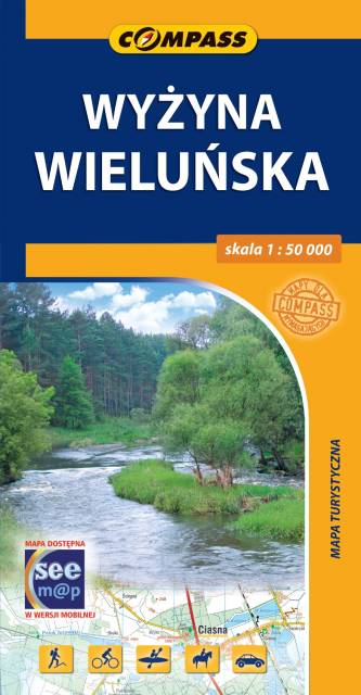
Wyżyna Wieluńska
Mapa przedstawia region geograficzny w południowej Polsce, rozciągający się pomiędzy Wieluniem a Częstochową. Zasięg mapy wyznaczają: Osjaków na północy, Radłów na zachodzie, Lubliniec na południu i Częstochowa na wschodzie. Obszar mapy obejmuje: Wieluń, Działoszyn, Pajęczno, Kłobuck, Blachownię i Częstochowę. Obszar ten charakteryzuje się zmiennym krajobrazem – od rozległych równin po wzniesienia sięgające 300 m n.p.m., skały wapienne i jaskinie. Najcenniejsze fragmenty Jury objęte są ochroną w postaci Załęczańskiego Parku Krajobrazowego i Parku Krajobrazowy Dolina Górnej Liswarty. Dużą atrakcją w regionie są doliny rzek: Warty i Liswarty. Popularnością cieszą się tu spływy kajakowe. Jest to atrakcyjny teren na wycieczki piesze i rowerowe.

MAPA TURYSTYCZNA W APLIKACJI TRASEO
Województwo opolskie i plan Opola
Mapa Opola i okolic obejmuje obszar województwa w skali 1:190 000. Mapa zawiera aktualny przebieg dróg wraz z numeracją, odległości drogowe, granice powiatów i gmin ponadto stacje paliw, hotele, parkingi, zabytki, zaznaczono wszystkie miejscowości. Mapa oprócz województwa obejmuje też pogranicze i obszar Wrocławia. Na obu mapach wkreślono współrzędne geograficzne zgodne z GPS. Opracowanie obejmuje także plan Opola w skali 1:20 000, widoczny po odpowiednim zbliżeniu.
MAPA TURYSTYCZNA W APLIKACJI TRASEO
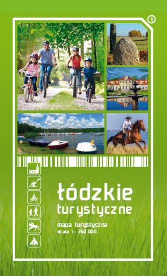
Województwo Łódzkie
Mapa województwa łódzkiego, na której zaznaczono miejscowości, drogi, tereny leśne, parki krajobrazowe, zabytki, kościoły, zabytki, ośrodki aktywności konnej i wodnej oraz główne szlaki rowerowe. Kolorem żółtym wyróżniono miejsca i miejscowości warte odwiedzenia.