R10 route for cycling along the Baltic Sea
The Velo Baltica cycle route, designated as R10, is one of the most charming and unique cycling links in Northern Europe. Known for its fascinating views and variety of coastal landscapes. The R10 Velo Baltica route on the Polish section is more than 530 km long. The entire R10 cycle route, also known as the Coastal Hanseatic Route, encircling the Baltic Sea basin, is over 8500 km long. It is a unique challenge for two-wheel enthusiasts who want to combine physical activity with discovering the charms of coastal towns.
How does the R10 cycle route run? Polish section of the EuroVelo 10 route
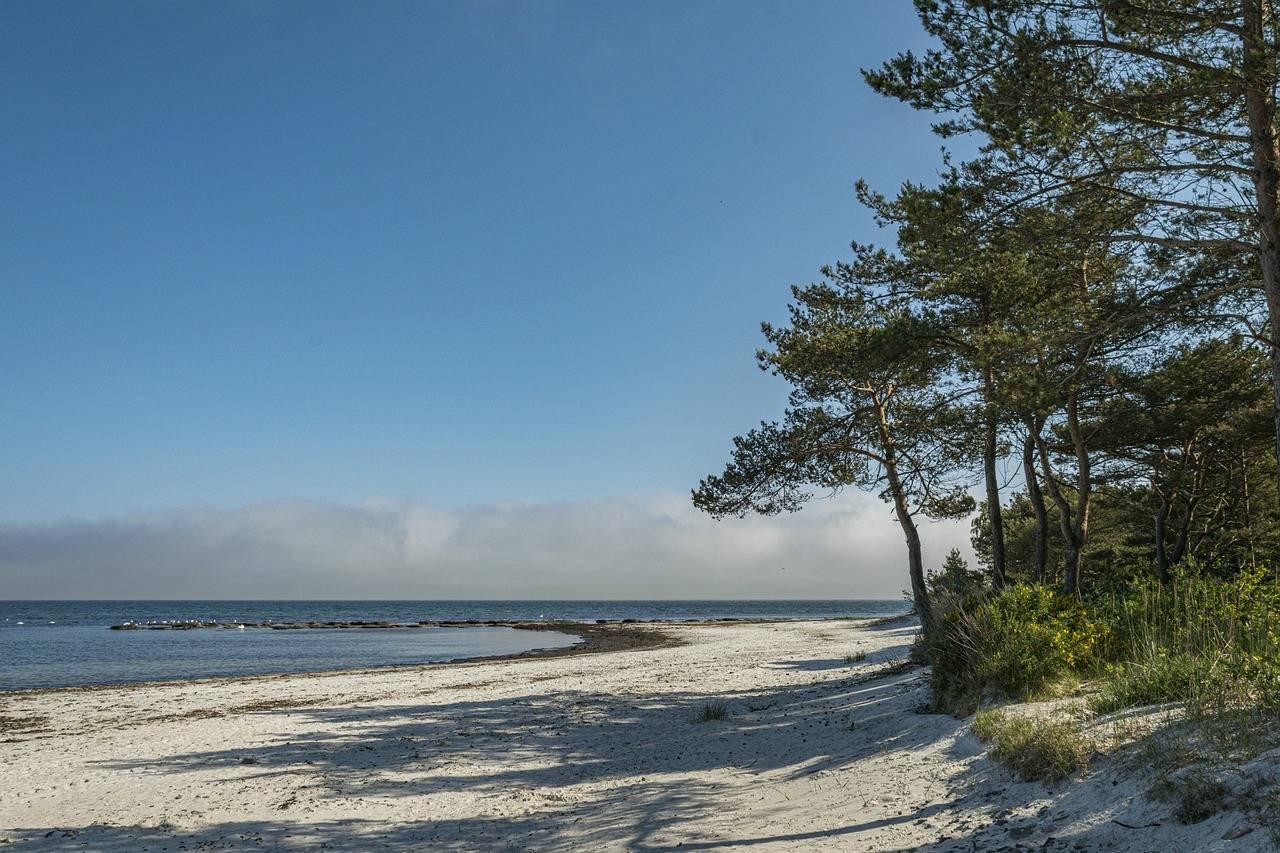
The R10 cycling route is an adventurous experience allowing you to discover the charms of the five Baltic countries: Poland, Lithuania, Latvia, Estonia and Finland. Starting the journey in one of these areas, cyclists pass through fascinating geographical areas, from dense forests to the charming Baltic coasts. The route passes through picturesque towns, traditional villages and stunning natural landscapes, creating a unique combination of culture and nature. The R10 Velo Baltica cycling route within Poland runs along the entire coast, passing towns such as Świnoujście, Dziwnów, Kołobrzeg, Darłowo, Ustka, Puck, Tricity and Elbląg. The varied towns along the route allow you to fully feel the atmosphere of the coast. Enthusiasts of smaller towns will find charming corners, while lovers of larger ones will enjoy a stay in Kołobrzeg or the Tri-City.
What kind of bike bike for the Velo Baltica?
Choosing the right bike for the R10 Velo Baltica route is a key part of the journey. Given the length of the route and the varied nature of the terrain, trekking or touring bikes are recommended. Versatile models offer comfort and stability both on tarmac sections and on bumpier surfaces or sandy sections. Good shock absorbers, durable tyres and a comfortable seating position will allow you to cover the miles in comfort. An additional aspect will be a bike rack with panniers into which you can pack your equipment. Many cyclists covering the Velo Baltica trail decide to organise accommodation in a tent - the large accommodation base on the Polish coast makes it possible to choose the most optimal option.
R10 Velo Batica - towns along the route on the Polish coast
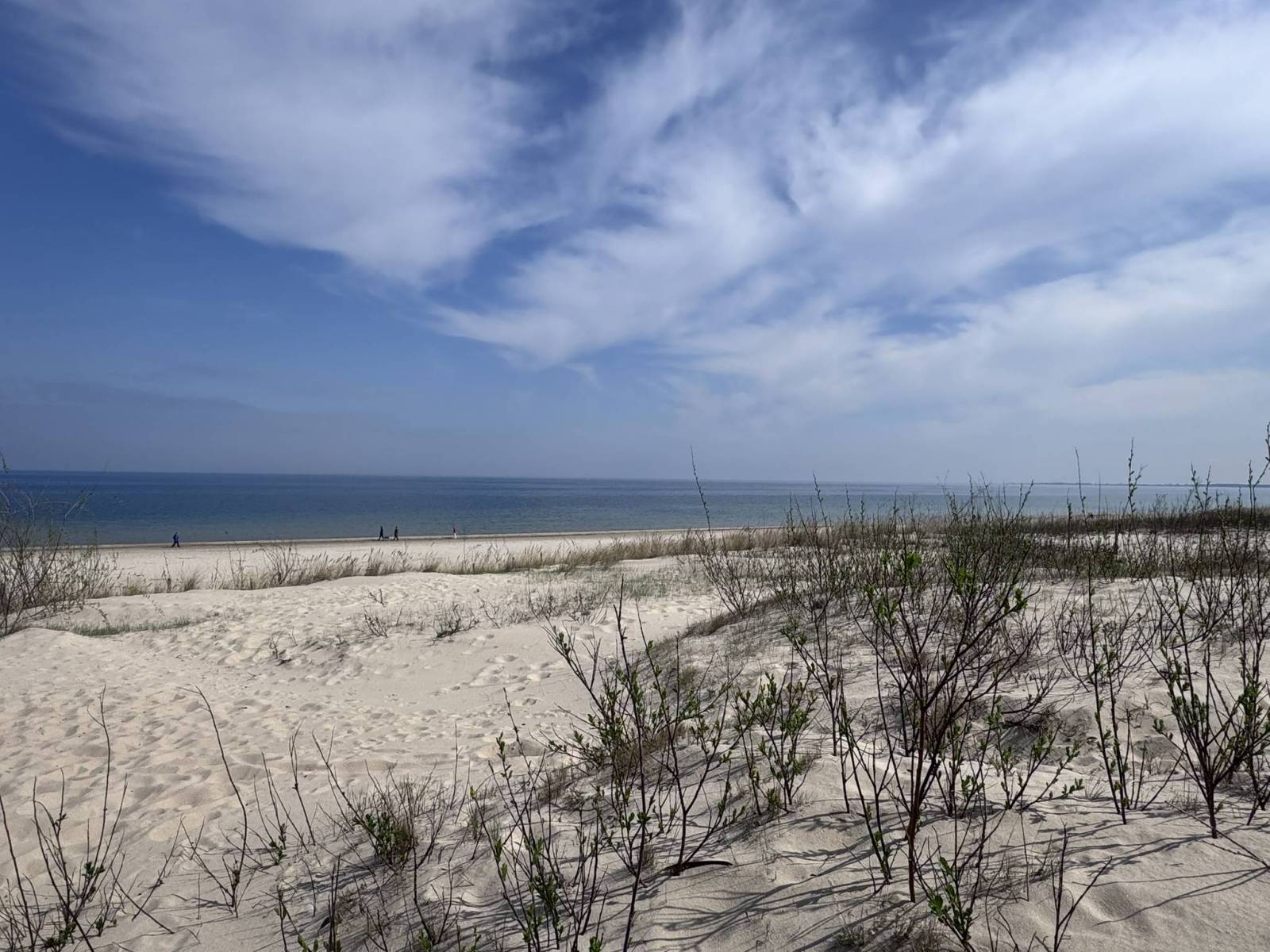
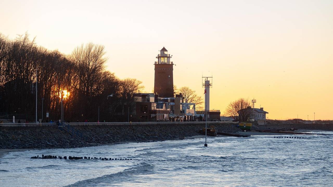
The start of the Polish section of the R10 trail is located in Świnoujście. It is a popular resort located on three islands: Usedom, Wolin and Krasibor. From the beaches there, you can enjoy beautiful views of the Baltic Sea and the lighthouse. Another interesting and larger city is Kołobrzeg, famous for its Basilica of the Assumption of the Blessed Virgin Mary and the lighthouse, which is 26 metres high. Here, the beaches and promenades also encourage visitors to take a longer break. The Velo Baltica R10 also runs through the vicinity of the Słowiński National Park, located between Ustka and Łeba, with its famous sand dunes and beautiful landscapes found nowhere else in Poland. In the Tri-City with the largest city on the route - Gdańsk - you can visit the historic Old Town, see the statue of Neptune, and see ships moored on the coast. Sopot, in turn, has the most famous pier in Poland. The Polish section of the Velo Baltica R10 route ends in Elbląg. However, for those thirsty for more excitement, it can lead much further.
List of larger towns along the EuroVelo 10 route in Poland (from west to east):
Świnoujście, Międzyzdroje, Dziwnów, Rewal, Trzęsacz, Pobierowo, Kołobrzeg, Ustronie Morskie, Mielno, Darłowo, Ustka, Rowy, Łeba, Władysławowo, Hel, Gdynia, Sopot, Gdańsk, Nowy Dwór Gdański, Elbląg.
What's the length of the R10 cycling route?
The length of the R10 cycle route (i.e. the Polish section of EuroVelo 10 / Velo Baltica) is approximately 588 km (including the Hel Peninsula). The shorter variant (without the Hel Peninsula) is approximately 533 km. This route runs along the Polish Baltic Sea coast, from Świnoujście (near the German border) to Elbląg (near the border with the Kaliningrad region). The final length of the route may vary slightly depending on the chosen variant (e.g. through the Hel Peninsula or variants leading through city centres).
Map of EuroVelo 10 in Poland. Cycling route r10 along the Baltic Sea map
On the map above you will find the official route of the EuroVelo 10 route in Poland. The Polish section of the EuroVelo 10 route is also known as R10 or Velo Baltica. You can pin the course of the route to My Map in the Traseo application or download its trace to a gpx file. You can download the Traseo map primer for offline mapping and use it even when you do not have internet access. We have marked all hiking and cycling trails and dedicated cycle paths on our map.