Charakterystyka trasy

Komentarze
NA TYCH TRASACH PRZYDA CI SIĘ MAPOPRZEWODNIK LUB MAPA Z NASZEJ APLIKACJI
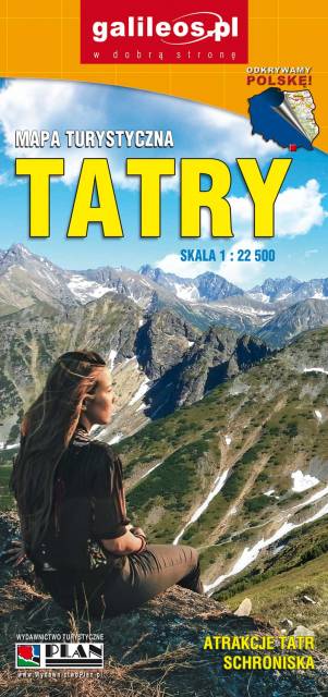
Mapa rzedstawia najbardziej znane i najczęściej odwiedzane góry w Polsce - Tatry. Zasięg mapy wyznaczają: Rysy (2499 m n.p.m.) na południu, Jurgów na wschodzie, Wołowiec (2064 m n.p.m.) na zachodzie i Bukowina Tatrzańska na północy. Obszar mapy obejmuje Tatry Zachodnie i część Tatr Wysokich.Na terenie Tatr, na wyznaczonych do tego szlakach lub obszarach, można uprawiać turystykę pieszą, rowerową, narciarstwo, taternictwo powierzchniowe i jaskiniowe.Na mapie zastosowano cieniowanie w celu uzyskania wrażenia plastyczności rzeźby terenu oraz przedstawiono informacje przydatne turystom w wysokich górach, m.in. miejsca zejścia lawin i łańcuchy. Dodatkowo zamieszczone zostały: plan Zakopanego (1:18500), informator o Tatrach i Tatrzańskim Parku Narodowym, propozycje wycieczek z czasami przejść, opisy schronisk turystycznych, a także ciekawostki na temat stolicy gór polskich. Treść mapy była konsultowana z pracownikami TPN i MSiT Zakopane. Mapę offline można zakupić w aplikacji Traseo na urządzenia mobilne. Rok wydania 2023
Mapa przedstawia najbardziej znane i najczęściej odwiedzane góry w Polsce - Tatry. Zasięg mapy wyznaczają: Rysy (2'499 m n.p.m.) na południu, Jurgów na wschodzie, Wołowiec (2'064 m n.p.m.) na zachodzie i Bukowina Tatrzańska na północy. Na mapie zastosowano cieniowanie w celu uzyskania wrażenia plastyczności rzeźby terenu oraz przedstawiono informacje przydatne turystom w wysokich górach, m.in. miejsca zejścia lawin i łańcuchy. Mapa zawiera także: plan Zakopanego (1:18'500), informator o Tatrach i Tatrzańskim Parku Narodowym, mapę grzbietową Tatr Polskich oraz szereg panoram Tatr z opisanymi szczytami. Treść mapy była konsultowana z pracownikami Tatrzańskiego Parku Narodowego. Mapę offline można zakupić w aplikacji Traseo na urządzenia mobilne. Rok wydania 2019
Mapa Tatr polskich i Słowackich, na południu jej zasięg jest po Strbske Pleso. Na mapie zaznaczono szlaki piesze i rowerowe wraz z dokładnymi czasami przejść. Została ona zaktualizowana w terenie. Mapę wyświetlisz pozakupie w formie jednego z podkładów mapowych w aplikacji turystycznej Traseo. Rok wydania 2021
Mapa obejmuje popularne wśród turystów Tatry Niżne w środkowej Słowacji, na terenie których znajduje się m.in. Dolina Demianowska wraz z centrum narciarskim Jasná – Chopok. Na obszarze pasma istnieje około tysiąca kilometrów znakowanych szlaków turystycznych. Głównym grzbietem Niżnych Tatr prowadzi fragment czerwono znakowanej Cesty hrdinov Slovenského národného povstania – część europejskiego długodystansowego szlaku E8. Pozostają także duże powierzchnie bez żadnych szlaków, zwłaszcza w północnej, niższej i gęsto zalesionej części Tatr Kráľovohoľskich. Mapa obejmuje ponadto zachodnią część Murańskiej planiny.
Rok aktualizacji: 2016/2017
Mapa prezentuje jedno z najczęściej odwiedzanych na Słowacji pasm górskich - Małą Fatrę, często nazywaną Tatrami w miniaturze. Masyw nie jest jednak zatłoczony przez turystów tak bardzo jak Tatry. Głównym miejscem wypadowym w Krywańską Fatrę jest miejscowość Terchová z bogatą bazą noclegową (hotele, domy wycieczkowe, prywatne kwatery, duży autokemping). Z Terchovej można samochodem dojechać na parkingi w głębi Vrátnej doliny, skąd zaczynają się liczne szlaki turystyczne i jest dolna stacja kolejki gondolowej Vrátna – Chleb. Łączna długość wyznakowanych szlaków turystycznych w masywie wynosi ok. 150 km. Podejścia na najwyższe szczyty Małej Fatry mogą być żmudne, gdyż różnica wysokości dochodzi czasami do 1300 m. W wyższe partie można dostać się również kolejką gondolową z Vrátnej, która wywozi turystów prawie na samą główną grań. Granią tą prowadzi czerwony, bardzo widokowy szlak turystyczny. Rejon Małej Fatry jest też jednym z najlepiej zagospodarowanych obszarów na Słowacji dla amatorów narciarstwa zjazdowego. Mapa prezentuje ponadto położone na wschód od Fatry Góry Choczańskie, których najwyższy szczyt - Wielki Chocz (1608 m) - słynie z malowniczej panoramy na większość gór Słowacji, w tym zwłaszcza na Tatry, Niżne Tatry oraz Wielką i Małą Fatrę. Data wydania: 2016 / 217.