Morąg (0.0 km) · Kretowiny (7.8 km) · Wilnowo (15.9 km) · Boguchwały (17.6 km) · Ponary (21.8 km) · Roje (24.0 km) · Niebrzydowo Wielkie (26.7 km) · Gulbity (30.3 km) · Bogaczewo (33.0 km) · Morąg (37.4 km)
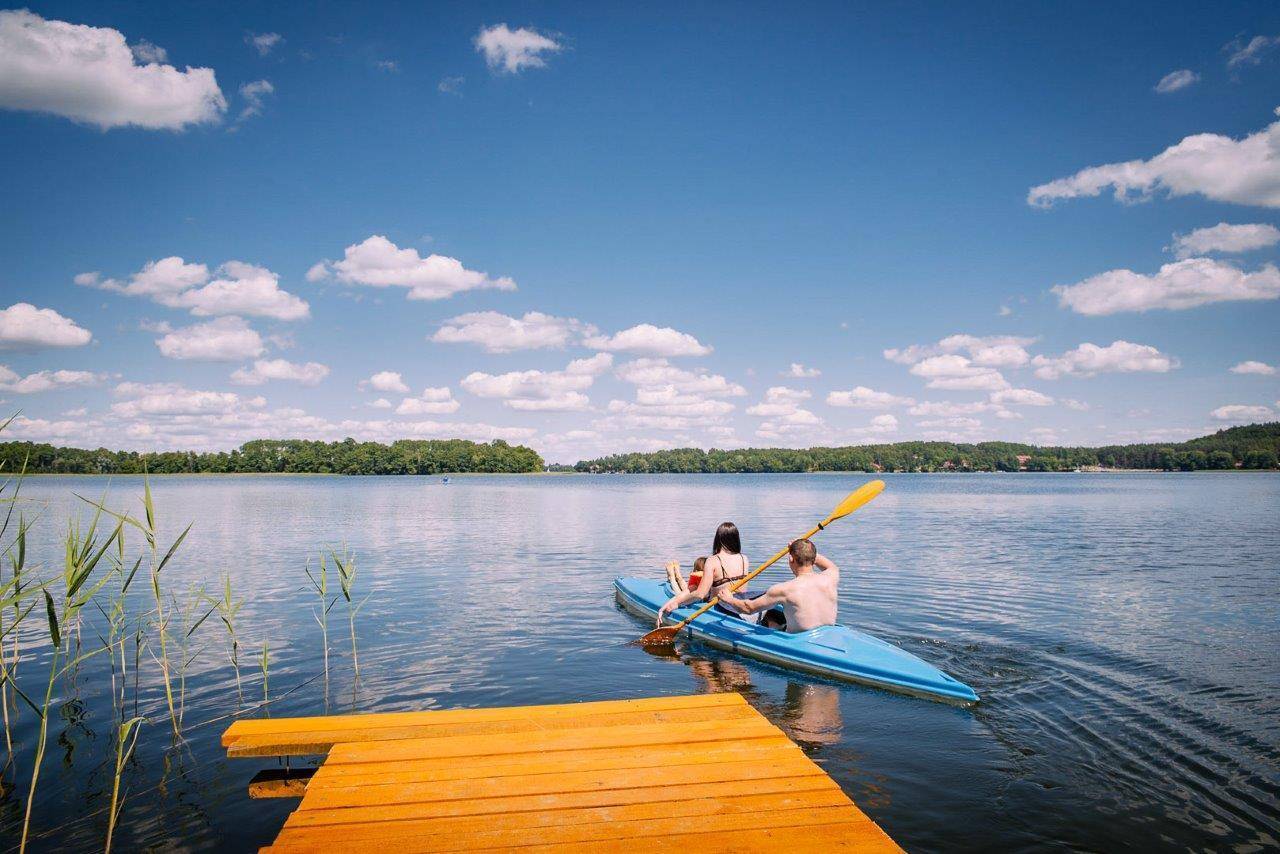
The trail offers very scenic views. Narie is a trough lake, nearly 11 km long, with a width ranging from 150 to 3,000 m. In some places, the steep banks rise high above the water’s surface, reaching up to 40 m. In other areas, however, the shores are accessible and invite visitors to relax by the water, especially since many piers have been built there. The lake has a very varied shoreline with numerous bays and is home to as many as 19 islands.
The trail begins in Morąg, at the Ratuszowe roundabout, not far from the ruins of the castle, St. Joseph’s Church, and the Dohn Palace. First, we follow the bike path southeast until we reach the cemetery in the village of Dury. Then, we take an asphalt road with light traffic, running parallel to the railroad tracks, toward Kretowiny. This 4.5-kilometer section runs mostly through mixed forest.
At the fork in the road before the village, turn left and continue to the Kretowiński Peninsula. This area is very well developed for tourism. In the center of the village, you can relax on a spacious, public beach with piers, located on the western side. It’s extremely popular. Here, you can rent water sports equipment to explore the lake from the water. Nearby is a promenade with numerous dining options, known as “Manhattan.” It’s worth taking a bike ride around the area, off the trail, in search of spots with beautiful views of the lake.
There are trail signs in front of the promenade. Follow them to turn right and continue through the forest on a well-maintained gravel road. We go around a large parking lot to the south—which can get crowded in the summer—then turn right following the trail signs and take the gravel road to reach the paved highway. Here, we turn left, toward the east, in the direction of Wilnów and Boguchwał. For the next few kilometers, we ride along the lake’s shore, passing a few rest areas along the way. As we circle the bay from the south, we pass a beach with a public pier. There are trail information signs next to it.
We arrive in Wilnów. It is a former fishing village first mentioned in 1402. At the intersection, we head toward Świątki. It’s worth stopping for at least a moment at the village beach with its small pier. To get there, turn left onto the first gravel road at the intersection. Following the trail, head north along the paved road through open countryside, among fields and meadows, with a view stretching to the distant horizon.
As you approach Boguchwał, you can see the tower of St. Barbara’s Church from a distance. The church was built in 1620 and took on its current Neo-Baroque form in the mid-19th century. On the left, we can see the ruined manor park. Unfortunately, the manor house itself has not survived to the present day.
From Boguchwał, we head to Ponar, following the sign for “Niebrzydowo 9.” We continue along a beautiful paved avenue through meadows and fields across gently rolling terrain. After riding 2 km, we enter a forest dominated by deciduous trees. We follow the trail markings visible on the trees. About 600 m from the edge of the forest, we can turn right off the trail to see a glacial erratic boulder, which is a natural monument. The boulder is 1.8 m high and has a circumference of 11 m. It is located about 600 m from the route, but to reach it, you’ll need to follow a path that narrows in places to a forest trail.
We return to the trail and follow the paved road to Ponar. Although it is a small town, it has a long history. This former noble village was first mentioned in 1337. It belonged to the Gröben family, well-known in East Prussia. Although they were not as famous as the Dohnows, who resided nearby, they were popular among the middle nobility. The Gröben family administered the town from the late 17th century until 1945. Not far from the trail, on the left, you can see their abandoned and neglected 18th-century Baroque palace, which is currently in private hands. Two cartouches bearing the Gröben coat of arms have been preserved on its facade.
Without leaving the paved road, we head toward the village of Roje. First mentioned in 1325, the village retained its Prussian character until the end of the 15th century. It was a farmstead that formed part of the Gröben estate in Ponar. The settlement’s original name, “Rogin,” likely referred to a Prussian word—now unknown—similar to the Lithuanian “rojus,” meaning “paradise.” Interestingly, the Prussian language is being systematically reconstructed by enthusiasts.
Continuing northward along the trail markers, we reach Naryjski Mill via a beautiful avenue. At the end of this small settlement, we turn onto a gravel road leading to the left. We cover a distance of 800 meters along a path, sometimes even a dirt road with a loose surface. On the left, you can see the lake. Here, you can rest on a small beach with a pier.
We turn left and continue along the embankment of the former Morąg–Orneta railroad line. Passing the end of Lake Narie on the left, we see the village of Niebrzydowo Wielkie on the right. Turning left again onto a dirt road, we reach the vacation village of Gulbity. There are many summer cottages here, but unfortunately, there is no access to the lake.
The next town on the route is Bogaczewo. The village is tourist-oriented, especially the part located closer to the lake. To reach the lakeshore, turn left in the center of the village, past the wayside shrine. You can take a break here and rent water sports equipment at the Plaża Resort. The Plaża restaurant is also located nearby. The final, four-kilometer section of the route leads from Bogaczewo back to Morąg.
The trail is marked in red. Most of the route follows little-traveled asphalt roads connecting villages, which are not always in perfect condition; therefore, we recommend touring or hybrid bikes for this trip.
Morąg lies on the railway line connecting Olsztyn with Elbląg. Regional trains and several long-distance trains stop here, including those from Warsaw, Gdynia, Szczecin, and Białystok. Near the route (in the vicinity of Kretowiny), there is also a regional train stop in the village of Żabi Róg.
Those arriving by car can park in the city center. There are plenty of parking spaces around City Hall.
Morąg
Morąg is a small town with a population of about 14,000, picturesquely situated between Lake Skiertąg and the Morąg Floodplain. The floodplain was once a larger lake, which was partially drained in the 19th century. The town, with its market square and town hall—both preserved to this day—as well as the castle, was originally founded right on the lake. Today, the floodplain serves as a refuge for waterfowl.
The settlement of this area began shortly after the Teutonic Knights’ conquest. Around 1280, construction began on a wooden watchtower on Lake Morąskie. In 1370, it was replaced by a stone castle. From the 16th century onward, it was increasingly neglected by the authorities because it had lost its defensive functions. In 1815, it was partially demolished. Only one structure has survived to the present day: the northwestern Renaissance wing, a fragment of a 14th-century Gothic gate, and a 16th-century gate passage. For over a dozen years, the property has been in the hands of a private owner who plans to partially reconstruct it.
In 1327, Morąg was granted town privileges. In the Middle Ages, it was surrounded by water on all sides: ditches were dug to the east, and to the west it was bordered by a stream called Młyński. At the turn of the 14th and 15th centuries, the town—built on a rectangular plan—was surrounded by walls.
The Gothic Church of Sts. Peter and Paul, with its imposing tower, dates from the 14th century. Over the centuries, the church remained in good condition despite the disasters that befell the town. In 1945, the Russians destroyed its interior. During the restoration of the furnishings in 1948, medieval murals depicting the Adoration of the Lamb, the Crucifixion, and the Apostles were discovered on the side walls of the chancel. A Gothic town hall was likely built in the center of the market square in 1444. The building was destroyed several times (including in 1697 and 1945) and rebuilt, which altered its shape. Today, the town hall houses a tourist information center. Next to the building stand two cannons captured during the Franco-Prussian War of 1870–1871. They were brought to Morąg in 1914. From 1525 until 1740, the hereditary office of Morąg starosts was held by members of the Dohn family, which was among the wealthiest aristocratic families in Ducal Prussia. Until the construction of the palace in Słobity (between 1562 and 1595), first the castle and then the palace in Morąg served as their main residences. In the 16th century, the castle began to be dismantled to obtain materials for the construction of the palace. In 1697, during a fire that destroyed a large part of the town, the palace was also damaged. Its reconstruction lasted until 1719. The new building was erected in the Baroque style, on a horseshoe-shaped floor plan, with a courtyard.
Today, the city center features many buildings constructed after World War II. The downtown area was severely damaged as a result of the Red Army’s operations when it entered Morąg on January 23, 1945. The Dohn Palace was not rebuilt until the 1980s. Today, it houses the Johann Gottfried Herder Museum. The main exhibits are related to the life and work of the museum’s namesake. Interesting permanent exhibitions feature, among other things, landscape and genre paintings, as well as court portraits. Among the interesting historical sites is the Jewish cemetery. Approximately 10 tombstones have been preserved there. The Jewish cemetery is located in the northern part of the city, on Kazimierza Jagiellończyka Street. An attractive place to relax is the city beach with piers on Lake Skiertąg, located on Żeromskiego Street.
The Battle of Morąg
The Napoleonic campaign in Prussia began in the vicinity of Morąg. The battle took place on January 25, 1807. Russian troops under the command of General Yevgeny Markov fought in it, attacking French forces from the east. After defeating Prussia in late 1806, these troops were resting in the town and its surroundings. According to various estimates, 9,000–16,000 soldiers fought on the Russian side. The French, under the command of Jean Baptiste Bernadotte, initially had about 9,000 soldiers at their disposal. Under pressure from the Russians, the French left the city. The next day, Bernadotte retreated toward Miłomłyn.