Elbląg (0.0 km) • Gronowo Górne (1.3 km) • Nowina (3.5 km) • Janów (5.8 km) • Komorowo Żuławskie (7.3 km) • Węzina (11.3 km) • Karczowizna (19.1 km) • Jelonki (21.9 km) • Jelenie ramp (23.1 km) • Oleśnica ramp (25.4 km) • Kąty ramp (28.2 km) • Kąty (29.2 km) • Buczyniec ramp (31.2 km) • Drulity (33.6 km) • Dargowo (35.9 km) • Marzewo (37.6 km) • Karczemka (39.8 km) • Małdyty (45.8 km) • Wilamowo (49.5 km) • Ględy (53.1 km) • Bartnicki Canal (57.7 km) • Liksajny (61.7 km) • Miłomłyn (69.1 km) • Ostróda (81.4 km)
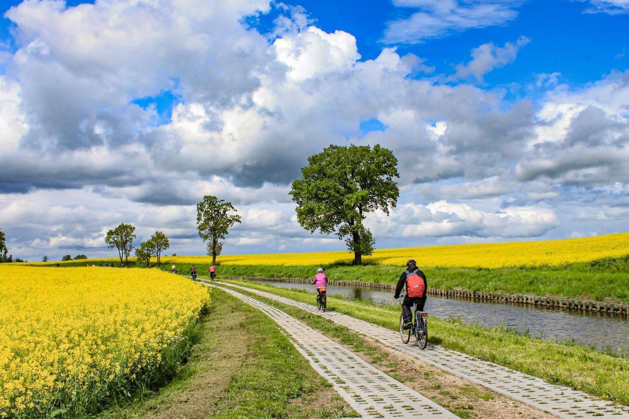
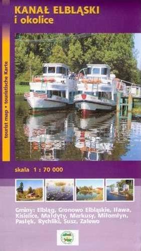
The Elbląg Canal Bicycle Trail, connecting Elbląg (and thus the Green Velo trail) with Ostróda, runs as close as possible to the waterway of the Elbląg Canal. The terrain along the route is varied, ranging from the flat lands of Żuławy, through steep hills near the canal’s slipways, to a gently undulating moraine landscape. The most distinctive attractions of the route are undoubtedly the slipways on the Elbląg Canal, the only hydrotechnical structures of their kind in Poland. The Elbląg Canal itself—a technical monument—has been recognized as one of the seven wonders of Poland.
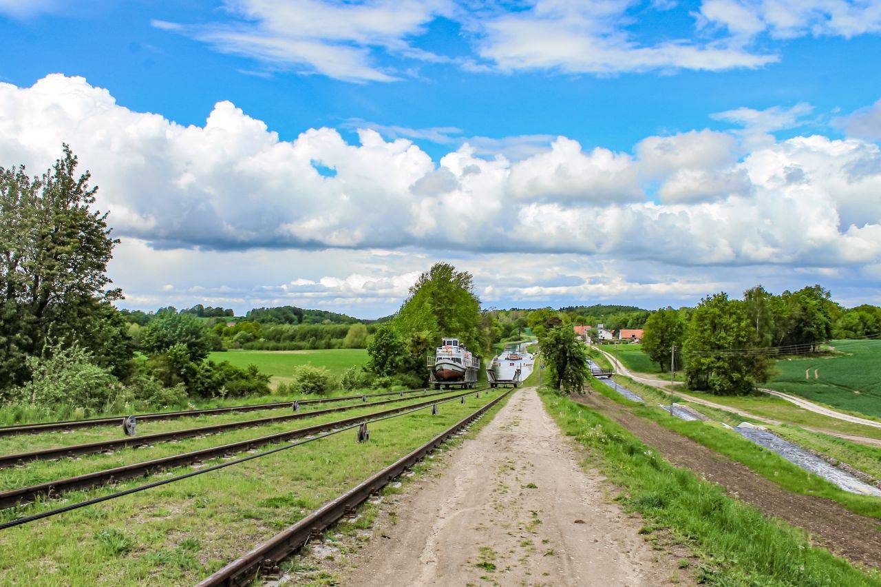
The trail begins in Elbląg, at the Battle of Grunwald roundabout. The first section leads through Nowina and Janów to Komorów Żuławski. In this town, we turn right onto the overpass crossing the S7 highway and the railroad tracks. We continue straight through Węzina and Dłużyna toward Klepa. Before the bridge over the Elbląg Canal, we turn right and then left. From this point, we ride along the canal on a concrete-slab path to Karczowizna. Here, an asphalt road begins, leading to the next bridge. Cross it to reach the other side of the canal and continue along a dirt road to Jelonki. In Jelonki, join the paved bike path. At this stage of the trip, you’ll pass three of the five slipways of the Elbląg Canal (Jelenie, Oleśnica, and Kąty). Past Kąty, the trail moves away from the Elbląg Canal and follows Provincial Road No. 526 toward Lepno. To reach the Buczyniec lock, turn right off the route.
The next section of the route follows an asphalt road to Marzewo. Along the way, as you pass through an intersection, you’ll see the Monier Bridge hanging below—a historic (1894) reinforced concrete structure that is the oldest of its kind in northern Poland—and further on, in Drulity, a neoclassical palace and manor complex from the mid-19th century, now serving as a lodging facility. From Marzewo, we take the old Route 7, which runs parallel to the S7 expressway, to the village of Karczemka. Here, we cross the Elbląg Canal again and immediately turn left, passing under the massive bridge on the S7. A little further on, we turn right and head toward Małdyty along a several-kilometer stretch of service road running parallel to the S7.
In Małdyty, next to the “Zajazd pod Kłobukiem” inn, we turn toward the town center, ride along Zamkowa Street, and turn right onto Leśna Street, which leads on to Wilamów. At the intersection in Wilamów, it’s worth veering off the route for a dozen or so meters to see the Church of Our Lady of Częstochowa. If you’d like to take a break, you can continue straight ahead to the beach on Lake Ruda Woda. From Wilamowo, a comfortable gravel road leads you further south to the village of Ględy, and then toward Liksajny, where you cross back to the other side of the Elbląg Canal. By the bridge over the canal stands a majestic oak tree, next to which is an original monument to the Oberland rafters. Upon reaching the paved road in Majdany Małe, we turn right toward Miłomłyn. From Miłomłyn, we take the old National Road No. 7 and turn left toward Samborowo, following the signs. About a kilometer further on, we see the abutments of a ruined railway viaduct; just past them, we turn left off the paved road, uphill, onto the railway embankment. The final section of the route follows the old railroad tracks to Ostróda, and then a pedestrian and bicycle path along Lake Drwęckie to the passenger marina of the Ostróda-Elbląg Shipping Company.
The trail passes through areas with varied terrain. The initial section is flat, but near the slipway on the Elbląg Canal, there are steep descents and ascents. Beyond Buczyńiec, the gentler hills of the terminal moraine stretch out. The route can be covered on a road bike, touring bike, hybrid bike, or mountain bike. Good places to rest include the shelter near the Kąty boat ramp and the beach in Wilamowo.
You can take the train to both the starting point in Elbląg and the endpoint in Ostróda. There is also a train station in Komorów Żuławski along the way.
How does the boat lift work?
The lift mechanisms, used to pull barges along the tracks, are powered by the force of falling water. The sections of the canal between the lifts are connected by canals. Water flows through them from the higher (southern) section to the lower (northern) section, driving the mechanism. As you pass by the slipways, it’s worth taking a closer look at how these remarkable historical hydraulic engineering monuments operate. At the Buczyniec inclined plane, you can visit the upper control station and the Elbląg Canal History Museum at Buczyniec 1a, 14-140 Pasłęk, www.ihke.pl. The museum is open from May 1 to September 30, Tuesday through Sunday, from 10:00 a.m. to 5:00 p.m.
Elbląg Canal
The Elbląg Canal is a waterway unique on a global scale and one of the most beautiful waterways in Europe. Built between 1844 and 1860, it remains in operation today in its original form.
Janów
Janów is home to a palace and park complex dating from 1886, built on the site of a former 14th-century manor house. Opposite it, on the right-hand side, stands a plaque marking the site of the early-medieval settlement of Truso, located on the shores of the lake and described by the Anglo-Saxon traveler Wulfstan in the 9th century. It was a trading settlement founded by the Vikings.
The “Zajazd pod Kłobukiem” Inn in Małdyty
This building is closely tied to the history of East Prussia and the Oberland. In the 17th century, it was part of a large palace and park complex owned by Augustus II the Strong. In 1813, during the Russian campaign, Napoleon was stationed here.
Around 1820, the building that now houses the inn (formerly an outbuilding) was rebuilt, taking on the form of a Neo-Gothic mansion, a style it has retained to this day. From 1841 to 1845, it was rented by Georg Jacob Steenke, the designer and builder of the Elbląg Canal. A historic benchmark—a surveying marker—is embedded in the wall near the entrance. It is believed that it was placed here at the designer’s instruction and served Steenke during the construction of the canal.
The main palace building was destroyed during World War II. In addition to the outbuilding, the entrance gate and remnants of the park with its monumental trees have survived. Directly opposite the entrance stands a magnificent, over 150-year-old thuja—one of the largest in Poland—and at the far end of the park stands the over 400-year-old Kłobuk Oak. The name “Zajazd pod Kłobukiem” was proposed by Zbigniew Nienacki, author of the well-known young adult novels about Pan Samochodzik, who once lived in nearby Jerzwałd.
Church of Our Lady of Częstochowa in Wilamów
A former Evangelical church, built between 1754 and 1755. It was founded by the Wilamowski family, who owned the village. In 1842, it was thoroughly rebuilt in the Classicist style.
Ostróda
Ostróda is an important tourist destination. Today, it is primarily associated with its history linked to the Teutonic Knights, the Elbląg Canal, and the reggae music festival.
The Teutonic Castle was built in the 14th century. It is worth noting that Napoleon was stationed there for several weeks in 1807. Among the city’s main landmarks are also three churches. The first is the Neo-Gothic Church of the Immaculate Conception of the Blessed Virgin Mary, which impresses with its architecture and stained-glass windows depicting saints. In a side chapel stands a 14th-century sculpture of Mary holding the body of Christ, an original work of woodcarving art.
Another noteworthy church is the Evangelical Methodist Church of God’s Grace, built of brick in the Neo-Gothic style in 1907. A distinctive feature of the building is its massive tower, topped with a double cupola. The church tower features an observation deck offering a beautiful panoramic view of Ostróda. The third of these historic churches, the Church of St. Dominic Savio, was built in the 14th century. The only surviving elements of its interior from that period are the stone baptismal fonts. When visiting the church, be sure to take a look at the Gothic portal of the entrance door.
On the shore of Lake Drwęckie, near the city beach, stands the Bismarck Tower. It was built in 1902 from hewn glacial erratic stones and was the first structure of its kind in East Prussia. Located on Grunwaldzka and Demokracji Streets is a barracks complex, known as the Red Barracks, erected between 1890 and 1898. During its construction, a medieval border mound, known as Ślimacza Góra, was leveled. A second barracks complex, known as the White Barracks, was put into service in 1913. Today, the former barracks host the Ostróda Reggae Festival, the largest event of its kind in Eastern Europe, which attracts fans from Poland and abroad every year.
It is also worth noting the plebiscite stone, commemorating the plebiscite regarding the affiliation of East Prussia to Poland or Germany after World War I. The date of the plebiscite—July 11, 1920—is carved into the boulder. The stone has survived from that time. Today, the plebiscite stone is on display in the renovated Collis Park in Ostróda, on 3 Maja Street. In the 1920s, monuments commemorating the German victory were erected in many towns. After World War II, these monuments were destroyed, condemning the places where they stood to oblivion. For many years, it was believed that the plebiscite monument in Ostróda had also been destroyed. It was rediscovered in 1999. One of Poland’s cleanest rivers, the Drwęca, flows through Ostróda. Its entire valley lies within the boundaries of the Drwęca River Nature Reserve.