

Traseo_Official_RoutesTraseo_Official_Routes
6/6
Charakterystyka trasy
2025-05-09

Długość trasy:
252 kmSuma przewyższeń:
517 mSuma spadków:
595 mOcena trasy:
6/6Map of the Tauber-Altmühl Radweg
The Tauber-Altmühl-Radweg cycle route is a scenic route of around 250 km, connecting the medieval town of Rothenburg ob der Tauber with Kelheim on the Danube. The route leads through the charming landscapes of Franconia and Bavaria, offering cyclists both cultural and natural richness.
Route, attractions
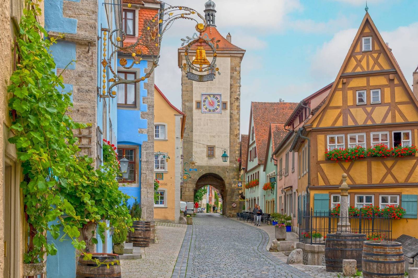
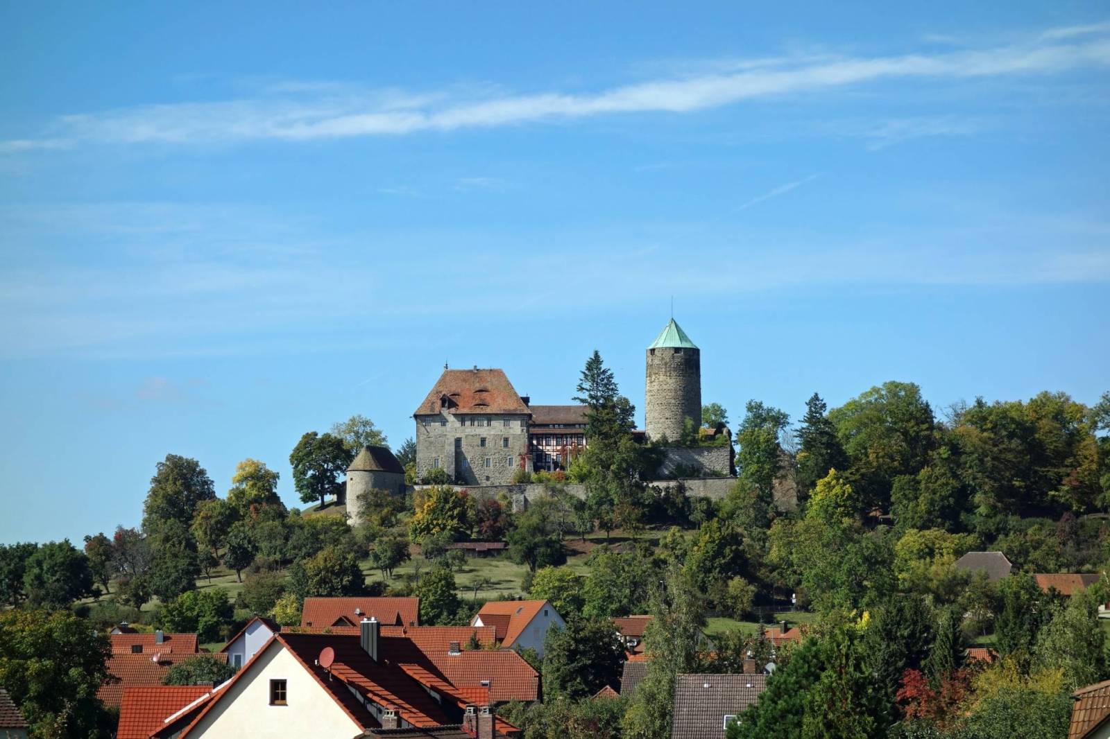
Starting in Rothenburg ob der Tauber, one of Germany's best-preserved medieval towns, cyclists can admire the historic town walls, the Kriminalmuseum and the Riemenschneider altar in St. James Church. The route then leads through the Naturpark Frankenhöhe, where the source of the Altmühl River near the Hornauer Weiher is located. In Colmberg, it is worth stopping by the Hohenzollern Castle, which offers the possibility of staying overnight within the historic walls.
The next stages lead through Leutershausen, where the museum of aviation pioneer Gustav Weißkopf is located, and Herrieden with its baroque architecture. The Naturpark Altmühltal begins in Gunzenhausen, and the Altmühlsee lake, 40% of which is a nature reserve, offers opportunities for swimming and birdwatching.
Further along, the route crosses the picturesque countryside around Gunzenhausen, a town on the Altmühlsee, where the character of the route changes - from now on cyclists follow the valley of the Altmühl River.
After Gunzenhausen, the route passes through quiet countryside, passing Bubenheim and then Markt Berolzheim before reaching Treuchtlingen. This charming town with its thermal baths and historic buildings is an important resting point on the route - an ideal place to stay overnight or relax in the thermal waters after an intense day's riding. Although the route does not go through Weißenburg in Bayern, this historical point with its Roman Biriciana camp and Wülzburg fortress is only about 10 km from the route and can be an attractive destination for an additional diversions.
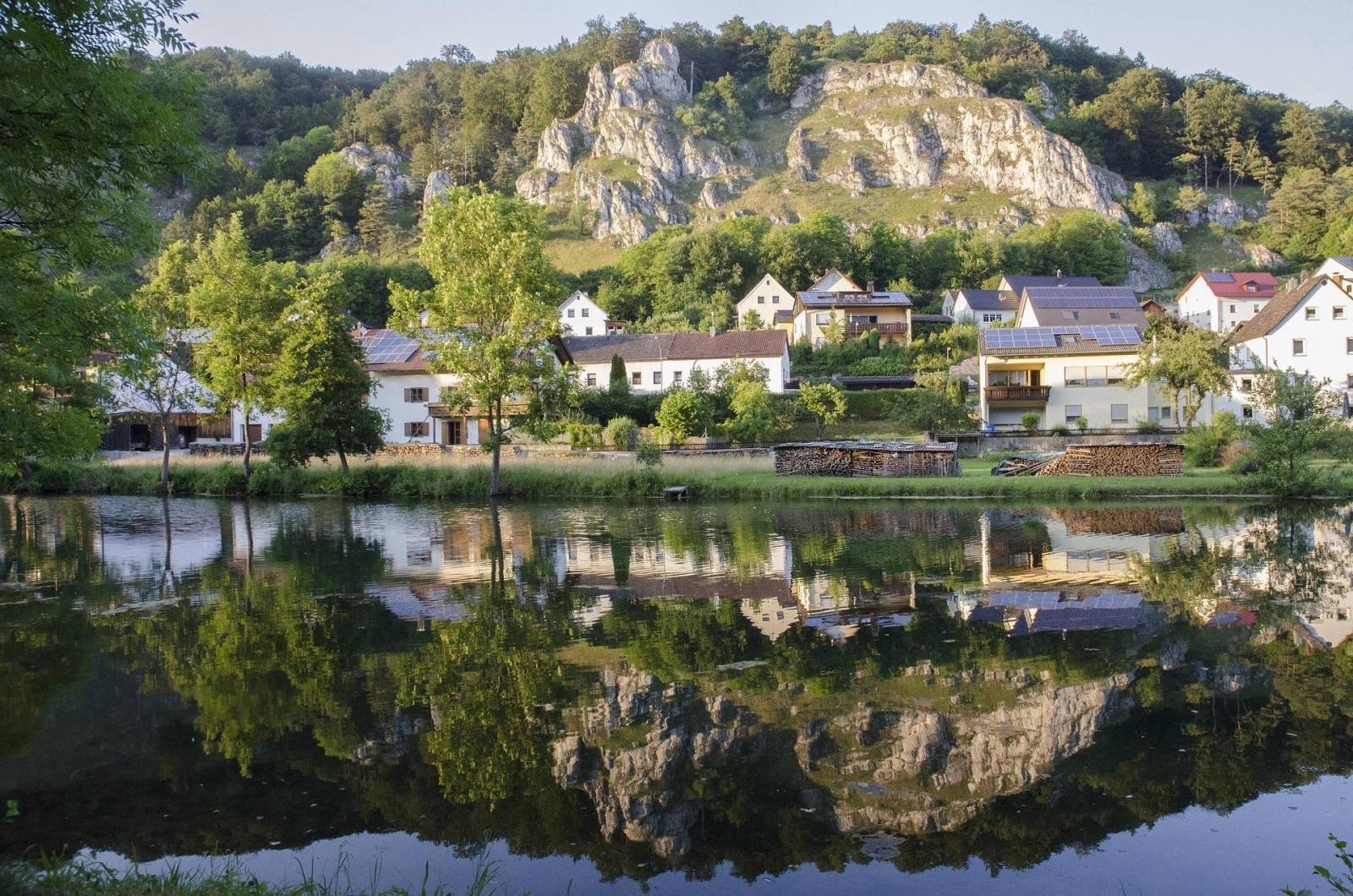
The trail then continues through Pappenheim, with its picturesque castle on a rock, and continues on serpentines through the Altmühl valley via Dollnstein and Solnhofen - known for its archaeological sites and Jurassic rocks, where an archaeopteryx was discovered. The route winds through the rocks and forests of the Altmühltal Nature Park, offering some of the most spectacular views of the entire trail.
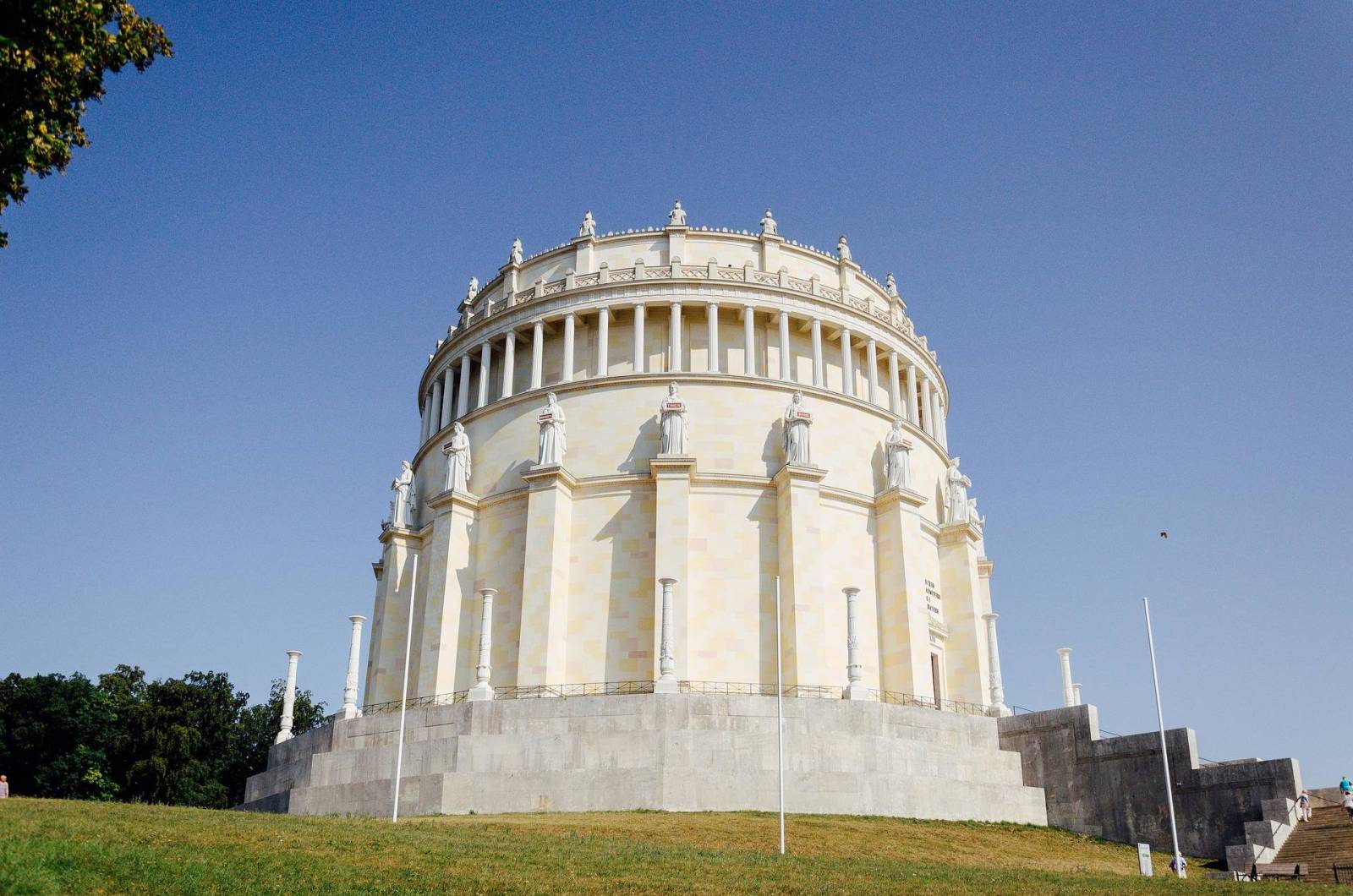
The next stages take you through Eichstätt, a baroque university town with a cathedral and bishop's gardens, and then through the boiling green surroundings of Kipfenberg and Beilngries. The trail ends in Kelheim. This place attracts visitors with the impressive Weltenburg monastery, one of the oldest monastic breweries in the world, picturesquely located in the limestone gorge of the Danube - the Donaudurchbruch. The monumental Hall of Liberation (Befreiungshalle), a neo-classical rotunda built at the behest of Ludwig I of Bavaria, also rises on a hill above the city.
A little further afield, near Regensburg, is also the famous Walhalla - a classicist temple to honour distinguished Germans, reminiscent of the Greek Parthenon. Although it is not on the route, it is well worth a visit if you continue along the Danube.
Level of difficulty
The route is mostly flat, with gentle climbs, making it suitable for families with children. The surface is mainly asphalt and gravel cycle paths, away from car traffic. Good train connections are available in Rothenburg ob der Tauber, Gunzenhausen and Saal an der Donau, and accommodation offers a wide range of options, including Bett+Bike certified facilities. Bike rental facilities are available in the larger towns along the route, such as Rothenburg ob der Tauber and Gunzenhausen.
From which side to start the trip?
Most cyclists start in Rothenburg, as this section gradually descends down the Altmühl valley. It is also a more atmospheric start.
..............................................................................................................................................................................................................................................................................................................................
Mapa szlaku Tauber-Altmühl Radweg
Szlak rowerowy Tauber-Altmühl-Radweg to malownicza trasa o długości około 250 km, łącząca średniowieczne miasto Rothenburg ob der Tauber z Kelheim nad Dunajem. Trasa prowadzi przez urokliwe krajobrazy Frankonii i Bawarii, oferując rowerzystom zarówno bogactwo kulturowe, jak i przyrodnicze.
Przebieg trasy, atrakcje
Rozpoczynając w Rothenburg ob der Tauber, jednym z najlepiej zachowanych średniowiecznych miast Niemiec, rowerzyści mogą podziwiać zabytkowe mury miejskie, Kriminalmuseum oraz ołtarz Riemenschneidera w kościele św. Jakuba. Następnie trasa prowadzi przez Naturpark Frankenhöhe, gdzie znajduje się źródło rzeki Altmühl w okolicach Hornauer Weiher. W Colmberg warto zatrzymać się przy zamku Hohenzollernów, który oferuje możliwość noclegu w historycznych murach.
Kolejne etapy prowadzą przez Leutershausen, gdzie znajduje się muzeum pioniera lotnictwa Gustava Weißkopfa, oraz Herrieden z barokową architekturą. W Gunzenhausen rozpoczyna się Naturpark Altmühltal, a jezioro Altmühlsee, którego 40% jest rezerwatem przyrody oferuje możliwość kąpieli i obserwacji ptaków.
W dalszej części drogi szlak przecina malownicze tereny wokół Gunzenhausen – miasta leżącego nad Altmühlsee, gdzie zmienia się charakter trasy – od tej chwili rowerzyści podążają doliną rzeki Altmühl.
Za Gunzenhausen trasa prowadzi przez spokojne tereny wiejskie, mijając Bubenheim, a potem Markt Berolzheim i dociera do Treuchtlingen. To urokliwe miasteczko z termami i zabytkową zabudową stanowi ważny punkt wypoczynkowy na trasie – idealne miejsce na nocleg lub relaks w wodach termalnych po intensywnym dniu jazdy. Mimo że trasa nie prowadzi przez Weißenburga in Bayern, to ten historyczny punkt z rzymskim obozem Biriciana i twierdzą Wülzburg znajduje się zaledwie ok. 10 km od szlaku i może być atrakcyjnym celem dodatkowego objazdu.
Szlak następnie kontynuuje przez Pappenheim z malowniczym zamkiem na skale, dalej prowadzi serpentynami przez dolinę Altmühl przez Dollnstein i Solnhofen – znane z wykopalisk archeologicznych i skał jurajskich, gdzie odkryto archeopteryksa. Trasa wije się wśród skał i lasów Parku Przyrodniczego Altmühltal, oferując jedne z najbardziej spektakularnych widoków całego szlaku.
Kolejne etapy prowadzą przez Eichstätt – barokowe miasto uniwersyteckie z katedrą i ogrodami biskupimi, a następnie przez kipiące zielenią okolice Kipfenberg i Beilngries. Szlak kończy się w Kelheim. To miejsce przyciąga turystów imponującym klasztorem Weltenburg, jednym z najstarszych klasztornych browarów na świecie, malowniczo ulokowanym w wapiennym wąwozie Dunaju – Donaudurchbruch. Na wzgórzu nad miastem wznosi się również monumentalna Hall of Liberation (Befreiungshalle) – neoklasycystyczna rotunda zbudowana na polecenie Ludwika I Bawarskiego.
Nieco dalej, w okolicy Ratyzbony, znajduje się również słynna Walhalla – klasycystyczna świątynia ku czci zasłużonych Niemców, przypominająca grecki Partenon. Choć nie leży na trasie szlaku, warto ją odwiedzić przy okazji dalszej podróży wzdłuż Dunaju.
Poziom trudności
Trasa jest przeważnie płaska, z łagodnymi przewyższeniami, co czyni ją odpowiednią dla rodzin z dziećmi. Nawierzchnia to głównie asfaltowe i żwirowe ścieżki rowerowe, z dala od ruchu samochodowego. Dobre połączenia kolejowe dostępne są w Rothenburg ob der Tauber, Gunzenhausen i Saal an der Donau, a noclegi oferują szeroką gamę opcji, w tym obiekty certyfikowane przez Bett+Bike. W większych miejscowościach na trasie, takich jak Rothenburg ob der Tauber i Gunzenhausen dostępne są wypożyczalnie rowerów.
Od której strony rozpocząć wyprawę?
Większość rowerzystów startuje w Rothenburgu, ponieważ odcinek ten stopniowo schodzi w dół doliną Altmühl. Jest to też bardziej klimatyczny początek.