


Charakterystyka trasy

Komentarze
NA TYCH TRASACH PRZYDA CI SIĘ MAPOPRZEWODNIK LUB MAPA Z NASZEJ APLIKACJI


Mapa "Pojezierze Powidzkie" obejmuje powiat słupecki i okolice, wraz z Powidzkim i Nadwarciańskim Parkiem Krajobrazowym oraz przepięknym opactwem cysterskim w Lądzie. Zaznaczono na niej informacje przydatne turyście, oraz podano przebiegi szlaków pieszych i rowerowych.

Mapa powiatu kaliskiego ze wszystkimi potrzebnymi turyście informacjami. Zaznaczono szlak kulinarny Kaliskie Smaki, szlak Kościołów Drewnianych Ziemi Kaliskiej i szlaki Dębów i Paproci oraz wszystkie inne szlaki turystyczne i rowerowe.
Rok wydania: 2017

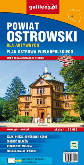
Mapa powiatu ostrowskiego w skali 1:70 000, w skład którego wchodzą gminy: Ostrów Wielkopolski, Nowe Skalmierzyce, Odolanów, Raszków, Przygodzice, Sieroszewice, Sośnie. Szczególnie atrakcyjne miejsca zaznaczono żółtą ramką. Podano aktualne przebiegi szlaków pieszych, rowerowych i dydaktycznych, łącznie z kilometrażem, co pozwala łatwiej zaplanować wycieczkę. Za pomocą wyraźnych, charakterystycznych znaków wskazano miejsca, gdzie można aktywnie spędzić wolny czas. Na mapie zaznaczono miejscowości, drogi, lokalizację obwodnicy Ostrowa Wielkopolskiego, zabytki, ważniejsze noclegi, łowiska, stadniny koni, parki linowe, przystanie żeglarskie, korty tenisowe, strzelnice sportowe, hale sportowe oraz kąpieliska i baseny. Ukształtowanie terenu pokazano przy pomocy warstwic o cięciu co 10 m. Obszar mapy ograniczony jest współrzędnymi 17°25’ - 18°14’ długości geograficznej wschodniej oraz 51°24’-51°48’ szerokości geograficznej północnej.

Mapa obejmuje obszar Dolnośląskiej Krainy Rowerowej, czyli obszar pow. górowskiego, pow. trzebnickiego, pow. milickiego oraz gmin: Wołów, Twardogóra i Dobroszyce. Zaznaczono tu wszystkie szlaki piesze, rowerowe, konne i kajakowe oraz ścieżki przyrodnicze i edukacyjne. Szczególnie zostały uwypuklone drogi rowerowe istniejące, w budowie i planowane. Mapa zawiera atrakcje turystyczne, przyrodnicze i bazę noclegową. Dodatkowo zostały zaznaczone miejsca przyjazne rowerzystom. Część opisowa zilustrowana fotografiami, obejmuje obszar mapy w podziale na regiony, wybrane szlaki rowerowe oraz krótką charakterystykę miejsc przyjaznych rowerzystom.