


Charakterystyka trasy

Komentarze
NA TYCH TRASACH PRZYDA CI SIĘ MAPOPRZEWODNIK LUB MAPA Z NASZEJ APLIKACJI
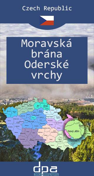
Brama Morawska to kraina geograficzna na Morawach w Czechach, stanowiąca obniżenie pomiędzy Karpatami Zachodnimi i Pogórzem Śląskim a Sudetami Wschodnimi. Od najdawniejszych czasów region ten stanowił naturalne przejście pomiędzy Sudetami i Karpatami. Tędy przebiegały najważniejsze trakty handlowe z południa Europy nad Morze Bałtyckie (np. jeden z wariantów Szlaku Bursztynowego), a także szlaki z Polski do Czech. Najważniejszym miastem Bramy Morawskiej jest dziś Ostrawa. U północnego wylotu Bramy Morawskiej po stronie polskiej leżą między innymi takie miasta, jak Racibórz czy Wodzisław Śląski. Mapa obejmuje także Gory Odrzańskie (najwyższy szczyt: Fidlův kopec, 680 m), okalające Bramę Morawską od zachodu i stanowiące najdalej na wschód wysunięte pasmo górskie łańcucha Sudetów, leżące całkowicie na terenie Czech.
Rok aktualizacji: 2016/2017
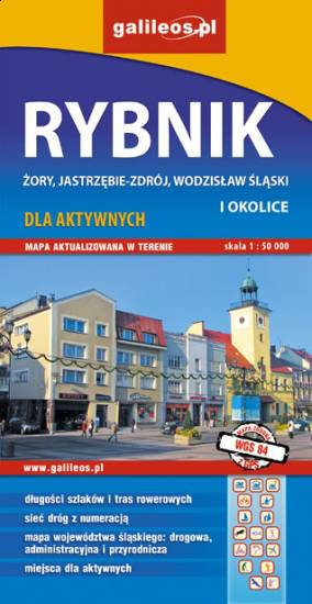
Mapa Rybnika i okolic obejmuje Żory, Jastrzębie-Zdrój, Rybnik i Wodzisław Śląski. Zaznaczono na niej informacje przydatne turyście, jak zabytki, noclegi, granice obszarów chronionych. W miejscowościach opisano nazwy głównych ulic. Podano aktualne przebiegi szlaków pieszych i rowerowych.

Turistická mapa Euroregionu Praděd zahrnuje území česko-polského příhraničí: na české straně okresy Jeseník a Bruntál, na polské straně Opolské vojvodství. Speciálně zpracovaný kartografický podklad obsahuje nezbytné informace pro aktivní turistiku v přeshraniční oblasti: pěší, jezdecké, cyklistické stezky a další významné objekty infrastruktury cestovního ruchu.
Mapa byla zpracována v rámci projektu „E-bike moderní turistika" spolufinancovaného z prostředků Evropského fondu pro regionální rozvoj a ze státního rozpočtu. „Překračujeme hranice".

Mapa turystyczna Euroregionu Pradziad obejmuje obszar pogranicza polsko-czeskiego: po polskiej stronie województwo opolskie a po czeskiej okresy Jesenik i Bruntal. Specjalnie opracowany podkład kartograficzny zawiera niezbędne informacje do uprawiania aktywnej turystyki w transgranicznym regionie: szlaki piesze, konne, trasy rowerowe oraz inne ważne elementy infrastruktury turystycznej.
Mapa została wykonana w ramach projektu „E-bike nowoczesna turystyka” współfinansowanego ze środków Europejskiego Funduszu Rozwoju Regionalnego oraz ze środków budżetu państwa. „Przekraczamy granice”.