Ełk (0.0 km) – Mrozy Wielkie (6.2 km) – Sordachy (11.1 km) – Koziki (13.4 km) – Giże (15.6 km) – Brodowo (17.0 km) – Laski Małe (19.1 km) – Sypitki (21.0 km) – Makosieje (23.6 km) – Łoje (26.5 km) – Laski Wielkie (28.9 km) – Sędki (31.2 km) – Szeligi (41.1 km) – Ełk (45.4 km)
A relatively easy 45-km route that guarantees an interesting full-day trip. The route’s biggest attraction is its starting and ending points: the incredibly picturesque town of Ełk (see p. 36), where you’ll find several interesting historical sites and numerous recreational areas. From there, the loop leads around one of the largest lakes in the Ełk Lake District—Selmęt Wielki—through places marked by the history of the area’s former inhabitants and the wars fought here. The trail markings in Ełk are green; around the lake, they are red.
We begin the trip at the city beach in Ełk, near the mouth of the Ełk River where it flows into Lake Ełckie. A promenade runs along the lake’s shore, featuring an asphalt bike path marked in green. We head south, moving away from the city center and the castle ruins. After 1 km, the path’s surface changes to cobblestones. On the lakeside embankment stands an observation tower, which is worth climbing to see Lake Ełckie in all its glory. At the far end of the lake, where Provincial Road DW621 meets it, there is a small terrace often occupied by anglers. About 250 m further on, we turn left and cross the national highway.
We continue east on the paved road toward the village of Mrozy Wielkie. Here, signs for the red cycling trail appear. We cross the railroad tracks near the Ełk Szyba Zachód station. Here lies the first, very inconspicuous World War I military cemetery. It’s easy to miss, as one might think there’s just a thuja tree a few meters tall growing here. Beneath it, however, is a memorial plaque dedicated to the fallen German soldiers. We pass another set of tracks and the Ełk Szyba Wschód station. A forest begins on the right, and also on the right, just before the intersection, we pass another World War I cemetery where Russian soldiers are buried. Beyond the cemetery, we cross the city limits.
The route continues through the forest. The trail turns left, following signs for the Ełk Forest District. We reach the S61 expressway, which we cross via an overpass, then turn left following the detour signs and continue on to the village of Mrozy Wielkie. We cross the tracks of the Ełk Narrow-Gauge Railway.
In Mrozy Wielkie, at the last fork, the route follows the main road to the right (if we turned left, we would soon reach the beach on Lake Selmęt Wielki). As we leave Mrozy Wielkie, a gravel road begins, which is unpaved in places. Riding through picturesque, rolling fields, we reach Sordachy. This summer resort village is very spread out. In its center, the road descends right down to the lake, which we pass on our left. Beautiful, old weeping willows line the road. The road surface turns to cobblestones. We continue straight ahead, passing the right-hand turnoff from the main road and staying close to the lake’s shore. At the end of the village, the cobblestones give way to gravel. We ride along a beautiful maple-lined avenue toward Koziki. The route follows the shore, and the cobblestone surface reappears. We pass a beach. Beyond the village, at the fork, we turn left onto a gravel road toward Giże, through which we ride straight ahead. Beyond Giże, marshlands stretch out on the left side of the road, while fields lie on the right. We enter Brodów, pass through it, and continue on among beautiful pollarded willows.
At the fork beyond the village, we turn left; a little further on, we cross the narrow-gauge railroad tracks and arrive at Laski Małe. The road first takes a sharp right turn, then reaches an asphalt road, where we turn left toward Sypitki; in Sypitki, we turn left again, following the road sign toward Sędki. Immediately after the next railroad crossing, turn left onto a forest road. From here on, pay close attention to the signs. At the first fork, take the road to the right, then right again, and pass by the war cemetery to emerge onto an asphalt road. Alternatively, you can skip the forest road and continue straight on the asphalt road. A stone half a meter in diameter, lying on the left side of the road, marks the way to the war cemetery. After traveling 1 km from this point, you’ll enter the village of Makosieje. Cross the bridge over the Ledze River to reach Łojów, where you’ll find scenic overlooks overlooking the lake and a swimming area. In the next village—Laski Wielkie—there is a historic Evangelical cemetery. To reach it, turn right onto a gravel road after entering the village. The cemetery is located in the forest, on a distinct hill, at the point where the road branches off to the left.
The trail continues straight ahead on an asphalt road to the village of Sędki, where it intersects with Provincial Road No. 625 (formerly National Road 16). Turn left and then left again, just before the overpass over the S61 highway. We continue along the service road toward the village of Szeligi. On the outskirts of Ełk, a paved bike path leading from Szeligi joins the road. You can take it to the left toward Szeligi, where you’ll find a historic Evangelical and military cemetery, as well as a swimming area and a water sports equipment rental shop. At the intersection with the expressway, the path disappears briefly, and we ride on a gravel road. From Szeligi, we return along the same route to Suwalska Street, which we follow, crossing the railroad tracks. After crossing them, we turn left onto Dąbrowskiego Street and then right onto Kościuszki Street. We reach the promenade along Lake Ełckie, turn left, and after a few minutes arrive at the city beach, where we started our ride.
Ełk
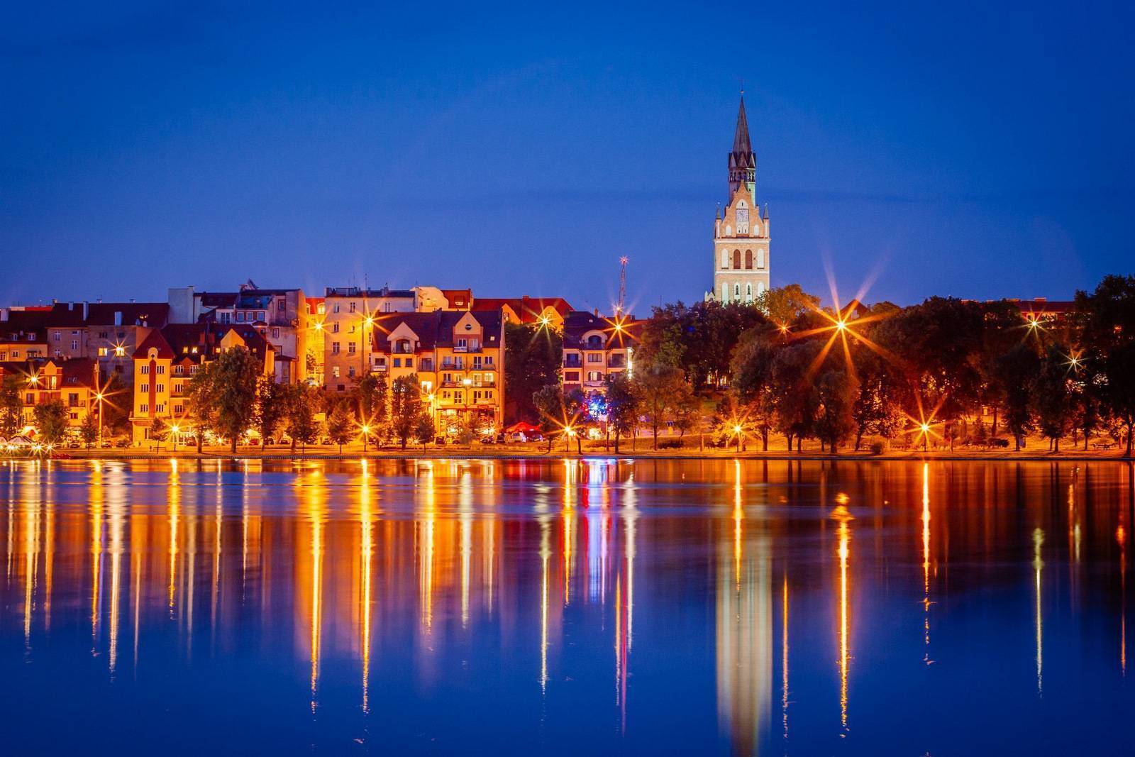
The oldest historic site in Ełk is the Teutonic Castle from the late 14th century, which Ulryk von Jungingen began building before he became Grand Master. The castle was built on an island located at the narrowest point of Lake Ełckie. Bridges connected it to the western and eastern shores. It was not heavily fortified, as its location provided the best protection. In the 15th century, during the Polish-Teutonic Wars, it changed hands many times. In the 16th century, as a result of the secularization of the Teutonic Order, it lost its military significance. In the 17th century, it was rebuilt into a palace. Among others, Marshal Ney resided here during the Napoleonic campaign of 1807. In 1833, the castle suffered severe damage in a fire. After this tragic event, it never regained its former splendor. Until 1970, it housed a prison. Today, it remains a picturesque ruin, visible from almost anywhere in the city center. Ełk is also home to two historic Neo-Gothic churches: the Cathedral of St. Adalbert, Bishop and Martyr, dating from 1893, and the Church of the Sacred Heart of Jesus from the mid-19th century, originally built as a Lutheran church. These are the most impressive buildings in the city, both featuring tall, soaring towers.
Competing with them in a race to the sky is the water tower from 1895, one of the best-preserved structures of its kind in Masuria. It is 33 meters tall and stands at the highest point in the city. Until 1970, when the city’s water supply system was established, it provided water to 80% of Ełk’s residents. It now houses the Museum of a Drop of Water, and there is an observation deck at its summit. The tower serves as the headquarters of the “Mazury” German Minority Association.
There are many green spaces near Lake Ełckie. It’s worth taking a break in Nicolaus Copernicus Park at the mouth of the Ełk River where it flows into Lake Ełckie. A statue of the astronomer “sits” on one of the 50 benches, and a model of the Solar System—with spheres symbolizing the Sun and the planets—has been set up in the alley next to it. The children’s playground is shaped like the constellations of the Big Dipper and the Little Dipper. There is also a running track and equipment for calisthenics and strength training.
Ełk – an old town without a market square
Even after exploring Ełk far and wide, you might not notice the feature that sets it apart from most cities in Poland—and perhaps even the world. It’s actually something that’s missing. Ełk has no town square, which is surprising for a city with 600 years of history. The city center lies on the lake, along the lakeside promenade and the road leading to the castle on the island, yet there is no classic town square with a square-shaped town hall—or even the site where one once stood.
The best way to reach the starting point of the tour is by train or bus. Ełk has convenient rail connections to Białystok and Olsztyn. Bus routes connect it to Warsaw, Suwałki, and Olsztyn.
Historical Museum and Ełk Narrow-Gauge Railway
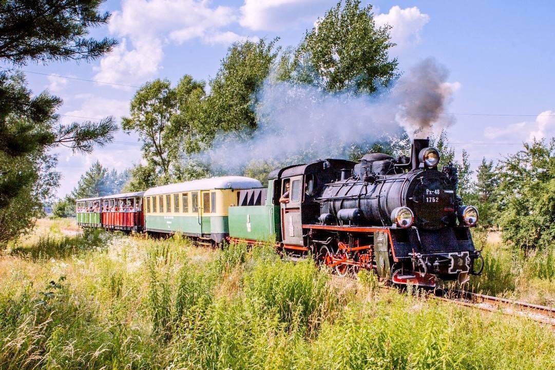
The Historical Museum, located at ul. Wąski Tor 1, 19-300 Ełk, tel. 87 732 02 83, sekretariat@muzeum.elk.pl, www.muzeum.elk.pl, is housed in a revitalized, historic narrow-gauge railway station building and also features exhibits of old locomotives and railcars. The Ełk Narrow-Gauge Railway, built between 1912 and 1914, operates as part of the facility. Today, it is a major tourist attraction. During the summer season, it carries passengers along the Ełk–Sypitki route. A one-way trip takes 45 minutes. The route runs through scenic terrain between Lake Selmęt Wielki and Lake Regielskie.
Lake Selmęt Wielki
One of the largest lakes in the Ełk Lake District, it covers an area of 1,270 hectares. Its size, interesting shape, and—above all—the strong winds that blow across it—due largely to its mostly forested shores—make it an ideal body of water for sailors. The largest marinas are located in the towns of Szeligi, Buczki, and Mrozy Wielkie, all situated near Ełk. These are also the easiest places to rent and launch kayaks, rowboats, and pedal boats. The lake is rich in nutrients and teeming with fish, making it a favorite among anglers as well. The Lega River, which flows through the lake, is an attractive kayaking route.
Evangelical Cemeteries
While traveling along the route, you can visit old cemeteries that serve as a reminder of the area’s former inhabitants: in Mrozy Wielkie, Makosieje, Laski Wielkie, and Szeligi. There are as many as 64 rural Evangelical cemeteries in the Ełk area. Most date from the second half of the 19th century. Their large number stems from tradition—wealthier Protestant families established their own small family cemeteries. A single village might have had several of them. They were usually located on hills, among fields, or in the forest, and were not fenced in. The graves were oriented along an east-west axis. Often unmarked, and sometimes family plots in larger cemeteries were enclosed by wrought-iron fences. Many of these cemeteries are in very poor condition, overgrown with trees, bushes, or grass. There are almost no descendants of the former residents living in the area. However, it does happen that the current villagers tidy up and restore them on their own.
War Cemeteries
From the summer of 1914 to February 1915, Ełk was caught in the crossfire of German-Russian battles and changed hands several times. A dozen or so war cemeteries, where fallen soldiers are buried, bear witness to these battles. Sometimes these are burial sites for soldiers from one army, and sometimes from both. Mass graves or individual unmarked graves are scattered throughout the forests and along the roads. You can also find soldiers’ burial plots in Evangelical cemeteries. Along the route, you’ll find them in Ełk, Makosieje, Sędki, and Szeligi.
Pollarded Willows
Pollarded willows is a term describing the form taken by two species of trees (white willow and crack willow) as a result of “pollarding,” or the pruning of branches that grow away from the trunk. Through patient repetition of this process every 5–6 years, a characteristic tree silhouette emerges—a thick trunk widening at the top, from which numerous thin branches grow upward. Willows are very hardy, and pollarding does not cause them significant harm. However, discontinuing this practice causes the brittle branches to break off from the trunk and the tree to gradually decay. Thanks to their numerous hollows and dense branches, willows provide nesting sites for many birds of several dozen species.