

Charakterystyka trasy

Komentarze
NA TYCH TRASACH PRZYDA CI SIĘ MAPOPRZEWODNIK LUB MAPA Z NASZEJ APLIKACJI
Mapa prezentuje obszar najmniejszego, ale jakże urokliwego polskiego Beskidu. Zasięg mapy obejmuje tereny pomiędzy Bielskiem-Białą na zachodzie i Suchą Beskidzką na wschodzie oraz Wadowicami od północy i Żywcem na południu.
Obszar Beskidu Małego posiada charakter zwartej, rozległej wyspy górskiej, którego najwyższym szczytem jest Czupel (930 m n.p.m.). Dla turystów jest to łatwo dostępny obszar z gęstą siecią szlaków turystyki pieszej, rowerowej i narciarskiej. Jeziora Żywieckie i Międzybrodzkie stwarzają dobre warunki do uprawiania sportów wodnych. Obszar Beskidu Małego to również region bogaty kulturowo, gdzie spotkać można ślady wczesnośredniowiecznych grodzisk, ruiny rycerskich zamków, dawne rezydencje magnackie, staropolskie szlacheckie dworki, czy niespotykane gdzie indziej kamienne szałasy. W regionie tym urodził się i wychował Jan Paweł II, który często wędrował po szlakach tego Beskidu.
Wydawnictwo Compass dokonało aktualizacji mapy na bazie własnych prac terenowych oraz w konsultacji ze znakarzami szlaków.
Wydanie 10, 2017 r.
Mapa Beskidu Makowskiego (zwanego także Średnim lub Myślenickim) swoim zasięgiem obejmuje także fragmenty Beskidów: Małego, Żywieckiego i Wyspowego. Najwyższym szczytem jest Mędralowa, pozostałe pasma osiągają wysokość do 700 – 800 m n.p.m. Beskid Makowski jest stosunkowo mało popularny wśród turystów, chociaż jest też dosyć gęsto zaludniony. Na mapie przedstawione zostały szlaki piesze oraz trasy rowerowe, zastosowano także cieniowanie w celu uzyskania wrażenia plastyczności terenu. Mapa offline, którą można zakupić w aplikacji Traseo na urządzenia mobilne, zasięgiem obejmuje tereny od Wadowic na zachodzie po Dobczyce i Rabkę-Zdrój na wschodzie. Rok wydania 2023
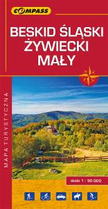
Mapa turystyczna Beskidu Śląskiego, Żywieckiego i Małego - zostały zaznaczone na niej najpotrzebniejsze dla turystów informacje: przebiegi szlaków i atrakcje turystyczne. Z mapy można korzystać będąc offline, po zakupie wybiera się ją jako jeden z podkładów mapowych, widać pozycję użytkownika na mapie. To świetna alternatywa dla map drukowanych. Rok wydania: 2018