Kadyny (0.0 km) • Buki Wysoczyzny Elbląskiej Nature Reserve (2.6 km) • Tolkmicko (17.6 km) • Kadyny (22.6 km)
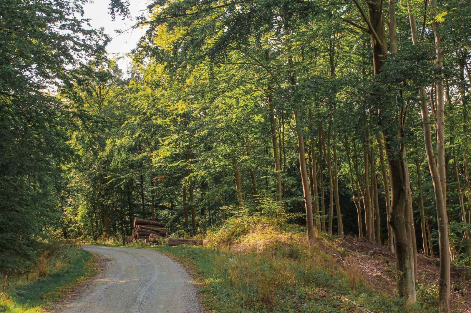
The route runs through the Elbląg Upland Landscape Park, through a beautiful deciduous forest dominated by beech trees. The terrain is challenging, featuring numerous ascents and descents as well as dirt and gravel forest trails. The trail is recommended for moderately experienced mountain bikers. Its main attraction is the beautiful scenery.
From Kadyn, we head south, passing the former imperial palace, now a hotel. The marked trail begins on the grounds of the stud farm, near the Chapel of the Holy Cross. Following the signs on the left and right sides of the road, we head uphill toward the Franciscan monastery. The first 5 km is an uphill climb along a rough road to the village of Ostrogóra, which is situated on the edge of the Buki Wysoczyzny Elbląskiej Nature Reserve. After the village, we ride straight ahead for a short stretch and then turn left. At this stage, two steep descents, marked with exclamation points, await us. It’s worth stopping at the hills along the way. These are the highest points on the route, offering magnificent views of the surrounding area. The next section follows a wide, gravel forest road toward Tolkmicko. This is by far the easiest part of the route.
After a few kilometers, we reach an intersection. We turn right, following the trail markers. The road leads downhill. We pass the scattered buildings of the village of Przybyłowo. Here begins a longer stretch of cobblestone. On the right, we see the Stradanka River and signs informing us about the Stradanka Valley Nature Reserve.
On the outskirts of Tolkmicko, we take a sharp left onto a wide, paved gravel road, from which we can admire a sweeping panorama of the surrounding area with the Vistula Lagoon in the background. Next, we reach the so-called “white road” and head downhill toward the Kadyny Vineyard—Biała Leśniczówka. We pass it on the left, and then, paying close attention to the signs, turn left a little further on and return to the road leading toward the Franciscan monastery.
The route is very well marked, though only in one direction. There are no designated rest areas along the way, but you can simply head down to the Vistula Lagoon, to Tolkmicko or Kadyn, to enjoy the charming sandy beaches offering sweeping views. Significant elevation changes mean the trail features numerous steep descents and ascents, which can pose considerable challenges for inexperienced cyclists. Long descents on paved gravel roads—such as those before Tolkmicko—add variety, though there are also sandy sections that can become muddy after rain. A hybrid or mountain bike is best suited for this route.
Kadyny is located along Provincial Road No. 503, 20 km north of Elbląg, where the nearest train station is located. It is not possible to reach the route with a bike via public transportation.
Kadyny
A picturesque village situated on the Vistula Lagoon, at the foot of the Elbląg Upland. A Prussian settlement once stood on this site. When it was conquered by the Teutonic Knights in the 13th century, the present-day village of Kadyny was established nearby. This recognized the strategic location of the earlier stronghold. The first mention of Kadyny dates back to 1255. In 1431, Jan Bażyński, a leader of the anti-Teutonic opposition and a participant in the Thirteen Years’ War, became its owner. In 1898, the village was granted to Emperor Wilhelm II, who ordered the construction of his summer residence there. As a result, a new layout for the village was even designed, based on plans drawn up by Berlin architects. By imperial decree, a ceramics factory was established in Kadyn in 1905. The local products quickly gained renown. In 2015, a new yacht marina opened in Kadyn.
The Franciscan Monastery in Kadyn
The Order of Friars Minor (Franciscans) is both contemplative and active. The three friars living in the Kadyny monastery combine prayer and work. The monastery is situated in a special location, away from the main road, in the middle of the protected Kadyny Forest nature reserve, on a hill known as Monastery Hill.
Kadyński Forest Nature Reserve
The reserve extends behind the historic palace complex in Kadyny. It protects sections of an old beech forest. Centuries-old beech, ash, and oak trees grow there, many of which are designated as natural monuments. Near the reserve runs an oak-lined avenue, along which stands, among others, the Bażyński Oak, named in honor of the village’s former owner, Jan Bażyński.
Tolkmicko
In the 13th century, the area around present-day Tolkmicko, inhabited by the Prussian tribe of the Pogezans, was conquered by the Teutonic Knights. Between 1296 and 1300, the settlement they founded was granted a town charter. The first written record of the town’s name (as “Tolkemit”) dates back to 1326. In 1440, Tolkmicko joined the Prussian Union. Fourteen years later, the town’s mayor swore an oath of allegiance to the Polish king, and the townspeople demolished the local Teutonic castle. After the end of the Thirteen Years’ War in 1466, Tolkmicko became part of Poland (Royal Prussia) and remained so until the First Partition in 1772. In January 1945, the Red Army destroyed 50% of the town. When exploring the town, it is worth noting its medieval urban layout, the 14th-century Church of St. James the Apostle, the late 14th-century tower, and the remains of the defensive walls. The oldest historical site in the vicinity of the town is the so-called Tolkmita Ramparts, the best-preserved Old Prussian hillfort in the region. It is located about 3 km south of Tolkmicko. In the valley of the Stradanka River, you can see the remains of moats and earthworks reaching up to 7 m in height. The fortifications, covering an area measuring 350 m by 150 m, were integrated into natural forest ravines, which enhanced the defensive capabilities of the complex.
Elbląg Upland Landscape Park
The park protects the most interesting sections of the Elbląg Upland, covered mainly by beech forests. The landscape bears a strong resemblance to the mountainous regions of southern Poland. The highest point is Góra Srebrna (198.5 m above sea level). In terms of topography, the Elbląg Upland is an example of a terminal moraine. Its northwestern edge drops steeply toward the Vistula Lagoon, even taking on the character of a cliff edge in some places.