Elbląg (0.0 km) · Kadyny (35.3 km) · Tolkmicko (41.7 km) · Frombork (60.4 km) · Nowa Pasłęka (69.5 km) · Braniewo (79.9 km) · Pieniężno (112.0 km) · Kandyty (139.9 km) · Górowo Iławeckie (152.2 km) · Lidzbark Warmiński (175.9 km) · Galiny (192.1 km) · Bartoszyce (209.0 km) · Sępopol (229.4 km) · Barciany (258.4 km) · Srokowo (267.8 km) · Węgorzewo (286.0 km) · Banie Mazurskie (307.7 km) · Gołdap (332.7 km) · Dubeninki (356.2 km) · Stańczyki (369.0 km) · Tripoint of Poland, Lithuania, and Russia (384.0 km)
The Green Velo Eastern Bicycle Trail is the longest bicycle route in Poland. It runs through five provinces, and its main route is 1,885 km long (and, together with 13 connecting and alternative routes, totals 2,071 km). The Warmian-Masurian section of the Green Velo trail is nearly 400 km long and allows cyclists to explore the region’s exceptionally picturesque landscapes, rich in natural and cultural attractions. It runs through the northern part of the province, along the border with Russia (the Kaliningrad Oblast). It encompasses three so-called “cycling kingdoms”: “Along the Vistula Lagoon,” “Warmia and Surroundings,” and “Northern Masuria.” It also connects several historical and geographical regions. Numerous local routes also intersect with the trail, so avid cyclists can extend their stay in the region to explore them as well.
The population density in the Warmian-Masurian Voivodeship is just under 60 people per km²; in the northern and eastern parts of the region, this figure is even lower. Small towns with populations of just a few thousand are not uncommon here. Near the country’s northern border, traffic on local roads is light, and the natural landscape has been altered only slightly by human activity.
The route begins in Elbląg, on the Elbląg Upland, which features the greatest elevation differences in the region.
This is the land of historic Powiśle, which in the past was part of Royal Prussia. From Elbląg, we head north through the Bażantarnia Forest Park. All the way to Tolkmicko, the route runs through the Elbląg Upland Landscape Park, covered mainly by beech forests. This section of the route can be challenging for cyclists due to the significant elevation changes. These are offset by steep descents that allow you to pick up speed.
Upon reaching the village of Nadbrzeże, we head further north and ride along the Vistula Lagoon—through Suchacz, Kadyny (known for Emperor Wilhelm II’s residence), and Tolkmicko.
The next stage of the route runs through Warmia with its former capitals: Frombork, Braniewo, and Lidzbark Warmiński. Frombork is a small town located on the Old Prussian Coast, known primarily for having been home to Nicolaus Copernicus. The town’s Cathedral Hill is one of the province’s most important historical sites.
From Frombork, the trail continues through picturesque spots along the Vistula Lagoon, following the lagoon’s shore and skirting the moraine hills, which are an undeniable attraction of the area. It then passes through the towns of Nowa and Stara Pasłęka and enters the Warmian Plain, situated in the Bauda and Pasłęka river basins, running along the Pasłęka River to the center of Braniewo and further east. This area is mostly lowland, with gentle hills.
The next town on the route is Pieniężno, situated on the Górowskie Hills, which are part of the Old Prussian Lowlands. There are no lakes here, and the road runs mainly through farmland.
From Pieniężno, passing through small villages, we head first north and then east, continuing through the Górowskie Hills. In their eastern part lies Górowo Iławeckie, which, with an area of just over 3 km², is the smallest town in Poland by this measure.
We continue southward, through the fields, to Lidzbark Warmiński. Just before reaching the town, in Wielochów, the route follows the so-called “glowing bike path.” It runs along Provincial Road No. 511, is about 100 m long, and has a blue surface made of a material that emits a dark blue light at night. Thanks to this, it is not only aesthetically pleasing but also ensures visibility, thereby improving safety for cyclists.
We arrive in Lidzbark Warmiński, which served as the capital of Warmia for over 600 years. The town is famous for the region’s largest surviving castle, known—in part because of its cloistered courtyard—as the “Wawel of the North.” Here, for the first time, we ride along the province’s longest river, the Łyna. We’ll encounter it again in several towns along the route. In Lidzbark Warmiński, the Symsarna flows into the Łyna; in recent years, the Symsarna Valley Spa Park has been established along its banks.
Taking the road heading east, we head toward Stoczek Klasztorny. The local Shrine of Our Lady of Peace is frequently visited by pilgrims not only as a center of Marian devotion but also as the site where Cardinal Stefan Wyszyński was interned by the communist government. Beyond Stoczek, we leave historic Święta Warmia behind. Continuing eastward, we cross the border between the Lidzbark and Bartoszyce counties. This is also the former border of Warmia, established as early as the 13th century.
We arrive at the village of Galiny, situated on the Pisa River (also known as the Northern Pisa), known for its historic manor house and horse stud farm. We enter the Sępopolska Lowlands. This is the territory of historic Barcja, stretching along the current border with Russia’s Kaliningrad Oblast. Toward the end of World War II, fighting took place here, during which many towns were destroyed. While exploring the area, however, it’s worth stopping by Bartoszyce, a town with centuries of history and tradition, blending Polish, German, and borderland influences. The border crossing in Bezledy is nearby.
In Sępopol and Sątoczno, located further east, Gothic churches have been preserved, while the next town on the route, Korsze, is well-known to all railway enthusiasts. It was once the central railway hub of the East Prussian province, but lost its significance after the border changes following World War II. Past Korsze, in the village of Drogosze, you can see an impressive palace—the seat of the aristocratic Dönhoff family.
We continue along a dedicated bike path to Barciany. This historic town features medieval landmarks: a Teutonic Knights’ castle and the Church of the Immaculate Heart of the Blessed Virgin Mary. Next, riding through farmland, we head toward Srokowo. Srokowo, like Barciany, lost its town privileges in 1945; however, it still boasts the oldest town hall in Masuria, built in 1775.
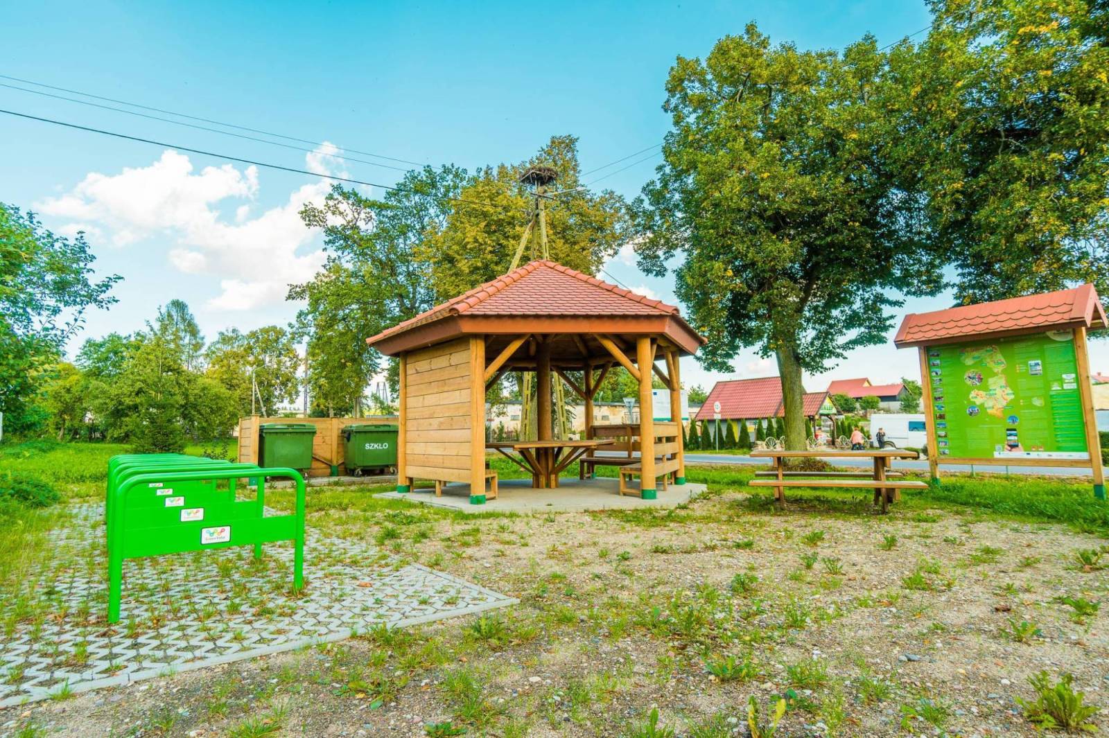
Riding along a dedicated bike path parallel to Provincial Road No. 650, near the village of Leśniewo, we pass the unfinished Leśniewo Górne lock on the Masurian Canal and the Cyclist Service Area on Lake Mamry, one of the most beautifully situated spots along the route.
If we veer off the trail here and ride a few kilometers along the Masurian Cycling Loop, we’ll reach the German Army Headquarters in Mamerki. The bunkers here are well-preserved and open to visitors. The complex features the tallest observation tower in Masuria and houses museum exhibits devoted primarily to World War II.
The Green Velo Trail continues through the Masurian Lake District, passing through the Land of the Great Masurian Lakes, the Węgorapa Region, and the Szeskie Hills. First, we pass through Węgorzewo, situated on the Węgorapa River, with its converted Teutonic castle and marina. Continuing eastward, we cover a significant portion of the route—all the way to Gołdap—along a former railroad track. The railroad line was dismantled after World War II.
If we veer off the trail in Banie Mazurskie and take a local road to the village of Rapa, we’ll see a famous historical site there—a pyramid-shaped tomb where members of the Prussian von Fahrenheid family are buried.
Continuing along the Green Velo trail toward Gołdap, we pass farmland. Gołdap is a spa town, and its northern border also marks the state border with Russia. The region where the town is located—due to its very undulating terrain—is sometimes called “Humpbacked Masuria.” The area is very attractive to cyclists, as the route often “meanders” between the hills, and sometimes you have to climb them.
To the east of Gołdap lies the Romincka Primeval Forest, reminiscent of Scandinavian spruce forests and sometimes called the “Polish taiga.” The trail runs south of the forest complex, and the road often forms the boundary of the Romincka Primeval Forest Landscape Park.
The next major town on the route is Dubeninki. Further on, we pass through Stańczyki, where two massive railway viaducts stand. Nearby, along the trail, there is an observation tower.
The Warmian-Masurian section of the Green Velo trail ends at the tripoint where the borders of Poland, Lithuania, and Russia meet, near the village of Bolcie in the municipality of Wiżajny.
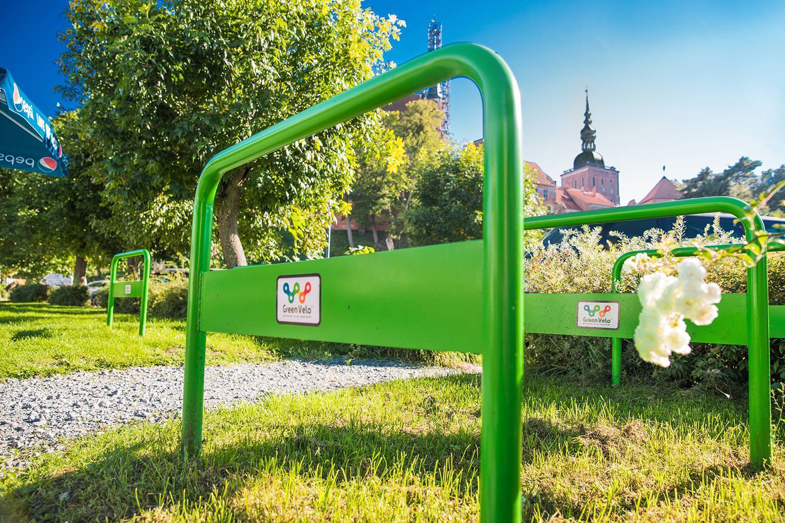
The trail is marked with orange signs featuring a bicycle symbol and the Green Velo logo. The Elbląg Upland features significant absolute elevations as well as large relative elevation changes. Numerous steep climbs and long descents may pose challenges for inexperienced cyclists.
Elbląg is easily accessible by train. Direct lines connect the city with Warsaw, Gdynia, and Szczecin, among other destinations. Regional trains from Olsztyn and Ełk also provide access to Korsz, which lies along the route. There is still a railroad line connecting Węgorzewo with Kętrzyn (34 km), on which tourist trains used to run during the summer season just a few years ago.
Elbląg
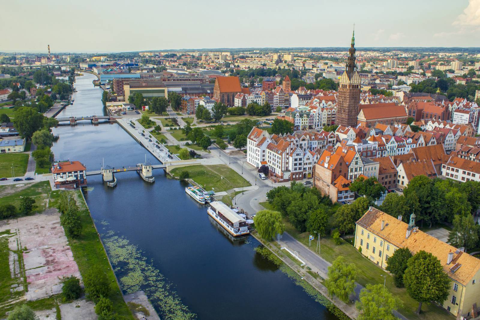
The oldest city within the borders of the Warmian-Masurian Voivodeship, founded by the Teutonic Order in 1237. It received its town charter in 1246 under Lübeck law. One of the distinctive features of towns established under this law was a separate main commercial street. Today, this is Stary Rynek Street. The city’s name derives from the Elbląg River, which flows through it.
The city became a base for organizing expeditions into Prussian territories, which caused its importance to grow rapidly. The situation changed in the mid-14th century. A major factor in this was the Teutonic Knights’ seizure of Gdańsk Pomerania in 1308 and the establishment of the state capital in nearby Malbork.
From 1466 to 1772, Elbląg belonged to Poland and attempted to compete with Gdańsk, though without significant success, except for a few decades at the turn of the 16th and 17th centuries, thanks to privileges granted by Stefan Batory. After the First Partition of Poland, the city became part of the Prussian state. In the 19th century, it became an industrial center, mainly due to the development of its shipyards.
During World War II, the Old Town was completely destroyed; only St. Nicholas Church and a few townhouses survived. It was not until the 1990s that the 4-hectare vacant lot was redeveloped with new, stylized buildings.
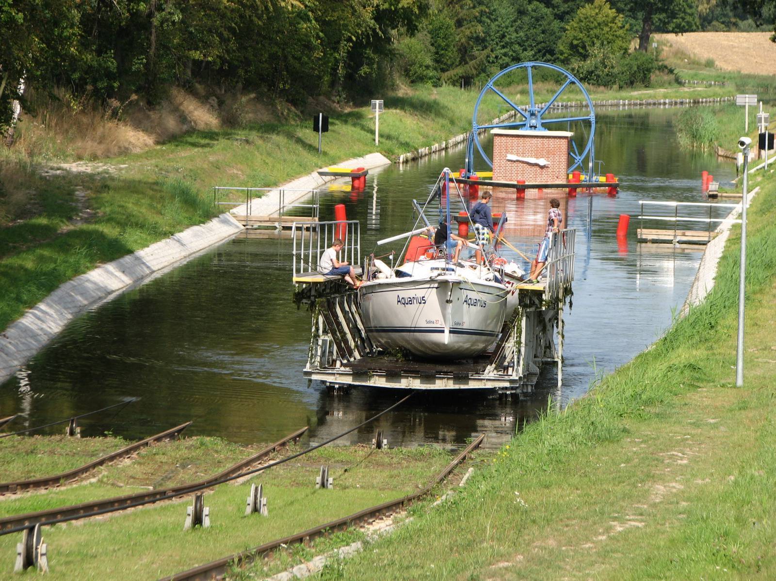
Today, Elbląg is the second-largest city in the Warmian-Masurian Voivodeship, with a population of nearly 120,000. In 2022, thanks to the opening of the Vistula Spit Canal, it gained a direct connection to the Baltic Sea. In the 19th century, Elbląg was connected to the central part of the region by the Elbląg Canal, now a unique monument to hydraulic engineering and one of the province’s main tourist attractions.
Among the city’s most important landmarks is the well-preserved 13th-century St. Nicholas Cathedral. The tower of this cathedral, which houses an observation deck, reaches a height of 99 meters. The Old Market Square is entered through the Market Gate, dating from 1309. A new attraction consists of scale models depicting the city’s medieval appearance, which have been set up in the Old Town Hall. Not to be missed is the Archaeological and Historical Museum, which houses, among other things, artifacts recovered from excavations at the Viking emporium of Truso.
Truso
A Viking trading settlement located on the southern coast of the Baltic Sea, active from the late 8th to the mid-11th century. It was described by the Anglo-Saxon traveler Wulfstan, who reached it around 890. Changes in the topography of the southern Baltic coast, caused by river sediments deposited over the centuries, meant that for a long time it was impossible to locate this site. It was not until the 1980s that archaeological research confirmed the existence of a settlement near the village of Janów, a few kilometers south of Elbląg.
Pheasantry
A historic forest park stretching along the edge of the Elbląg Upland, northeast of Elbląg. Since the 18th century, it has been a recreational destination for the city’s residents. It is worth visiting not only for its natural beauty but also for its excellent recreational facilities. Marked hiking trails run through the park, and there are rest areas and a restaurant on the premises. The terrain here resembles that of foothill regions. The park is home mainly to hornbeams and beeches.
Elbląg Upland Landscape Park
The park protects the areas of the Elbląg Upland that are most interesting in terms of nature and landscape; in terms of topography, this area is an example of an undulating ground moraine. Its northwestern edge drops steeply toward the Vistula Lagoon, taking on the character of a cliff shore in some places. The local landscape bears a strong resemblance to the mountainous regions of southern Poland. The highest point is Srebrna Góra (198.5 m above sea level). The park is primarily covered by beech forests, and there are also numerous streams
Vistula Lagoon
Once part of the Gulf of Gdańsk, it was cut off from it by the Vistula Spit. In 2022, thanks to the opening of a shipping channel near Krynica Morska, the lagoon gained a second connection to the sea (the first being the Pilawska Strait in Russia). The average depth of the body of water is 2.7 m. The lagoon is one of the most important spawning grounds for herring in the southern Baltic Sea; their spawning season here lasts from March to May.
Kadyny
A village picturesquely situated on the Vistula Lagoon, at the foot of the Elbląg Upland. The first mention of it dates back to 1255. The village was founded in the 13th century by the Teutonic Knights, who conquered a nearby Prussian settlement. In 1431, Jan Bażyński, leader of the anti-Teutonic opposition and a participant in the Thirteen Years’ War, became the owner of Kadyny. In 1898, the village became the property of German Emperor Wilhelm II. On his initiative, a Baroque palace—the emperor’s summer residence—was built in Kadyn. A new layout for the village was also designed at that time by architects from Berlin. In 1905, also at the emperor’s initiative, a ceramics factory was established, and its products quickly gained renown.
Behind the historic palace complex lies the Kadyński Las Nature Reserve, which protects sections of an old beech forest. The forest is home to centuries-old beech, ash, and oak trees, many of which are designated as natural monuments. Near the reserve runs an oak-lined avenue, adorned by the magnificent Bażyński Oak, named in honor of the former owner of Kadyn.
In 2015, a marina was built in Kadyn. The area also boasts the best swimming spot on the Vistula Lagoon: a beautiful sandy beach known as the Silver Riviera.
Tolkmicko
A small town, picturesquely situated on the Vistula Lagoon, in an area originally inhabited by the Prussian tribe of the Pogezans, which was conquered by the Teutonic Knights in the 13th century. The settlement they founded received a town charter between 1296 and 1300. However, the first surviving record of the town’s name dates only from 1326 and reads “Tolkemit.” In 1454, after joining the Prussian Union, the townspeople demolished the local Teutonic castle. After the Thirteen Years’ War, in 1466, Tolkmicko, as part of Royal Prussia, was incorporated into Poland. It belonged to the Polish-Lithuanian Commonwealth until the First Partition, that is, until 1772. Toward the end of World War II, it was largely destroyed by the Red Army.
Tolkmicko has preserved its medieval urban layout. Landmarks from this period include the 14th-century Church of St. James the Apostle, a tower from the late 14th century, and the remains of defensive walls. Among the newer structures, the 1867 railway station is a sight to behold.
The so-called Tolkmita Ramparts are the remains of an Old Prussian stronghold. The hillfort is located about 3 km south of the town and is one of the best-preserved sites of its kind in the region. The original layout was approximately 350 m long and 150 m wide and was skillfully integrated into the natural forested ravines of the Stradanka River valley. The distinct contours of the ramparts and moats, as well as the remains of fortifications reaching up to 7 m in height, have survived to this day.
About 4 km beyond Tolkmicko in the direction of Frombork, in the waters of the Vistula Lagoon, 20–30 m from the shore, lies a glacial erratic boulder known as the Holy Stone. It is currently a natural monument, but it is believed that the Prussians once made sacrifices to their deities on it.
Frombork
The Polish name for Frombork derives from the German word Frauenburg, which in turn comes from a translation of the Latin phrase “Castrum Dominae Nostrae,” meaning “Castle of Our Lady.” The town is located on the Old Prussian Coast, on the Vistula Lagoon, near the northern edge of the Elbląg Upland. It features a small seaport and a maritime border crossing.
Frombork was granted city rights in 1310. After World War II, due to a decline in population, it lost those rights, only to regain them in 1959.
Cathedral Hill in Frombork has been designated a historical monument. It is a world-class landmark. The oldest structure in the architectural complex is the Cathedral of the Assumption of the Blessed Virgin Mary and St. Andrew the Apostle, built between 1329 and 1388.
Following the Peace of Toruń, from 1466 until the First Partition, the city belonged to Poland. During this period—specifically from 1510 until his death in 1543—Nicolaus Copernicus lived here. On Cathedral Hill, in the former bishop’s palace, stands the Nicolaus Copernicus Museum, dedicated to the eminent astronomer. A planetarium operates in the basement of the former bell tower, known as Radziejowski Tower.
The Copernicus Trail in the Warmian-Masurian Voivodeship
This marked driving route, nearly 300 km long (from the vicinity of Nowe Miasto Lubawskie to Elbląg), passes through towns associated with Nicolaus Copernicus, including Olsztyn, Lidzbark Warmiński, Orneta, Braniewo, Frombork, and Elbląg. The hiking version of the trail follows a different route; it is 236 km long and connects Olsztyn with Elbląg.
Nowa and Stara Pasłęka
Small fishing villages located at the mouth of the Pasłęka River where it flows into the Vistula Lagoon. Nowa Pasłęka lies on the left bank of the river, and Stara Pasłęka—now a small summer resort settlement—lies on the right.
The area around the river’s mouth was once inhabited by the Prussian tribe of the Warmians. When the Teutonic Knights arrived here in 1240, they considered this location exceptionally suitable for establishing a guard post. Since the time of the Teutonic Knights, the river has formed the border between the lands belonging to the Order and those under the jurisdiction of the bishops of Warmia. Later, until the First Partition in 1772, it served as the border between Poland and Ducal Prussia, and subsequently the Kingdom of Prussia.
Braniewo
A town founded in the 13th century on the site of an Old Prussian stronghold. From 1243 to 1341, it served as the seat of the bishops of Warmia. Due to its location, it was also the bishopric’s main port, a member of the Hanseatic League. The primary commodities traded here were grain and timber.
The first Jesuit college in Poland was established in Braniewo (in 1565). Thanks to this, the town became the main center of intellectual life in Warmia.
During World War II, Braniewo was heavily damaged, which is why not many historic buildings have survived. The monumental Church of St. Catherine of Alexandria, built in the 14th century, was not rebuilt until 1984, following the destruction caused by the war and its aftermath. Of the castle, also dating from the 14th century, only the gate tower remains; it is the oldest stone structure in Warmia. Following its restoration, a viewing platform was installed there. The building of the former Jesuit college now houses a vocational school complex.
Pieniężno
The town’s origins date back to the 13th century, when the Teutonic Knights captured the Prussian stronghold and transferred its lands to the Bishop of Warmia.
The town was severely damaged during World War II, during an Allied air raid in August 1944 that targeted Königsberg. Due to its population being reduced to a few hundred people, it lost its municipal rights. It regained them only in 1973.
Among the original historical monuments are the ruins of the Warmian Chapter’s castle. Construction of the castle began in the 14th century. Bombed during World War II and subsequently burned by the Red Army, it remains unreconstructed to this day.
In the city center stands a reconstructed 14th-century town hall, which has been rebuilt many times. An attraction unusual on a Polish scale is the Missionary and Ethnographic Museum of the Divine Word Missionaries. The order operates worldwide, which is why the exhibits on display come from many distant corners of Asia, Oceania, Africa, and South America. Among them are musical instruments, ornaments, ritual masks, and objects of worship.
The local railway bridge, spanning the Wałsza River valley, is famous. It is the second-highest (28.5 m) railway bridge in Poland and the highest among those still in use.
Górowo Iławeckie
The town is charmingly situated on seven hills. In terms of area, it is the smallest municipality in Poland, with a population of approximately 4,000. Górowo Iławeckie was originally a market settlement and received its town charter in 1335. It was given its current name after World War II; until 1945, it was known as Landsberg.
Górowo Iławeckie has preserved its medieval urban layout. In the center of the market square (Ratuszowy Square) stands a Gothic town hall. Another medieval landmark is the 14th-century church, to which a tower was added in the following century (now a Greek Catholic church). Inside, be sure to note the Baroque ceiling painting depicting the town’s history. It features, among other things, the family coats of arms of its former owners. Napoleon Bonaparte spent the night in 1807 in the parish building next to the church. A plaque on the wall commemorates this event.
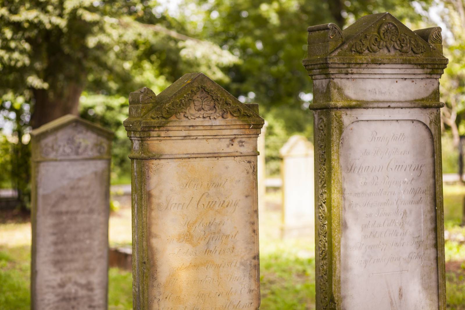
History and technology enthusiasts—and others as well—should visit the Warmia and Mazury Gasworks Museum. This unique museum is housed in a historic coke gasworks dating from 1908. On Sikorskiego Street, next to the health clinic, you can see the remains of a Jewish cemetery, where only a few matzevot have survived.
Górowo Iławeckie has plenty of green spaces. To the west of the town center lies the Municipal Park. The paths and the pier along Garncarski Pond also invite visitors to take a stroll. In the northern part of the town lies the Municipal Reservoir, an artificial body of water situated on the edge of the forest. Here, visitors can enjoy the swimming area, walking trails, and designated campfire sites.
Lidzbark Warmiński
The former capital of Warmia, this town is picturesquely situated at the confluence of the Łyna River and its tributary, the Symsarna, on the border of the Ornecka Plain, the Górowskie Hills, the Olsztyn Lake District, and the Sępopolska Lowland.
Among the most important historical monuments of the town—and the region—is the Lidzbark Bishop’s Castle. It is one of the largest and most beautiful Gothic structures in Poland, known as the “pearl of Gothic architecture” and the “Wawel of the North.” Its construction was begun in 1350 by Jan of Meissen, Bishop of Warmia. From that time onward, for approximately 600 years, the stronghold served as the seat of the bishops. In addition to the castle itself, the complex also includes a Baroque outer bailey, which has been converted into a hotel. Two-story cloisters surround the castle’s inner courtyard. Today, the building houses the Warmia Museum, a branch of the Museum of Warmia and Mazury. Of particular note are the collection of religious art, spanning the periods from the Middle Ages to the Baroque, and the exhibition of Polish paintings from the late 19th and 20th centuries. It is worth stopping by the Great Refectory, which also served as a courtroom. Next to it is a prison cell.
On the other side of the Łyna River stands the 14th-century Gothic Church of Sts. Peter and Paul. Its main altar dates from 1912–1915. Another important landmark of the city is the multi-story, 14th-century Gothic High Gate. It is one of the largest defensive structures of its kind in Poland.
The monument that is probably photographed most often during the summer season is the former Krasicki Orangery (now the Orangery of Culture), due to its beautiful location on a hill within the grounds of the former bishop’s gardens. The Classicist-style palace was built as a summer residence for the bishops, and the surrounding park was the pride and joy of Ignacy Krasicki.
Lidzbark is home to the Warmian Thermal Baths—the only facility of its kind in the Warmian-Masurian Voivodeship. It features not only pools with highly mineralized thermal water but also numerous water attractions—slides, water gardens, a children’s area, and a spa and sauna zone. Adjacent to the thermal baths are a hotel, a restaurant and bar, a bowling alley, and a rope park.
Symsarny Valley Spa Park
Also known as the “Lidzbark Serpentines.” The park’s colloquial name refers to the Symsarny River, which meanders through its grounds. It’s the perfect place for a walk, a jog, or a bike ride. The extensive recreational infrastructure includes walking paths—including a sensory trail—exercise equipment, and rest areas. Signposts lead to the most interesting attractions, and information boards provide visitors with fascinating facts about the park and its history.
Stoczek Klasztorny
A village in Warmia famous for its Marian shrine—the Basilica of the Visitation of the Blessed Virgin Mary. The rotunda-style church was built between 1639 and 1641. The brick monastery was founded in 1666. Several decades later, modeled after Święta Lipka, construction began on cloisters with corner chapels surrounding the church.
Stoczek is visited by tourists and pilgrims not only for its architectural merits and the devotion to the Mother of Peace associated with the painting of Our Lady of Stoczek, but also for its recent history. From October 1953, Cardinal Stefan Wyszyński, Primate of Poland, who had been interned by the authorities of the People’s Republic of Poland, stayed at the local monastery for a year. He recorded his memories of his stay in Stoczek in his *Prison Notes*. Today, visitors can tour the rooms where he lived.
Galiny
A small village in the Sępopolska Lowlands, famous for the former residence of the Eulenburg family. The palace buildings are situated in a picturesque garden overlooking an artificial oxbow lake of the Pisa River (known as the Northern Pisa). After World War II, they were nationalized. For a short time, a children’s summer camp operated here; later, the complex began to fall into disrepair. In the 1990s, a private owner began renovating it. Today, it houses a hotel and a horse farm. It’s also worth visiting the local Gospoda Galiny—the restaurant serves dishes drawing on the rich culinary heritage of Warmia, Masuria, and Powiśle.
Bartoszyce
The town lies on the Łyna River, not far from the border of Warmia, within the historical region known as Barcja, once inhabited by the Prussian tribe of the Bartowie. The town took its name from this tribe, first as the German Bartenstein, and later as the Polish-ized Bartoszyce.
After the Treaty of Toruń was signed in 1466, the town belonged to Ducal Prussia. It gained greater economic significance in the 17th century. In 1656, during the Swedish Deluge, Swedish King Gustavus Adolphus met here with Prussian Duke Frederick William I.
The second meeting in Bartoszyce of significance to European history took place during the Napoleonic Wars in 1807. It occurred between the Prussian King Frederick William III and Tsar Alexander I. The Russian ruler convinced Prussia to join the war against Napoleon. Historians have dubbed the signed agreement the Treaty of Bartoszyce.
The Old Town has preserved its medieval urban layout, featuring a market square (which was revitalized in 2021) and a grid of streets radiating from it, as well as medieval walls—including the Lidzbark Gate—that partially surround it. The city’s oldest religious building is the 14th-century Church of St. John the Apostle and Evangelist. Near the Municipal Park, at the roundabout where Bohaterów Warszawy and Marii Skłodowskiej-Curie streets intersect, stone statues—known as “Prussian women”—have been erected and named Bartel and Gustebalda. It is not known what their original purpose was. Historians speculate that they may have been boundary stones marking the lands inhabited by various Prussian tribes, or representations of gods, mythical heroes, or great warriors.
Sępopol
This small town, with a population of about 2,000, boasts a long history. It was founded on the site of a former Prussian settlement around 1319. For centuries, it held little economic significance. In February 1945, the Red Army entered the deserted town and destroyed approximately 80% of it. At the end of 1945, Sępopol lost its municipal rights, which it regained in 1973.
An interesting historic site here is the Gothic Church of St. Michael the Archangel, built in the 14th century. It has been preserved to this day with its original furnishings, dating mainly from the 16th and 17th centuries.
Sątoczno
Currently a small village with just over 100 residents, it was, however, a significant town during the Teutonic Knights’ era. In 1326, a watchtower was built at a strategic location at the confluence of the Sajna and Gubra rivers, followed later by a fortified church; markets with a regional reach also began to be organized there. After several decades, Sątoczno began to lose its importance, likely due to the loss of its defensive function, its location far from the country’s borders, and the rising prominence of nearby Kętrzyn. However, it was still considered a town as late as the 15th century. The local castle was demolished in 1628.
Along the trail stands the massive Gothic Church of Christ the King of the Universe, with a 32-meter-high tower. Inside, in addition to the original furnishings, there is the 18th-century Eulenburg family burial chapel. The Eulenburgs were the former owners of Sątoczno.
Korsze
The village, founded in the 15th century, was a small hamlet with a manor until the early 19th century. Its name likely derives from the Prussian language, from the name of the earlier settlement Cohorsen, which in the related Lithuanian language means “hazelnut.” When construction of the railway network in East Prussia began in the second half of the 19th century, an important railway junction was established in Korsze. The town then experienced very rapid development. Railway enthusiasts will be interested in the three preserved historic water towers. One of them, made of steel, has a spherical Klönne-type tank (there are only two such structures left in Poland).
Toward the end of World War II, Korsze was defended by German armored units. During the fighting, the town’s buildings were significantly damaged. Among the surviving historic sites are the Neo-Gothic Church of the Exaltation of the Holy Cross from 1903 and the Evangelical church, which opened a year later—now the Orthodox Church of Saints Peter and Paul the Apostles.
Drogosze
A village associated with the aristocratic Dönhoff family, who owned it from the 17th century onward. The Baroque palace, built between 1710 and 1714, was one of the three largest residences in East Prussia and is currently the largest in Masuria. It remained in the hands of the Dönhoffs until 1945. After World War II, it became the property of a state-owned farm (PGR) and was used primarily for training tractor drivers. In the early 1990s, the estate was sold to a private owner.
Barciany
A small town that held municipal rights until 1945. Until the 13th century, it was the main stronghold of the Prussian Bart tribe, which was seized by the Teutonic Order following the conquest in 1240. In the Middle Ages, the town was surrounded by defensive walls with three gates: the Królewiecka, Kętrzyńska, and Młyńska Gates. However, a record from 1692 mentions the absence of walls, so they must have been demolished earlier. From 1612 onward, Barciany belonged to the von der Gröben family.
The town’s most important historical monuments are the 14th-century Gothic Church of the Immaculate Heart of the Blessed Virgin Mary and the Teutonic castle, also dating from the same century. Numerous arrowslits are visible in the castle walls. This indicates that the stronghold in Barciany was prepared for active defense using firearms.
Srokowo
It was granted town rights in 1405, but lost them in 1945 as a result of destruction caused by the Red Army during World War II and depopulation. The town’s former name was Drengfurt (Polonized to Dryfort); its current name commemorates Stanisław Srokowski (1872–1950)—a geographer and author of numerous scholarly works on East Prussia, who chaired the commission responsible for establishing Polish place names in the so-called Recovered Territories.
The historic town hall was built between 1772 and 1775, and the turret was added in 1817. It is currently the oldest town hall in Masuria. The highest elevation in the area—Diabla Góra (157 m above sea level)—is an attractive viewpoint. Standing on it is the Bismarck Tower, built in 1902, which once served as an observation tower but is now in ruins.
Leśniewo
A small village situated on Lake Rydzówka. The Masurian Canal runs west of Leśniewo. Two of the five locks planned for the canal are located near this village, though neither has been completed. The submerged ruins of the Leśniewo Dolne lock, which was under construction, remain, while the Leśniewo Górne lock is an impressive structure, even though only about 30% of its construction was completed. The lock chamber is 45.5 m long, 7.5 m wide, and the structure itself reaches a height of 17 m. A recess for the Nazi emblem has been preserved in the concrete wall.
Gołdap
A town located in the Garbate Masuria region, in the northeastern part of the Masurian Lake District, on the outskirts of the Romincka Primeval Forest and near the border with Russia (there is a border crossing in Gołdap). It has the status of a health resort. It was founded on the site of the former village of Szyłajty and received its town charter in 1570. Its name comes from the Gołdapa River.
The historical region in which Gołdap is located was known as “Little Lithuania.” It was an area inhabited mainly by Lithuanians, who converted to Lutheranism after paying homage to Prussia in 1525.
The town’s buildings suffered significant damage during World War II. Few of the old structures have survived, including: the Gothic Church of the Blessed Virgin Mary, Mother of the Church, formerly a Lutheran church (dating from 1578, rebuilt in the 17th and 18th centuries, and reconstructed between 1981 and 1984), the Church of St. Leo from 1894, a water tower from the turn of the 19th and 20th centuries, and 19th-century townhouses.
In the center of Gołdap lies the large and well-maintained Victory Square, which serves as the town square. It is also a recreational area, featuring trees preserved from the former city park, walking paths, a fountain, and a pond with a picturesque bridge.
The town’s surroundings offer beautiful scenery—the areas around the village of Żytkiejmy are sometimes referred to as the “Polish prairies,” and the spruce forests of the Romincka Primeval Forest are compared to the Siberian taiga.
The highest peak in the area is Góra Szeska (309 m above sea level), which forms the highest point of the Szeskie Hills. South of the town, on Gołdapska Góra (272 m above sea level), also known as Piękna Góra, there is a ski resort with chairlifts and a T-bar lift, as well as a toboggan run. The ski runs are covered with artificial snow. At the lower station of the lift, there is an inn with a restaurant, and at the upper station, a revolving café.
Kartacze
This is the region’s most famous culinary specialty—a type of potato dumpling filled with meat. It’s worth noting that Gołdap is home to the World Center for Kartacze Gourmets, and every August, the World Kartacze Eating Championship is held here.
Health Resort in the Luftwaffe Quarter
Gołdap is the first—and so far the only—health resort in the Warmian-Masurian Voivodeship. Patients at the Wital sanatorium, located in the suburban forest of Kumiet on Lake Gołdap, benefit from the properties of the therapeutic mud and the cleanest air in Poland. Among other conditions, the sanatorium treats musculoskeletal, respiratory, and rheumatic diseases.
Some of the buildings currently used by the sanatorium were part of the headquarters complex of the Luftwaffe (German Air Force) during World War II. In the Kumiecie Forest, following the model of other Masurian headquarters, sturdy shelters and several auxiliary buildings were erected. A research center for jet engines likely operated here as well. During martial law, the sanatorium was converted into an internment center.
The Romincka Primeval Forest
It is the third-largest (area of approx. 35,000 km²) forest complex in the Warmian-Masurian Voivodeship, after the Piska and Borecka Primeval Forests. It lies on the border between Poland and Russia, with the smaller part located on the Polish side. The forest is home to nearly all animal species found in the forests of Central Europe; since 2021, even a herd of European bison has been living here.
At the turn of the 19th and 20th centuries, German Emperor Wilhelm II used to go hunting in the primeval forest. His hunting lodge was located in Rominty (now Krasnolesye on the Russian side). A memento of the emperor’s stays in the forest are the so-called “Wilhelm’s Boulders,” placed at the sites of his successful hunts. During World War II, clashes between the Red Army and the Germans took place here, and after the war, Polish and Lithuanian partisans operated in the forest.
Stańczyki
Two impressive viaducts span the ravine through which the Błędzianka River flows. With a length of approximately 180 m, they rise 36.5 m above the river’s surface. The viaducts were part of the Gołdap–Żytkiejmy railway line. They were designed by Italian architects in the early 20th century. The northern viaduct was built between 1912 and 1914, and trains ran across it from 1927 to 1944. The southern viaduct was erected between 1923 and 1926, but no tracks were ever laid on it.
Triple Border Junction
The Warmian-Masurian section of the Green Velo trail ends at the tripoint where the borders of Poland, Lithuania, and Russia meet, near the village of Bolcie in the municipality of Wiżajny. This spot is marked by a border marker named “Wisztyniec.” The border between the Warmian-Masurian and Podlaskie provinces also ends here at the national border.