Nidzica (0.0 km) – Piątki (1.5 km) – Olszewo (3.5 km) – Borowy Młyn (5.0 km) – Kanigowo (8.6 km) – Siemiątki (10.8 km) – Zagrzewo (12.6 km) – Piotrowice (14.8 km) – Magdaleniec (16.1 km) – Módłki* (18.9 km) – Muszaki (23.6 km) – Wały (32.6 km) – Zimna Woda (36.2 km) – Natać Mała (44.7 km) – Natać Wielka (47.8 km) – Jabłonka (49.3 km) – Brzeźno Łyńskie (54.2 km) – Lipowo Kurkowskie (57 km) – Orłowo (63.3 km) – Bolejny (65.7 km) – Żelazno (67.4 km) – Bujaki (69.8 km) – Frąknowo (74.3 km) – Dobrzyń (77.5 km) – Las Miejski (83.1 km) – Nidzica (87.2 km)
Temporary route on the section: Módłki – Grabowo – Muszaki; a detour due to road repairs, which extends the entire route by 2.1 km (this section is 6.8 km long in total).
A long route, nearly 90 km in length, leading mainly through uninhabited forest areas on roads of varying quality. Ideal for nature lovers and those interested in 20th-century history, military affairs, and the art of war. Completing the route in a single day requires excellent physical fitness and good sense of direction.
We begin the trip at the train station in Nidzica, about 1.5 km west of the town center, where most of its historic sites are located, including the Teutonic Knights’ castle, the castle brewery, the Evangelical church, the town hall, and the Catholic Church of the Immaculate Conception of the Blessed Virgin Mary and St. Adalbert. An interesting attraction in the area is the largest erratic boulder in Masuria, known as the Tatar Stone, located in Tatary, about 2 km from the center of Nidzica.
From the train station, we head south on Kolejowa Street, with the railroad tracks on our right. After 1.5 km, we reach the village of Piątki; we pass through it and ride under the S7 overpass. The quality of the asphalt surface deteriorates. We pass Olszewko and enter Olszewo. Majestic old trees line the road. A few dozen meters past the green sign marking the village boundary, we turn left onto a gravel road. After riding a few hundred meters, we reach Borowy Młyn. At the crossroads at the edge of the village, we turn right. Following a gravel road winding through fields, meadows, and groves, we reach Kanigów, where we ride straight through two intersections and then over the overpass above the S7 highway, heading toward Siemiątki and Zagrzewo. In Zagrzewo, at the fork, we turn left and follow the concrete-slab road along a stone wall. Next, we turn right onto an asphalt road, keeping the wall on our right. After passing the green sign marking the village boundary, we turn right onto a gravel road toward Piotrowice, where we cross the intersection and take the paved road toward Magdaleniec. At the second intersection in this village, turn onto the gravel road toward the village of Módłki, where you’ll turn right onto Provincial Road DW604, which you’ll follow for 4.5 km to Muszak. This road is currently under repair but remains passable (narrow sections, alternating traffic).
Alternative route for the section during road repairs
After entering the village of Módłki, take a sharp right turn and ride through the forest to Grabów, where you turn left onto the main road to Muszak. In Muszaki, follow the signpost along the road to Ulesie, through the grounds of the former Muszaki military training area. If plans to reactivate the training area are carried out, the route will have to undergo significant modifications. Currently, the area is uninhabited. We enter the Napiwodzko-Ramucka Forest via a narrow paved road.
At the fork in the road, we go straight ahead; we do not turn right. Further on, at the intersection, we turn left onto a cobblestone road, which gradually fades away and turns into a gravel road. After traveling a few kilometers, we reach an asphalt road on the outskirts of the village of Wały and turn left onto it. The hilly terrain between Wały and Zimna Woda is called the Złote Góry (Golden Mountains). We reach Zimna Woda after riding about 3.5 km, where we turn right toward Szczytno onto provincial road DW545. In 1914, part of the military operations—later collectively known as the Battle of Tannenberg—took place in this area. German forces defeated the Russian army there, and somewhere in this region, General Samsonov’s legendary treasure went missing.
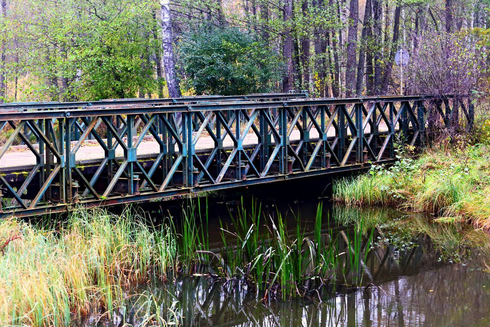
After driving 1.5 km, at the white sign pointing to the Omulew resort, turn left. Past the resort, the paved road turns into a gravel road, and the route runs along the fence enclosing a military area, continuing through the forest the entire time. Beyond this area, you’ll cross a truss bridge over the Omulew River. On the left, you can sometimes see Lake Omulew through the trees. About 1.5 km past the bridge, at the intersection of forest roads, turn left off the main road. The trail markings are clearly visible here. After riding another kilometer, at the fork, take the left unpaved road, which leads to Nataca Mała, situated on Lake Omulew. Turn right onto the paved road and ride in a curve around the lake. At the intersection 2 km past the village, turn left onto the main road leading to Nidzica, which takes you to Nataca Wielka and Jabłonka. In Jabłonka, past the red-brick house, where there is a convex mirror for drivers on the left side of the road, turn right onto a gravel road. A little further on, at a fork in the road, take the right fork, and after a few hundred meters, you’ll enter the forest. The road is overgrown with grass in the middle and sandy in places.
Ride straight ahead for about 5 km until you reach Brzeźno Łyńskie. Cross the bridge over the Łyna River. The road is paved in places. At the first fork after the village, turn right; at the second fork in the forest, leave the paved road and turn left onto a sandy path. Before Lipowo Kurkowskie, the road becomes paved again. In the village, we turn left onto an asphalt road, go straight through the intersection, and continue south on a cobblestone road—which later becomes an asphalt road covered with sand—into the forest. After about 1.5 km, we pass an intersection with a smaller forest road; just past it, a dirt road branches off to the left, which we take. A little further on, we exit the forest and ride to Wólka Orłowska, where we turn right onto an asphalt road toward Bolejny. If we miss the turnoff earlier in the forest (the trail is poorly marked here), we’ll also end up in Bolejny. Between Wólka Orłowska and Bolejny, there are marked bunkers and anti-tank fortifications from World War II. From Bolejny, continue straight on toward Żelazno. After entering the village, turn left at the intersection, and once past the village, stay on the main road, which curves to the right toward Bujaki, turning into a gravel road. We pass a railroad crossing and enter the forest. In some places, the road is unpaved. At the intersection, we turn right, then left after a few hundred meters, and after about 1 km, left again onto a smaller dirt road; fortunately, the trail markers are visible here. After traveling about 2 km, we go straight through the intersection, then over the overpass above the S7 highway, and enter Frąkowo. Here, we make a sharp left turn, cross another overpass over the S7, and follow an asphalt road lined with old trees. After riding about 2.5 km, turn right at the second intersection toward Dobrzyń. Upon leaving the town, take the gravel road to the left. Ride through the forest; after about 2 km, turn right at the intersection onto a dirt road. At the next intersection, turn left onto a gravel road, leaving the Municipal Forest on your left. Before the railroad crossing, turn right onto Leśna Street, which runs along the tracks to Olsztyńska Street. Turn left onto Olsztyńska Street and continue to the train station.
The trail is marked with green signs, though they are sometimes hard to see.
Recommended bike type: mountain bike.
Nidzica has direct train connections to Olsztyn and Warsaw, and through them to Gdańsk, Kraków, and the Silesian Metropolitan Area. There are about ten one-way trains to Olsztyn daily. You can also reach the tour’s starting point by bus—Nidzica is located along the S7 expressway and has direct bus connections to many major cities in Poland.
Nidzica
The monumental Teutonic Castle in Nidzica is the largest stronghold in Masuria. Built at the turn of the 14th and 15th centuries, it guarded the strategic border with Poland. During the Polish-Teutonic Wars of the 15th century, it was besieged many times and changed hands repeatedly. A similar fate befell it during the Swedish Deluge. Bombed during World War II, it was quickly rebuilt. Today, it houses the Museum of the Nidzica Region (ul. Zamkowa 2, 13-100 Nidzica, tel. 89 625 03 70, zamek@nidzica.pl, www.nok.nidzica.pl/zapraszamy/zwiedzanie-zamku), the Nidzica Cultural Center, the Knights’ Brotherhood of the Nidzica Commandery (which organizes knightly tournaments, combat demonstrations, history lessons, and participates in other such events in Poland), a gallery, and a library. Visitors can also stay in guest rooms and dine at the restaurant. Entry to the courtyard is free; admission to the museum requires a fee, and guided tours are available on the hour. At the foot of the castle hill stands a brick building from 1868, which housed a brewery until World War II. After 1945, it was used to produce orangeade, and from 1958 onward, mead. Today, the mead production facility is privately owned.
The history of Nidzica’s oldest churches is particularly interesting. The Evangelical church was originally built in the Neo-Gothic style as a Catholic church in 1860; a tower was added 30 years later. In 1948, due to an influx of Catholic residents and a declining number of Evangelicals, the Catholic and Lutheran parishes exchanged their places of worship. The interior of the church houses many artifacts from abandoned Lutheran churches in the area, including several panel paintings—the oldest of which dates to the 15th century—an altar, and several statues and paintings dating to the 18th century. The Church of the Immaculate Conception of the Blessed Virgin Mary and St. Adalbert was built at the turn of the 14th and 15th centuries, naturally as a Catholic church. After 1525, it was taken over by Protestants, and after World War II, it returned to Catholic hands. Throughout its history, the church has been destroyed and rebuilt many times, resulting in its current architectural style, which is a blend of Gothic and Neo-Renaissance. Inside, the galleries running along the main nave and the coffered, wooden, semicircular ceiling are particularly noteworthy.
Medieval Defensive Embankments
Between the villages of Wały and Zimna Woda, on the southern side of the road along a 3-kilometer stretch, mysterious embankments run through the forest—sometimes a single one, sometimes two parallel ones. There was likely a moat between them in the past. These are the remains of fortifications dating from the 11th to the 13th centuries, built to defend Mazovia against invasions by the Prussians. Later, they marked the border between the Polish Crown and the State of the Teutonic Order. Currently, the ramparts are approximately 1.5 meters high. The construction technique likely involved covering a wooden structure with earth. In some places, they were reinforced with a log palisade and watchtowers. They served their purpose until 1343, when an agreement between Poland and the Teutonic Knights shifted the border several kilometers south to the Orzyc River.
General Samsonov’s Grave
The site of the suicide of Russian Army Commander General Alexander Samsonov remained a mystery. Had it not been for his wife’s determination, it would likely never have been found. A year after the battle, Elżbieta Samsonowa, accompanied by several people, found the grave in a forest near Wielbark, in territory occupied by the Germans. It was pointed out to her by forest workers who had buried the general and taken a gold medallion bearing the likenesses of his wife and children. Samsonov was reburied on his family estate in Ukraine, and a monument was erected at the site of his death.
Watch Out for Ospreys
In the vicinity of Lake Omulew, you may come across informational signs for the “Osprey.” It is one of the rarest birds of prey in Poland. It lives near clean lakes (where it catches fish) and builds its nests in the tops of old trees, mostly pines. Its nesting sites are protected by a restricted zone. During the breeding season, you must not approach them within 500 meters, and no forestry work may be carried out in this zone at any time of year.
Tatarski Kamień in Tatary
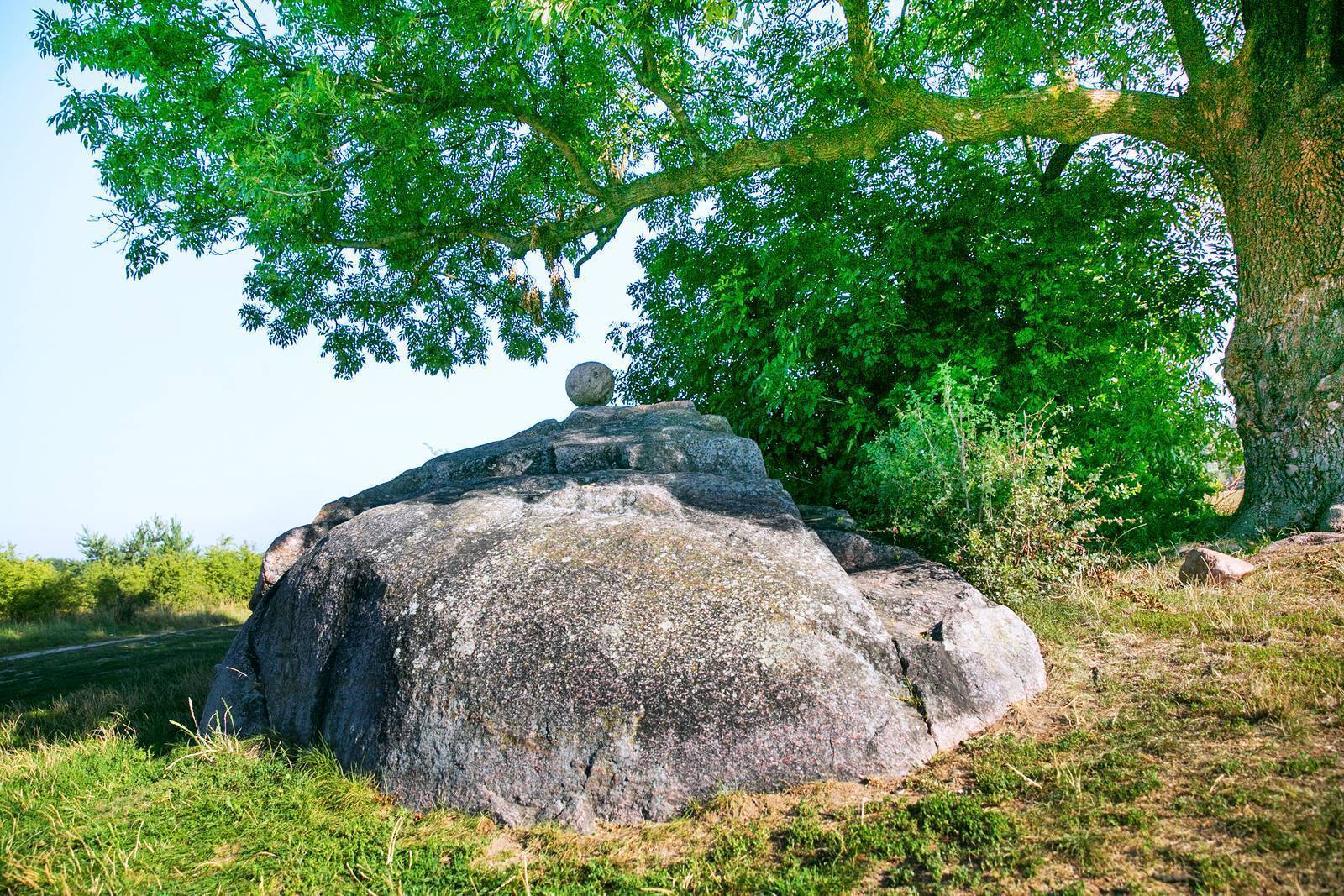
One of the largest erratic boulders in Masuria lies in a field by a dirt road in the village of Tatary near Nidzica (it is a metamorphic rock, known as granito-gneiss). It has a circumference of 19 m, is 6.5 m long, 4 m wide, and 2 m high. It is known that over the centuries, large fragments were chipped off it to be used as millstones. On its summit lies a stone cannonball which—according to legend—killed the Tatar chieftain who was planning to capture Nidzica during the Swedish Deluge. The chieftain’s death thwarted these plans.
The Muszaki Military Training Ground
After World War II, to expand the training ground, several villages were evacuated and demolished: Piec, Małga, Ulesie, Sadek, Retkowo, and Rude Wały. After the training ground was decommissioned in 1993, the area remained uninhabited and became a haven for wildlife. Part of the area was designated as the Małga Nature Reserve. It covers an area of nearly 150 hectares. It is an important gathering place for cranes during their fall migrations, as well as a breeding ground for the lesser spotted eagle, the marsh harrier, the kestrel, the short-eared owl, the black grouse, and many species of waders. In the remnants of former villages, on forest roads, in marshes, and on sandy islets, groups of paintball players and seekers of General Samsonov’s legendary treasure sometimes appear. Recently, reports have emerged about plans to reactivate the military training ground.
The Battle of Tannenberg and Samsonov’s Treasure
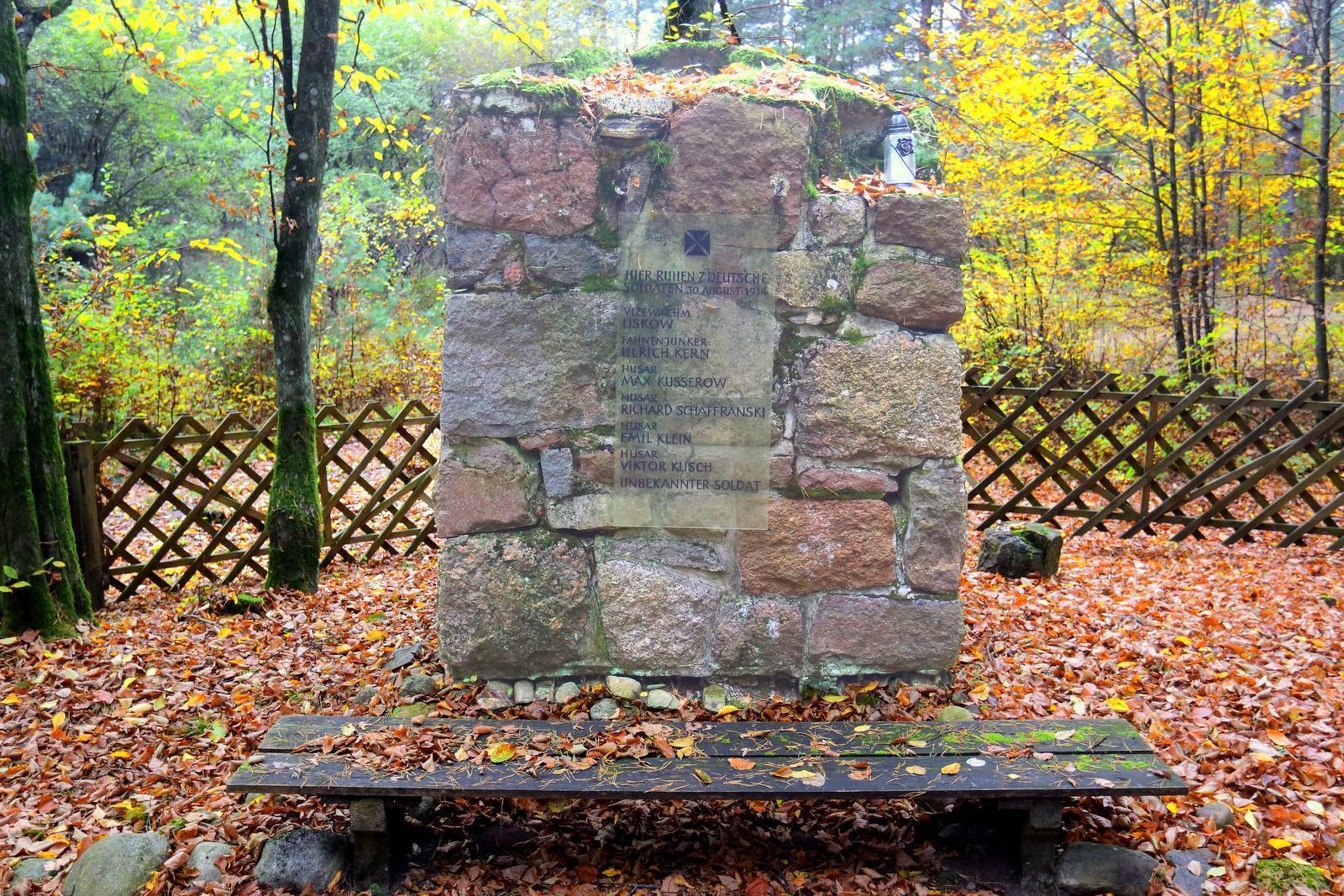
The battle between German and Russian forces took place between August 26 and 30, 1914. It began near Grunwald, several dozen kilometers to the west, and ended near Muszak, where the Russian commander, General Samsonov, committed suicide. Despite their numerical superiority, the Russians suffered a crushing defeat. For the Germans, it was an important victory both strategically and in terms of propaganda. They proclaimed that it was the Germanic peoples’ revenge on the Slavs for the Battle of Grunwald, lost nearly 500 years earlier. Initially, the attacking Russians were confident of victory; they lost due to mistakes and a lack of coordination among their commanders. General Samsonov had a wagon loaded with gold with him, which was to be distributed to the soldiers as a reward after winning the battle. When he realized defeat was inevitable, he reportedly sank the wagon in a swampy river near a destroyed bridge, eliminated the witnesses, and then committed suicide. There are many swampy waterways, forest roads, and small bridges in the area. To this day, you can still encounter treasure hunters with metal detectors combing the area. In the village of Zimna Woda, there is one of the many war cemeteries where the victims of the battle were buried.
TheOmulwi Kayaking Trail
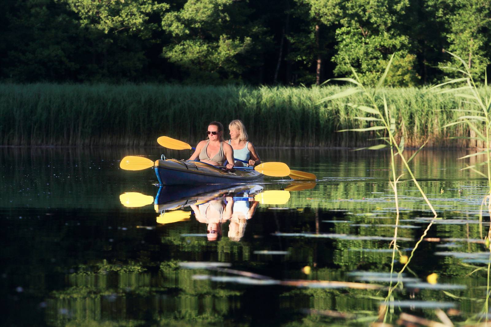
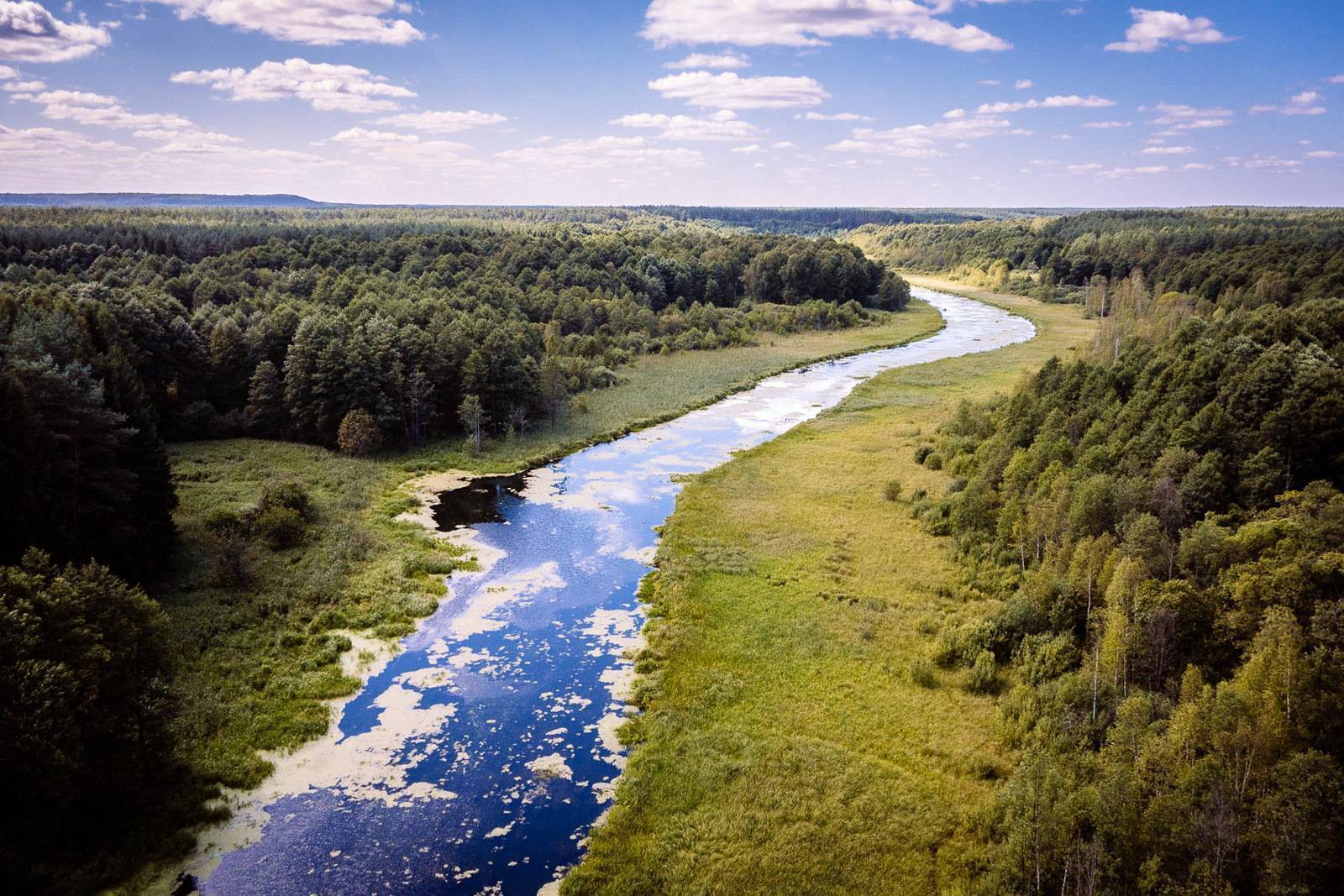
The Omulew is a kayaking trail approximately 130 km long, 46 km of which lie within the borders of the Warmian-Masurian Voivodeship. The river flows out of Lake Omulew, where the towns of Jabłonka and Wikno offer convenient launch sites. It flows through the wild and uninhabited terrain of a former military training ground, through the forest and the Małga Wildlife Reserve, and on through the idyllic, open landscapes of the Kurpiowska Plain. It flows into the Narew River in Ostrołęka. It takes several days to paddle the entire route, though one-day trips can also be organized on selected sections. Initially, the river is narrow, full of sharp bends, and its current is obstructed by fallen tree trunks. Further on, the route becomes easier, but the current slows down. The uninhabited surroundings offer a unique opportunity to experience wild nature. The river is not as popular among kayakers as the better-known kayaking routes in Masuria.
Lake Omulew
The lake has a very irregular shape consisting of two parallel but asymmetrical basins connected by a channel; it covers an area of approximately 500 hectares and contains five islands. On the western shore lie the resort towns of Jabłonka and Wikno, which feature several designated swimming areas as well as wild beaches. The remaining shores are mostly forested. The lake is a popular fishing spot among anglers, home to pike, zander, perch, bream, and other fish species. Visitors can paddle kayaks, rowboats, and sailboats on the lake, but the use of internal-combustion engines is prohibited, as the lake is located within a quiet zone.
The Łyna Kayaking Trail
In Brzeźno Łyńskie, near the bridge, there is a convenient starting point for a kayak trip down the Łyna. This largest river in Warmia and Masuria is one of the region’s most popular kayaking routes (nearly 200 km within Poland’s borders). From Brzeźno, you can paddle upstream through four small lakes: Morze, Duże Brzeźno, Małe Brzeźno, and Krzyż. This section is very scenic, offering opportunities to observe beavers and waterfowl. The current is slow. Starting from Brzeźno Łyńskie offers the best way to reach this section of the river; launching kayaks upstream of the village is very difficult. Due to lush aquatic vegetation that slows down the kayak, the route can be difficult to navigate in summer when water levels are low. Return via the same route. From Brzeźno, you can also paddle downstream to the village of Kurki, known for the 1958 kayaking trip in which Karol Wojtyła participated. A plaque commemorating this event is displayed on the wall of the local church. The trip can be continued further to Lake Łańskie. As it flows out of this body of water, the Łyna crosses the fenced-off grounds of a resort (permission from the resort management is required to navigate this section). Further on, the river flows through the Las Warmiński Nature Reserve. Organizing a rafting trip within its boundaries requires approval from the Regional Directorate for Environmental Protection in Olsztyn.