Lubawa (0.0 km) – Złotowo (5.0 km) – Lubstyn (8.1 km) – Stegna (Lubstynek) (10.6 km) – Napromek (13.6 km) – Omule (15.4 km) – Prątnica (18.6 km) – Fijewo (22.3 km) – Lubawa (24.2 km)
This loop route begins and ends in Lubawa, one of the oldest towns in the Warmian-Masurian Voivodeship. This cultural route offers the opportunity to explore the fascinating historical heritage of the Lubawa region. Both secular and religious monuments are scattered throughout this picturesque landscape of rolling hills, fields, and forests. It’s a great option for a family outing lasting a few hours.
We begin the tour at the market square in Lubawa. We head east along Zamkowa Street, passing the Gothic Church of the Visitation of the Blessed Virgin Mary and St. Anne on our right. We enter Zamkowy Square, where the cobblestone road turns right. Leaving the restored castle ruins on our left, we head downhill to the paved Kupnera Street, where we turn left. We pass the former Bernardine Church of St. John the Baptist and the Łazienki Lubawskie City Park. After a few hundred meters, a cobblestone bike path appears alongside the road. Riding along it, we pass a park on the left that houses the Shrine of Our Lady of Lipy in Lipy. A little further on, the path and the built-up area come to an end.
We ride along Provincial Road DW537 among old trees. We enter Złotów and, shortly after the bus stop, turn left onto a side road. We pass the wooden Church of St. Barbara. At the end of the village, we turn right onto a gravel road toward Lubstyn; after passing it, at the fork in the dirt roads, we take the right-hand branch. The road is very scenic, winding through rolling hills, fields, and deciduous forests.
There are a few longer uphill and downhill sections. After passing the forest on our right, we turn right toward Stegna, a separate part of the village of Lubstynek. A short section of the route takes us along an asphalt road, then we return to a gravel road. The road now heads south and rejoins the DW537, where we turn left toward Napromek. After about 100 m, we turn right onto a narrow asphalt road leading to the village of Omule. In the village, we first turn left, then right toward Prątnica, where one of the most interesting historic churches on the route is located. We ride through this village on a winding road; past the church, we turn right onto the main road leading to Fijewo. In Fijewo, an unmarked bike path appears on the sidewalk, which we follow to Lubawa.
At the roundabout, take the first exit to the right. The path ends. Continue straight ahead until you see a signpost directing you left toward the town center. At the next roundabout, we also turn right, and after a short while we reach the town square. Before leaving the area, it’s worth visiting the wooden Church of St. Barbara in Lubawa, located outside the old town, as well as Rożental, situated a few kilometers north of Lubawa, where there is a beautiful wooden Church of St. Lawrence.
Seat of the Bishops of Chełmno
Lubawa is one of the oldest towns in the Warmian-Masurian Voivodeship. The first mentions of it date back to 1216. It was founded as a Prussian stronghold. Later, it changed hands several times between the warring Prussians, Teutonic Knights, and Poles. Its development as the seat of the Chełmno bishops was a thorn in the side of the Teutonic Order. In 1325, the knights of the Order founded Nowe Miasto Lubawskie as a rival town intended to limit Lubawa’s growth.
A Hilly Landscape
Along the route, you can see how settlement, which has been developing since the Middle Ages, has shaped the natural landscape. Fields and meadows cover the bases and slopes of the hills. The forest has survived on their peaks and in the steepest areas, where plowing was difficult. The hills around Lubstyn and Lubstynka are high enough that there is a ski slope near the “Zielony Zakątek” agritourism farm. We are on the foothills of Dylewska Góra—the highest peak in northeastern Poland.
Lubawa
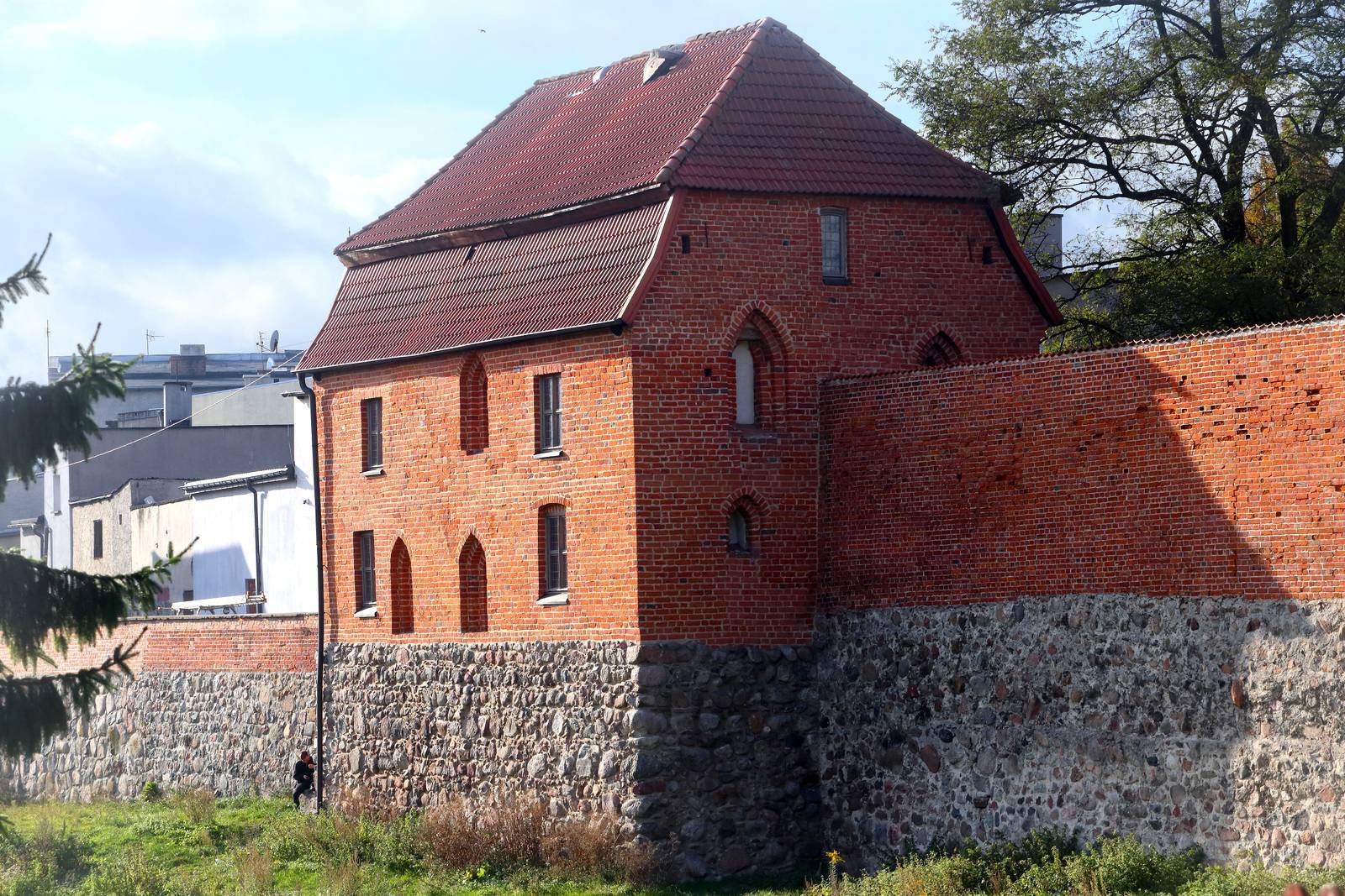
The first wooden castle, dating from 1260, burned down during the Prussian uprising. The stone castle, built beginning in the early 14th century, served as the seat of the bishops of Chełmno for over 400 years, until 1773. Destroyed several times, it was abandoned after a fire in 1813, and local residents dismantled its remains, using the bricks and stones as building materials. Fragments of the castle’s perimeter walls and a round corner tower have survived to the present day. Following archaeological research and revitalization, the Lubawa Center for Social Activity was established in the castle cellars and the wings, which were reconstructed in a modern style. ul. Biskupów Chełmińskich 1, 14-260 Lubawa, tel. +48 573 003 719, e-mail: kontakt@lcas.lubawa.pl, www.lubawamojemiasto.pl, which now houses, among other things, a tourist information center.
Standing along the line of the former city walls, the Church of the Visitation of the Blessed Virgin Mary and St. Anne was built in 1330 in the Gothic style, which has been preserved to this day despite several fires and renovations. The single-nave church was built on a rectangular plan, and its massive tower on a square plan. Inside, five historic altars have been preserved; the main altar, dating from 1723, features a painting of Our Lady of the Rosary dating from around 1600. The Renaissance Mortęski side chapel, attached to the church, houses a miraculous statue of Our Lady of Lipsk—the patroness of Lubawa—to whom pilgrimages have been made since the early 18th century. The oldest elements of the church’s furnishings include: a 15th-century holy water font, a silver chalice from the turn of the 15th and 16th centuries, a silver chalice for ampoules from 1603, and a silver monstrance from 1689. The Museum of the Lubawa Region operates at the parish, located at 5 Kościelna St., 14-260 Lubawa, tel. +48 782 486 261, www.facebook.com/lubawafara. The museum displays goldsmith works, paintings, and epitaphs.
The Gothic-Renaissance Church of St. John the Baptist and St. Michael the Archangel was built between 1600 and 1610 on the site of an earlier church. It originally belonged to the Bernardine Order. After the order was dissolved by the Prussian authorities in the early 19th century, Protestants took over the church and established a school and a court there. After World War II, the church served as a warehouse, and it was not until 2003 that it, along with the monastery, was transferred to the Catholic parish. Inside the church, the most notable features are the original Renaissance ceiling from 1610–1612, with paintings and sculptures depicting the life of St. Francis, and the Baroque main altar from 1728, which was crafted by the Lubawa artist Jerzy Dąbrowicz. The church houses a valuable relic—a fragment of John Paul II’s bloodstained robe, which he was wearing during the assassination attempt in 1981.
The wooden Church of St. Barbara, despite its relatively recent construction—it was built between 1770 and 1779—is considered a particularly valuable historic monument. It was erected on the site of the former Church and Hospital of St. George. The church’s Baroque interior places it among the most beautiful in the region. Inside, the following elements deserve special attention: the main altar, which connects to two side altars; the pulpit; the rood beam at the junction of the nave and the chancel, featuring a Crucifixion group; as well as the sculptures of St. George and St. Nepomucene. The organ is in the Neo-Renaissance style.
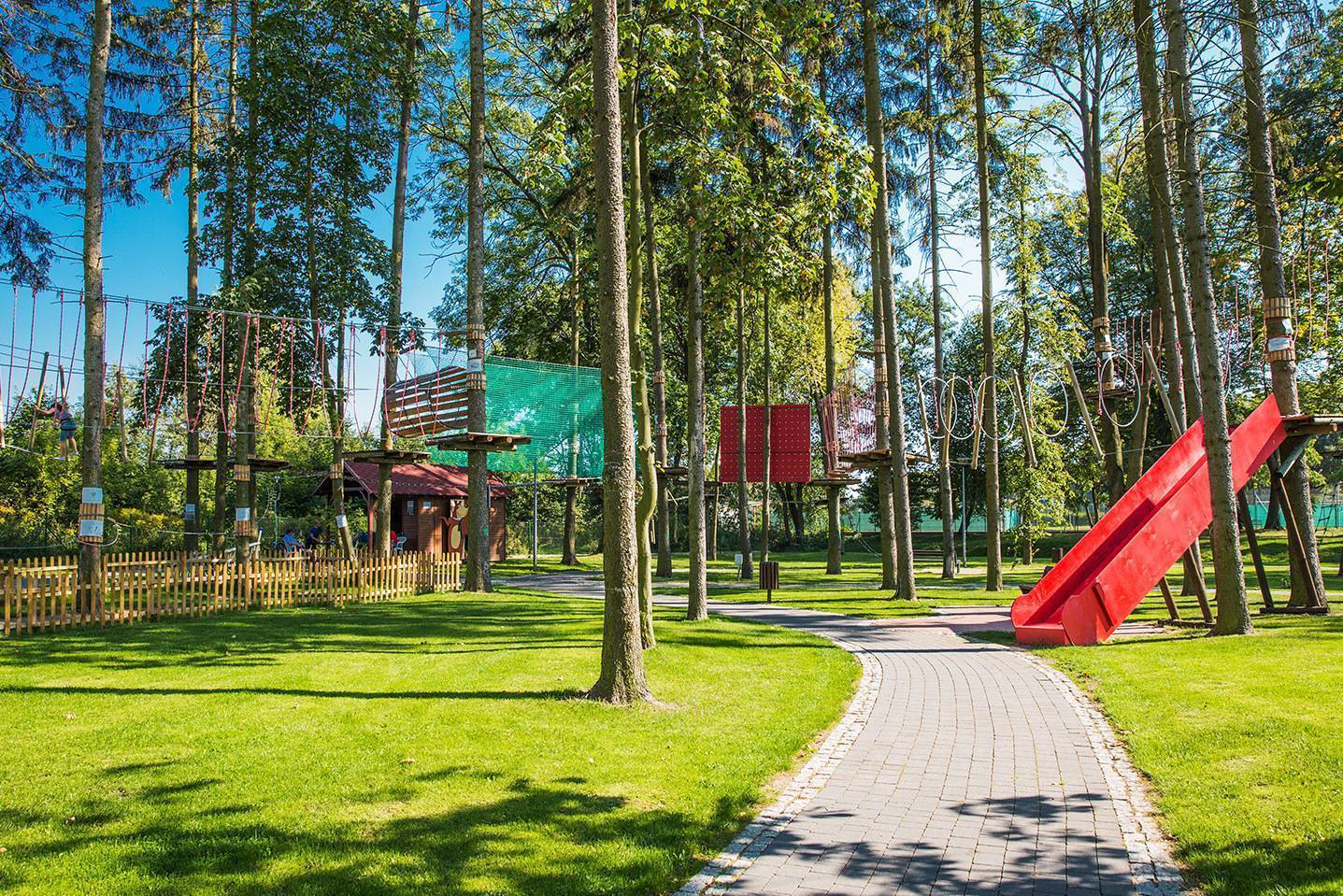
After a bike ride, a good place to rest is the revitalized Łazienki Lubawskie City Park, which stretches behind the Church of St. John the Baptist. There are benches, shelters, and a playground here. Paths wind along the ponds and canals, spanned by stylish bridges. A pier has been built on the largest pond, and an area for artistic performances is located nearby. Here, you can use the outdoor gym, and in the summer—the rope park as well.
Copernicus in Lubawa
In its heyday, the Lubawa Castle hosted Nicolaus Copernicus (1541). The astronomer, along with Georg Joachim Rheticus, visited his friend here, Tiedemann Giese, who was then the Bishop of Chełmno. During this stay, Giese and Rheticus persuaded Copernicus to publish his groundbreaking work *On the Revolutions*.
Shrine of Our Lady of Lipy in Lipy
The Neo-Gothic Church of the Visitation of the Blessed Virgin Mary, built in 1870, stands in a vast park adjacent to the Sandeli River. According to legend, a miraculous statue of the Virgin Mary with the Child was found on a linden tree growing above the river, and this event was preceded by the appearance of a bright light. Before the Prussians were baptized—which took place in the early 13th century—this linden tree was an object of pagan worship. The figurine was taken to the church in Lubawa, but inexplicably returned to Lipy. At that time, Bishop Chrystian decided to build a chapel at the site where the figurine was found. Currently, the figurine is permanently housed in St. Anne’s Church in Lubawa and is brought to Lip for the church fair, which takes place on July 2. Interestingly, the beautiful figurine of the Virgin Mary with the Child in her right arm dates back to the early 16th century. It is small (only about 30 cm tall), richly decorated, and painted. The largest pilgrimages come to Lip on May 31, the Feast of the Visitation of the Blessed Virgin Mary, and on July 2, the anniversary of the statue’s coronation by Cardinal Wyszyński.
St. Barbara’s Church in Złotów
The wooden Church of St. Barbara was built in 1725. Its construction and the material from which it was built, like those of eight other churches in the area, attest to the cultural and historical distinctiveness of the Lubawa region, which became prominent in the 18th century. Instead of monumental red-brick structures, small wooden churches were built here. The cemetery adjacent to the church contains the grave of a German soldier who fell during World War I.
The Prussian Stone in Prątnica
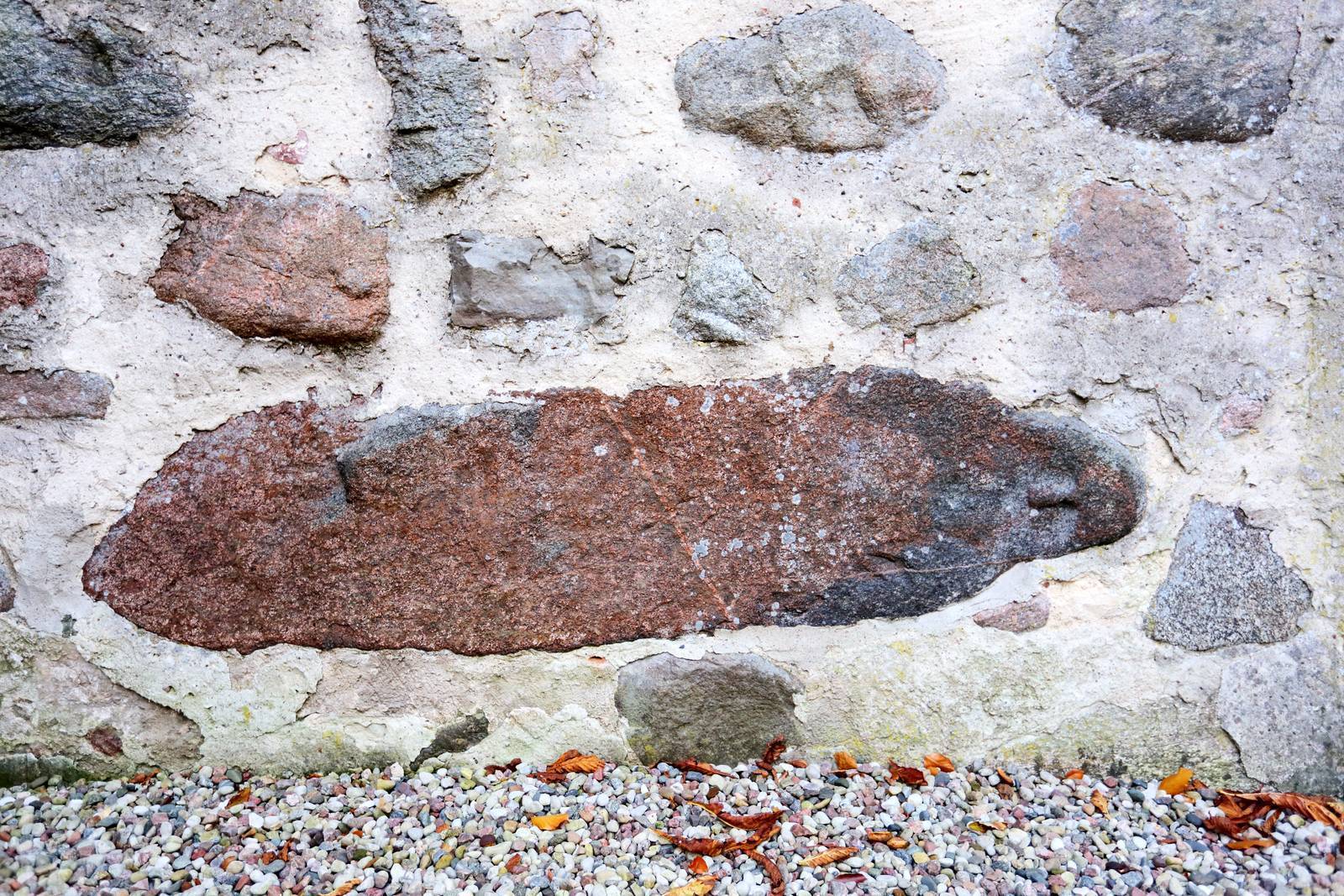
The Church of St. Catherine of Alexandria in Prątnica stands out in several respects. It was built in the first half of the 14th century and renovated in the 17th century. Its side walls are made of stone, the gables of brick, and the tower of wood. In the side wall of the church, about 1.5 meters above the ground, a so-called “Prussian woman” statue has been embedded horizontally. The outline of the face—the forehead, eyes, nose, and mouth—is clearly visible. The statue is 2.25 m long and approximately 0.5 m wide, and is considered the slimmest of the known “baba” statues. The significance of pre-Christian stone statues is unclear. They are quite commonly regarded as objects of worship. The embedding of the “baba” in the church wall in a reclining position may symbolize the victory of Christianity over pagan idols.
St. Lawrence Church in Rożental
Rożental is located about 5 km north of Lubawa, off the route of our tour, but it is definitely worth visiting precisely because of the church located there. This Baroque wooden church impresses not only with its exterior appearance and interior decor but also with its exceptionally valuable furnishings. Among other things, visitors can see Gothic sculptures of the Virgin Mary and four saints from the 15th century, as well as two chalices dating from the 16th century. Until 1919, the church tower housed a clock made by carpenter Jan Sałacki, whose weights were field stones. Currently, the clock is stored in Nowe Miasto Lubawskie. Interestingly, the church underwent a “minor renovation apocalypse” in the late 19th century, when its interior was painted with aquamarine oil paint. It took an enormous amount of work and patience to strip it away, which was done during renovations in the 1960s.