Kruklanki (0.0 km) • Przerwanki (4.9 km) • Jasieniec (10.5 km) • Jeziorowskie (12.0 km) • Kruklanki (16.7 km)
A very easy trail for the whole family. Along the route, there are two spots where you can rest by the water—one on the western side of the lake and the other in the village of Jeziorowskie.
The trail begins next to the Tourist Information Center on 22 Lipca Street in Kruklanki. From here, we head north toward the nearby Church of the Assumption of the Blessed Virgin Mary. Past the church, we turn left and continue to the end of Wczasowa Street. From there, a gravel road leads us to the summer resort village of Przerwanki. Along the way, we pass Lake Gołdapiwo and have our first chance to relax on the beach. Here, you can rent kayaks and go on a kayaking trip down the Sapina River.
Upon reaching Przerwanki, keep heading left. At the fork with the shrine to the Immaculate Virgin Mary, turn right onto the paved road, and after crossing the bridge over the Sapina River, turn right again onto a gravel road. On the right, you’ll pass the single-chamber Przerwanki lock. The areas through which the Sapina River flows have been designated as biocenters—that is, areas that have undergone the least human alteration in terms of their natural environment. The gravel road is in good condition. It runs along the northern shore of the lake, where numerous vacation resorts are located. In the summer, it is frequently used by pedestrians. Near Przerwanek, in the vicinity of the village of Jasieńczyk, there are areas listed in Poland’s central register of health resort areas due to the therapeutic qualities of the air. Upon reaching the paved road, we turn right toward Jasieniec. Then we ride between Lake Gołdapiwo and its bay known as Żabinki. We pass through Jasieniec (on the bike path) and Jeziorowskie. These are popular summer resorts, but they lack direct access to the lake. At the fork in Jeziorowskie, we take the right-hand branch, heading along the lake’s shore. At the end of the village, there is a small, public beach. Upon reaching the paved road, we turn right and continue straight on to Kruklanki. On the final stretch, after passing the canal connecting Lakes Gołdapiwo and Brożówka, you may come across the remains of a total of six bunkers and guard posts from World War I and World War II on both sides of the road, which belonged to the Giżycko Fortified Region.
The blue-marked trail leads through gently rolling terrain without any significant hills. The route follows local roads with little traffic.
Kruklanki is located 6 km east of National Road No. 63, which connects Giżycko with Węgorzewo. It is not possible to reach the trail directly with a bicycle via public transportation. The nearest train station is in Giżycko, 13 km from Kruklanki.
Kruklanki
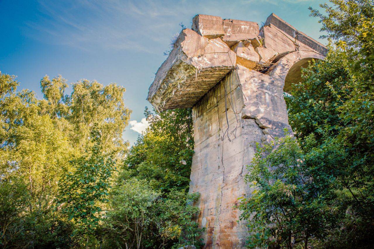
The village was founded in 1545 and must have flourished, as a church was built there as early as 1574. Today, this valuable architectural monument is the Parish Church of the Assumption of the Blessed Virgin Mary. During a period of intense economic development at the turn of the 19th and 20th centuries, two railway lines were built here. Kruklanki was located on the route from Giżycko to Węgorzewo, and a line to Olecko also ran from here. Remnants of the old railway structures have survived to this day: the station buildings in Kruklanki, embankments, viaducts, and bridges, as well as the ruins of the railway bridge over the Sapina River (several hundred meters south of Lake Patelnia)—the most famous site in the Kruklanki area.
Built of reinforced concrete, the five-span bridge was constructed in 1908. It was one of the largest railway structures in Masuria. In 1945, it was mined; however—according to unconfirmed reports—it was not blown up by soldiers but by local residents. Witnessing Soviet looting, they detonated the charges they had prepared earlier to prevent the loot from being transported by rail. Kruklanki currently has a population of about 1,300 and is a well-known tourist destination.
Lake Gołdapiwo
This body of water covers an area of 862 ha; its maximum depth is 26.9 m, its length is 5.4 km, and its width is 2.7 km. Gołdapiwo is oval in shape; only in its northeastern part does it transition into an elongated bay surrounded by hills, which is also considered a separate lake called Żabinki. The shores of Gołdapiwo are generally high and hilly. The Sapina River canoe trail runs through the lake. Due to its location near the Borecka Primeval Forest, which serves as a refuge for wild bison, the lake has been designated a quiet zone.
The Przerwanki Lock
Built in 1910, the lock has wooden gates opened by a hand-operated mechanism. Its construction was linked to the building of the Masurian Canal. Lake Gołdapiwo was intended to serve as a reserve water supply reservoir for the canal, and the lock functioned as a regulating element. It is the only lock in Poland operating on a river that does not have the status of a waterway, as the Sapina River is essentially only a kayaking route (though the lake is also navigable by sailboat).
The Giżycko Fortified Region Trail
Until World War I, it was believed that in Masuria—following the construction of the Boyen Fortress—the natural obstacles in the form of lakes were sufficient. However, Russian military operations in August and September 1914, as well as the battles for Kruklanki, led to the decision in 1915–1917 to build four strongpoints. In the 1930s, additional fortifications were added, creating the largest defensive complex in Masuria. In the Kruklanki area, natural terrain obstacles—forests, lakes, and hills—were also utilized for this purpose. However, this heavily fortified area did not play a significant role during World War II. Flanking maneuvers employed by the Red Army led to the rapid withdrawal of German troops. Over 80 different fortification structures have been preserved in the vicinity of Kruklanki. The network of structures stretches from Lake Gołdapiwo, between Lakes Brożówka, Małe, Babka, and Patelnia, to Lake Kruklin. They are connected by the Giżycko Fortified Region Fortification Trail. The Mazurian Fortifications Road Trail and the nature and educational trail “Discover the Secrets of Kruklanki with Us” also run through Kruklanki.