Iława PKP (0.0 km) – Gardzień (10.8 km) – Siemiany (20.8 km) – Jerzwałd (29.4 km) – Dobrzyki (34.8 km) – Zalewo (40.7 km) – Rąbity (45.2 km) – Międzychód (46.9 km) – Śliwa (49.6 km) – Karpowo (53.5 km) – Wieprz (56.3 km) – Gubławki (58.5 km) – Urowo (64.0 km) – Sąpy (67.4 km) – Jezierzyce (72.3 km) – Jażdżówki (73.8 km) – Szałkowo (78.1 km) – Iława PKP (86.5 km)
A long, over 86 km route, but an easy one. It leads through the very picturesque and ecologically valuable areas of the Iława Lake District Landscape Park and its buffer zone. Due to its length, it is recommended for people in good physical condition and experienced in cycling tourism. You can spread it out over two or more days and modify the route as you wish.
We begin our trip in Iława at the train station. We cross the square in front of the station and follow the cobblestone path along Żeromskiego Street to the northwest, straight through the roundabout onto Andersa Street, which becomes Sobieskiego Street.
After passing under the railroad overpass, we turn left onto Mickiewicza Street. We ride around Lake Mały Jeziorak, keeping it on our right. The path turns right onto Biskupska Street, and we reach the roundabout on National Road DK16. 300 m further on, on the right along Chodkiewicza Street by Lake Jeziorak, is the Iława Port, where a ferry service operates to Wielka Żuławy, the largest inland island in Poland. At the roundabout, turn left onto Sienkiewicza Street, then continue straight for about 2 km until you reach the intersection with Provincial Road DW 521 toward Kwidzyn, where you turn right. The trail leads through the forest. The path ends, and we continue on an asphalt road. This section is marked with the blue bicycle trail, which, after about 2.5 km, turns left onto a side road. We continue straight ahead. After another 2 km, we turn right onto the road to Siemiany and enter the Iława Lake District Landscape Park. The quality of the asphalt deteriorates noticeably. We reach Gardzień after riding 4 km; the road turns right. About 1.5 km past Gardzień, at the fork, we turn left. On the left, between the trees, we see Lake Gardzień. After riding about 4 km, we arrive in Siemiany. Here, you can grab a bite to eat and do some shopping. In the village, there is a narrow cobblestone path running along the sidewalk. From Siemiany, we ride through the woods to Jerzwałd. Along the way, about 2 km past Siemiany, on the left side past the hamlet of Jeziorno, there is a forest parking lot from which an educational nature trail leads to the Jezioro Jasne Nature Reserve. After traveling another 4 km, we reach an intersection with a larger road and turn right. It’s one kilometer to Jerzwałd, where we stay on the main road and then head east, slightly toward the north, in the direction of Dobrzyki and Zalewo. Signs for the green cycling trail appear and guide us all the way to Zalewo. About 2 km before Zalewo, a road branches off sharply to the right, heading south toward Iława and Miłomłyn. You can shorten the trip by turning onto this road. From Zalewo, the route returns to this point via the same road. However, it’s worth making your way to the town center and Lake Ewingi. From Zalew, head back while following the blue bike trail. Ignore the main road to Małdyty; at the intersection, turn right toward Susz and Iława, and after a few hundred meters, at the “fork-shaped” junction past the gas station and bus stop, we turn left toward Iława. The road winds through a variety of field and forest landscapes; there are many old maple and linden trees here. We pass Rąbita and Międzychód, which lie off to the side. In Śliwa, we leave the blue trail and the road to Iława, turning right toward Karpowo, Wieprz, and Gubławki. The road remains very picturesque. After riding 7 km, in Wieprz, we turn left at a right angle. We pass a gravel turnoff to the right leading to the former island of Bukowiec and continue straight ahead. In Gubławki, the asphalt on the road gets worse and worse, and at a sharp left turn, it turns into a gravel road. A very picturesque section of the route lies ahead. The road runs along the edge of the forest and then along Kraga Bay. The shores are deserted, steep, and forested. Along the way, we pass the wild swimming spot Łąka Jeziorak. After riding about 4 km, we reach the end of the bay at the point where the Iława Canal joins it. There is a dock here for yachts preparing to pass under the bridge on the canal.
We reach an asphalt road, turn right onto it, and cross the bridge over the canal. On the left is a forest parking lot with a shelter and information signs. For a stretch of several hundred meters, signs for the blue bicycle trail appear, but when the trail veers left, we continue straight toward Urowo and Sąpy. In Sąpy, at the bus stop, we turn right onto a gravel road leading through the forest to Jezierzyce. After riding about 3 km, we reach the intersection with the road to Maków; we go straight through it and continue on the paved road again. At the left turn toward Tynwałd, a cobblestone bike path appears, running alongside the road. There is a small shrine here made from a kayak, which serves as a station on the Papal Calvary of the Iława Lake District. As we reach Jezierzyce, signs for the blue bicycle trail appear.
We head toward Iława through Jażdżówki and Szałkowo. In Szałkowo, the bike path ends at the road to Wólka Kamieńska. The next one begins in Iława. We enter the city via Lipowy Dwór Street, turn right onto Wańkowicza Street, and from there turn left onto the bike path along Jeziorak. We pass the city’s Dzika Beach and Ekomarina, reach Dąbrowskiego Street, and turn right. At the roundabout, take the second exit onto the city’s main thoroughfare—Niepodległości Street—pass the city hall and the Gothic Church of the Transfiguration, then turn right toward the Louis Armstrong Amphitheater. We reach John Paul II Boulevard along Małe Jeziorak Lake, which takes us to Sobieskiego Street, merging into Anders Street and Żeromskiego Street, leading to the train station. This is where our loop ends.
The route partially overlaps with the blue and green bicycle trails. Iława has a PKP train station; the city is a major railway hub, and you can reach it by train from most major cities in Poland. Next to the station, there is a large, free parking lot for passenger cars. Buses serving both local and long-distance routes also stop next to the station.
The Early History of Wielka Żuławy
In the 13th century, there was a Teutonic Knights’ watchtower in Wielka Żuławy. It was connected to the mainland by a wooden bridge, the remains of which were found at the bottom of the lake. Interestingly, the 2.5-meter-wide structure led north, rather than south toward what is now Iława.
Wieprz Floats in the Wieprz
The name Wieprz does not fit the Prussian-Teutonic-German history of the region. The first mentions of the village date back to 1386. The original name “Wepren” and the later German name “Weepers” suggest Polish linguistic influences. Traces of an early Iron Age settlement have been found in Wieprz. The village is also known for the “floating boar,” a figure serving as the village’s mascot that stands on a flat pedestal in the water. It can be seen from the swimming area, as well as from the road to Bukowiec, a former island connected to Wieprz by a causeway in 1938.
The Iława Canal
The Iława Canal is a branch of the Elbląg Canal, which connects to the Vistula Lagoon and the Baltic Sea. Interestingly, a section of the Iława Canal runs along a causeway crossing Lake Karnickie. The Elbląg Canal waterway system is over 150 km long and is one of the biggest tourist attractions in Warmia and Masuria. A height difference of approximately 100 m allows vessels to navigate unique locks, where ships are pulled on trolleys from the lower station to the upper station (or vice versa). All five slipways are located between Elbląg and Małdyty.
Iława
The Neo-Gothic railway station in Iławawas built in 1905 of red brick, featuring decorative dormers, pinnacles, and pointed arches. The ceiling of the main hall is decorated with frescoes featuring floral motifs and city coats of arms. The station is considered the most beautiful in Warmia and Masuria. A steam locomotive stands in a prominent spot on the square in front of the station.Thestylish,ornate town hall building was constructedin the Neo-Baroque style between 1910 and 1912. From World War II until 1998, it housed the city market. On display in a showcase at the Department of Public Relations is a silver chain presented to the mayor of Iława by the town’s residents on the occasion of the 600th anniversary of the town’s incorporation (Iława has held town privileges since 1305).
The oldest building in the city is the Gothic Church of the Transfiguration, built between 1317 and 1325. The Renaissance tower dates from 1550. This monumental church, located on a hill on the northern shore of Małe Jeziorak—Iława’s inner lake—is practically immersed in greenery. Due to the color of its brick walls, it is sometimes called the “red church.” Inside, the main attractions are the 18th-century Rococo altar and the early 20th-century organ. On the left wall hangs a cross on which Christ’s legs are not crossed, which is a unique depiction of the Crucifixion in religious art.
One of Iława’s most famous contemporary structures isthe Louis Armstrong Amphitheater. Since 1994, it has hosted the “Old Jazz Meeting Złota Tarka” International Traditional Jazz Festival (which was previously held in Warsaw). The event begins on August 15 and lasts two or three days. In 2021, the amphitheater—adorned with Louis Armstrong’s distinctive golden trumpet—hosted the festival’s 50th anniversary edition.
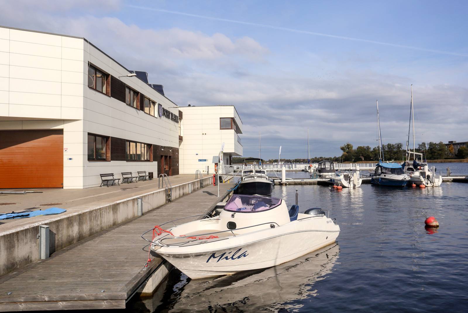
The Port of Iława is the most moderninland port in Warmia and Masuria. It is located at the southern tip of Lake Jeziorak. It serves yachts, inland passenger ships, and cargo vessels. Here you’ll find facilities for minor yacht repairs, boat ramps, winter storage hangars, rooms for victims of water accidents, an observation deck with a restaurant, a memorial hall, and a sailors’ promenade. There’s also a tourist information center here. The marina organizes cruises on tour boats, regattas, shanty concerts, and other events.
Lake Jeziorak
Jeziorak is the longest lake in Poland. It is 27.4 km long, with a maximum width of 2.4 km, though it is generally much narrower. It is also the sixth-largest lake in the country (36,400 ha). It has several islands and a very varied shoreline; the banks are mostly high and dry. Jeziorak is an excellent body of water for sailing, kayaking, and fishing. During the season, many regattas are held here, including the “Blue Ribbon of Jeziorak” Regatta—one of the oldest in Poland.
Wielka Żuława
The largest island on Jeziorak is also the largest inland island in Poland. It has an area of 82.4 hectares and, administratively, lies within the boundaries of Iława, to which it is connected by a ferry crossing for pedestrians, cyclists, and cars. There are several vacation resorts on Wielka Żuławy. There is an anecdote associated with the island: in the 1970s, Cardinal Wojtyła—later Pope John Paul II—had his kayak stolen here during a break in a kayaking trip.
Iława Lake District Landscape Park
The park covers an area of over 25,000 hectares, of which approximately 10% is located in the Pomeranian Voivodeship, and the rest in the Warmian-Masurian Voivodeship. Its boundaries include Lake Jeziorak and the forests on its western shore. There are 31 lakes within the park (27% of its area), with another 12 in its buffer zone. Most of the park’s area (62%) is covered by forests, primarily beech, pine, and mixed forests. A total of 135 breeding bird species have been recorded there, including rare and protected species (the Eurasian scops owl, white-tailed eagle, osprey, red kite, bittern, corncrake, and crane), as well as 32 species of mammals (including wolves and lynx). The park area is protected internationally under the Natura 2000 program as the Lasy Iławskie Bird Sanctuary. The park boasts rich vegetation (approximately 35% of Poland’s plant species). The moraine hills offer excellent vantage points. The most interesting historical site is located in the park’s buffer zone, near its southwestern border. These are the ruins of the Pomesanian Chapter’s castle in Szymbark, picturesquely situated on Lake Szymbarskie. This castle was the second-largest stronghold within the Teutonic Order’s territory, after Malbork.
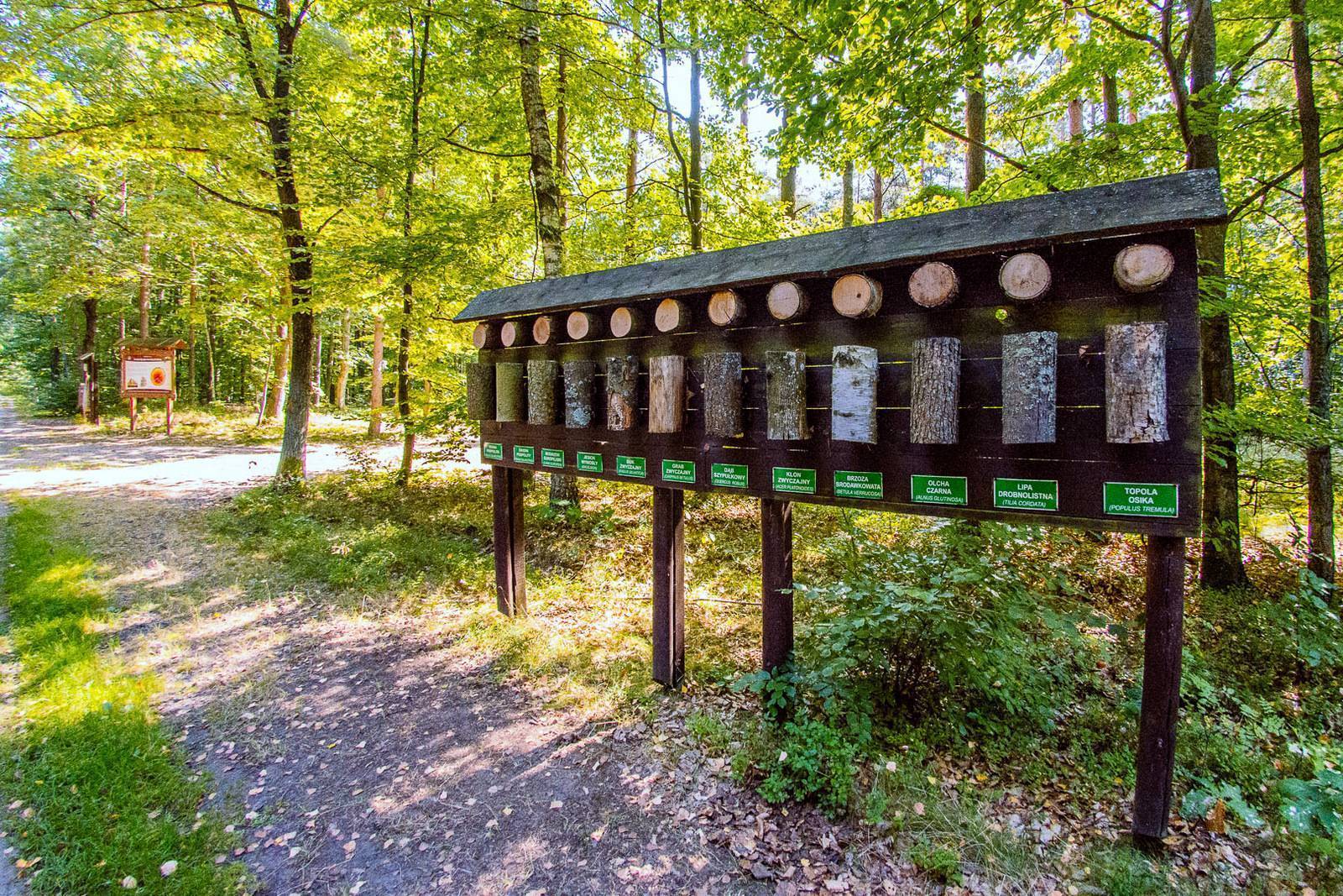
The “Jasne” Educational Trail
This 2.2-kilometer-long educational trail leads to the Lake Jasne Nature Reserve. The lake covers an area of 11 hectares and is completely surrounded by forest. It belongs to a type of oligotrophic lake that is very rare in Poland, with water that is very low in nutrients. The water is acidic. Plant and animal life struggles to thrive under such conditions. The zone of aquatic vegetation is very narrow, and in some places it is completely absent. The only species of fish living here are perch, and the larger ones feed on the smaller ones. The water is very clear—visibility reaches 15 m deep.
Jerzwałd
Zbigniew Nienacki (1929–1994), a writer and author of the very popular young adult books about the adventures of Pan Samochodzik, lived in Jerzwałd for many years. This museum curator and detective, in search of lost treasures, drove an amphibious vehicle and fought thieves and smugglers. He was Poland’s Indiana Jones, but his character was created much earlier. Many of his adventures took place on and around Lake Jeziorak. The writer lived in a small red-brick house at the entrance from the Siemiany side, on the right side of the road. After his death, he was buried in the local cemetery. A plaque with information about the settings of his novels has been erected next to the cemetery. Jerzwałd is home to the headquarters of the Iława Lake District and Dylewo Hills Landscape Parks Complex, 14-230 Jerzwałd 62, tel. 89 758 85 27, zpk@warmia.mazury.pl, zpk.warmia.mazury.pl, featuring an educational garden where visitors can learn about the habitats and plant species of the region. Nature-based educational activities are conducted here using the collected exhibits.
Siemiany – Views of the Lake
In Siemiany, there is a wooden observation tower by the road, offering a beautiful view of Lake Jeziorak at one of its widest points. There are swimming areas, vacation resorts, bars, and a sailing eco-marina with berths for several dozen yachts. The eco-marinas on Lake Jeziorak (the one in Siemiany and the other two in Iława and Zalewo) are equipped to collect wastewater from yachts and discharge it directly into the sewer system. Several marked local bike trails branch out from Siemiany in various directions.
Zalewo
Zalewo was granted town privileges in 1305 and was founded on the site of a former Prussian stronghold. It survived, among other things, the Swedish Deluge, the march of Napoleon’s armies, and the plague. After World War II, it lost its city rights, only to regain them in 1987. The town’s most valuable historic monument is the Gothic Church of St. John the Evangelist from 1351, featuring an 18th-century organ. Next to it stands a low, square tower from 1407, a section of the town walls, and a Neo-Gothic rectory from 1898. There is also a Jewish cemetery established in the first half of the 19th century. On Lake Ewingi, which is connected to Lake Jeziorak via the Dobrzycki Canal, there is an eco-marina, an observation tower, and a sundial, which was constructed using a drive wheel from the Elbląg Canal’s slipway. In 1991, a hoard of gold coins from the 13th and 14th centuries was discovered in the Lagoon. Inspired by this event, Jerzy Ignaciuk wrote the book *Pan Samochodzik and the Florins of the Lagoon*, a continuation of the adventures of the character created by Nienacki.
Jezierzyce
Jezierzyce, formerly known as Gizerek, is the town where Cardinal Karol Wojtyła—later Pope John Paul II—spent time in 1973. This event is commemorated by a local shrine, as well as the Papal Calvary of the Iława Lake District. The chapels marking the Stations of the Cross are built from distinctive yellow kayaks placed upright. Karol Wojtyła also spent time in this area in 1959.