


skoredskored
Charakterystyka trasy
2015-06-07
Polska, podlaskie, Małe Raczki

Długość trasy:
8.8 kmSuma przewyższeń:
77 mSuma spadków:
94 mŚredni czas potrzebny na pokonanie trasy:
3 h 20 minOcena trasy:
1.3/6Komentarze
NA TYCH TRASACH PRZYDA CI SIĘ MAPOPRZEWODNIK LUB MAPA Z NASZEJ APLIKACJI
MAPA TURYSTYCZNA W APLIKACJI TRASEO
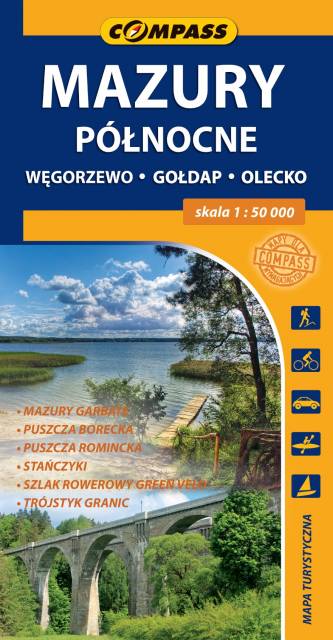
Northern Mazury
The map covers the borderland of Masuria spreading from Węgorzewo to the contact point of three borders: Polish, Lithuanian and Russian, and the part of Hunchbacked Masuria spreadind below Olecko. The map range: Polish and Russian border to the north, Węgorzewo to the west, Kruklanki and Gąski to the south, Bakałarzewo to the east. There are all well-known tourist attractions marked on the map, e.g. Puszcza Borecka (Borki's Forest), Puszcza Romincka (Romincka Forest), Stańczyki, where two large railway viaducts can be seen, and Gołdap health resort. Cyclists will find on the map the detailed track of Green Velo - the longest cycling route in Poland.
MAPA TURYSTYCZNA W APLIKACJI TRASEO
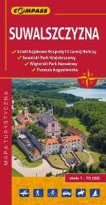
Suwałki Region
The map presents the small region around the city of Suwałki in northeastern Poland, near the border of Lithuania. The region is considered relatively undeveloped, but thanks to many lakes and forests it is perfect for recreation - canoeing, cycling or walking.