The Via Claudia Augusta, marked on the map above, is an ancient Roman road that some 2,000 years ago served as a military and trade route connecting the regions of Rome with the provinces north of the Alps. Over the centuries, the road lost its importance, but in the late 1990s it was rediscovered as an exceptional bicycle route, which was restored while preserving its historical heritage.
Via Claudia Augusta route
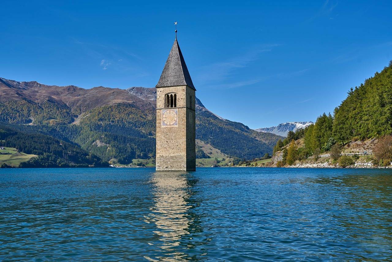
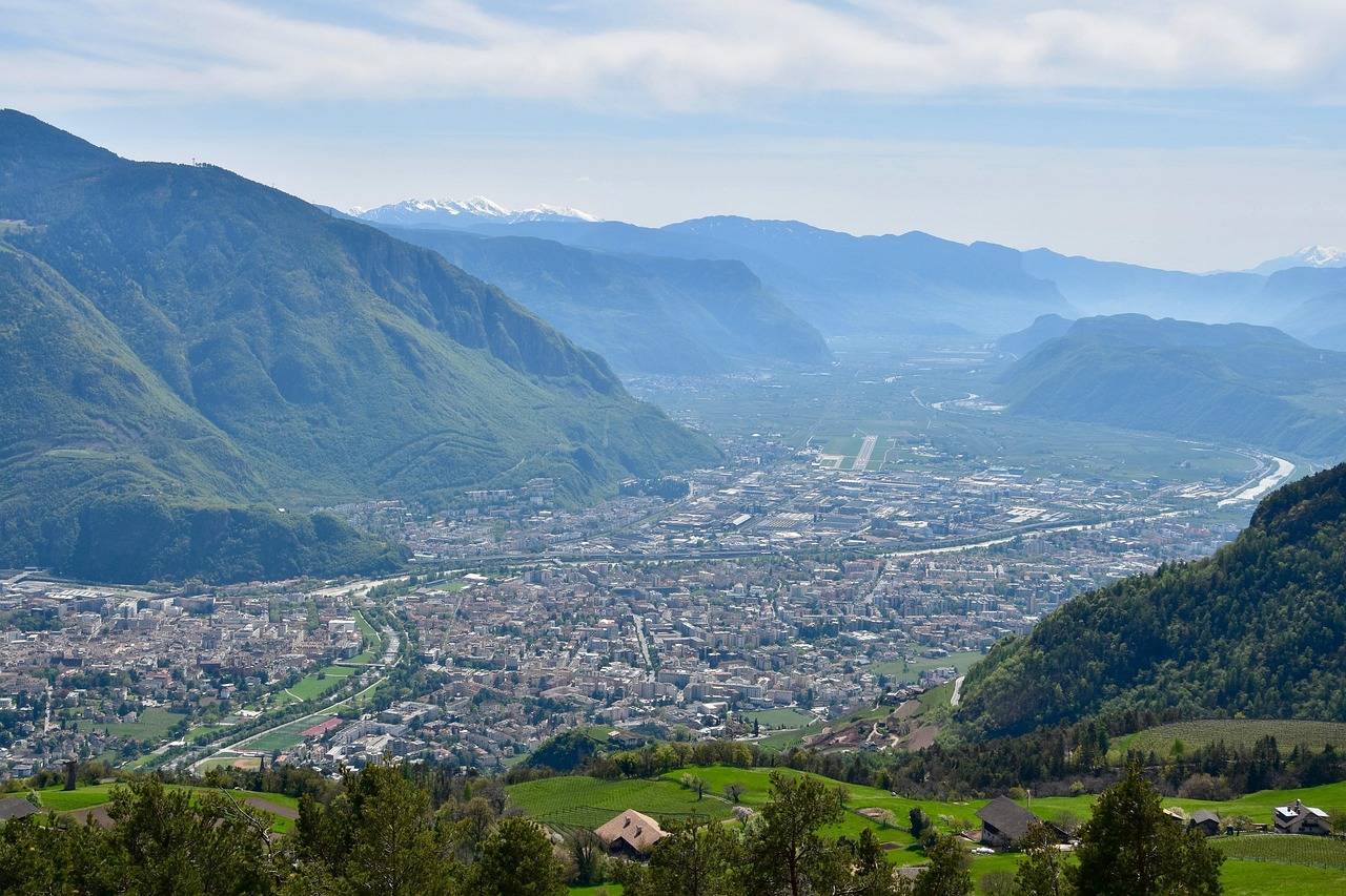
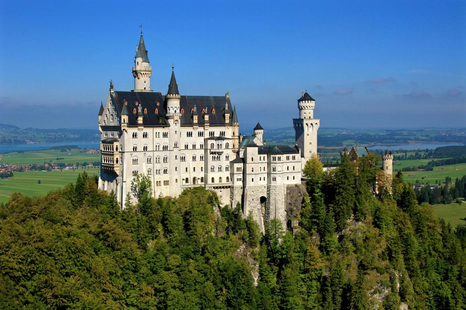
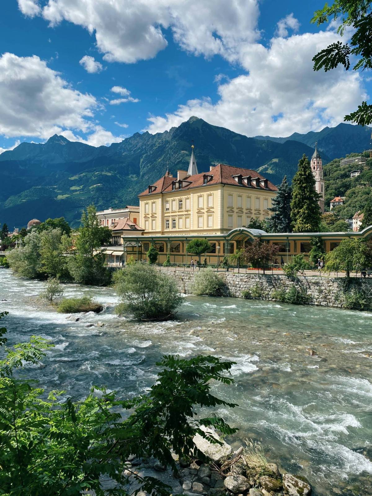
Officially, the route is 678.9 kilometers long, starting in Donauwörth on the Danube, which can be reached by train, and ending in Ostiglia on the Po River. There is also the option of taking a second, slightly longer route option, leading to Altino near Venice. The highest point during the crossing of the Alps will be the Reschen Pass, located at 1507m above sea level. The total ascent is 3265m and the descent is 3657m. The route, which begins in a quiet Bavarian town on the Danube River, impresses with its tranquility and greenery right from the start. The route passes through Augsburg, one of Germany's oldest cities, full of Roman memorabilia, Renaissance fountains and the famous Fuggerei - the world's oldest social settlement. The route continues south toward the Alps, passing, among others, the charming Landsberg am Lech with one of the best-preserved historic old towns in upper Bavaria. In the vicinity of Füssen, it is possible to deviate briefly from the route to visit the fairy-tale Neuschwanstein Castle and Hohenschwangau Castle, 2 km away. The challenge begins in Austria, where you have to cross the Fernpass and the Reschen Pass, however, the views definitely make up for the effort! You are rewarded with magnificent panoramas of the Alps, as well as the iconic, one of the most photogenic places on the route-Lake Reschensee with its sunken church tower sticking out of the water. After crossing the Austrian-Italian border at the Reschenpass, the trail mellows out. The first Italian section of the route runs through the Val Venosta (German: Vinschgau) - the upper part of the Adige Valley. The region is famous for its exceptionally sunny climate, extensive apple orchards, and medieval towns. After driving down to Merano, the landscape begins to gradually change - the picturesque Adige Valley (Val d'Adige) begins, full of vineyards and surrounded by gentler hills. It's worth stopping here for a while in Bolzano - the capital of South Tyrol, a place where German and Italian cultures meet. The route along the Adige is almost flat, very well marked and leads mainly on paved bicycle paths separated from car traffic.
Via Claudia Augusta by bicycle - route variants
In Trento, the route splits into two branches. Via Claudia Augusta Padana: leads through Verona, the city of Romeo and Juliet, to Ostiglia on the Po River. Via Claudia Augusta Altinate: heads east through Feltre to Altino near Venice. The Italian part of the Via Claudia Augusta is the quintessential cycling pleasure: impressive mountains in the north, vineyards in the middle, and open plains in the Po valley. It's also a journey through history - in the footsteps of Roman legionaries, medieval merchants and modern two-wheeled enthusiasts. Great infrastructure and a diverse landscape make this one of Europe's most interesting bicycle routes.