

Traseo_Official_RoutesTraseo_Official_Routes
6/6
Charakterystyka trasy
2025-05-09

Długość trasy:
236 kmSuma przewyższeń:
0 mSuma spadków:
0 mOcena trasy:
6/6Verte France route
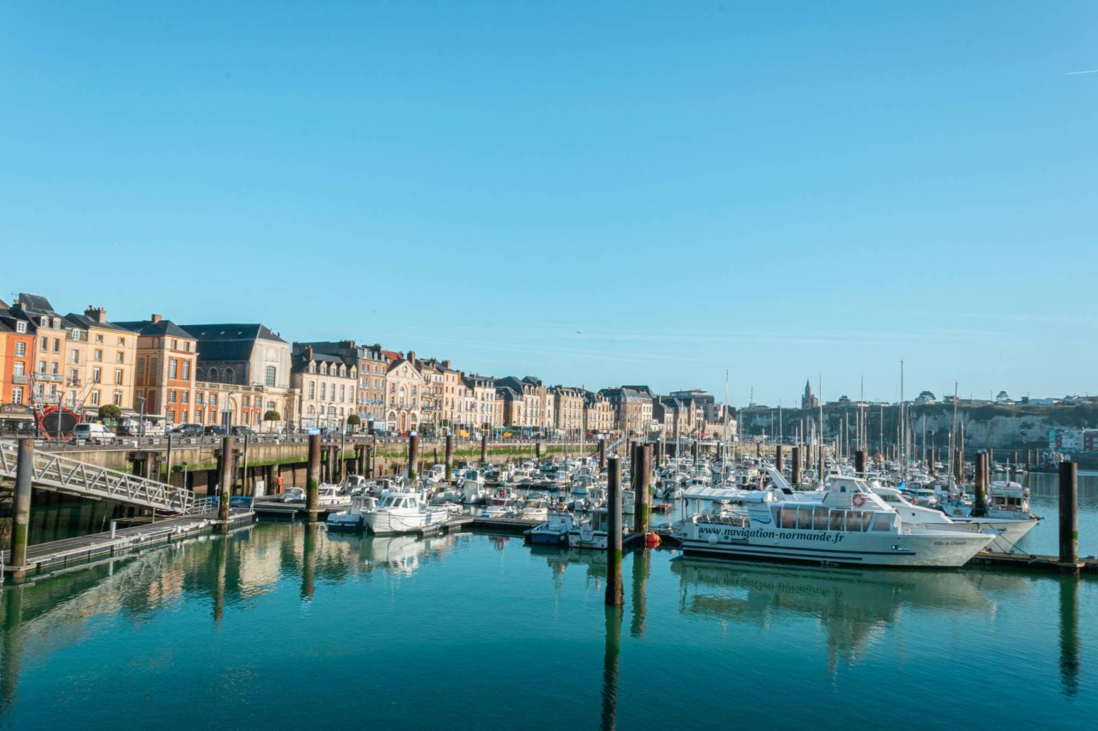
The section of the Avenue Verte cycle route marked on the map above is a unique journey from Dieppe to Paris, covering some 230 kilometres and leading through the picturesque landscapes of Normandy and Île-de-France. It is one of the most friendly and atmospheric cycle routes in France.
The route starts in the port city of Dieppe, where we set off on a paved cycle path following the former railway line known as La Voie Verte. For more than 50 kilometres, we can admire the green Béthune valley, passing villages such as Arques-la-Bataille with its castle ruins and Neufchâtel-en-Bray, known for its traditional heart-shaped cheese. The finish of the first stage is in Forges-les-Eaux, a small spa town with a market, restaurants and accommodation.
The route continues through the rolling terrain of the Pays de Bray region, full of small villages, tarmac side roads and hills. Along the way, it's worth stopping in Gournay-en-Bray for a coffee and then seeing the abbey at Saint-Germer-de-Fly, one of the oldest in France. The evening is best spent in Gisors, an atmospheric town with an impressive Templar castle and Gothic church. From here, the trail enters the wilder region of Vexin Français, where the road runs through forests and orchards in the Epte river valley. Villages such as Bray-et-Lu and Wy-dit-Joli-Village are inviting in their architecture and tranquillity.
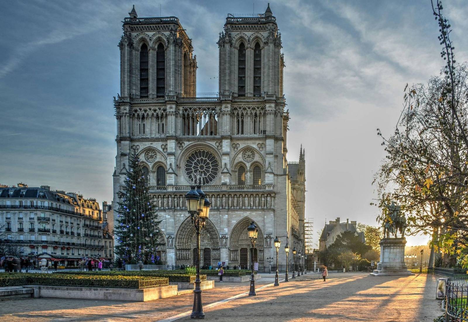
At Cergy, at the gates of the Paris metropolitan area, the rural part of the route ends. From there, the road goes through the green suburbs, the woods of Saint-Germain-en-Laye and then runs along the Oise river and the Seine. At Conflans-Sainte-Honorine, it is worth taking a look at life on the houseboats that have been moored here for years. The final kilometres take you along the Saint-Denis canal and numerous cycle paths all the way to Notre-Dame Cathedral in the heart of Paris, where the route officially ends with the symbolic “London 408 km” sign.
Connection to London
The Avenue Verte route is primarily a scenic cycle route leading from Dieppe to Paris, but it is worth knowing that it is part of a larger project linking London and Paris. For those who wish to extend their trip, there is the option to continue all the way to the British capital. In the seaside town of Dieppe, you and your bike can board a passenger ferry to Newhaven - the journey takes around four hours and is operated by DFDS Seaways. Once in England, the route takes you through the green countryside of the counties of East Sussex and Surrey, snagging places such as Lewes and Redhill, before ending in central London, near the London Eye.
Route signage
The signage is generally very good and allows you to drive comfortably without having to constantly glance at a map. The main markings are signs with a compass symbol - usually black on yellow or green on white. In some places, especially closer to Paris, there is also the distinctive Avenue Verte logo to aid orientation. In Paris itself, however, the route signage is less consistent and can be confusing - you need to rely more on GPS navigation there. In the final section, leading to Notre-Dame Cathedral, the route overlaps with the urban cycle route marked with pink north-south (N/S) signs - so look out for them where the classic Avenue Verte signage is missing.
Level of difficulty
The Avenue Verte route on the French side is an excellent choice even for beginner cyclists. It passes through gentle terrain with minimal ascent, and there is little or no car traffic on most sections. The route mainly follows cycle paths and side roads with good surfaces, making the ride comfortable and safe.
Ride time
The typical time to cover the section from Dieppe to Paris is four days at a leisurely pace, allowing enough time for sightseeing and rest. More experienced and well-prepared cyclists can complete this route in as little as two days.
___________________________________
Przebieg trasy Verte France
Zaznaczony na powyższej mapie odcinek trasy rowerowej Avenue Verte to wyjątkowa podróż z Dieppe do Paryża, licząca około 230 kilometrów i prowadząca przez malownicze krajobrazy Normandii oraz Île-de-France. Jest to jeden z najbardziej przyjaznych i klimatycznych szlaków rowerowych we Francji.
Trasa rozpoczyna się w portowym Dieppe, gdzie wyrusza się asfaltową ścieżką rowerową poprowadzoną dawną linią kolejową, znaną jako La Voie Verte. Przez ponad 50 kilometrów możemy podziwiać zieloną dolinę Béthune, mijając miejscowości takie jak Arques-la-Bataille z ruinami zamku oraz Neufchâtel-en-Bray, znane z tradycyjnego sera w kształcie serca. Meta pierwszego etapu znajduje się w Forges-les-Eaux – małym uzdrowiskowym miasteczku z rynkiem, restauracjami i noclegami.
Dalsza trasa prowadzi przez falisty teren regionu Pays de Bray, pełen małych wiosek, bocznych asfaltowych dróg i pagórków. Po drodze warto zatrzymać się w Gournay-en-Bray na kawę, a następnie zobaczyć opactwo w Saint-Germer-de-Fly, jedno z najstarszych we Francji. Wieczór najlepiej spędzić w Gisors – klimatycznym miasteczku z imponującym zamkiem templariuszy i gotyckim kościołem. Stąd szlak wkracza do bardziej dzikiego regionu Vexin Français, gdzie droga biegnie przez lasy i sady w dolinie rzeki Epte. Wioski takie jak Bray-et-Lu czy Wy-dit-Joli-Village zapraszają swoją architekturą i spokojem.
W Cergy, u bram aglomeracji paryskiej, kończy się wiejska część trasy. Stamtąd droga wiedzie przez zielone przedmieścia, lasy Saint-Germain-en-Laye, a następnie biegnie wzdłuż rzeki Oise i Sekwany. W Conflans-Sainte-Honorine warto przyjrzeć się życiu na barkach mieszkalnych, które cumują tu od lat. Końcowe kilometry prowadzą wzdłuż kanału Saint-Denis i licznych ścieżek rowerowych aż do katedry Notre-Dame w sercu Paryża, gdzie znajduje się oficjalne zakończenie trasy z symbolicznym oznaczeniem „London 408 km”.
Połączenie z Londynem
Szlak Avenue Verte to przede wszystkim malownicza trasa rowerowa prowadząca z Dieppe do Paryża, ale warto wiedzieć, że jest on częścią większego projektu łączącego Londyn z Paryżem. Dla tych, którzy mają ochotę rozszerzyć swoją wyprawę, istnieje możliwość kontynuowania podróży aż do stolicy Wielkiej Brytanii. W nadmorskiej miejscowości Dieppe można z rowerem wsiąść na prom pasażerski do Newhaven – podróż trwa około czterech godzin i jest obsługiwana przez DFDS Seaways. Po dotarciu do Anglii, trasa wiedzie przez zielone tereny hrabstw East Sussex i Surrey, zahaczając o miejsca takie jak Lewes czy Redhill, a kończy się w centrum Londynu, w pobliżu London Eye.
Oznakowanie trasy
Oznakowanie jest na ogół bardzo dobre i pozwala na komfortową jazdę bez konieczności ciągłego zerkania w mapę. Główne oznaczenia to znaki z symbolem kompasu – najczęściej w wersji czarnej na żółtym tle lub zielonej na białym. W niektórych miejscach, zwłaszcza bliżej Paryża, pojawia się również charakterystyczne logo Avenue Verte, które ułatwia orientację.
W samym Paryżu oznakowanie trasy jest jednak mniej spójne i bywa mylące – trzeba tam bardziej polegać na nawigacji GPS. W końcowym odcinku, prowadzącym do katedry Notre-Dame, trasa pokrywa się z miejską trasą rowerową oznaczoną różowymi znakami kierunku północ–południe (N/S) – warto więc ich wypatrywać w miejscach, gdzie brakuje klasycznego oznaczenia Avenue Verte.
Poziom trudności
Trasa Avenue Verte po stronie francuskiej jest doskonałym wyborem nawet dla początkujących rowerzystów. Przebiega przez łagodne tereny z minimalnymi przewyższeniami, a ruch samochodowy na większości odcinków jest znikomy lub w ogóle nie występuje. Szlak prowadzi głównie ścieżkami rowerowymi i bocznymi drogami o dobrej nawierzchni, co czyni jazdę komfortową i bezpieczną.
Czas przejazdu
Typowy czas pokonania odcinka z Dieppe do Paryża to cztery dni przy spokojnym tempie, co daje wystarczająco dużo czasu na zwiedzanie i odpoczynek. Bardziej doświadczeni i dobrze przygotowani rowerzyści mogą tę trasę przejechać nawet w dwa dni.