The EuroVelo 9 in Austria, stretching from the Czech border near Břeclav to the Slovenian border near Spielfeld, passes through diverse landscapes, historic towns and renowned wine regions. This route is mostly paved and well-maintained, making it accessible to cyclists of all skill levels. The terrain ranges from flat segments to more challenging ascents in the Vienna Alps, providing cyclists with rewarding views of the surrounding landscapes. It is well signposted with the EuroVelo logo, for easy navigation throughout the journey. It is also well supported with a wide range of accommodations, including hotels, guesthouses and bike-friendly lodgings. Whether you are an experienced cyclist or a amateur, this route offers a memorable journey through the heart of Europe, perfect for those looking for an immersive cycling adventure.
What is the EuroVelo 9 Cycle route?
The EuroVelo 9 "Baltic - Adriatic" cycle route, sometimes also called the "Amber Route" is a long-distance cycling trail that stretches approximately 2,050 km (1,275 miles). It connects the Baltic Sea from Gdańsk in Poland to the Adriatic Sea at Pula in Croatia. It traverses through six countries: Poland, the Czech Republic, Austria, Slovenia, Italy and Croatia. The route is designed to be accessible to cyclists of various skill levels, with well-marked paths and a mix of dedicated cycle routes and quiet roads. The EuroVelo 9 cycle route offers a unique opportunity to explore the heart of Europe on two wheels, combining adventure, culture and natural beauty into one unforgettable journey.
How long is this section of the route?
The Austrian section of the EuroVelo 9 cycle route is approximately 400 kilometers (248,5 miles) long. The route starts at the Czech border near Břeclav and ends at the Slovenian border near Spielfeld. The route offers a variety of stages suitable for both recreational and more experienced cyclists. It features a mix of flat sections through hilly terrain as well as more challenging terrains in the Vienna Alps, providing a diverse and enriching cycling experience through Austria's picturesque landscapes and cultural landmarks.
How long does it take to complete this section of the route?
Completing the EuroVelo 9 section in Austria depends on individual cycling pace, fitness level and the number of stops made along the route. Usually, this segment takes cyclists between 4 to 6 days, at an average cycling speed of around 20 km/h. More experienced cyclists can complete this route in approximately 2 days. The route runs through varied landscapes, including the flat plains and hilly terrains. Taking breaks to explore towns, visit attractions or enjoy local cuisine can extend the overall travel time. This route offers an unforgettable cycling adventure and with proper planning, cyclists can ensure a safe and enjoyable journey along this scenic route.
Is Austria bike friendly?
Yes, Austria is a bike-friendly destination, offering a diverse range of cycling experiences suitable for cyclists of all skill levels. It boasts an extensive network of well-maintained cycle paths, including part of the famous "Danube Cycle Path". It also offers numerous accommodations, providing amenities such as secure bike storage and repair points. Many of these facilities are part of the Bed+Bike network, ensuring that the needs of cyclists are met. Cyclists can easily transport their bikes on Austrian trains, making it easier to explore and travel through different regions. The integration of cycling with public transport improves the overall cycling experience.
Attractions along the route
The EuroVelo 9 route in Austria offers something for everyone, with attractions such as:
The Weinviertel region
Famous for its vineyards and traditional wine taverns. These places offer local wines and regional delicacies, providing a perfect stop to relax and immersion into local culture.
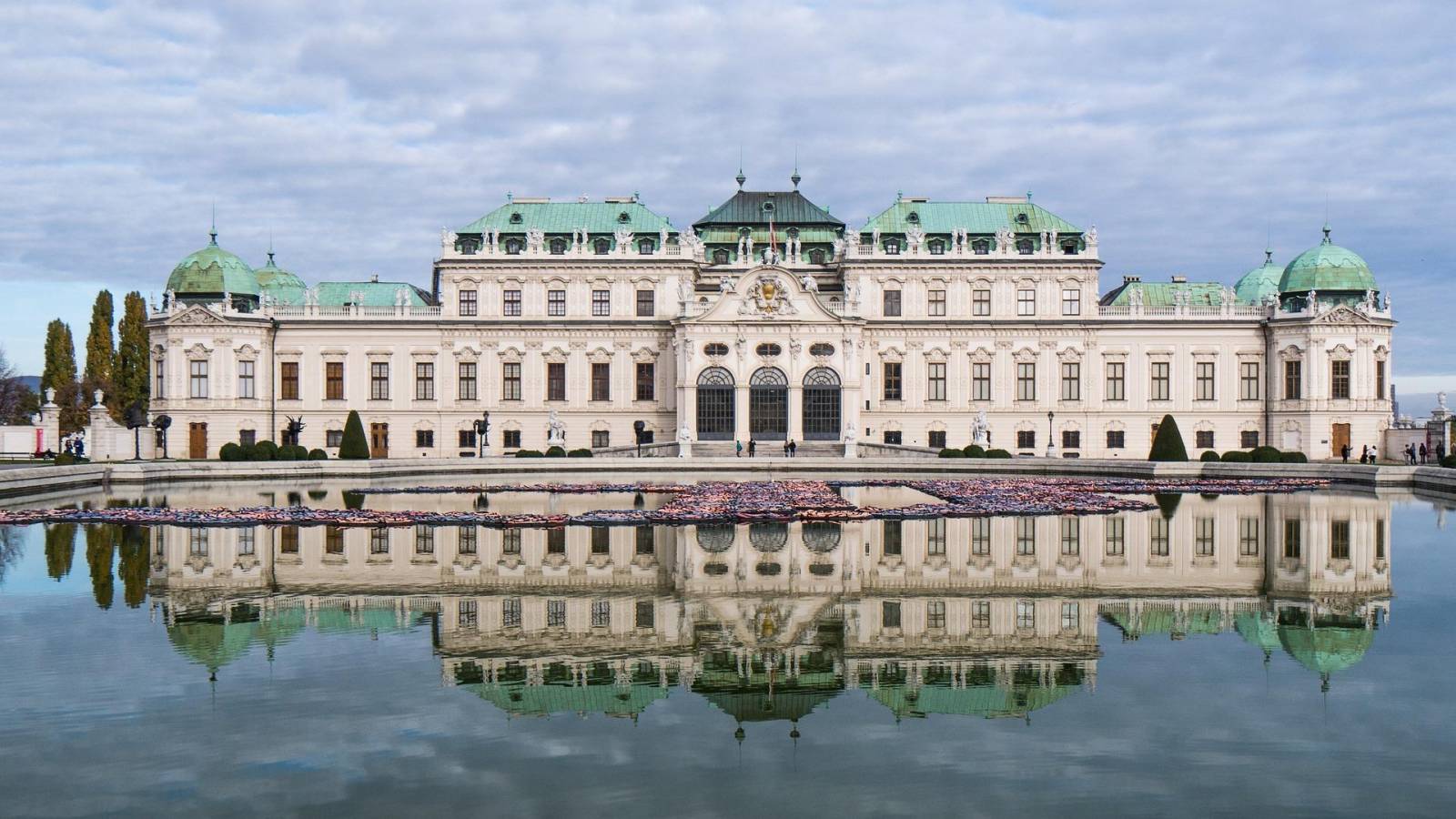
Vienna
The capital city with significant landmarks such as the Rathaus (City Hall), the Schönbrunn Palace, Baroque palace, once the summer residence of the Habsburgs, the Hofburg Palace, once serving as the winter residence of the Habsburgs, the Ringstraß, a grand boulevard surrounding the city center, lined with monumental buildings such as the Vienna State Opera, one of the leading opera houses in the world.
Thermal Spas
Continuing south, the route follows the "Thermenradweg" (Spas Route), leading cyclists through the Thermal Spa Region. This area is dotted with historic towns such as Baden bei Wien and Bad Erlach, known for their thermal baths and wellness facilities. The surrounding vineyards add to the peaceful atmosphere.
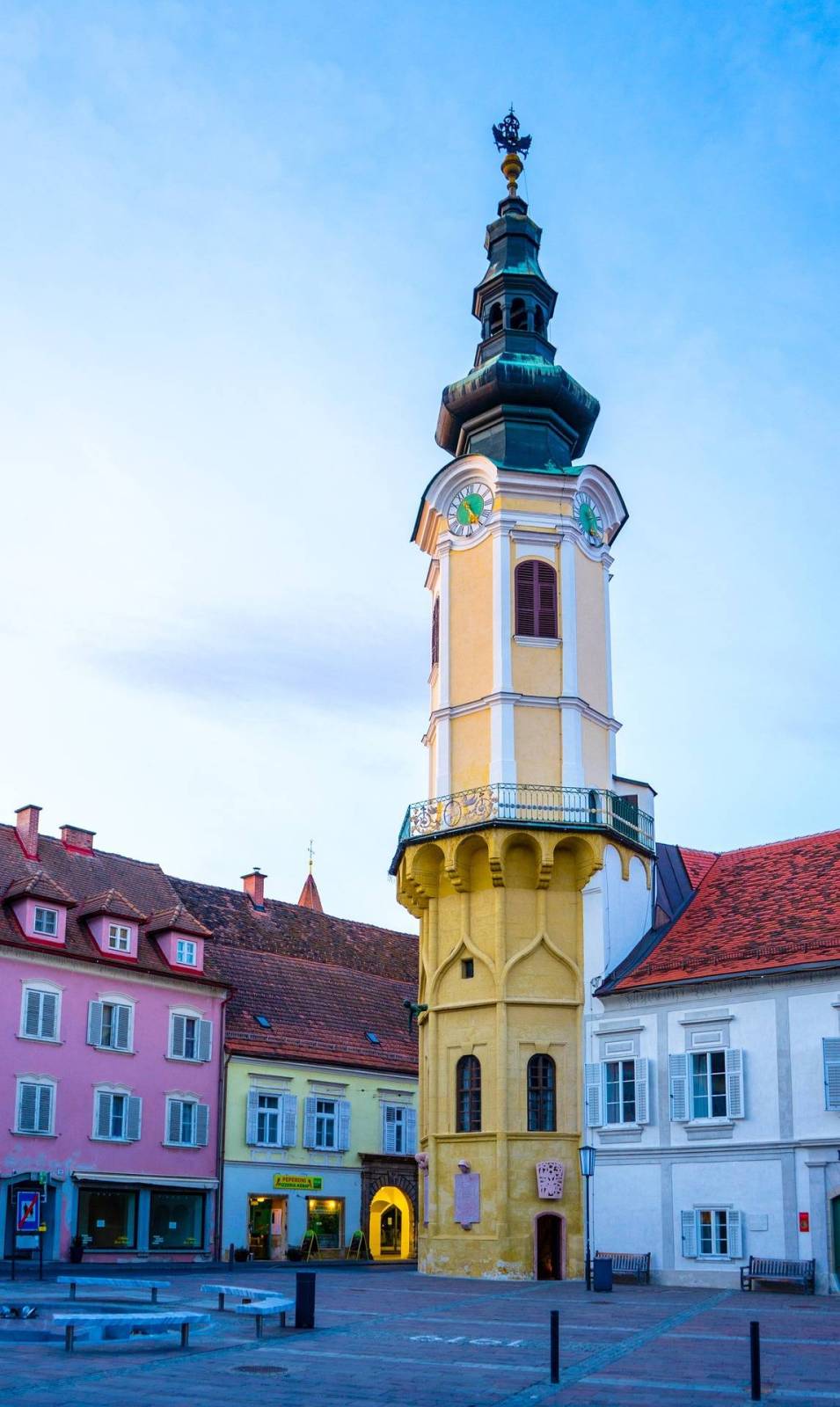
The Eastern Styria region
Offers a rich culinary experience, influenced by different cultures. Cyclists can enjoy traditional desserts as well as local specialties. This region is also home to spa resorts offering unique wellness experiences. The hilly landscape, filled with vineyards, provides stunning views and a relaxing atmosphere.
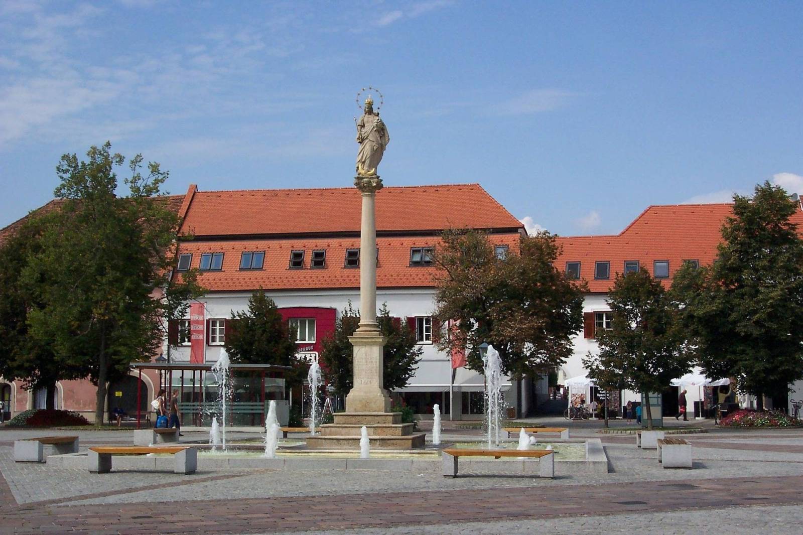
Bad Radkersburg
Situated at the confluence of the Mur and Mura rivers, it is renowned cycling destination. The town's well-preserved medieval architecture and vibrant cultural scene make it a must-visit stop along the route.
-----------------------------------------------------------------------------
EuroVelo 9 w Austrii, rozciągająca się od granicy z Czechami w pobliżu Břeclav do granicy ze Słowenią w okolicach Spielfeld, prowadzi przez zróżnicowane krajobrazy, historyczne miasta oraz słynne regiony winiarskie. Trasa jest w większości asfaltowa i dobrze utrzymana, dzięki czemu jest dostępna dla rowerzystów o różnym poziomie zaawansowania. Teren obejmuje zarówno płaskie odcinki, jak i bardziej wymagające podjazdy w Alpach Wiedeńskich, oferując piękne widoki na otaczające krajobrazy. Szlak jest dobrze oznakowany logo EuroVelo, co ułatwia orientację podczas całej podróży. Wzdłuż trasy znajduje się także szeroka baza noclegowa, obejmująca hotele, pensjonaty oraz obiekty przyjazne rowerzystom. Niezależnie od tego, czy jesteś doświadczonym kolarzem, czy amatorem, trasa ta zapewnia niezapomnianą podróż przez serce Europy i jest idealna dla osób szukających prawdziwej rowerowej przygody.
Czym jest trasa rowerowa EuroVelo 9?
EuroVelo 9 „Bałtyk – Adriatyk”, czasami nazywana również „Szlakiem Bursztynowym”, to długodystansowa trasa rowerowa licząca około 2050 km. Łączy Morze Bałtyckie w Gdańsku z Morzem Adriatyckim w chorwackiej Puli. Przebiega przez sześć krajów: Polskę, Czechy, Austrię, Słowenię, Włochy i Chorwację. Trasa została zaprojektowana tak, aby była dostępna dla rowerzystów o różnym poziomie umiejętności – oferuje dobrze oznakowane ścieżki oraz połączenie wydzielonych dróg rowerowych i spokojnych dróg lokalnych. EuroVelo 9 daje wyjątkową możliwość odkrywania serca Europy na dwóch kołach, łącząc przygodę, kulturę i piękno natury w jednej niezapomnianej podróży.
Jak długa jest austriacka część trasy?
Austriacki odcinek EuroVelo 9 ma około 400 kilometrów długości. Rozpoczyna się przy granicy z Czechami w pobliżu Břeclav i kończy przy granicy ze Słowenią w okolicach Spielfeld. Trasa oferuje różnorodne etapy odpowiednie zarówno dla rekreacyjnych, jak i bardziej doświadczonych rowerzystów. Obejmuje zarówno płaskie odcinki, jak i pagórkowate tereny oraz bardziej wymagające fragmenty w Alpach Wiedeńskich, zapewniając różnorodne i bogate doświadczenie rowerowe pośród malowniczych krajobrazów Austrii i jej atrakcji kulturowych.
Ile czasu zajmuje pokonanie tego odcinka?
Czas przejazdu austriackiego odcinka EuroVelo 9 zależy od tempa jazdy, kondycji rowerzysty oraz liczby postojów po drodze. Zazwyczaj pokonanie tego fragmentu zajmuje od 4 do 6 dni przy średniej prędkości około 20 km/h. Bardziej doświadczeni rowerzyści mogą ukończyć trasę w około 2 dni. Szlak prowadzi przez zróżnicowane krajobrazy – od płaskich terenów po bardziej pagórkowate obszary. Przerwy na zwiedzanie miast, odwiedzanie atrakcji czy degustację lokalnej kuchni mogą wydłużyć całkowity czas podróży. Przy odpowiednim planowaniu trasa zapewnia bezpieczną i wyjątkowo przyjemną rowerową przygodę.
Czy Austria jest przyjazna rowerzystom?
Tak, Austria jest krajem bardzo przyjaznym rowerzystom i oferuje szeroki wybór tras odpowiednich dla osób o różnym poziomie zaawansowania. Kraj posiada rozbudowaną sieć dobrze utrzymanych ścieżek rowerowych, w tym fragment słynnej „Dunajskiej Trasy Rowerowej”. Dostępnych jest również wiele obiektów noclegowych oferujących udogodnienia dla rowerzystów, takie jak bezpieczne przechowalnie rowerów czy punkty naprawcze. Wiele z nich należy do sieci Bed+Bike, dzięki czemu potrzeby rowerzystów są odpowiednio uwzględniane. Rowerzyści mogą także łatwo przewozić rowery w austriackich pociągach, co ułatwia zwiedzanie różnych regionów kraju. Integracja transportu publicznego z infrastrukturą rowerową dodatkowo podnosi komfort podróżowania.
Atrakcje wzdłuż trasy
Region Weinviertel
Słynie z winnic i tradycyjnych gospod winnych. Można tam spróbować lokalnych win i regionalnych specjałów, co stanowi doskonałą okazję do odpoczynku i poznania lokalnej kultury.
Wiedeń
Stolica Austrii oferuje wiele ważnych zabytków, takich jak Rathaus (Ratusz), pałac Schönbrunn – barokowa rezydencja będąca niegdyś letnią siedzibą Habsburgów, Hofburg – dawna zimowa rezydencja Habsburgów, oraz Ringstraße – reprezentacyjny bulwar otaczający centrum miasta, przy którym znajdują się monumentalne budynki, w tym Opera Wiedeńska, jedna z najważniejszych oper świata.
Termalne uzdrowiska
Kierując się na południe, trasa prowadzi szlakiem „Thermenradweg” (Trasa Uzdrowiskowa), przechodząc przez region słynący z term i uzdrowisk. Znajdują się tam historyczne miejscowości, takie jak Baden bei Wien i Bad Erlach, znane z kąpielisk termalnych i ośrodków wellness. Okoliczne winnice dodatkowo podkreślają spokojny charakter tego regionu.
Region Wschodniej Styrii
Oferuje bogate doświadczenia kulinarne inspirowane różnymi kulturami. Rowerzyści mogą spróbować tradycyjnych deserów oraz lokalnych specjałów. Region słynie również z kurortów uzdrowiskowych oferujących wyjątkowe zabiegi wellness. Pagórkowaty krajobraz pełen winnic zapewnia piękne widoki i relaksującą atmosferę.
Bad Radkersburg
Położone u zbiegu rzek Mur i Mura miasto jest znanym celem podróży rowerowych. Dobrze zachowana średniowieczna architektura oraz bogate życie kulturalne sprawiają, że jest to obowiązkowy punkt postoju na trasie.