


Traseo_Official_TrailsTraseo_Official_Trails
Charakterystyka trasy
2025-09-01

Długość trasy:
3013 kmSuma przewyższeń:
17174 mSuma spadków:
17186 mOcena trasy:
6/6Komentarze
NA TYCH TRASACH PRZYDA CI SIĘ MAPOPRZEWODNIK LUB MAPA Z NASZEJ APLIKACJI
MAPA TURYSTYCZNA W APLIKACJI TRASEO
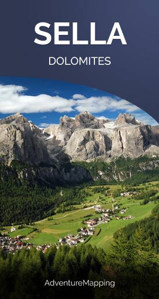
Sella
Masyw Sella leży w samym sercu włoskich Dolomitów, na północ od najwyższego szczytu tych gór - Marmolady. Najwyższy szczyt to Piz Boè (3,151 m). Ze względu na tarasowy charakter masywu jest on łatwo dostępny dla niewprawionych turystów, natomiast pionowe ściany tutejszych szczytów upodobali sobie wspinacze.
MAPA TURYSTYCZNA W APLIKACJI TRASEO
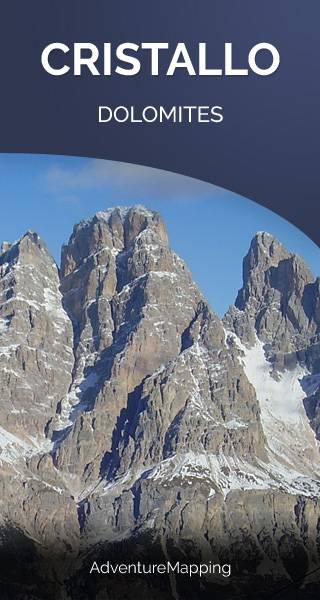
Cristallo
Cristallo to grupa górska w północnych Włoszech w Dolomitach, na północny wschód od Cortina d'Ampezzo, w prowincji Belluno. Cztery szczyty tej grupy osiągają wysokość ponad 3000 m: Monte Cristallo (3221 m), Piz Popena (3153 m), Cima di Mezzo (3154 m) i Cristallino d'Ampezzo (3008 m). Cima di Mezzo i Cristallino d'Ampezzo można zdobyć poprzez Via ferraty, natomiast Monte Cristallo i Piz Popena wymagają dużych umiejętności wspinaczkowych. (wikipedia.com)
MAPA TURYSTYCZNA W APLIKACJI TRASEO
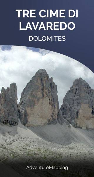
Tre Cime di Lavaredo
Tre Cime di Lavaredo to trzy charakterystyczne szczyty w masywie Dolomiti di Sesto, w pólnocno-wschodniej części Włoch. Najwyższy z nich - The Cima Grande - mierzy 2999 m n.p.m. To jedna z najpopularniejszych turystycznych destynacji we włoskich Dolomitach. Masywy oplata sieć szlaków, z których kilka prowadzi też na wierzchołki.
MAPA TURYSTYCZNA W APLIKACJI TRASEO
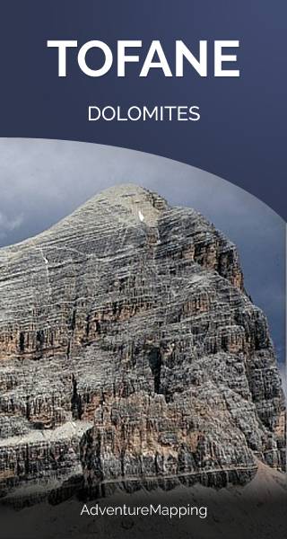
Tofane
Tofane to stosunkowo wysoki i popularny wśród turystów masyw włoskich Dolomitów, położony w prowincji Belluno. W górne partie prowadzi tutaj sieć kolejek linowych z miejscowości Cortina d’Ampezzo.. Najwyższym szczytem masywu jest Tofana di Mezzo (3 244 m), natomiast Tofana di Rozes (3 225 m) to najwyższy szczyt Dolomitów, na który można wejść, nie posiadając sprzętu ubezpieczającego.
MAPA TURYSTYCZNA W APLIKACJI TRASEO
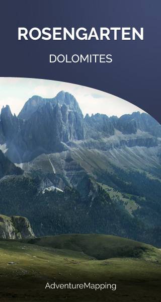
Rosengarten
Rosengarten to masyw włoskich Dolomitów rozciągający się pomiędzy Tierser Tal i Eggental w Południowym Tyrolu a Fassa Valley w Trentino. Jest średniej wysokości, za to mocno oblegany przez turystów, którzy przyjeżdżają głównie do jego wschodniej części. Tutaj wokół gór znajdują się piękne zielone łąki i funkcjonują górskie kurorty. Jest to też region o największym w Dolomitach zagęszczeniu schronisk turystycznych.