The EuroVelo 14 is a captivating cycling route that meanders through the heart of Austria and Hungary, following the paths of several significant rivers and lakes. The journey begins in the picturesque town of Zell am See, situated beside the pristine Lake Zell. Then, breathtaking views of alpine meadows and towering peaks, set the tone for the adventure ahead. The journey continous to Szentgotthard near the border, marking the end of the Austrian segment. The path continous through lush forests, traditional wooden houses, vineyards and rich folklore, allowing cyclists to immerse themselves in Hungarian culture, ending the great journey in the city of Debrecen. Whether you are an avid cyclist or a casual traveller, this route promises an unforgettable adventure.
What is the EuroVelo 14 Cycle route?
The EuroVelo 14, also known as the "Waters of Central Europe," is a breathtaking cycling route through Austria and Hungary. The route starts in Zell am See in Austria, passing through rivers, lakes and spa towns, following regional cycle paths leading cyclists through picturesque towns and UNESCO World Heritage sites such as Graz. Continuing into Hungary, it passes through the Őrség Natural Park, along the northern shore of Lake Balaton - the largest lake in Central Europe, and ends in Debrecen near Budapest. EuroVelo 14 offers a fascinating cycling adventure for enthusiasts wanting to experience the natural beauty and cultural richness of Central Europe.
How long is this the EuroVelo 14 cycle route and how long does it take to complete it?
The EuroVelo 14 cycling route stretches for approximately 1,150 kilometers from Zell am See in Austria to Debrecen in Hungary. The time nedded to complete this route at an average pace of 60 to 70 kilometers per day is approximately 17 to 20 days. However, some cyclists may decide to extend their trip to 3 to 4 weeks to fully enjoy the attractions and landscapes along the way. With frequent train connections along the route, cyclists can easily combine cycling with trail travel, providing flexibility and convenience.
Is the route family-friendly, or is it more suited for experienced cyclists?
The EuroVelo 14 cycle route is generally well accessible. The route predominantly follows existing cycle paths, which are well maintained and minimise interaction with car traffic, increasing safety. Additionally, the route passes through towns with a variety of family-friendly accommodations and amenities. While most of the route is flat or gently rolling, some areas feature hilly terrain or involve gravel or less paved surfaces, which may be more challenging for younger or less experienced cyclists. However, most of these sections can be bypassed by local train services. Whether you are an experienced cycylist taking on a long journey or exploring sections at a leisurely pace, this route is designed for cyclists of all skill levels, as well as families with children, ensuring a safe and enjoyable cycling experience.
Attractions along the route
The EuroVelo 14 cycle route offers cyclists numerous attractions, such as:
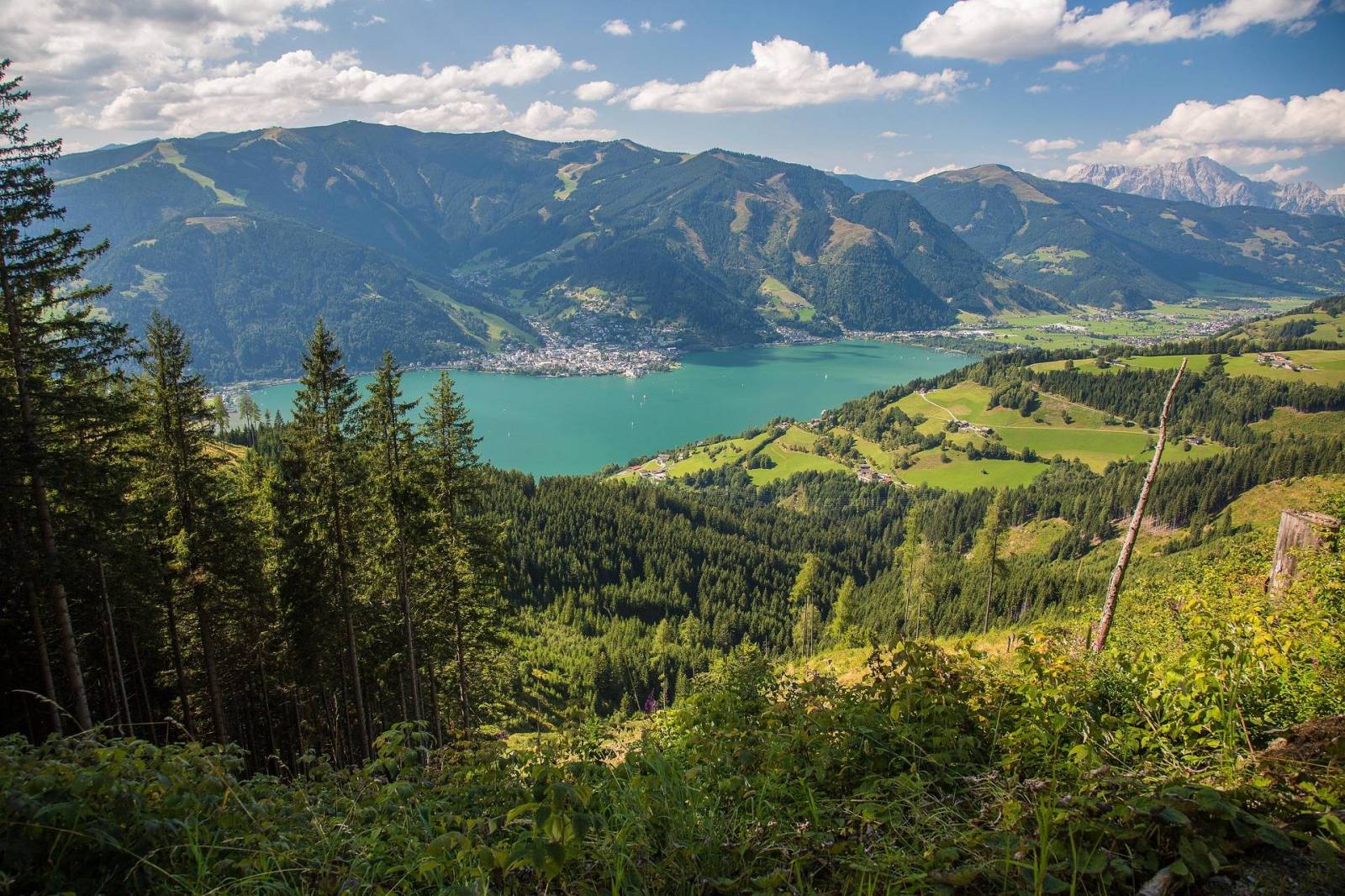
Lake Zell
The route starts in Zell am See at Lake Zell, offering picturesque views and a peaceful start to the journey.
Kitzlochklamm Gorge
Located near Taxenbach, one of the most beautiful gorges in Austria, offering spectacular views and a refreshing stop.
Graz
UNESCO World Heritage Site and City of Design, known for its Renaissance and Baroque buildings. It boasts attractions like the Schlossberg hilltop castle and the futuristic Kunsthaus museum.
Riegersburg Castle
Situated on a volcanic rock near Feldbach, it is a well-preserved medieval fortress with exhibitions about knights and witches and wonderful view from the top.
Berghofer Mühle
Traditional grain and oil mill where tourists can learn about the production of pumpkin seed oil, taste local specialties and purchase regional products.
Szentgotthárd
Small town near the Austrian border, known for its baroque architecture and spa culture. It is the perfect place to relax after a long ride in local thermal baths or wellness hotels.
Őrség National Park
Located in Hungary, close to the Austrian border, this is a peaceful and unspoiled region of rolling hills, meadows and forested trails, traditional villages and rich biodiversity.
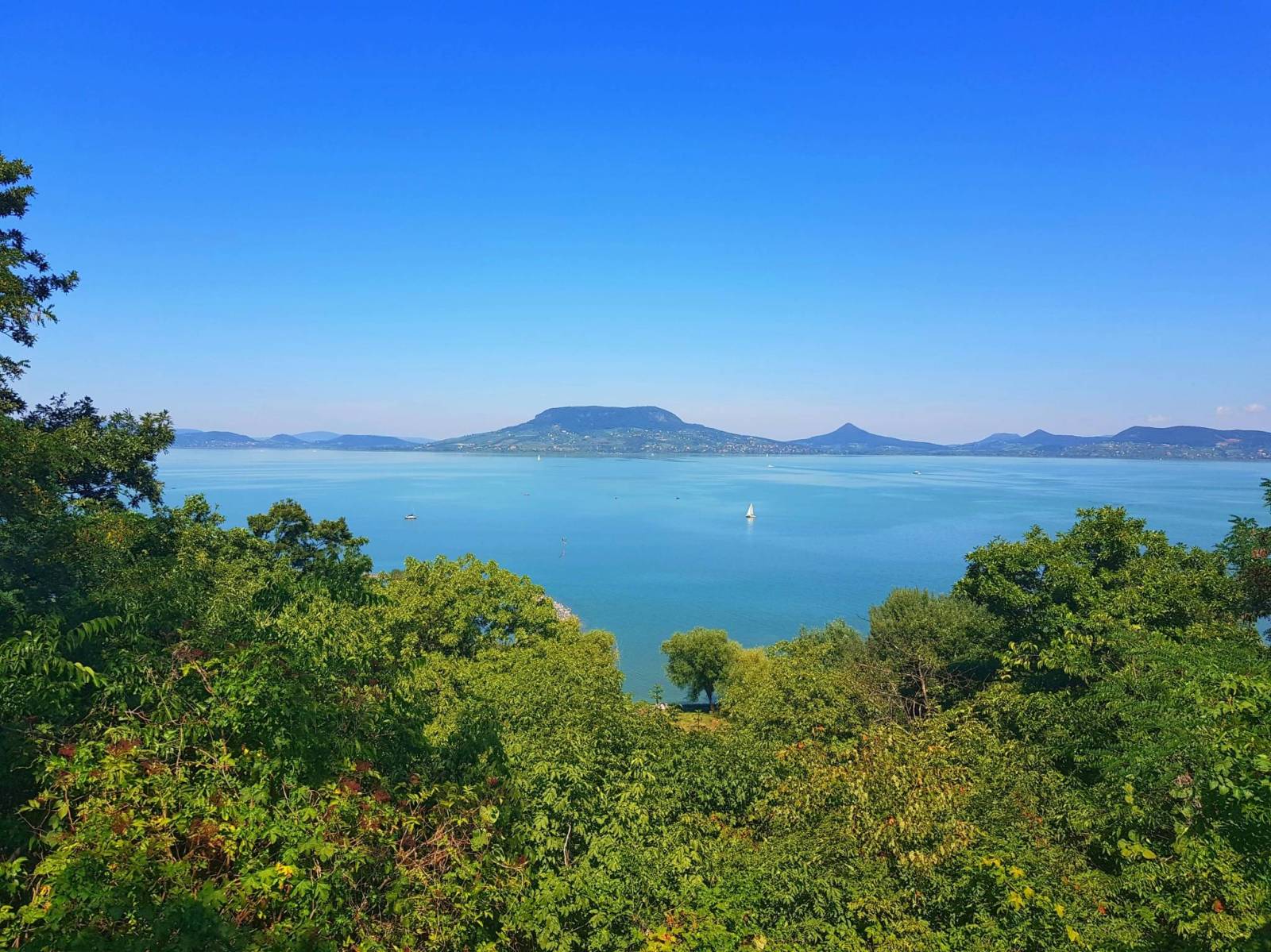
Lake Balaton
The largest freshwater lake in Central Europe, offering cycling-friendly accommodations, swimming opportunities and diverse dining options.
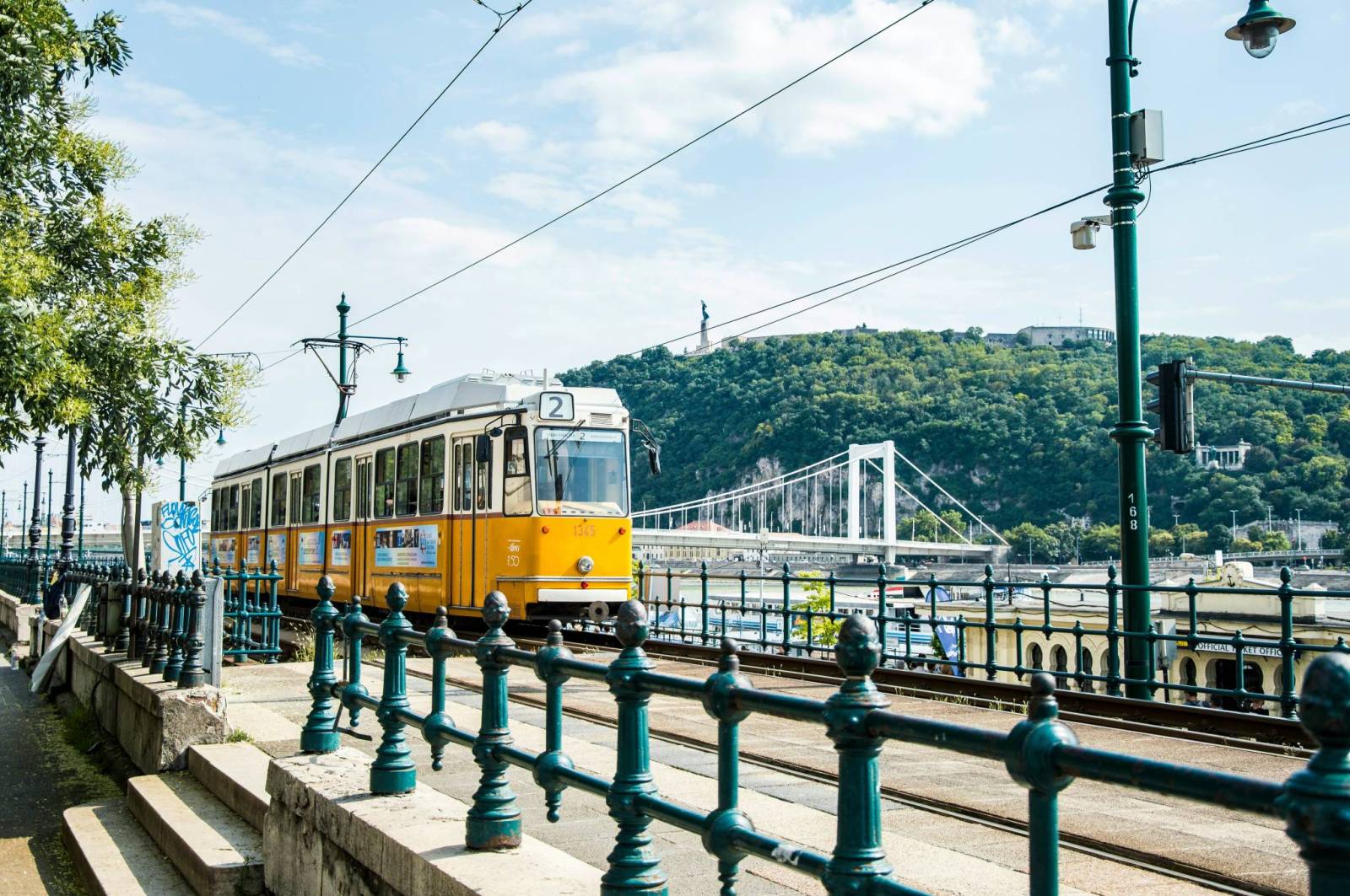
Budapest
The capital city is famous for its thermal baths, historic monuments and vibrant atmosphere. While here, an absolute must see are the Buda Castle, a UNESCO World Heritage Site located on Castle Hill, the Parliament Building, one of most beautiful parliament buildings in Europe, the Fisherman’s Bastion (Halászbástya), a fairytale-like neo-Romanesque terrace, and Matthias Church, a stunning Gothic cathedral.
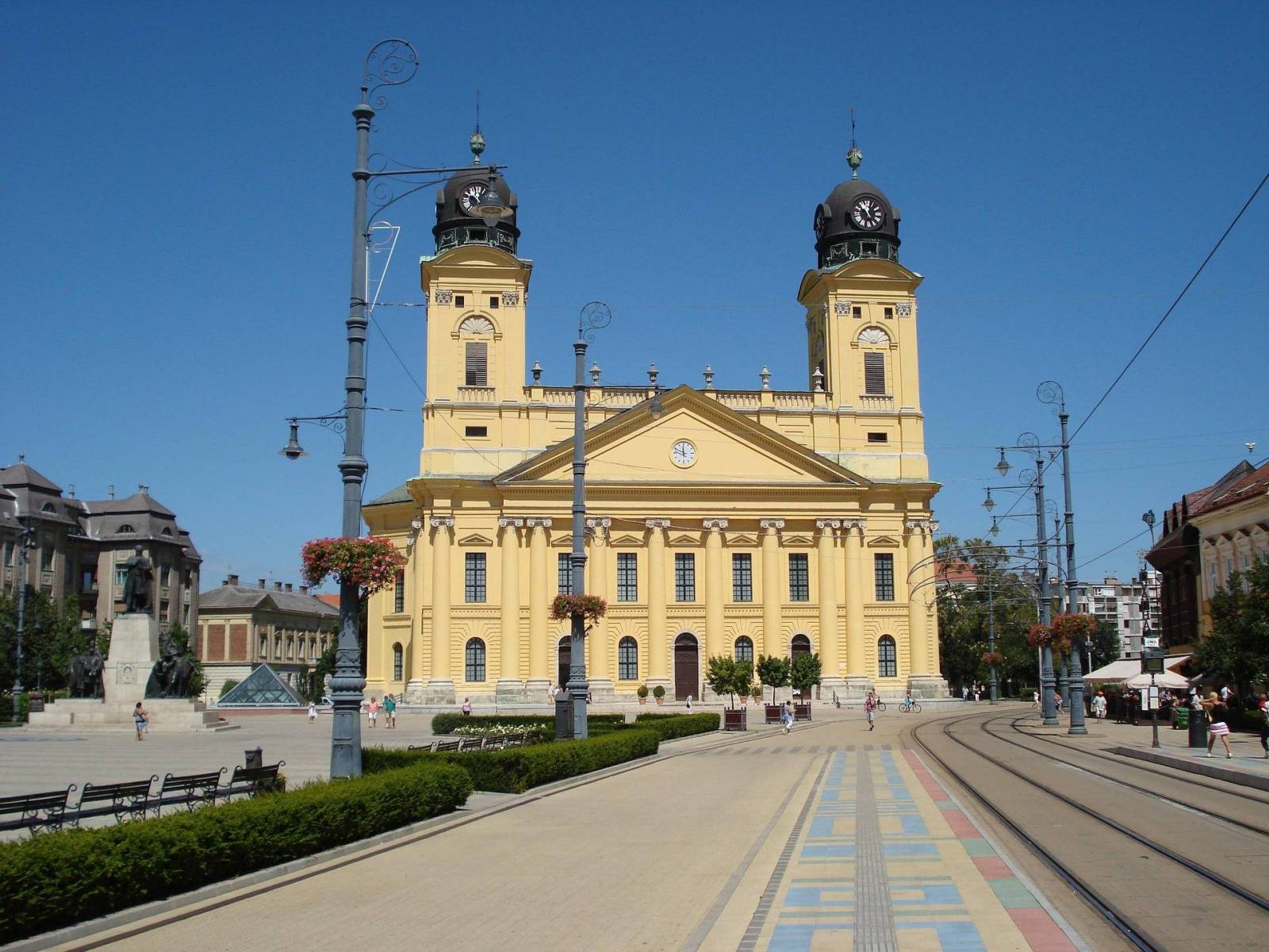
Eger
City known for the Eger Castle (Egri Vár), Cathedral Basilica of St. John the Apostle, thermal baths and baroque architecture.
Lake Tisza
The second largest lake in Hungary, part of the Hortobágy National Park and one of the most important birding areas in Europe.
Hortobágy National Park
These areas offer unique landscapes, wildlife and cycling bridges, perfect for nature enthusiasts.
-------------------------------------------------------
EuroVelo 14 to fascynująca trasa rowerowa prowadząca przez serce Austrii i Węgier, biegnąca wzdłuż ważnych rzek i jezior Europy Środkowej. Podróż rozpoczyna się w malowniczym miasteczku Zell am See, położonym nad krystalicznie czystym jeziorem Zeller See. Zapierające dech w piersiach widoki alpejskich łąk i majestatycznych szczytów nadają ton całej wyprawie. Trasa prowadzi dalej do Szentgotthárd przy granicy, gdzie kończy się austriacki odcinek szlaku. Następnie wiedzie przez bujne lasy, tradycyjne drewniane domy, winnice i regiony bogate w folklor, pozwalając rowerzystom zanurzyć się w kulturze Węgier, aż do zakończenia podróży w mieście Debreczyn. Niezależnie od tego, czy jesteś zapalonym kolarzem, czy podróżujesz rekreacyjnie, ta trasa gwarantuje niezapomnianą przygodę.
Czym jest trasa rowerowa EuroVelo 14?
EuroVelo 14, znana również jako „Wody Europy Środkowej”, to niezwykle malownicza trasa rowerowa przebiegająca przez Austrię i Węgry. Szlak rozpoczyna się w Zell am See w Austrii i prowadzi wzdłuż rzek, jezior oraz uzdrowisk, wykorzystując regionalne trasy rowerowe biegnące przez urokliwe miasteczka i miejsca wpisane na listę światowego dziedzictwa UNESCO, takie jak Graz. Po przekroczeniu granicy z Węgrami trasa wiedzie przez Park Narodowy Őrség, wzdłuż północnego brzegu Balatonu – największego jeziora Europy Środkowej – i kończy się w Debreczynie niedaleko Budapesztu. EuroVelo 14 oferuje wyjątkową rowerową przygodę dla osób pragnących odkrywać piękno natury i bogactwo kulturowe Europy Środkowej.
Jak długa jest trasa EuroVelo 14 i ile czasu zajmuje jej pokonanie?
Trasa EuroVelo 14 liczy około 1150 kilometrów i prowadzi z Zell am See w Austrii do Debreczyna na Węgrzech. Pokonanie całego szlaku przy średnim dziennym dystansie wynoszącym od 60 do 70 kilometrów zajmuje zwykle od 17 do 20 dni. Niektórzy rowerzyści decydują się jednak wydłużyć podróż do 3–4 tygodni, aby w pełni nacieszyć się atrakcjami i krajobrazami po drodze. Dzięki częstym połączeniom kolejowym wzdłuż trasy można łatwo łączyć jazdę rowerem z podróżowaniem pociągiem, co zapewnia dużą elastyczność i wygodę.
Czy trasa jest przyjazna rodzinom, czy raczej przeznaczona dla doświadczonych rowerzystów?
Trasa EuroVelo 14 jest generalnie bardzo dobrze dostępna dla różnych grup rowerzystów. W większości prowadzi istniejącymi ścieżkami rowerowymi, które są dobrze utrzymane i ograniczają kontakt z ruchem samochodowym, zwiększając bezpieczeństwo podróży. Szlak przebiega także przez miejscowości oferujące szeroki wybór noclegów i udogodnień przyjaznych rodzinom. Choć większość trasy jest płaska lub lekko pagórkowata, niektóre odcinki mogą obejmować bardziej wymagający teren lub fragmenty szutrowe i słabiej utwardzone, co może stanowić wyzwanie dla młodszych lub mniej doświadczonych rowerzystów. Większość takich odcinków można jednak ominąć dzięki lokalnym połączeniom kolejowym. Niezależnie od tego, czy jesteś doświadczonym rowerzystą planującym długą wyprawę, czy zwiedzasz trasę spokojnym tempem, szlak został zaprojektowany z myślą o rowerzystach na każdym poziomie zaawansowania, w tym także o rodzinach z dziećmi.
Atrakcje wzdłuż trasy
Jezioro Zeller See
Trasa rozpoczyna się w Zell am See nad jeziorem Zeller See, oferując malownicze widoki i spokojny początek podróży.
Wąwóz Kitzlochklamm
Położony w pobliżu Taxenbach jeden z najpiękniejszych wąwozów Austrii, oferujący spektakularne widoki i orzeźwiający przystanek podczas podróży.
Graz
Miasto wpisane na listę UNESCO i uznane za Miasto Designu, znane z renesansowej i barokowej architektury. Wśród atrakcji znajdują się wzgórze zamkowe Schlossberg oraz futurystyczne muzeum Kunsthaus.
Zamek Riegersburg
Położony na wulkanicznej skale niedaleko Feldbach doskonale zachowany średniowieczny zamek z wystawami poświęconymi rycerzom i czarownicom oraz pięknym widokiem z góry.
Berghofer Mühle
Tradycyjny młyn zbożowo-olejarski, gdzie można poznać proces produkcji oleju z pestek dyni, spróbować lokalnych specjałów i kupić regionalne produkty.
Szentgotthárd
Niewielkie miasto przy granicy z Austrią, znane z barokowej architektury i kultury uzdrowiskowej. To idealne miejsce na odpoczynek po długiej jeździe w termach lub hotelach wellness.
Park Narodowy Őrség
Położony na Węgrzech, niedaleko granicy z Austrią, spokojny i nieskażony region pełen łagodnych wzgórz, łąk, leśnych ścieżek, tradycyjnych wiosek i bogatej przyrody.
Jezioro Balaton
Największe jezioro słodkowodne Europy Środkowej, oferujące liczne noclegi przyjazne rowerzystom, możliwość kąpieli oraz bogatą ofertę gastronomiczną.
Budapeszt
Stolica Węgier słynie z term, zabytków i tętniącej życiem atmosfery. Koniecznie warto zobaczyć Zamek Królewski na Wzgórzu Zamkowym wpisany na listę UNESCO, budynek Parlamentu – jeden z najpiękniejszych parlamentów Europy, Basztę Rybacką (Halászbástya) przypominającą bajkową neoromańską budowlę oraz Kościół Macieja – imponującą gotycką świątynię.
Eger
Miasto znane z zamku Eger (Egri Vár), Bazyliki św. Jana Apostoła, term oraz pięknej barokowej architektury.
Jezioro Cisa (Tisza)
Drugie co do wielkości jezioro Węgier, będące częścią Parku Narodowego Hortobágy i jednym z najważniejszych obszarów obserwacji ptaków w Europie.
Park Narodowy Hortobágy
Region oferujący wyjątkowe krajobrazy, bogatą faunę oraz mosty rowerowe, idealny dla miłośników natury i aktywnego wypoczynku.