

Traseo_Official_RoutesTraseo_Official_Routes
6/6
Charakterystyka trasy
2025-04-27

Długość trasy:
164 kmSuma przewyższeń:
0 mSuma spadków:
0 mOcena trasy:
6/6Cambridge to Oxford ncn 51 route map
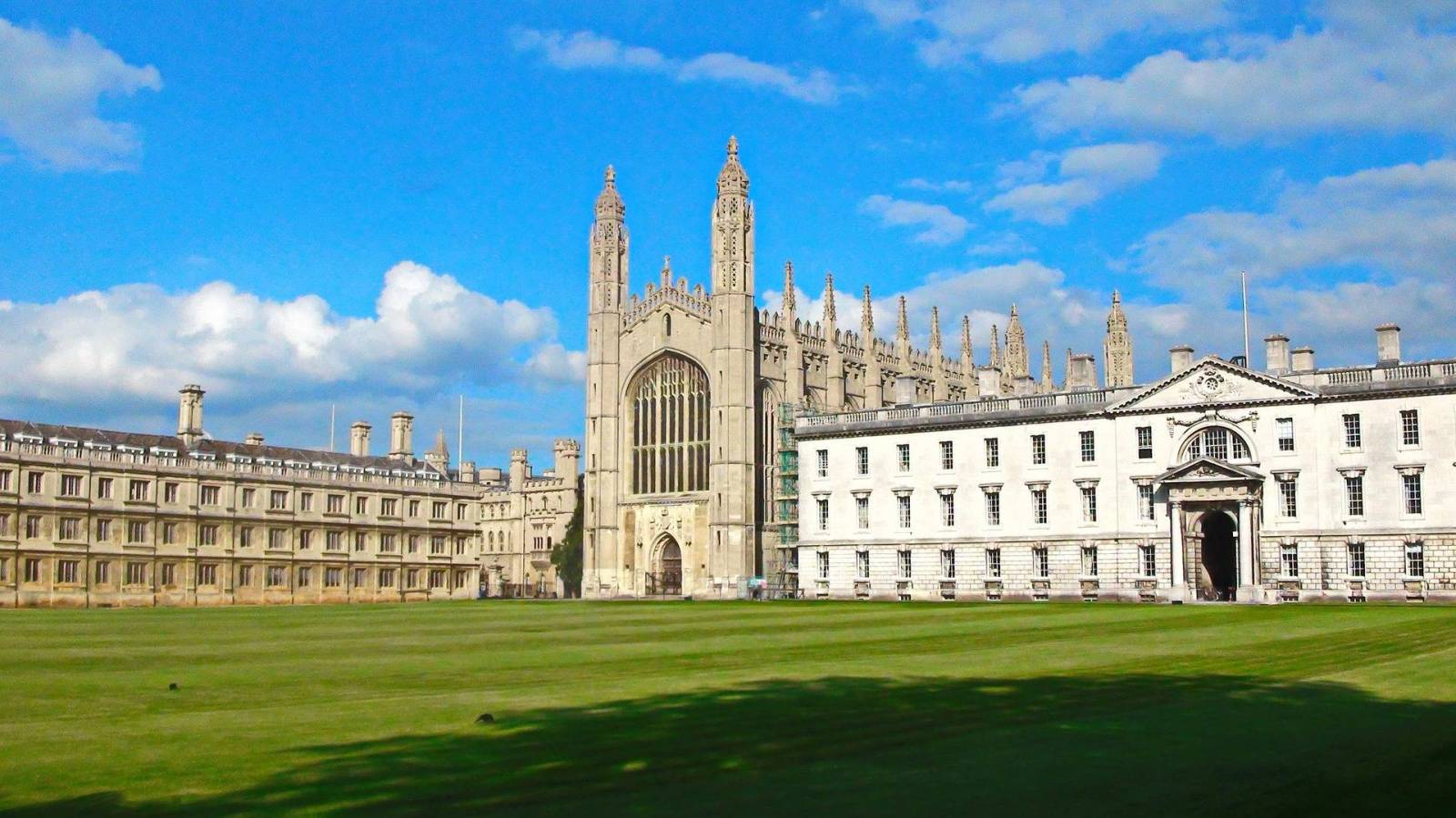
Marked on the map above, the Cambridge-Oxford cycle route, also known as “The Varsity Way”, is the official route of National Cycle Network Route 51 (NCN 51), approximately 164 km (101 miles) long, linking two historic university towns in southern England - Cambridge and Oxford. The route offers a scenic journey through the English countryside, towns and diverse landscapes, offering an unforgettable experience for cyclists of all levels.
Route options
The NCN Route 51 (National Cycle Network Route 51) linking Cambridge and Oxford offers two attractive and scenic route options - one running through Godmanchester, the other through Orwell. Both routes have a slightly different character and allow you to discover different facets of the English countryside, while maintaining high quality pavement and good signage.
Route through Orwell:
The route runs from Cambridge through villages such as Haslingfield, Barrington and charming Orwell - with its distinctive Wimpole Hill and the Wimpole Estate, managed by the National Trust. This site is one of the highlights of the route: extensive parkland, gardens, a stud farm and a classicist mansion. This route follows more hilly terrain, making it more interesting for those looking for a bit more of a challenge and beautiful views of the South Cambridgeshire hills. The route continues through Sandy and Bedford, eventually joining the main route towards Oxford.
Route through Godmanchester:
The route heads west from Cambridge via St Ives and Huntingdon, offering a leisurely ride on a former railway line converted into a cycle path (Guided Busway) which runs through the Fen Drayton Lakes nature reserve - a perfect place for a short break amongst the waterfowl and reed beds. The route continues through charming Godmanchester with its historic bridges and traces of Roman history, and then through Buckden with views of Buckden Towers Castle. This option takes you through mainly flat terrain, making it less physically demanding and suitable for longer, leisurely hikes.
Attractions along the route
After the two variants of the NCN 51 route merge at Willington (Bedfordshire), the route continues west towards Oxford, offering cyclists numerous natural, historical and scenic attractions. This section is relatively gentle, well signposted and follows mainly side roads and dedicated cycle paths.
Willington, although small, surprises at the outset - there is a 16th century dovecote and stables owned by the National Trust (Willington Dovecote and Stables) preserved in almost perfect condition. It is a testament to a time when these villages were bustling with landed estates, and today they are quiet havens for weary cyclists and history enthusiasts. The trail continues towards Bedford, leading through gentle fields and side roads. Bedford beckons you to stop for a while - the extensive waterfront of the River Great Ouse, with a cycle path winding along the water, makes for a pleasant ride through Russell Park and on to Priory Country Park, a green retreat in the heart of the town. History buffs can climb Castle Mound, a small hill, a remnant of a medieval fortress, which overlooks the peaceful town.
Beyond Bedford, the landscape changes subtly - the cyclist enters the Marston Vale area, once devastated by industry, now revitalised and full of life. The focal point here is the Forest Centre and Millennium Country Park - a place created for ecology, education and relaxation, surrounded by lakes, paths through the woodland, lookout points and meadows full of wildflowers.
The road continues through the gently rolling countryside of Buckinghamshire. Milton Keynes, although associated with modern urbanism, surprises with its greenery. Cyclists here can enjoy a system of so-called redways - separate paths running through parks, under bridges and among trees, without contact with urban traffic. Willen Lake, a vast body of water surrounded by cycle paths and picnic areas, allows you to take a moment to cool off or lazily watch the boats on the water.
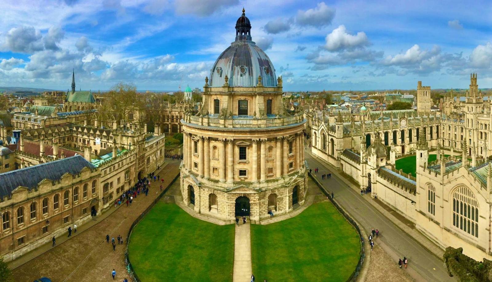
The closer you get to Oxford, the more the route sinks into the rural, classically English landscape. The Oxfordshire countryside - tranquil, with ivy-covered stone houses and old churches - until finally the towers of the university town come into view - Radcliffe Camera, Magdalen College, a thicket of narrow streets and courtyards - this is where we end our journey in Oxford.
Route signage
The route is signposted as NCN Route 51 with distinctive blue signs. However, in some places, especially at junctions, the signage may be less visible. It is recommended to use navigation apps or GPS maps .