The Alpe Adria Cycle Path is a impresive and accessible long-distance cycling route from Salzburg in Austria, to Grado in Italy, running through the Alps and ending at the Adriatic Sea. This cross-border route offers cyclists a unique blend of natural beauty, cultural heritage, and historical landmarks. The path is suitable for cyclists of all skill levels as it is mostly paved, well maintained, with numerous towns and bike-friendly accommodations along the way. This makes it easy to divide it and plan your trip according to your own preferences.
What is the difference between the Alpe Adria Trail and the Alpe Adria Cycle Path?
While looking for more information about the Alpe Adria Cycle Path, you can also find information about the Alpe Adria Trail, which is a completely different route intended for walkers rather than cyclists. This is very important to pay attention to when planning a trip, because both routes are significantly different from each other. The Alpe Adria Trail runs along already existing paths, connecting them and creating a mainly non-alpine hiking trail, ideal for recreational hiking. While the Alpe Adria Cycle Path was created by connecting old railway tracks and tunnels, offering a relatively gentle cycling experience, perfect for cycling adventures.
How long is the Alpe Adria Cycle Path?
The Alpe Adria Cycle Path, is a scenic, long-distance cycling route that stretches for approximately 400 to 420 kilometers (248 to 258 miles). It begins in Mozart’s hometown - Salzburg in Austria, runs through the picturesque Alps, to end at the Adriatic Sea in Grado, Italy. The path consists of well-maintained surfaces, mainly asphalt and aggregate, and intergrated old railway tracks and tunnels, which allow a relatively gentle descent without tiring ascent, from the Alps to the Adriatic coast.
How long does it take to complete the route?
Cyclists typically complete the route in 6 to 8 days, depending on individual pace and rest preferences. This time frame is ideal for most cyclists, allowing you to explore towns and attractions along the route with at a comfortable pace. More experienced cyclists with a high level of fitness can complete the route more quickly in 3 to 5 days, although this would require longer daily rides and less time for sightseeing. It is recommended to divide the route into eight stages, which are described in more detail in the section below.
Trip stages and attractions along the route
Stage 1: From Salzburg to Bischofshofen
This part of the route is approximately from 50 - 60 km long. Departing from the beautiful, historic city centre of Salzburg, the city of Mozart, this stage follows the lovely Salzach River, through Hallein, Golling an der Salzach, past the Hohenwerfen Fortress in Werfen, all the way to picturesque alpine town of Bischofshofen.
Stage 2: From Bischofshofen to Bad Gastein
This section is about 50 - 55 km long. Leaving Bischofshofen, initially along the Salzach River, to the city of St. Johann im Pongau, where you can admire the view of the St. Johann's Cathedral. Then up the hill to the green Gastein Valley, along the Gasteiner Ache River, then first to the village of Dorfgastein and then to the heart of the well known spa town of Bad Hofgastein. Continuing along the banks of the Gasteiner Ache, the last few meters uphill to the next stop in the town of Bad Gastein. A wonderful spa town situated in a high valley with wonderful Gastein Waterfall in the center of town.
Stage 3: From Bad Gastein to Mallnitz - Spittal an der Drau
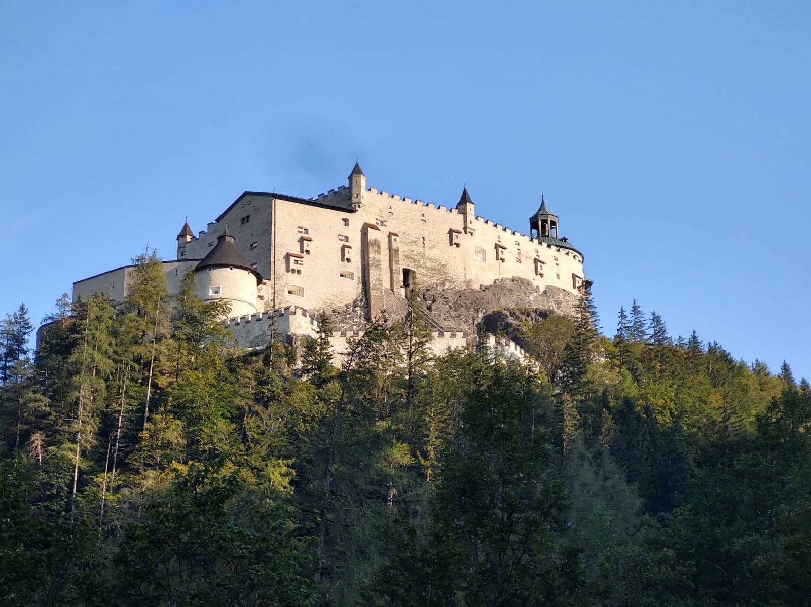
This part is about 60 km long. From Bad Gastein a short bike ride to Bockstein, from where you take the train through the eight-kilometre long Tauern Tunnel to the town of Mallnitz. Then cycle towards the Möll River, through the Carinthia region of Austria, one of the most important tourism regions. Next through the Lower Mölltal valley to reach the next stop in the town of Spittal an der Drau. This town has a rich history, which can be explored by visiting the local hisotry museum located in the beautiful Renaissance Porcia Castle.
Stage 4: From Spittal an der Drau to Villach
This section is approximately 40 km long. Following the banks of the Drau River, this stage leads to Villach, a city known for its fantastic thermal spa, where you can relax before continuing your journey.
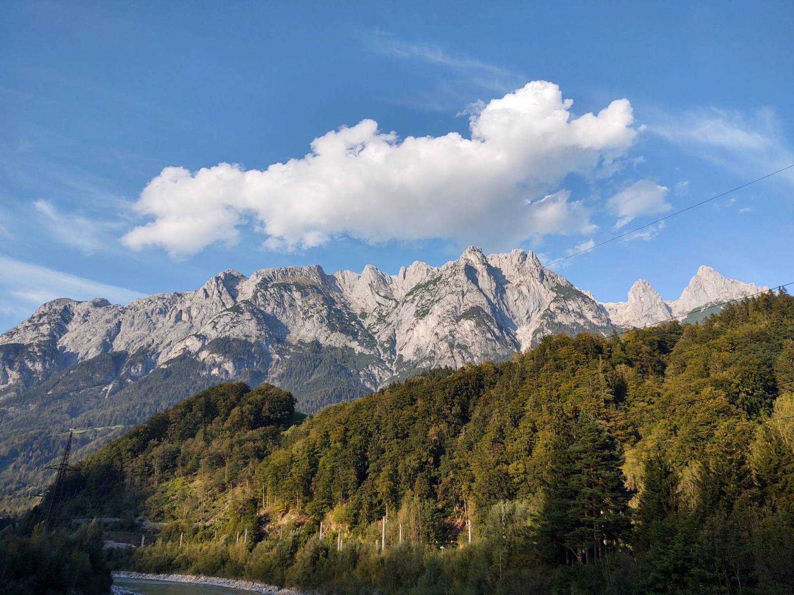
Stage 5: From Villach to Tarvisio
This part is about 35 - 40 km long. Cycling alongside the Gail River and abandoned railway lines through small villages, you gradually get closer to the Italian border in Thörl-Maglern. After a short ride you will reach next stop in the town of Tarvisio, surrounded by vast and picturesque valleys and forests.
Stage 6: From Tarvisio to Venzone
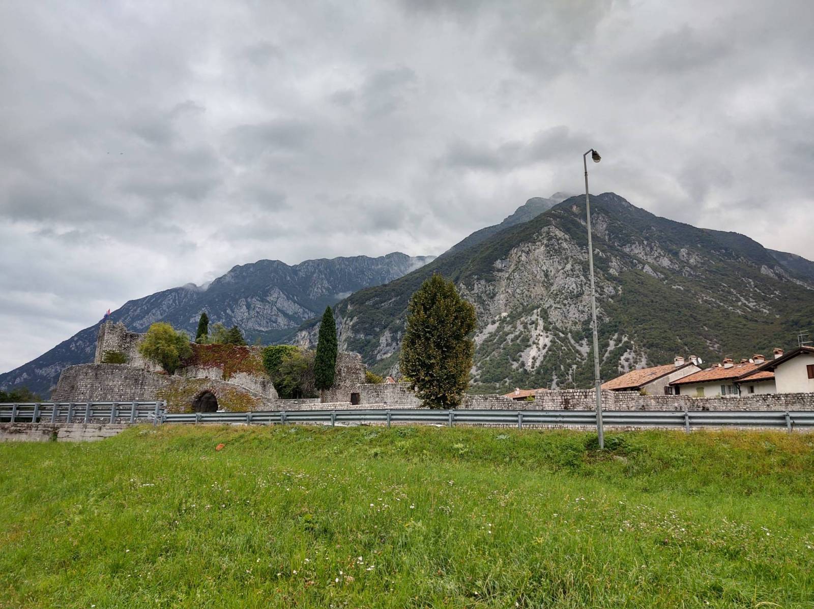
This section is approximately 60 km long. This phase follows the former Pontebbana railway line all the way to Dogna, offering views of the Fiume Fella river and the surrounding Alps. Then, following National Road number 13 to Chiusaforte and Resiutta, then passing the city of Moggio Udinese, you will arrive straight at your next stop, the historic village of Venzone. With beautiful medieval architecture and cobbled streets with breathtaking Alpine scenery in the background.
Stage 7: From Venzone to Udine
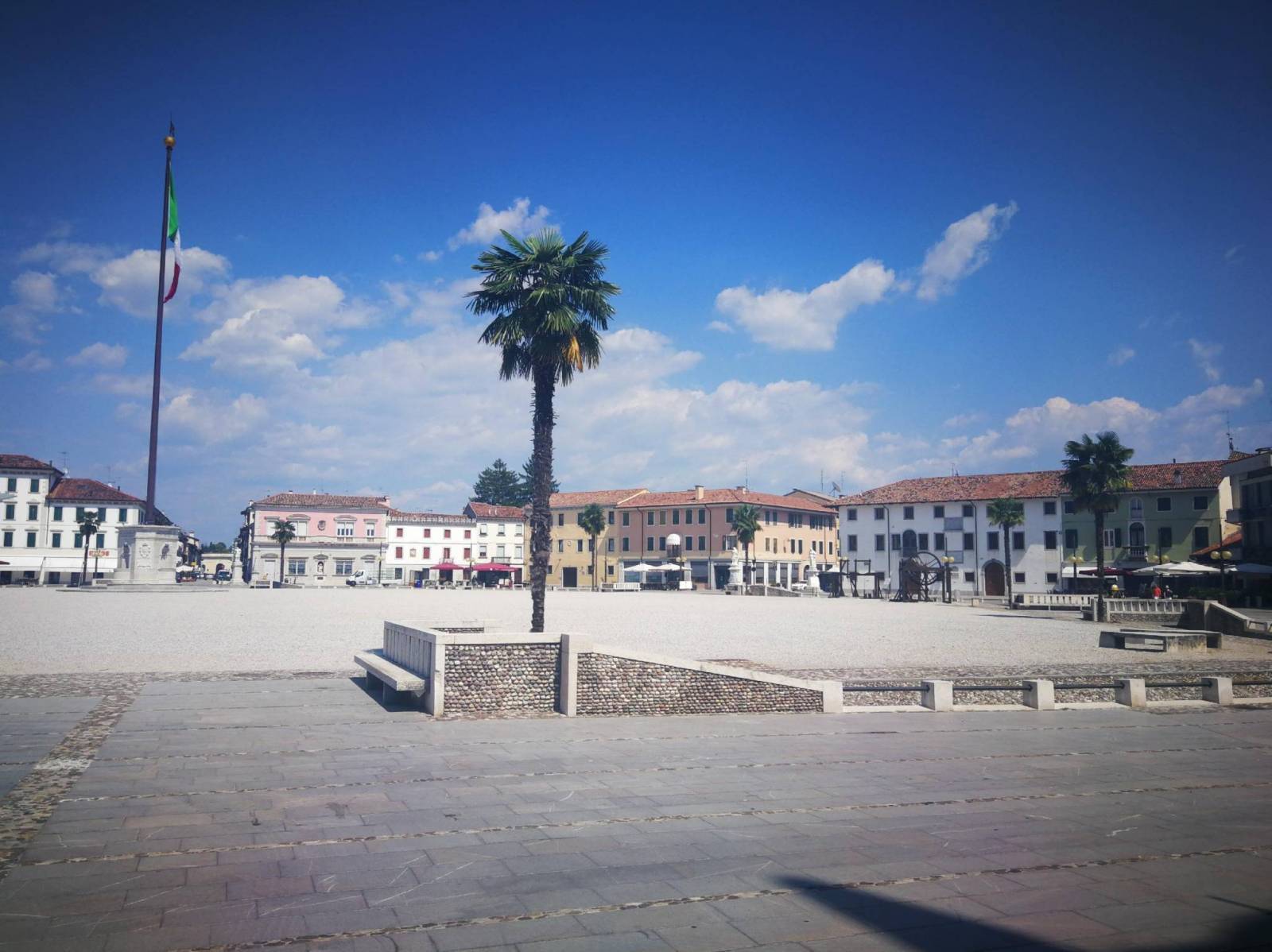
This part is approximately from 55 km long. This section begins with short ride to the town of Gemona del Friuli, leaving the Alpine scenery behind entering more hilly terrain with many vineyards in the Friuli-Venezia Giulia region of Italy. Head to your next stop - the city of Udine. The city rich in history and art, with the Church of Santa Maria Annunziata, dating back to the 13th century and located in the heart of the city, and the the Castle of Udine, which now houses several museums and art galleries.
Stage 8: From Udine to Grado
This section is about 50 - 60 km long. The final stage leads to the Adriatic coast, passing through Palmanova and Aquileia, two UNESCO World Heritage towns worth exploring. The route ends in Grado, a charming seaside town with well-preserved town centre with shops, bars, and restaurants, as well as large and sandy beaches and popular beach resort.
What is the best time of year to cycle on the Aple-Adria cycle path?
The best time of year to cycle the Alpe Adria Cycle Path is between May and October, when weather conditions are most favorable and all cycling infrastructure is fully operational. May and June are great for avoiding peak-season crowds while enjoying fresh greenery and cooler alpine temperatures. July and August are the warmest and busiest months, especially popular among tourists, with temperatures ranging from 20°C to 30°C in lower areas. September and October are often considered the optimal months due to more comfortable climate, lower tourist density, and the added charm of harvest season in regions like Friuli Venezia Giulia.
How challenging is the Alpe Adria Cycling route? Is it accessible to families with children?
The Alpe Adria Cycle Path is considered a medium-difficulty route, making it accessible for families with children, provided they have a basic level of fitness and cycling experience. The path is mostly paved, with few gravel sections, and combines old railway tracks and tunnels, making for a smoother journey through the Alps. The path is well-maintained, with numerous rest areas, benches, and bike-friendly accommodations along the way. The route is divided into eight stages, each of which can be devided into smaller parts if necessary. This makes it easier to plan more leisurely rides with enough breaks to explore towns and enjoy local attractions.