

wielogorskiNa Traseo od kwietnia 2011
CHARAKTERYSTYKA TRASY
2018-11-03
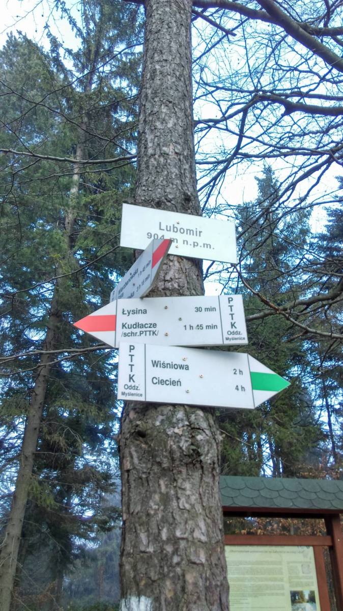
Polska, małopolskie, Wiśniowa, powiat myślenicki, Beskid Wyspowy, Zewnętrzne Karpaty Zachodnie, Karp

12 km
6655 m
6655 m
Średni
3 h 23 min
2.6/6
Komentarze
NA TEJ TRASIE PRZYDA CI SIĘ MAPA Z NASZEJ APLIKACJI
MAPA TURYSTYCZNA W APLIKACJI TRASEO
Island Beskids and Gorce Mountains
The map in detailed scale presents part of the Polish Carpathian Mountains, south from Krakow: Beskid Wyspowy (Island Beskid), Pogórze Wiśnickie (Wiśnicz Foothills), eastern part of Pogórze Wielickie (Wieliczka Foothills) and Gorce - one of the most popular and beautiful passes in Beskid.